How to get to Metabank by bus?
Click on the bus route to see step by step directions with maps, line arrival times and updated time schedules.
From Church Street, Manhattan
54 minFrom 26 Federal Plaza, Manhattan
56 minFrom Statue of Liberty, Manhattan
65 minFrom 22 Cortlandt Street, Manhattan
59 minFrom Ridgewood, NY, Queens
68 minFrom Ridgewood, Queens
54 minFrom Moxy NYC Downtown, Manhattan
60 minFrom King Spa, Palisades Park
42 minFrom Fort Lee, NJ, Fort Lee
50 min
How to get to Metabank by train?
Click on the train route to see step by step directions with maps, line arrival times and updated time schedules.
How to get to Metabank by subway?
Click on the subway route to see step by step directions with maps, line arrival times and updated time schedules.
Bus stops near Metabank in Manhattan
Ferry station near Metabank in Manhattan
- West 39th St., Nyc, 11 min walk,VIEW
Bus lines to Metabank in Manhattan
What are the closest stations to Metabank?
The closest stations to Metabank are:
- 9 Av/W 46 St is 80 yards away, 2 min walk.
- W 49th St & 10th Ave is 293 yards away, 4 min walk.
- W 49 St/10 Av is 303 yards away, 4 min walk.
- W 42nd St & 10th Ave is 338 yards away, 5 min walk.
- W 42 St/10 Av is 348 yards away, 5 min walk.
- 11 Av/W 47 St is 437 yards away, 6 min walk.
- 49 St is 673 yards away, 9 min walk.
- 50 St is 687 yards away, 9 min walk.
- West 39th St., Nyc is 828 yards away, 11 min walk.
Which bus lines stop near Metabank?
These bus lines stop near Metabank: 156, 42ND ST, 50TH ST, M20, M42, ROCKLAND COACHES, X37.
Which train line stops near Metabank?
YEL (Journal Square - 33rd Street)
Which subway lines stop near Metabank?
These subway lines stop near Metabank: 1, 2, 3, A.
What’s the nearest subway station to Metabank in Manhattan?
The nearest subway stations to Metabank in Manhattan are 49 St and 50 St. The closest one is a 9 min walk away.
What’s the nearest bus station to Metabank in Manhattan?
The nearest bus station to Metabank in Manhattan is 9 Av/W 46 St. It’s a 2 min walk away.
What’s the nearest ferry station to Metabank in Manhattan?
The nearest ferry station to Metabank in Manhattan is West 39th St., Nyc. It’s a 11 min walk away.
What time is the first subway to Metabank in Manhattan?
The 1 is the first subway that goes to Metabank in Manhattan. It stops nearby at 3:01 AM.
What time is the last subway to Metabank in Manhattan?
The A is the last subway that goes to Metabank in Manhattan. It stops nearby at 3:59 AM.
What time is the first bus to Metabank in Manhattan?
The M42 is the first bus that goes to Metabank in Manhattan. It stops nearby at 3:06 AM.
What time is the last bus to Metabank in Manhattan?
The M42 is the last bus that goes to Metabank in Manhattan. It stops nearby at 3:06 AM.
What time is the first ferry to Metabank in Manhattan?
The SEASTREAK is the first ferry that goes to Metabank in Manhattan. It stops nearby at 8:40 AM.
What time is the last ferry to Metabank in Manhattan?
The SEASTREAK is the last ferry that goes to Metabank in Manhattan. It stops nearby at 6:05 PM.
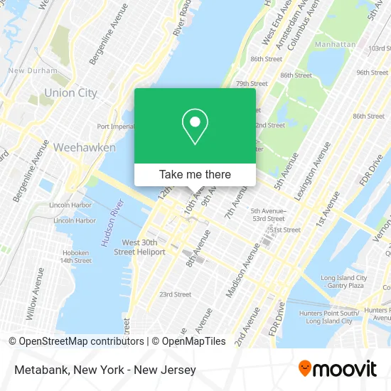
See Metabank, Manhattan, on the map
Public Transit to Metabank in Manhattan
Wondering how to get to Metabank in Manhattan? Moovit helps you find the best way to get to Metabank with step-by-step directions from the nearest public transit station.
Moovit provides free maps and live directions to help you navigate through your city. View schedules, routes, timetables, and find out how long does it take to get to Metabank in real time.
Looking for the nearest stop or station to Metabank? Check out this list of stops closest to your destination: 9 Av/W 46 St; W 49th St & 10th Ave; W 49 St/10 Av; W 42nd St & 10th Ave; W 42 St/10 Av; 11 Av/W 47 St; 49 St; 50 St; West 39th St..
Bus: 156, 42ND ST, 50TH ST, M20, M42, ROCKLAND COACHES, X37, M11, W44, 59TH ST.Train: YEL.Subway: 1, 2, 3, A, N, Q, R, W, C, E.Ferry: SEASTREAK.
Want to see if there’s another route that gets you there at an earlier time? Moovit helps you find alternative routes or times. Get directions from and directions to Metabank easily from the Moovit App or Website.
We make riding to Metabank easy, which is why over 1.5 million users, including users in Manhattan, trust Moovit as the best app for public transit. You don’t need to download an individual bus app or train app, Moovit is your all-in-one transit app that helps you find the best bus time or train time available.
For information on prices of bus, subway and train, costs and ride fares to Metabank, please check the Moovit app.
Use the app to navigate to popular places including to the airport, hospital, stadium, grocery store, mall, coffee shop, school, college, and university.
Metabank Address: 648 10th Ave New York, NY 10036 street in Manhattan
- UPS Access Point,
- Kochi,
- Tannersville,
- By & by,
- Vela | the Candle Kitchen,
- Ryan Chelsea-Clinton Health Clinic,
- 10th Ave (10th w 46th st),
- Entrata,
- Nyc Auto Brokers,
- W 45th St & 10th Ave,
- Metro Bicycles - Hell's Kitchen,
- Famous Halal Food,
- La Calenita Bakery & Cafeteria,
- New York Dynamic,
- New York Quick Auto Glass Glass Auto,
- Hell's Kitchen Dental,
- Cаr Jumр Stаrt Nyc,
- Stylish Ten Nail and Spa,
- Hell's Kitchen,
- Heart Of Chelsea Veterinary Group
Places Near Metabank (Manhattan)
- Wall Street, Manhattan,
- Queens Center Mall, Queens,
- Rockefeller Center, Manhattan,
- Chinatown, Manhattan,
- Pier 83, Manhattan,
- Mountainside Hospital, Glen Ridge,
- Hudson Yards, Manhattan,
- Times Square, Manhattan,
- Katz's Deli, Manhattan,
- 376 Hudson Street, Manhattan,
- SoHo, Manhattan,
- 111 Centre New York City Supreme Court, Manhattan,
- 66 John Street, Manhattan,
- qqqq, Manhattan,
- San Gennaro Feast, Manhattan,
- 3 Stone St, Manhattan,
- Bellevue Hospital, Manhattan,
- 26 Federal Plaza, Manhattan,
- 911 Memorial, Manhattan,
- 1 Police Plaza, Manhattan
How to get to popular places in New York - New Jersey with public transit
Get around Manhattan by public transit!
Traveling around Manhattan has never been so easy. See step by step directions as you travel to any attraction, street or major public transit station. View bus and train schedules, arrival times, service alerts and detailed routes on a map, so you know exactly how to get to anywhere in Manhattan.
When traveling to any destination around Manhattan use Moovit's Live Directions with Get Off Notifications to know exactly where and how far to walk, how long to wait for your line, and how many stops are left. Moovit will alert you when it's time to get off — no need to constantly re-check whether yours is the next stop.
Wondering how to use public transit in Manhattan or how to pay for public transit in Manhattan? Moovit public transit app can help you navigate your way with public transit easily, and at minimum cost. It includes public transit fees, ticket prices, and costs. Looking for a map of Manhattan public transit lines? Moovit public transit app shows all public transit maps in Manhattan with all Bus, Train, Subway, Light Rail, Ferry and Cable Car routes and stops on an interactive map.
New York - New Jersey has 6 transit type(s), including: Bus, Train, Subway, Light Rail, Ferry and Cable Car, operated by several transit agencies, including MTA Subway, Metro-North Railroad, LIRR, PATH, MTA New York City Transit - Express routes, MTA Bus, NJ Transit, NYC Ferry, NICE bus, Bee-Line Bus, NJ Transit Rail, Norwalk Transit District, Hartford Line, River Valley Transit and HART