Directions to Metro (Kfar Saba) with public transportation
The following transit lines have routes that pass near Metro
 Bus: 39, 486, 2, 13, 15.
- Israel Railways: Ashkelon - Herzliya, Beer Sheva Center - Nahariya, Ofakim - Herzliya, Ashdod Ad Halom - Herzliya, Ashkelon - Herzliya.
How to get to Metro by bus?
Click on the bus route to see step by step directions with maps, line arrival times and updated time schedules.
From Herzliya Pituach, Herzliya
40 minFrom Shared Taxi from Tel Aviv to Netanya, Herzliya
28 minFrom Reichman University (Interdisciplinary Herzliya), Herzliya
40 minFrom Segula Junction, Petah Tikva
34 minFrom Petah Tikva, Petah Tikva
48 minFrom Segula Cemetery, Petah Tikva
39 minFrom Petah Tikva Magistrate Court, Petah Tikva
39 minFrom Atidim Park Tel Aviv, Tel Aviv-Yafo
54 minFrom Loewenstein Hospital, Ra'anana
29 minFrom Atidim Tower Building 4, Tel Aviv-Yafo
55 min
How to get to Metro by Israel Railways?
Click on the Israel Railways route to see step by step directions with maps, line arrival times and updated time schedules.
Bus stops near Metro in Kfar Saba
Israel Railways station near Metro in Kfar Saba
- Hod HaSharon-Sokolov Station, 28 min walk,VIEW
Bus lines to Metro in Kfar Saba
- 2, Pardes Chaim Cemetery,VIEW
- 13, Qalansawe,VIEW
- 15, Ra'anana,VIEW
- 29, Herzliya,VIEW
- 42, Petah Tikva,VIEW
- 151, Tzofim,VIEW
- 247, Tel Aviv-Yafo,VIEW
- 259, Tel Aviv-Yafo,VIEW
- 610, Netanya,VIEW
- 714, Tel Aviv-Yafo,VIEW
- 149, Kfar Saba,VIEW
- 222, Herzliya,VIEW
- 636, Kfar Saba,VIEW
- 9, Hod HaSharon,VIEW
- 10, Kfar Saba,VIEW
- 230, Tel Aviv-Yafo,VIEW
- 231, Tel Aviv-Yafo,VIEW
- 18, Sal'it,VIEW
- 20, Kfar Saba Central Station/Weizmann,VIEW
- 21 ♿, Kokhav Yair,VIEW
What are the closest stations to Metro?
The closest stations to Metro are:
- HaTaas/Yochanan HaSandlar is 21 meters away, 1 min walk.
- Taas/Galgalei HaPelada is 120 meters away, 2 min walk.
- HaTa'as/Yad Harutzim is 310 meters away, 5 min walk.
- Kfar Saba Industrial Zone is 472 meters away, 7 min walk.
- Weizmann/Alkalai is 490 meters away, 7 min walk.
- Weizmann/HaTaas is 498 meters away, 7 min walk.
- Weizmann/HaTaas is 549 meters away, 8 min walk.
- G Mall/Weizmann is 602 meters away, 8 min walk.
- Road 55/HaMovil Road is 644 meters away, 9 min walk.
- Hod HaSharon-Sokolov Station is 2130 meters away, 28 min walk.
Which bus lines stop near Metro?
These bus lines stop near Metro: 39, 486.
Which Israel Railways lines stop near Metro?
These Israel Railways lines stop near Metro: Ashkelon - Herzliya, Beer Sheva Center - Nahariya.
What’s the nearest Israel Railways station to Metro in Kfar Saba?
The nearest Israel Railways station to Metro in Kfar Saba is Hod HaSharon-Sokolov Station. It’s a 28 min walk away.
What’s the nearest bus station to Metro in Kfar Saba?
The nearest bus station to Metro in Kfar Saba is HaTaas/Yochanan HaSandlar. It’s a 1 min walk away.
What time is the first Israel Railways to Metro in Kfar Saba?
The Herzliya - Ashkelon is the first Israel Railways that goes to Metro in Kfar Saba. It stops nearby at 5:24 AM.
What time is the last Israel Railways to Metro in Kfar Saba?
The Ashkelon - Herzliya is the last Israel Railways that goes to Metro in Kfar Saba. It stops nearby at 12:31 AM.
What time is the first bus to Metro in Kfar Saba?
The 230 is the first bus that goes to Metro in Kfar Saba. It stops nearby at 3:04 AM.
What time is the last bus to Metro in Kfar Saba?
The 149 is the last bus that goes to Metro in Kfar Saba. It stops nearby at 12:57 AM.
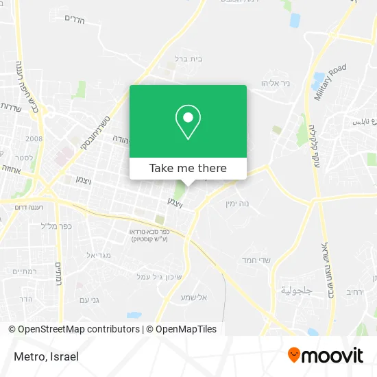
See Metro, Kfar Saba, on the map
Public Transit to Metro in Kfar Saba
Wondering how to get to Metro in Kfar Saba? Moovit helps you find the best way to get to Metro with step-by-step directions from the nearest public transit station.
Moovit provides free maps and live directions to help you navigate through your city. View schedules, routes, timetables, and find out how long does it take to get to Metro in real time.
Looking for the nearest stop or station to Metro? Check out this list of stops closest to your destination: HaTaas/Yochanan HaSandlar; Taas/Galgalei HaPelada; HaTa'as/Yad Harutzim; Kfar Saba Industrial Zone; Weizmann/Alkalai; Weizmann/HaTaas; Weizmann/HaTaas; G Mall/Weizmann; Road 55/HaMovil Road; Hod HaSharon-Sokolov Station.
Bus: 39, 486, 2, 13, 15, 29, 42, 149, 222, 636, 9, 10, 230, 231.Israel Railways: Ashkelon - Herzliya, Beer Sheva Center - Nahariya, Ofakim - Herzliya, Ashdod Ad Halom - Herzliya, Ashkelon - Herzliya, Be'er Sheva Center - Herzliya, Herzliya - Ofakim.
Want to see if there’s another route that gets you there at an earlier time? Moovit helps you find alternative routes or times. Get directions from and directions to Metro easily from the Moovit App or Website.
We make riding to Metro easy, which is why over 1.5 million users, including users in Kfar Saba, trust Moovit as the best app for public transit. You don’t need to download an individual bus app or train app, Moovit is your all-in-one transit app that helps you find the best bus time or train time available.
For information on prices of bus and Israel Railways, costs and ride fares to Metro, please check the Moovit app.
Use the app to navigate to popular places including to the airport, hospital, stadium, grocery store, mall, coffee shop, school, college, and university.
Metro Address: התע"ש 44425 כפר סבא street in Kfar Saba
- Atzmala,
- Rehita - Designed Home Furniture,
- Taas 14,
- Khan Baba Center (Savir Center),
- Bellers,
- Ariston,
- La Pasta Della Casa,
- Adler Institute,
- Good Driving School,
- Making Art Accessible - Khan Baba Center, Kfar Saba,
- Julius Meinl,
- Tov College - Transportation College,
- HaTa'as St 11,
- Antkovich,
- TML Communication Ltd,
- Red Pirate Toys,
- Bank Otzar HaChayal,
- Workshop 6,
- Bell House,
- Pakala
Places Near Metro (Kfar Saba)
- Expo Tel Aviv, Tel Aviv-Yafo,
- Ramat Gan Stadium, Ramat Gan,
- Ichilov Hospital, Tel Aviv-Yafo,
- Carmel Market, Tel Aviv-Yafo,
- Southern Medical Center, Ramat Negev Regional Council,
- HaKotel, Jerusalem,
- Beilinson Hospital, Petah Tikva,
- Tel Hashomer Base, Ramat Gan,
- Moovit Office, Nes Ziona,
- Assuta Hospital - Ramat HaHayal, Tel Aviv-Yafo,
- Tel HaShomer North Gate, Ramat Gan,
- Kashcafe, Kiryat Ata,
- Menora Mivtachim Arena, Tel Aviv-Yafo,
- Azrieli, Tel Aviv-Yafo,
- Bislach 17, Ramat Negev Regional Council,
- Gideon Camp - Military Base 7, Emek Lod Regional Council,
- Bloomfield Stadium, Tel Aviv-Yafo,
- Dizengoff Center, Tel Aviv-Yafo,
- Glilot Complex, Hof HaSharon Regional Council,
- Yarkon Park, Tel Aviv-Yafo
How to get to popular places in Israel with public transit
Get around Kfar Saba by public transit!
Traveling around Kfar Saba has never been so easy. See step by step directions as you travel to any attraction, street or major public transit station. View bus and train schedules, arrival times, service alerts and detailed routes on a map, so you know exactly how to get to anywhere in Kfar Saba.
When traveling to any destination around Kfar Saba use Moovit's Live Directions with Get Off Notifications to know exactly where and how far to walk, how long to wait for your line, and how many stops are left. Moovit will alert you when it's time to get off — no need to constantly re-check whether yours is the next stop.
Wondering how to use public transit in Kfar Saba or how to pay for public transit in Kfar Saba? Moovit public transit app can help you navigate your way with public transit easily, and at minimum cost. It includes public transit fees, ticket prices, and costs. Looking for a map of Kfar Saba public transit lines? Moovit public transit app shows all public transit maps in Kfar Saba with all Bus, Israel Railways, Light Rail, Carmelit / Rachbalit and Shuttle routes and stops on an interactive map.
Israel has 5 transit type(s), including: Bus, Israel Railways, Light Rail, Carmelit / Rachbalit and Shuttle, operated by several transit agencies, including Dan, Tel Aviv Light Rail - Tevel - Red Line, Israel Railways, Egged, Metropoline, Kavim, Electra Afikim, Nateev Express, Extra, Extra Jerusalem, Jerusalem Light Rail - Kfir, Egged Jerusalem Envelope Route, Dan Badarom, Dan Beer-Sheva and Electra Afikim Transport
