How to get to Metro Linen Service by bus?
Click on the bus route to see step by step directions with maps, line arrival times and updated time schedules.
From The Wharf, Washington
68 minFrom Verizon Center, Washington
51 minFrom D.C. Jail, Washington
61 minFrom US Marine Corps War Memorial (Iwo Jima), Arlington County
94 minFrom The Anthem, Washington
69 minFrom Residence Inn-Washington (Residence Inn by Marriott Washington, DC Downtown), Washington
51 minFrom Moxy Washington, DC Downtown, Washington
54 minFrom Thomas Jefferson Memorial, Washington
75 minFrom Consulado Bolivia Washington, Washington
54 minFrom National Theatre, Washington
55 min
How to get to Metro Linen Service by train?
Click on the train route to see step by step directions with maps, line arrival times and updated time schedules.
How to get to Metro Linen Service by metro?
Click on the metro route to see step by step directions with maps, line arrival times and updated time schedules.
From The Wharf, Washington
47 minFrom Verizon Center, Washington
29 minFrom D.C. Jail, Washington
45 minFrom US Marine Corps War Memorial (Iwo Jima), Arlington County
51 minFrom The Anthem, Washington
48 minFrom Residence Inn-Washington (Residence Inn by Marriott Washington, DC Downtown), Washington
39 minFrom Moxy Washington, DC Downtown, Washington
36 minFrom Thomas Jefferson Memorial, Washington
55 minFrom Consulado Bolivia Washington, Washington
41 minFrom National Theatre, Washington
34 min
Bus stops near Metro Linen Service in Washington
Metro stations near Metro Linen Service in Washington
Train station near Metro Linen Service in Washington
- Silver Spring Marc Eb, 20 min walk,VIEW
Bus lines to Metro Linen Service in Washington
What are the closest stations to Metro Linen Service?
The closest stations to Metro Linen Service are:
- Eastern Av Nw+Whittier St NW is 525 yards away, 7 min walk.
- Butternut St Nw+4 St NW is 573 yards away, 7 min walk.
- Carroll Ave & Laurel Ave is 643 yards away, 8 min walk.
- Silver Spring is 1453 yards away, 18 min walk.
- Silver Spring Marc Eb is 1683 yards away, 20 min walk.
- Fort Totten is 2495 yards away, 30 min walk.
Which bus lines stop near Metro Linen Service?
These bus lines stop near Metro Linen Service: C75, D5X, P42.
Which train line stops near Metro Linen Service?
MARC (Inbound - Brunswick)
Which metro line stops near Metro Linen Service?
RED (Glenmont)
What’s the nearest metro station to Metro Linen Service in Washington?
The nearest metro station to Metro Linen Service in Washington is Silver Spring. It’s a 18 min walk away.
What’s the nearest train station to Metro Linen Service in Washington?
The nearest train station to Metro Linen Service in Washington is Silver Spring Marc Eb. It’s a 20 min walk away.
What’s the nearest bus station to Metro Linen Service in Washington?
The nearest bus stations to Metro Linen Service in Washington are Eastern Av Nw+Whittier St NW and Butternut St Nw+4 St NW. The closest one is a 7 min walk away.
What time is the first metro to Metro Linen Service in Washington?
The RED is the first metro that goes to Metro Linen Service in Washington. It stops nearby at 5:10 AM.
What time is the last metro to Metro Linen Service in Washington?
The GREEN is the last metro that goes to Metro Linen Service in Washington. It stops nearby at 12:30 AM.
What time is the first train to Metro Linen Service in Washington?
The MARC is the first train that goes to Metro Linen Service in Washington. It stops nearby at 5:51 AM.
What time is the last train to Metro Linen Service in Washington?
The MARC is the last train that goes to Metro Linen Service in Washington. It stops nearby at 7:37 PM.
What time is the first bus to Metro Linen Service in Washington?
The D50 is the first bus that goes to Metro Linen Service in Washington. It stops nearby at 3:15 AM.
What time is the last bus to Metro Linen Service in Washington?
The D50 is the last bus that goes to Metro Linen Service in Washington. It stops nearby at 3:35 AM.
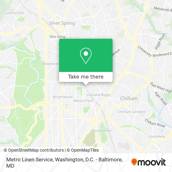
See Metro Linen Service, Washington, on the map
Public Transit to Metro Linen Service in Washington
Wondering how to get to Metro Linen Service in Washington? Moovit helps you find the best way to get to Metro Linen Service with step-by-step directions from the nearest public transit station.
Moovit provides free maps and live directions to help you navigate through your city. View schedules, routes, timetables, and find out how long does it take to get to Metro Linen Service in real time.
Looking for the nearest stop or station to Metro Linen Service? Check out this list of stops closest to your destination: Eastern Av Nw+Whittier St NW; Butternut St Nw+4 St NW; Carroll Ave & Laurel Ave; Silver Spring; Silver Spring Marc Eb; Fort Totten.
Bus: C75, D5X, P42, C77, D50, 12, 13, 16, 18.Train: MARC.Metro: RED, GREEN, YELLOW.
Want to see if there’s another route that gets you there at an earlier time? Moovit helps you find alternative routes or times. Get directions from and directions to Metro Linen Service easily from the Moovit App or Website.
We make riding to Metro Linen Service easy, which is why over 1.5 million users, including users in Washington, trust Moovit as the best app for public transit. You don’t need to download an individual bus app or train app, Moovit is your all-in-one transit app that helps you find the best bus time or train time available.
For information on prices of metro, bus and train, costs and ride fares to Metro Linen Service, please check the Moovit app.
Use the app to navigate to popular places including to the airport, hospital, stadium, grocery store, mall, coffee shop, school, college, and university.
Metro Linen Service Address: 6600 Sandy Spring Rd NW Washington, DC 20012 street in Washington
- Van Buren St NW and 3rd St NW,
- Wholistic Habilitative Services,
- 6856 Eastern Ave NW Parking,
- Imperial Auto Body,
- Class Deli,
- Bangangte Development Community,
- Finn Family Group,
- Washington Vehicle Lockout 25,
- Vandal Pest Control Services,
- Young Playwrights' Theater,
- District Ink,
- DC Shirt & Print Co.,
- Washington Dc Table Tennis,
- EF Washington DC,
- 110 Carroll Ave Parking,
- Jemal's TP Land,
- Helping Hands Community Services,
- Max Tax Professionals,
- Cooper and Crickman,
- CNC Civil Services, LLC
Places Near Metro Linen Service (Washington)
- Marriott Marquis Washington, DC, Washington,
- Pennsylvania Ave NW (3rd st and pennsylvania), Washington,
- Sibley Memorial Hospital, Washington,
- Museum Of The Bible, Washington,
- Georgetown, Washington,
- The Anthem, Washington,
- Amazon Hq2, Arlington County,
- Washington DC VA Medical Center, Washington,
- Basilica of the National Shrine, Washington,
- National Zoo, Washington,
- Camden Yards, Baltimore,
- Westfield Montgomery Mall, Montgomery County,
- National Mall, Washington,
- PG Mall, Prince George's County,
- National Museum of African American History and Culture, Washington,
- Rock Creek Tennis Center, Washington,
- Washington National Cathedral, Washington,
- M&T Bank Stadium, Baltimore,
- Capital One Arena, Washington,
- Warner Theatre, Washington
How to get to popular places in Washington, D.C. - Baltimore, MD with public transit
Get around Washington by public transit!
Traveling around Washington has never been so easy. See step by step directions as you travel to any attraction, street or major public transit station. View bus and train schedules, arrival times, service alerts and detailed routes on a map, so you know exactly how to get to anywhere in Washington.
When traveling to any destination around Washington use Moovit's Live Directions with Get Off Notifications to know exactly where and how far to walk, how long to wait for your line, and how many stops are left. Moovit will alert you when it's time to get off — no need to constantly re-check whether yours is the next stop.
Wondering how to use public transit in Washington or how to pay for public transit in Washington? Moovit public transit app can help you navigate your way with public transit easily, and at minimum cost. It includes public transit fees, ticket prices, and costs. Looking for a map of Washington public transit lines? Moovit public transit app shows all public transit maps in Washington with all Bus, Train, Metro, Light Rail and Ferry routes and stops on an interactive map.
Washington, D.C. - Baltimore, MD has 5 transit type(s), including: Bus, Train, Metro, Light Rail and Ferry, operated by several transit agencies, including WMATA, Montgomery County Ride On, Fairfax Connector, TheBus, PRTC, DASH - Alexandria, Arlington Transit (ART), RTA of Central Maryland, MDOT MTA, MDOT MTA Light RailLink, MDOT MTA Commuter Bus, MDOT MTA Local Bus, FXBGO!, Virginia Railway Express (VRE) and MARC