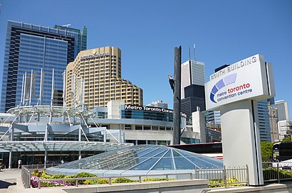
Directions to Metro Toronto Convention Centre with public transportation
The following transit lines have routes that pass near Metro Toronto Convention Centre
 Bus: 19, 504A, 504B, 97C, 114.
- Train: LW, UP, MAPLE LEAF, MAPLE LEAF, BR.
- Subway: 1.
How to get to Metro Toronto Convention Centre by bus?
Click on the bus route to see step by step directions with maps, line arrival times and updated time schedules.
How to get to Metro Toronto Convention Centre by train?
Click on the train route to see step by step directions with maps, line arrival times and updated time schedules.
How to get to Metro Toronto Convention Centre by subway?
Click on the subway route to see step by step directions with maps, line arrival times and updated time schedules.
Train stations near Metro Toronto Convention Centre
- Toronto, 0 min walk,
- Up Express Union Station, 4 min walk,
- Union Station, 5 min walk,
Bus stops near Metro Toronto Convention Centre
- Bay St at Front St West South Side - Union Station, 3 min walk,
- Toronto (Union Station Bus Terminal), 4 min walk,
- Front St West at Bay St, 4 min walk,
- Union Station Bus Terminal, 6 min walk,
- Yonge St at Front St East, 16 min walk,
Streetcar stations near Metro Toronto Convention Centre
- Queens Quay West at Harbourfront Centre, 6 min walk,
Bus lines to Metro Toronto Convention Centre
- GREYHOUND US0215, New York - Buffalo - Toronto,
- FLIXBUS 2685, Toronto - Ithaca - NYC,
- FLIXBUS N2685, NYC - Toronto night,
- FLIXBUS 2700, Toronto - Ottawa,
- FLIXBUS N2700, Toronto - Ottawa night,
- FLIXBUS 2701, Detroit - Toronto - Ottawa,
- FLIXBUS 2702, Toronto - London,
- FLIXBUS 2704, Toronto - Niagara Falls,
- FLIXBUS N2706, Toronto - Detroit night,
- FLIXBUS 2708, Toronto - Sudbury,
- FLIXBUS 2709, Ottawa - Toronto - Niagara Falls,
- FLIXBUS 2710, Ottawa - Toronto - London,
- FLIXBUS N2710, Ottawa - Toronto - London night,
- FLIXBUS 2711, Toronto - Owen Sound,
- FLIXBUS N2768A, Toronto - NYC express,
- 19, Davenport Rd at Dupont St,
- 97C, Eglinton Station at Bus Bay 1,
- 882, Yonge St at Dundas St East - Dundas Station,
- 114, Lake Shore Garage Loop,
- 121, Bay St at Front St West South Side - Union Station,
What are the closest stations to Metro Toronto Convention Centre?
The closest stations to Metro Toronto Convention Centre are:
- Toronto is 0 meters away, 0 min walk.
- Toronto (Union Station Bus Terminal) is 127 meters away, 4 min walk.
- Front St West at Bay St is 186 meters away, 4 min walk.
- Bay St at Front St West South Side - Union Station is 194 meters away, 3 min walk.
- Union Station Bus Terminal is 245 meters away, 6 min walk.
- Up Express Union Station is 266 meters away, 4 min walk.
- Union Station is 373 meters away, 5 min walk.
- Queens Quay West at Harbourfront Centre is 399 meters away, 6 min walk.
- Yonge St at Front St East is 1208 meters away, 16 min walk.
Which bus lines stop near Metro Toronto Convention Centre?
These bus lines stop near Metro Toronto Convention Centre: 19, 504A, 504B, 97C.
Which train lines stop near Metro Toronto Convention Centre?
These train lines stop near Metro Toronto Convention Centre: LW, UP.
Which subway line stops near Metro Toronto Convention Centre?
1 (Vaughan Metropolitan Centre)
What’s the nearest Streetcar station to Metro Toronto Convention Centre?
The nearest Streetcar station to Metro Toronto Convention Centre is Queens Quay West at Harbourfront Centre. It’s a 6 min walk away.
What’s the nearest train station to Metro Toronto Convention Centre?
The nearest train station to Metro Toronto Convention Centre is Toronto. It’s a 0 min walk away.
What’s the nearest bus station to Metro Toronto Convention Centre?
The nearest bus stations to Metro Toronto Convention Centre are Toronto (Union Station Bus Terminal) and Front St West at Bay St. The closest one is a 4 min walk away.
What time is the first Streetcar to Metro Toronto Convention Centre?
The 310 is the first Streetcar that goes to Metro Toronto Convention Centre. It stops nearby at 3:05 AM.
What time is the last Streetcar to Metro Toronto Convention Centre?
The 310 is the last Streetcar that goes to Metro Toronto Convention Centre. It stops nearby at 3:08 AM.
What time is the first train to Metro Toronto Convention Centre?
The UP is the first train that goes to Metro Toronto Convention Centre. It stops nearby at 4:55 AM.
What time is the last train to Metro Toronto Convention Centre?
The VIA RAIL is the last train that goes to Metro Toronto Convention Centre. It stops nearby at 11:22 PM.
What time is the first bus to Metro Toronto Convention Centre?
The FLIXBUS N2710 is the first bus that goes to Metro Toronto Convention Centre. It stops nearby at 3:00 AM.
What time is the last bus to Metro Toronto Convention Centre?
The GREYHOUND US0215 is the last bus that goes to Metro Toronto Convention Centre. It stops nearby at 11:55 AM.
See Metro Toronto Convention Centre on the map
Public Transportation to Metro Toronto Convention Centre
Wondering how to get to Metro Toronto Convention Centre? Moovit helps you find the best way to get to Metro Toronto Convention Centre with step-by-step directions from the nearest public transit station.
Moovit provides free maps and live directions to help you navigate through your city. View schedules, routes, timetables, and find out how long does it take to get to Metro Toronto Convention Centre in real time.
Looking for the nearest stop or station to Metro Toronto Convention Centre? Check out this list of stops closest to your destination: Toronto; Toronto (Union Station Bus Terminal); Front St West at Bay St; Bay St at Front St West South Side - Union Station; Union Station Bus Terminal; Up Express Union Station; Union Station; Queens Quay West at Harbourfront Centre; Yonge St at Front St East.
Bus: 19, 504A, 504B, 97C, 114, 121, 320, GREYHOUND US0215, FLIXBUS 2685, FLIXBUS N2685, FLIXBUS 2700, FLIXBUS N2700, 882.Train: LW, UP, MAPLE LEAF, MAPLE LEAF, BR, KI, LE, MI.Subway: 1.
Want to see if there’s another route that gets you there at an earlier time? Moovit helps you find alternative routes or times. Get directions from and directions to Metro Toronto Convention Centre easily from the Moovit App or Website.
We make riding to Metro Toronto Convention Centre easy, which is why over 1.5 million users, including users in Toronto, trust Moovit as the best app for public transit. You don’t need to download an individual bus app or train app, Moovit is your all-in-one transit app that helps you find the best bus time or train time available.
For information on prices of bus, subway, train and Streetcar, costs and ride fares to Metro Toronto Convention Centre, please check the Moovit app.
Use the app to navigate to popular places including to the airport, hospital, stadium, grocery store, mall, coffee shop, school, college, and university.
Location: Toronto
Popular routes to Metro Toronto Convention Centre
- Entrance from Skywalk - MTCC - Level 500,
- Comic Con Toronto,
- Metro Toronto Convention Centre - South Building,
- DELTA-Toronto,
- Lower Simcoe Street Underpass,
- MTCC - South Building,
- Audi @ Toronto Autoshow,
- Delta Hotels by Marriott Toronto,
- Ripley s Aquarium,
- SOCO Kitchen+Bar,
- Rides to Niagara Falls,
- 75 Lower Simcoe Street,
- SP+ Parking,
- Delta Hotels by Marriott,
- DELTA Hotels-Toronto,
- The PATH - Skywalk,
- 288 Bremner Boulevard,
- Ripley's Aquarium Of Canada,
- The Railway Children Theater,
- Intercontinental Toronto Centre Hotel
Places Near Metro Toronto Convention Centre
- St Michael s Hospital, Toronto,
- Meridian Hall, Toronto,
- Toronto Western Hospital, Toronto,
- Toronto Eaton Centre, Toronto,
- Rogers Centre, Toronto,
- Enercare Centre, Toronto,
- Medieval Times, Toronto,
- Distillery District Map, Toronto,
- Toronto zoo, Toronto,
- Vaughan Mills Shopping Centre, Vaughan,
- St. Michael's Hospital, Toronto,
- Toronto Courthouse, Toronto,
- Great Canadian Casino Resort, Toronto,
- Scarborough Town Centre, Toronto,
- Sunnybrook Hospital, Toronto,
- Toronto General Hospital, Toronto,
- Budweiser Stage, Toronto,
- St Lawrence Market, Toronto,
- Exhibition Place, Toronto,
- Chelsea Hotel, Toronto, Toronto
How to get to popular places in Toronto with public transit
Get around Toronto by public transit!
Traveling around Toronto has never been so easy. See step by step directions as you travel to any attraction, street or major public transit station. View bus and train schedules, arrival times, service alerts and detailed routes on a map, so you know exactly how to get to anywhere in Toronto.
When traveling to any destination around Toronto use Moovit's Live Directions with Get Off Notifications to know exactly where and how far to walk, how long to wait for your line, and how many stops are left. Moovit will alert you when it's time to get off — no need to constantly re-check whether yours is the next stop.
Wondering how to use public transit in Toronto or how to pay for public transit in Toronto? Moovit public transit app can help you navigate your way with public transit easily, and at minimum cost. It includes public transit fees, ticket prices, and costs. Looking for a map of Toronto public transit lines? Moovit public transit app shows all public transit maps in Toronto with all Bus, Train, Subway, Streetcar and Ferry routes and stops on an interactive map.
Toronto has 5 transit type(s), including: Bus, Train, Subway, Streetcar and Ferry, operated by several transit agencies, including TTC, Toronto Subway, Brampton Transit, MiWay, York Region Transit, GO Transit Bus, GO Transit, Durham Region Transit, UP Express, Grand River Transit, Guelph Transit, Hamilton Street Railway, Burlington Transit, Oakville Transit and Peterborough Transit