Directions to Metrocare Of Springfield (Boston) with public transportation
The following transit lines have routes that pass near Metrocare Of Springfield
 Bus: G73E, GREYHOUND US0171, PETER PAN, B6, B17.
- Train: LAKE SHORE LIMITED, VERMONTER, AMTRAK HARTFORD LINE, NORTHEAST REGIONAL, VALLEY FLYER.
How to get to Metrocare Of Springfield by bus?
Click on the bus route to see step by step directions with maps, line arrival times and updated time schedules.
From Worcester, MA, Worcester
80 minFrom Polar Park, Worcester
82 minFrom Walmart Supercenter, Worcester
139 minFrom Palladium, Worcester
86 minFrom Registry Of Motor Vehicles (Rmv) Branch Office, Worcester
84 minFrom South High Community School, Worcester
177 minFrom Foxwoods, Worcester
110 minFrom Dcu Center, Worcester
83 min
How to get to Metrocare Of Springfield by train?
Click on the train route to see step by step directions with maps, line arrival times and updated time schedules.
Bus stops near Metrocare Of Springfield in Boston
Train station near Metrocare Of Springfield in Boston
- Springfield, 43 min walk,VIEW
Bus lines to Metrocare Of Springfield in Boston
- B6, Ludlow Big Y Via Bay/Berkshire,VIEW
- B17, 16 Acres Via Wilbraham Rd / Worthington St,VIEW
- G3, Springfield Plaza To Rmv Via Union Station,VIEW
- G5, Union Station Via Jewish Home,VIEW
- R10, Union Station,VIEW
- R14, Agawam Industrial Park,VIEW
- T6, Post Office,VIEW
- X90, State And Federal To Union Station,VIEW
- B7, Colonial Estates Via Independence House,VIEW
- G1, Five Town Plaza Via Bicentennial,VIEW
- G2, E Springfield Via Union Station-Mercy,VIEW
- T1, State Street Bunt Pk Rd,VIEW
- T2, Post Office Via Main Street / South End,VIEW
- T3, Post Office,VIEW
- T4, State Street Blunt Pk Rd To Bay St,VIEW
- T5, Belmont To the X,VIEW
- T92, Orange To the X,VIEW
- X92, Memorial Industrial Park Via Senior Center And Roosevelt,VIEW
- T21, State Street Blunt Park Rd. To Bay Street,VIEW
- B4, Union Station,VIEW
What are the closest stations to Metrocare Of Springfield?
The closest stations to Metrocare Of Springfield are:
- Harrison Avenue is 226 yards away, 3 min walk.
- Main / Worthington is 264 yards away, 4 min walk.
- Main / Bridge is 302 yards away, 4 min walk.
- Springfield Union Station is 525 yards away, 7 min walk.
- Union Station Springfield is 572 yards away, 7 min walk.
- Springfield is 3658 yards away, 43 min walk.
Which bus lines stop near Metrocare Of Springfield?
These bus lines stop near Metrocare Of Springfield: G73E, GREYHOUND US0171, PETER PAN.
Which train lines stop near Metrocare Of Springfield?
These train lines stop near Metrocare Of Springfield: LAKE SHORE LIMITED, VERMONTER.
What’s the nearest bus station to Metrocare Of Springfield in Boston?
The nearest bus station to Metrocare Of Springfield in Boston is Harrison Avenue. It’s a 3 min walk away.
What time is the first train to Metrocare Of Springfield in Boston?
The NORTHEAST REGIONAL is the first train that goes to Metrocare Of Springfield in Boston. It stops nearby at 4:10 AM.
What time is the last train to Metrocare Of Springfield in Boston?
The LAKE SHORE LIMITED is the last train that goes to Metrocare Of Springfield in Boston. It stops nearby at 6:04 PM.
What time is the first bus to Metrocare Of Springfield in Boston?
The FLIXBUS N2615 is the first bus that goes to Metrocare Of Springfield in Boston. It stops nearby at 3:00 AM.
What time is the last bus to Metrocare Of Springfield in Boston?
The FLIXBUS N2605 is the last bus that goes to Metrocare Of Springfield in Boston. It stops nearby at 5:40 AM.
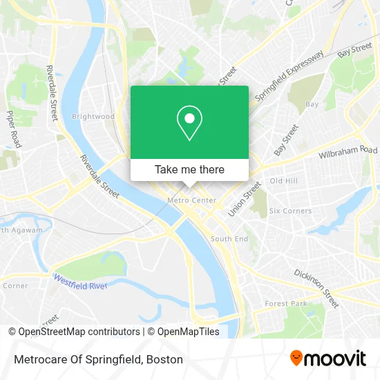
See Metrocare Of Springfield, Boston, on the map
Public Transit to Metrocare Of Springfield in Boston
Wondering how to get to Metrocare Of Springfield in Boston? Moovit helps you find the best way to get to Metrocare Of Springfield with step-by-step directions from the nearest public transit station.
Moovit provides free maps and live directions to help you navigate through your city. View schedules, routes, timetables, and find out how long does it take to get to Metrocare Of Springfield in real time.
Looking for the nearest stop or station to Metrocare Of Springfield? Check out this list of stops closest to your destination: Harrison Avenue; Main / Worthington; Main / Bridge; Springfield Union Station; Union Station Springfield; Springfield.
Bus: G73E, GREYHOUND US0171, PETER PAN, B6, B17, G3, G5, R10, B7, G1, G2, T1, T2, T21, FLIXBUS 2610, FLIXBUS 2619, FLIXBUS 2691, FLIXBUS N2605, FLIXBUS N2615, B4, B12, P20, P21.Train: LAKE SHORE LIMITED, VERMONTER, AMTRAK HARTFORD LINE, NORTHEAST REGIONAL, VALLEY FLYER.
Want to see if there’s another route that gets you there at an earlier time? Moovit helps you find alternative routes or times. Get directions from and directions to Metrocare Of Springfield easily from the Moovit App or Website.
We make riding to Metrocare Of Springfield easy, which is why over 1.7 million users, including users in Boston, trust Moovit as the best app for public transit. You don’t need to download an individual bus app or train app, Moovit is your all-in-one transit app that helps you find the best bus time or train time available.
For information on prices of bus and train, costs and ride fares to Metrocare Of Springfield, please check the Moovit app.
Use the app to navigate to popular places including to the airport, hospital, stadium, grocery store, mall, coffee shop, school, college, and university.
Metrocare Of Springfield Address: 51 Taylor St street in Boston
- Southern Baptist Convention,
- Loophole Brewing,
- Mulberry Law Group,
- Favorite Healthcare Staffing,
- Impact Center,
- The Creative Strategy Agency,
- Petra Cafe,
- Jess Miller Comedy,
- Mark Sutton Realty,
- Wells & Bicycle Blocks,
- 15 Taylor,
- The Ethnic Study Cowork Cafe & Bookstore,
- Angus Locksmith,
- Lucky S,
- Taylor Street Garage,
- Executive Parking,
- Massachusetts State Office Building,
- Ma Comm for Blind,
- Haymond Law Firm,
- Odessy 54
Places Near Metrocare Of Springfield (Boston)
- Faneuil Hall, Boston,
- Mgm Music Hall, Boston,
- Leader Bank Pavilion (Leader Bank Pavillion), Boston,
- Castle Island, Boston,
- Museum Of Science, Boston,
- Prudential Center, Boston,
- Cheers, Boston,
- Td Garden, Boston,
- Isabella Stewart Gardner Museum, Boston,
- Boston Children's Hospital, Boston,
- Boston Medical Center, Boston,
- North End, Boston,
- House Of Blues, Boston,
- Wilbur Theatre, Boston,
- Seaport District, Boston,
- Wang Theater, Boston,
- Boston Convention & Exhibition Center, Boston,
- Massachusetts General Hospital, Boston,
- Quincy Market, Boston,
- Boston Common, Boston
How to get to popular places in Boston with public transit
Get around Boston by public transit!
Traveling around Boston has never been so easy. See step by step directions as you travel to any attraction, street or major public transit station. View bus and train schedules, arrival times, service alerts and detailed routes on a map, so you know exactly how to get to anywhere in Boston.
When traveling to any destination around Boston use Moovit's Live Directions with Get Off Notifications to know exactly where and how far to walk, how long to wait for your line, and how many stops are left. Moovit will alert you when it's time to get off — no need to constantly re-check whether yours is the next stop.
Wondering how to use public transit in Boston or how to pay for public transit in Boston? Moovit public transit app can help you navigate your way with public transit easily, and at minimum cost. It includes public transit fees, ticket prices, and costs. Looking for a map of Boston public transit lines? Moovit public transit app shows all public transit maps in Boston with all Bus, Train, Subway and Ferry routes and stops on an interactive map.
Boston has 4 transit type(s), including: Bus, Train, Subway and Ferry, operated by several transit agencies, including MBTA, Southeastern Regional Transit Authority, MetroWest Regional Transit Authority, Rhode Island Public Transit Authority, WRTA, Lowell Regional Transit Authority, Merrimack Valley Transit, Montachusett Regional Transit Authority, Cape Cod Regional Transit Authority, Brockton Area Transit Authority, Martha's Vineyard Transit Authority, the WAVE - Nantucket Regional Transit Authority, GATRA, Cape Ann Transportation Authority and Massport