Directions to Mettray with public transportation
The following transit lines have routes that pass near Mettray
How to get to Mettray by bus?
Click on the bus route to see step by step directions with maps, line arrival times and updated time schedules.
Bus stations near Mettray
- Artisans, 7 min walk,
Bus lines to Mettray
- 52, Tranchee,
- 66, Lycee Vaucanson,
- 73, Moulin Maillet,
What are the closest stations to Mettray?
The closest stations to Mettray are:
- Artisans is 508 meters away, 7 min walk.
Which bus lines stop near Mettray?
These bus lines stop near Mettray: 14, 2.
What’s the nearest bus stop to Mettray?
The nearest bus stop to Mettray is Artisans. It’s a 7 min walk away.
What time is the first bus to Mettray?
The 52 is the first bus that goes to Mettray. It stops nearby at 11:51 AM.
What time is the last bus to Mettray?
The 52 is the last bus that goes to Mettray. It stops nearby at 6:28 PM.
See Mettray on the map
Public Transportation to Mettray
Wondering how to get to Mettray, France? Moovit helps you find the best way to get to Mettray with step-by-step directions from the nearest public transit station.
Moovit provides free maps and live directions to help you navigate through your city. View schedules, routes, timetables, and find out how long does it take to get to Mettray in real time.
Looking for the nearest stop or station to Mettray? Check out this list of stops closest to your destination: Artisans.
Bus: 14, 2, 52, 66, 73.
Want to see if there’s another route that gets you there at an earlier time? Moovit helps you find alternative routes or times. Get directions from and directions to Mettray easily from the Moovit App or Website.
We make riding to Mettray easy, which is why over 1.5 million users, including users in Tours, trust Moovit as the best app for public transit. You don’t need to download an individual bus app or train app, Moovit is your all-in-one transit app that helps you find the best bus time or train time available.
For information on prices of bus and light rail, costs and ride fares to Mettray, please check the Moovit app.
Use the app to navigate to popular places including to the airport, hospital, stadium, grocery store, mall, coffee shop, school, college, and university.
Location: Tours
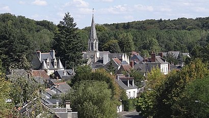
Mettray (French pronunciation: [mɛtʁɛ] ) is a commune in the Indre-et-Loire department in central France. The Mettray Penal Colony was opened there in 1839.Wiki
Popular routes to Mettray
Popular routes from Mettray
Attractions near Mettray
Esat Anais De Mettray,Cath et Jf,Association at,Alexandra Coiffure,Pains et Délices,Apem,Commune de Mettray,A.F.P.A.,Mme Morand Melanie,Les Plantes de la Sévaudière,Atouts et Perspectives,33 Rue des Bourgetteries,Stephan Erwan,Manon Jouillat,Association Atouts Perspectives Tout Age,La Ferme de la Paternelle - Magasin à la Ferme,Convivio Ltr - Itep,Touraine Travaux Publics et Services,Les Bourgetteries,Couleurs PatinesHow to get to popular attractions in Tours with public transit
Les Bonnes Grillades, Tours,37540, Saint-Cyr-Sur-Loire,Marne, Tours,Observaloire, Rochecorbon,35 Rue de la Bergeonnerie, Tours,Gare De Saint-Pierre-Des-Corps 1 - Nord, Saint-Pierre-Des-Corps,Centre D'examen Des Permis De Conduire, Parçay-Meslay,Pôle Emploi Les Deux Lions, Tours,Stade Jules Ferry, Joué-Lès-Tours,1 Avenue de la République, Tours,Emmaüs, Tours,69 Rue Devildé, Tours,Préfecture, Tours,Piscine du Lac, Tours,Rue Mansart, Chambray-Lès-Tours,Auchan, Tours,Campus des Métiers et de l'Artisanat, Joué-Lès-Tours,Kizou Aventures, Saint-Cyr-Sur-Loire,Parc De La Branchoire, Saint-Avertin,63 Rue de la Gaudinière, Saint-Cyr-Sur-LoireGet around Tours by public transit!
Traveling around Tours has never been so easy. See step by step directions as you travel to any attraction, street or major public transit station. View bus and train schedules, arrival times, service alerts and detailed routes on a map, so you know exactly how to get to anywhere in Tours.
When traveling to any destination around Tours use Moovit's Live Directions with Get Off Notifications to know exactly where and how far to walk, how long to wait for your line, and how many stops are left. Moovit will alert you when it's time to get off — no need to constantly re-check whether yours is the next stop.
Wondering how to use public transit in Tours or how to pay for public transit in Tours? Moovit public transit app can help you navigate your way with public transit easily, and at minimum cost. It includes public transit fees, ticket prices, and costs. Looking for a map of Tours public transit lines? Moovit public transit app shows all public transit maps in Tours with all Bus and Light Rail routes and stops on an interactive map.
Tours has 2 transit type(s), including: Bus and Light Rail, operated by several transit agencies, including Fil Bleu (Tours)