Directions to Meyer Rosene Advertising Design (Reno) with public transportation
The following transit lines have routes that pass near Meyer Rosene Advertising Design
 Bus: 11, 4, VRGN.
- Train: CALIFORNIA ZEPHYR.
How to get to Meyer Rosene Advertising Design by bus?
Click on the bus route to see step by step directions with maps, line arrival times and updated time schedules.
From Bubble Tea Station, Sparks
77 minFrom Scheels, Sparks
76 minFrom Mindsmatter Wellness Center, Reno
41 minFrom Xpress Lube, Smog and Car Wash, Sparks
79 minFrom Sierra Sol, Sparks
74 minFrom Lake Moore, Reno
50 minFrom BMO Bank of Montreal, Sparks
79 minFrom Engineering Office Inspection Office, Reno
51 minFrom Luxe Life Home Staging, Reno
62 min
Bus stop near Meyer Rosene Advertising Design in Reno
- W 7th Street And Keystone Avenue, 6 min walk,VIEW
Train station near Meyer Rosene Advertising Design in Reno
- Reno, 26 min walk,VIEW
Bus lines to Meyer Rosene Advertising Design in Reno
- 4, Rtc 4th Street Station,VIEW
What are the closest stations to Meyer Rosene Advertising Design?
The closest stations to Meyer Rosene Advertising Design are:
- W 7th Street And Keystone Avenue is 453 yards away, 6 min walk.
- Reno is 2121 yards away, 26 min walk.
Which bus lines stop near Meyer Rosene Advertising Design?
These bus lines stop near Meyer Rosene Advertising Design: 11, 4, VRGN.
What’s the nearest train station to Meyer Rosene Advertising Design in Reno?
The nearest train station to Meyer Rosene Advertising Design in Reno is Reno. It’s a 26 min walk away.
What’s the nearest bus station to Meyer Rosene Advertising Design in Reno?
The nearest bus station to Meyer Rosene Advertising Design in Reno is W 7th Street And Keystone Avenue. It’s a 6 min walk away.
What time is the first train to Meyer Rosene Advertising Design in Reno?
The CALIFORNIA ZEPHYR is the first train that goes to Meyer Rosene Advertising Design in Reno. It stops nearby at 3:37 PM.
What time is the last train to Meyer Rosene Advertising Design in Reno?
The CALIFORNIA ZEPHYR is the last train that goes to Meyer Rosene Advertising Design in Reno. It stops nearby at 9:24 AM.
What time is the first bus to Meyer Rosene Advertising Design in Reno?
The 4 is the first bus that goes to Meyer Rosene Advertising Design in Reno. It stops nearby at 5:27 AM.
What time is the last bus to Meyer Rosene Advertising Design in Reno?
The 4 is the last bus that goes to Meyer Rosene Advertising Design in Reno. It stops nearby at 11:22 PM.
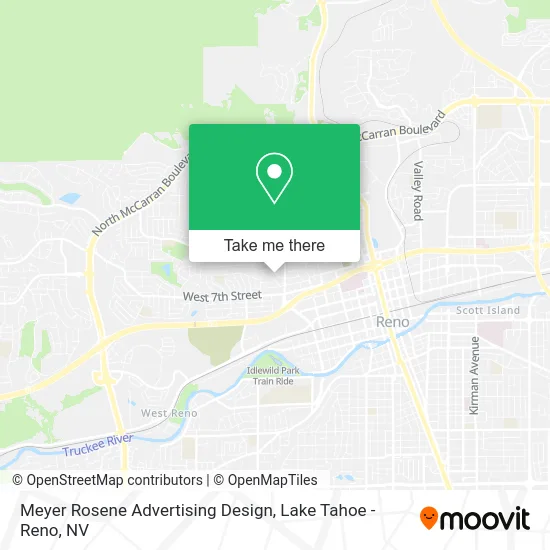
See Meyer Rosene Advertising Design, Reno, on the map
Public Transit to Meyer Rosene Advertising Design in Reno
Wondering how to get to Meyer Rosene Advertising Design in Reno? Moovit helps you find the best way to get to Meyer Rosene Advertising Design with step-by-step directions from the nearest public transit station.
Moovit provides free maps and live directions to help you navigate through your city. View schedules, routes, timetables, and find out how long does it take to get to Meyer Rosene Advertising Design in real time.
Looking for the nearest stop or station to Meyer Rosene Advertising Design? Check out this list of stops closest to your destination: W 7th Street And Keystone Avenue; Reno.
Bus: 11, 4, VRGN.Train: CALIFORNIA ZEPHYR.
Want to see if there’s another route that gets you there at an earlier time? Moovit helps you find alternative routes or times. Get directions from and directions to Meyer Rosene Advertising Design easily from the Moovit App or Website.
We make riding to Meyer Rosene Advertising Design easy, which is why over 1.5 million users, including users in Reno, trust Moovit as the best app for public transit. You don’t need to download an individual bus app or train app, Moovit is your all-in-one transit app that helps you find the best bus time or train time available.
For information on prices of bus, costs and ride fares to Meyer Rosene Advertising Design, please check the Moovit app.
Use the app to navigate to popular places including to the airport, hospital, stadium, grocery store, mall, coffee shop, school, college, and university.
Meyer Rosene Advertising Design Address: 350 Sunnyside Dr Reno, NV 89503 street in Reno
- Irving Circle Park,
- Keystone,
- Coinstar - Bitcoin ATM,
- Launderland Wash & Dry,
- Reno Family Co-OP,
- Amazon Locker-Lumber,
- Foodmart,
- 775 Nutrition Spot,
- Bed and Breakfast Seo,
- Great Basin Solar,
- Graham Painting,
- STARBUCKS,
- Surf Thru Express Car Wash,
- Terror,
- All About Kids,
- Latino Tax Help,
- Grant Company,
- Thistle & Nightshade,
- Dr Richard Diffenderfer,
- Lawry & Associates
Places Near Meyer Rosene Advertising Design (Reno)
- Grand Sierra Resort, Reno,
- University of Nevada, Reno, Reno,
- Reno, Nevada, Reno,
- Peppermill, Reno,
- Walmart Supercenter, Reno,
- Hidden Beach, Incline Village,
- The Summit (Summit Shopping Center), Reno,
- Mount Rose Ski Resort Entrance, Reno,
- Tesla, Carson City,
- Boomtown Hotel, Reno,
- 2777 usa Parkway, Sparks,
- Department of Motor Vehicles (DMV), Reno,
- Tesla, Reno,
- Tesla, Reno,
- Emerald Bay, South Lake Tahoe,
- Meadowood Mall, Reno,
- DMV, Reno,
- Social Security Administration, Reno,
- The Nugget Sparks - Tesla Destination, Sparks,
- Boreal Mountain Resort, Truckee
How to get to popular places in Lake Tahoe - Reno, NV with public transit
Get around Reno by public transit!
Traveling around Reno has never been so easy. See step by step directions as you travel to any attraction, street or major public transit station. View bus and train schedules, arrival times, service alerts and detailed routes on a map, so you know exactly how to get to anywhere in Reno.
When traveling to any destination around Reno use Moovit's Live Directions with Get Off Notifications to know exactly where and how far to walk, how long to wait for your line, and how many stops are left. Moovit will alert you when it's time to get off — no need to constantly re-check whether yours is the next stop.
Wondering how to use public transit in Reno or how to pay for public transit in Reno? Moovit public transit app can help you navigate your way with public transit easily, and at minimum cost. It includes public transit fees, ticket prices, and costs. Looking for a map of Reno public transit lines? Moovit public transit app shows all public transit maps in Reno with all Bus and Train routes and stops on an interactive map.
Lake Tahoe - Reno, NV has 2 transit type(s), including: Bus and Train, operated by several transit agencies, including RTC RIDE, Tahoe Truckee Area Regional Transit, North Lake Tahoe Express - 24 hour advance reservations required, Tahoe Transportation District, Amtrak and Greyhound-us