How to get to Mf Preparacoes by bus?
Click on the bus route to see step by step directions with maps, line arrival times and updated time schedules.
From Brt Gláucio Gil - Sentido Alvorada, Recreio Dos Bandeirantes
34 minFrom Guanabara, Barra Da Tijuca
38 minFrom BRT 50 - Parque Olímpico X Jardim Oceânico (Parador), Barra Da Tijuca
30 minFrom BRT - Linha Paradora Recreio / Terminal Alvorada, Recreio Dos Bandeirantes
49 minFrom Estrada Dos Tres Rios, Freguesia (Jacarepaguá)
43 minFrom Rio Design Barra (Shopping Rio Design), Barra Da Tijuca
33 minFrom BRT - Estação Gláucio Gil, Recreio Dos Bandeirantes
34 minFrom BRT - Estação Magalhães Bastos, Magalhães Bastos
32 minFrom Rio das pedras/ Jacarepaguá, Jacarepaguá
42 minFrom Avenida das Américas, Recreio Dos Bandeirantes
35 min
Bus stops near Mf Preparacoes in Curicica
Bus lines to Mf Preparacoes in Curicica
- SN 810, Taquara - Pontal (Via Estrada do Guerenguê),VIEW
- 881, Taquara - Alvorada (Via Curicica / Camorim),VIEW
- 380, Curicica - Candelária (Brs 5 - Via Linha Amarela),VIEW
- 390, Curicica - Candelária (Brs 5 - Via Freguesia),VIEW
- 611, Riocentro - Nova América / Del Castilho (Via Merck / Linha Amarela - Integração Com Metrô),VIEW
- 35, Alvorada (via Morro do Outeiro - Saída Manaceia),VIEW
- 348, Riocentro - Candelária (Brs 5 - Via Linha Amarela),VIEW
- 368, Riocentro - Candelária (Brs 5 - Via Maracanã),VIEW
- SN 368, Riocentro - Candelária (BRS 5 - via Maracanã),VIEW
- 810, Taquara - Pontal (Via César Maia),VIEW
- SP 810, Taquara - Vargem Grande (Via César Maia),VIEW
- 954, Taquara - Recreio (via Benvindo de Novaes),VIEW
- 861, Rio Das Pedras,VIEW
- SN 861, Rio Das Pedras,VIEW
What are the closest stations to Mf Preparacoes?
The closest stations to Mf Preparacoes are:
- Rua João Bruno Lôbo, 201-249 is 277 meters away, 4 min walk.
- Praça Delfos (Praça B) is 330 meters away, 5 min walk.
- Praça Do Bandolim is 549 meters away, 8 min walk.
- Estrada Dos Bandeirantes | Praça Do Bandolim is 562 meters away, 8 min walk.
- Rua Da Ventura, 552-600 is 641 meters away, 9 min walk.
Which bus lines stop near Mf Preparacoes?
These bus lines stop near Mf Preparacoes: 51, 881.
What’s the nearest bus station to Mf Preparacoes in Curicica?
The nearest bus station to Mf Preparacoes in Curicica is Rua João Bruno Lôbo, 201-249. It’s a 4 min walk away.
What time is the first bus to Mf Preparacoes in Curicica?
The SN 861 is the first bus that goes to Mf Preparacoes in Curicica. It stops nearby at 3:01 AM.
What time is the last bus to Mf Preparacoes in Curicica?
The SN 368 is the last bus that goes to Mf Preparacoes in Curicica. It stops nearby at 3:47 AM.
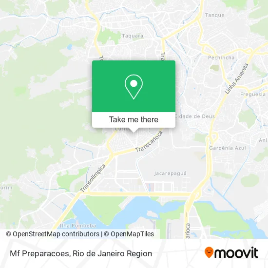
See Mf Preparacoes, Curicica, on the map
Public Transit to Mf Preparacoes in Curicica
Wondering how to get to Mf Preparacoes in Curicica? Moovit helps you find the best way to get to Mf Preparacoes with step-by-step directions from the nearest public transit station.
Moovit provides free maps and live directions to help you navigate through your city. View schedules, routes, timetables, and find out how long does it take to get to Mf Preparacoes in real time.
Looking for the nearest stop or station to Mf Preparacoes? Check out this list of stops closest to your destination: Rua João Bruno Lôbo; Praça Delfos (Praça B); Praça Do Bandolim; Estrada Dos Bandeirantes | Praça Do Bandolim; Rua Da Ventura.
Bus: 51, 881, SN 810, 380, 390, 611, 35, 348, 368, SN 368, 810, SP 810, 861, SN 861.
Want to see if there’s another route that gets you there at an earlier time? Moovit helps you find alternative routes or times. Get directions from and directions to Mf Preparacoes easily from the Moovit App or Website.
We make riding to Mf Preparacoes easy, which is why over 1.5 million users, including users in Curicica, trust Moovit as the best app for public transit. You don’t need to download an individual bus app or train app, Moovit is your all-in-one transit app that helps you find the best bus time or train time available.
For information on prices of bus, costs and ride fares to Mf Preparacoes, please check the Moovit app.
Use the app to navigate to popular places including to the airport, hospital, stadium, grocery store, mall, coffee shop, school, college, and university.
Mf Preparacoes Address: Rua Corbélia, 15 Curicica Rio de Janeiro-RJ 22780-670 street in Curicica
- Rgs Manutencao,
- Nilsonmoveis,
- Pmiranda Produtos de Limpeza,
- Martempresa,
- Sociedade Hermética da Aurora Dourada,
- Rua Ísis, 374,
- Wesley Soares,
- Alex Silva,
- Appont Prestadora de Serviços - Curicica,
- Forno Jpa,
- Creche Unidunite,
- Manuel Antônio da Luz,
- Santos Refrigeracao,
- Gruta Oficial,
- Espetos Em Casa Gourmet Delivery,
- Elimar Clínica Dentária,
- Edi Medalhista Olímpica Agatha Bednarczuk,
- Sorveteria Normando,
- Jc Santos Servicos,
- Rua Heráclito 42
Places Near Mf Preparacoes (Curicica)
- Museu Do Amanhã, Centro,
- Rodoviária Novo Rio (Rodoviária do Rio de Janeiro), Santo Cristo,
- Hospital Pedro Ernesto, Vila Isabel,
- Norte Shopping, Cachambi,
- Shopping Rio Sul, Botafogo,
- Praia do Arpoador, Ipanema,
- Rua Licínio Cardoso, São Francisco Xavier,
- Rio De Janeiro,
- Shopping Downtown, Barra Da Tijuca,
- Avenida Venezuela 134, Saúde,
- Shopping RioSul, Botafogo,
- Hospital Federal Cardoso Fontes, Jacarepaguá,
- Rua Ulysses Guimarães 16, Cidade Nova,
- Hospital Municipal Ronaldo Gazolla, Acari,
- Niterói, Niterói,
- Avenida Rio Branco, Centro,
- Shopping Nova América, Del Castilho,
- Hospital Federal Do Andaraí, Andaraí,
- Feirão De Malhas, Duque De Caxias,
- Feira Livre da Gloria, Glória
How to get to popular places in Rio de Janeiro Region with public transit
Get around Curicica by public transit!
Traveling around Curicica has never been so easy. See step by step directions as you travel to any attraction, street or major public transit station. View bus and train schedules, arrival times, service alerts and detailed routes on a map, so you know exactly how to get to anywhere in Curicica.
When traveling to any destination around Curicica use Moovit's Live Directions with Get Off Notifications to know exactly where and how far to walk, how long to wait for your line, and how many stops are left. Moovit will alert you when it's time to get off — no need to constantly re-check whether yours is the next stop.
Wondering how to use public transit in Curicica or how to pay for public transit in Curicica? Moovit public transit app can help you navigate your way with public transit easily, and at minimum cost. It includes public transit fees, ticket prices, and costs. Looking for a map of Curicica public transit lines? Moovit public transit app shows all public transit maps in Curicica with all Bus, Train, Metro, Light Rail, Ferry, Cable Car, Gondola and Funicular routes and stops on an interactive map.
Rio de Janeiro Region has 8 transit type(s), including: Bus, Train, Metro, Light Rail, Ferry, Cable Car, Gondola and Funicular, operated by several transit agencies, including TrensRJ, Metrô Rio, VLT Carioca, Barcas Rio, BRT MOBI-Rio, Auto Viação Alpha, Auto Viação Tijuca, Gire Transportes, Transurb, Viação Nossa Senhora das Graças, Consórcio INTERSUL, Braso Lisboa (Municipal), Caprichosa Auto Ônibus, Auto Viação Três Amigos and Rodoviária Âncora Matias