Directions to Mf Transporte e Turismo (Maria Da Graça) with public transportation
The following transit lines have routes that pass near Mf Transporte e Turismo
 Bus: 610, 679, 275, SN 474, 625.
- Metro: L2.
- Train: RAMAL BELFORD ROXO, RAMAL SARACURUNA.
How to get to Mf Transporte e Turismo by bus?
Click on the bus route to see step by step directions with maps, line arrival times and updated time schedules.
From Terminal das Vans (Central do Brasil), Gamboa
42 minFrom Estação Praça XV, Centro
45 minFrom CCR Barcas - Estação Praça XV, Centro
45 minFrom Av. Nilo Peçanha, Centro
43 minFrom Pechincha, Pechincha
34 minFrom Avenida Paulo de Frontin, Rio Comprido
49 minFrom Avenida Geremario Dantas, Pechincha
32 minFrom Travessa do Paço 23, Centro
43 minFrom Ônibus 775 - linha Rio X Niterói, Glória
50 minFrom Avenida Presidente Vargas 482, Centro
45 min
How to get to Mf Transporte e Turismo by train?
Click on the train route to see step by step directions with maps, line arrival times and updated time schedules.
How to get to Mf Transporte e Turismo by metro?
Click on the metro route to see step by step directions with maps, line arrival times and updated time schedules.
From Terminal das Vans (Central do Brasil), Gamboa
44 minFrom Estação Praça XV, Centro
53 minFrom CCR Barcas - Estação Praça XV, Centro
53 minFrom Av. Nilo Peçanha, Centro
45 minFrom Avenida Paulo de Frontin, Rio Comprido
61 minFrom Travessa do Paço 23, Centro
51 minFrom Ônibus 775 - linha Rio X Niterói, Glória
51 minFrom Avenida Presidente Vargas 482, Centro
45 min
Bus stops near Mf Transporte e Turismo in Maria Da Graça
Train stations near Mf Transporte e Turismo in Maria Da Graça
Metro station near Mf Transporte e Turismo in Maria Da Graça
- Nova América / Del Castilho, 18 min walk,VIEW
Bus lines to Mf Transporte e Turismo in Maria Da Graça
What are the closest stations to Mf Transporte e Turismo?
The closest stations to Mf Transporte e Turismo are:
- Padaria Do Anibal | Rua Conde De Azambuja is 101 meters away, 2 min walk.
- Rua Miguel Ângelo, 485 is 653 meters away, 9 min walk.
- Manguinhos is 773 meters away, 10 min walk.
- Nova América / Del Castilho is 1327 meters away, 18 min walk.
- Del Castilho is 1364 meters away, 18 min walk.
Which bus lines stop near Mf Transporte e Turismo?
These bus lines stop near Mf Transporte e Turismo: 610, 679.
Which metro line stops near Mf Transporte e Turismo?
L2 (Pavuna)
Which train line stops near Mf Transporte e Turismo?
RAMAL BELFORD ROXO (Belford Roxo)
What’s the nearest metro station to Mf Transporte e Turismo in Maria Da Graça?
The nearest metro station to Mf Transporte e Turismo in Maria Da Graça is Nova América / Del Castilho. It’s a 18 min walk away.
What’s the nearest train station to Mf Transporte e Turismo in Maria Da Graça?
The nearest train station to Mf Transporte e Turismo in Maria Da Graça is Manguinhos. It’s a 10 min walk away.
What’s the nearest bus station to Mf Transporte e Turismo in Maria Da Graça?
The nearest bus station to Mf Transporte e Turismo in Maria Da Graça is Padaria Do Anibal | Rua Conde De Azambuja. It’s a 2 min walk away.
What time is the first metro to Mf Transporte e Turismo in Maria Da Graça?
The L2 is the first metro that goes to Mf Transporte e Turismo in Maria Da Graça. It stops nearby at 5:20 AM.
What time is the last metro to Mf Transporte e Turismo in Maria Da Graça?
The L2 is the last metro that goes to Mf Transporte e Turismo in Maria Da Graça. It stops nearby at 12:30 AM.
What time is the first train to Mf Transporte e Turismo in Maria Da Graça?
The RAMAL BELFORD ROXO is the first train that goes to Mf Transporte e Turismo in Maria Da Graça. It stops nearby at 4:56 AM.
What time is the last train to Mf Transporte e Turismo in Maria Da Graça?
The RAMAL SARACURUNA is the last train that goes to Mf Transporte e Turismo in Maria Da Graça. It stops nearby at 10:49 PM.
What time is the first bus to Mf Transporte e Turismo in Maria Da Graça?
The SN 474 is the first bus that goes to Mf Transporte e Turismo in Maria Da Graça. It stops nearby at 3:15 AM.
What time is the last bus to Mf Transporte e Turismo in Maria Da Graça?
The SN 474 is the last bus that goes to Mf Transporte e Turismo in Maria Da Graça. It stops nearby at 3:19 AM.
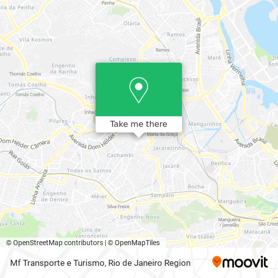
See Mf Transporte e Turismo, Maria Da Graça, on the map
Public Transit to Mf Transporte e Turismo in Maria Da Graça
Wondering how to get to Mf Transporte e Turismo in Maria Da Graça? Moovit helps you find the best way to get to Mf Transporte e Turismo with step-by-step directions from the nearest public transit station.
Moovit provides free maps and live directions to help you navigate through your city. View schedules, routes, timetables, and find out how long does it take to get to Mf Transporte e Turismo in real time.
Looking for the nearest stop or station to Mf Transporte e Turismo? Check out this list of stops closest to your destination: Padaria Do Anibal | Rua Conde De Azambuja; Rua Miguel Ângelo; Manguinhos; Nova América / Del Castilho; Del Castilho.
Bus: 610, 679, 275, SN 474, 625.Metro: L2.Train: RAMAL BELFORD ROXO, RAMAL SARACURUNA.
Want to see if there’s another route that gets you there at an earlier time? Moovit helps you find alternative routes or times. Get directions from and directions to Mf Transporte e Turismo easily from the Moovit App or Website.
We make riding to Mf Transporte e Turismo easy, which is why over 1.5 million users, including users in Maria Da Graça, trust Moovit as the best app for public transit. You don’t need to download an individual bus app or train app, Moovit is your all-in-one transit app that helps you find the best bus time or train time available.
For information on prices of bus, metro and train, costs and ride fares to Mf Transporte e Turismo, please check the Moovit app.
Use the app to navigate to popular places including to the airport, hospital, stadium, grocery store, mall, coffee shop, school, college, and university.
Mf Transporte e Turismo Address: Rua Conde de Azambuja, 1208 Maria da Graça Rio de Janeiro-RJ 20785-342 street in Maria Da Graça
- Luiz Americo Alves Duarte,
- Rua Luiza Vale 340,
- Mecanica Otavio,
- Mecanica Castelluccio,
- Favela Bandeira 2,
- Rua Miguel Angelo,
- Rua Conde de Azambuja,
- Padaria do Anibal,
- Rua São Gabriel,
- Mini Mercado Carniel,
- Posto Predileto de Maria da Graça,
- Maria da Graça,
- Avenida Dom Helder Camara 3229,
- Jorge Aguiar Moveis Planejados,
- Resenhando Delivery Comercio de Alimentos,
- Instituto de Estudos em Saúde Coletiva (IESC-UFRJ),
- Betinho Suspensões,
- Túnel Noel Rosa,
- Rua Ferreira de Andrade 1146,
- Igreja Batista Betel em Maria da Graça
Places Near Mf Transporte e Turismo (Maria Da Graça)
- Norte Shopping, Cachambi,
- Shopping Downtown, Barra Da Tijuca,
- Praia do Arpoador, Ipanema,
- Feira Livre da Gloria, Glória,
- Rodoviária Novo Rio (Rodoviária do Rio de Janeiro), Santo Cristo,
- Rua Licínio Cardoso, São Francisco Xavier,
- Shopping Rio Sul, Botafogo,
- Museu Do Amanhã, Centro,
- Avenida Venezuela 134, Saúde,
- Hospital Pedro Ernesto, Vila Isabel,
- Shopping Nova América, Del Castilho,
- Niterói, Niterói,
- Hospital Federal Do Andaraí, Andaraí,
- Shopping RioSul, Botafogo,
- Rio De Janeiro,
- Hospital Municipal Ronaldo Gazolla, Acari,
- Avenida Rio Branco, Centro,
- Hospital Federal Cardoso Fontes, Jacarepaguá,
- Rua Ulysses Guimarães 16, Cidade Nova,
- Feirão De Malhas, Duque De Caxias
How to get to popular places in Rio de Janeiro Region with public transit
Get around Maria Da Graça by public transit!
Traveling around Maria Da Graça has never been so easy. See step by step directions as you travel to any attraction, street or major public transit station. View bus and train schedules, arrival times, service alerts and detailed routes on a map, so you know exactly how to get to anywhere in Maria Da Graça.
When traveling to any destination around Maria Da Graça use Moovit's Live Directions with Get Off Notifications to know exactly where and how far to walk, how long to wait for your line, and how many stops are left. Moovit will alert you when it's time to get off — no need to constantly re-check whether yours is the next stop.
Wondering how to use public transit in Maria Da Graça or how to pay for public transit in Maria Da Graça? Moovit public transit app can help you navigate your way with public transit easily, and at minimum cost. It includes public transit fees, ticket prices, and costs. Looking for a map of Maria Da Graça public transit lines? Moovit public transit app shows all public transit maps in Maria Da Graça with all Bus, Train, Metro, Light Rail, Ferry, Cable Car, Gondola and Funicular routes and stops on an interactive map.
Rio de Janeiro Region has 8 transit type(s), including: Bus, Train, Metro, Light Rail, Ferry, Cable Car, Gondola and Funicular, operated by several transit agencies, including TrensRJ, Metrô Rio, VLT Carioca, Barcas Rio, BRT MOBI-Rio, Auto Viação Alpha, Auto Viação Tijuca, Gire Transportes, Transurb, Viação Nossa Senhora das Graças, Consórcio INTERSUL, Braso Lisboa (Municipal), Caprichosa Auto Ônibus, Auto Viação Três Amigos and Rodoviária Âncora Matias