Directions to Mi Chula (Ocoyucan) with public transportation
The following transit lines have routes that pass near Mi Chula
How to get to Mi Chula by bus?
Click on the bus route to see step by step directions with maps, line arrival times and updated time schedules.
From Parada Plaza San Diego, San Jerónimo Tecuanipan
42 minFrom Anillo Periférico Ecológico 3507, San Andrés Cholula
30 minFrom Plaza Crystal, San Andrés Cholula
31 minFrom Chedraui, Puebla
48 minFrom Loma Bonita, Puebla
52 minFrom Fraccionamiento Los Heroes 1° Sección, Ocoyucan
35 minFrom San Pablo Xochimehuacan, San Pedro Cholula
50 minFrom Parque Ecoturismo Venta Grande, San Pedro Cholula
52 minFrom Guadalupe Caleras, San Pedro Cholula
51 minFrom Plaza Victoria, Puebla
48 min
Bus stops near Mi Chula in Ocoyucan
Bus lines to Mi Chula in Ocoyucan
- RUTA AZTECA B, Ramal 1, Lomas Flor Del Bosque - Villa De Los Ángeles (Ida),VIEW
- RUTA SAN ANDRÉS CHOLULA, Ramal 2, Ciudad Judicial,VIEW
- A6 - A, Ciudad Judicial - Estadios,VIEW
- RUTA AZTECA C, Ramal 1, San Esteban - Villa De Los Ángeles,VIEW
- RUTA SUBURBANA PIRÁMIDES, Ramal 2, Barrio De San Miguel - Ciudad Judicial,VIEW
- RUTA 14A, Ramal 1, 20 De Nov. - Paseo De San Andrés,VIEW
- RUTA 29, Ramal 2 El Molinito - Coronel Miguel Auza,VIEW
- LÍNEA PERIFÉRICO, Ramal Finsa - 11 Sur (Circuito),VIEW
What are the closest stations to Mi Chula?
The closest stations to Mi Chula are:
- Acuario, 2 is 32 meters away, 1 min walk.
- Paseos Del Ángel is 50 meters away, 1 min walk.
- Wallmart Ciudad Judicial is 265 meters away, 4 min walk.
Which bus lines stop near Mi Chula?
These bus lines stop near Mi Chula: A6 - A, LÍNEA PERIFÉRICO, RUTA AZTECA B, RUTA SAN ANDRÉS CHOLULA.
What’s the nearest bus station to Mi Chula in Ocoyucan?
The nearest bus stations to Mi Chula in Ocoyucan are Acuario, 2 and Paseos Del Ángel. The closest one is a 1 min walk away.
What time is the first bus to Mi Chula in Ocoyucan?
The A6 - A is the first bus that goes to Mi Chula in Ocoyucan. It stops nearby at 5:02 AM.
What time is the last bus to Mi Chula in Ocoyucan?
The A6 - A is the last bus that goes to Mi Chula in Ocoyucan. It stops nearby at 11:37 PM.
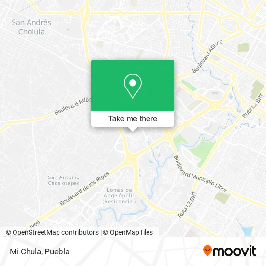
See Mi Chula, Ocoyucan, on the map
Public Transit to Mi Chula in Ocoyucan
Wondering how to get to Mi Chula in Ocoyucan? Moovit helps you find the best way to get to Mi Chula with step-by-step directions from the nearest public transit station.
Moovit provides free maps and live directions to help you navigate through your city. View schedules, routes, timetables, and find out how long does it take to get to Mi Chula in real time.
Looking for the nearest stop or station to Mi Chula? Check out this list of stops closest to your destination: Acuario; Paseos Del Ángel; Wallmart Ciudad Judicial.
Bus: A6 - A, LÍNEA PERIFÉRICO, RUTA AZTECA B, RUTA SAN ANDRÉS CHOLULA, RUTA AZTECA C, RUTA SUBURBANA PIRÁMIDES, RUTA 14A, RUTA 29.
Want to see if there’s another route that gets you there at an earlier time? Moovit helps you find alternative routes or times. Get directions from and directions to Mi Chula easily from the Moovit App or Website.
We make riding to Mi Chula easy, which is why over 1.5 million users, including users in Ocoyucan, trust Moovit as the best app for public transit. You don’t need to download an individual bus app or train app, Moovit is your all-in-one transit app that helps you find the best bus time or train time available.
For information on prices of bus, costs and ride fares to Mi Chula, please check the Moovit app.
Use the app to navigate to popular places including to the airport, hospital, stadium, grocery store, mall, coffee shop, school, college, and university.
Mi Chula Address: Mi Chula, Avenida Orión Sur, Fraccionamiento Atlixcayotl 2000, 72825 San Andrés Cholula, Puebla street in Ocoyucan
- Ipsum Soluciones Hospitalarias,
- Hot Dogs y Hamburguesas Sonora,
- MoneyGram,
- Cevicheria Martinica,
- Pollo Bachoco,
- Tortilleria Mi Pueblito,
- Colegio San Ángel,
- Tintoreria Dryclean,
- Cemitas La Explosiva,
- Prenda Mex,
- Antojitos Mexivanos Memelandia,
- Amazon Counter-Oxxo Santa Clara Pbf,
- Mas Fotos Estudio,
- Cecina de Yecapixtla,
- Complejo Deportivo Mayaquen,
- Lavanderia le Blanc,
- Avenida Orión Sur & Avenida Orion Norte,
- Las Pilingas,
- Tortas Gigantes,
- Universidad Anáhuac Puebla
Places Near Mi Chula (Ocoyucan)
- Ciudad Universitaria, Puebla,
- Centro Comercial Angelópolis, San Andrés Cholula,
- SAT, San Andrés Cholula,
- Plaza Dorada Centro Comercial, Puebla,
- Complejo Cultural Universitario, Ocoyucan,
- Hospital General Regional 36 IMSS San Alejandro, San Andrés Cholula,
- Plaza Las Animas, Puebla,
- Hospital Traumatología y Ortopedia de Puebla, San Pedro Cholula,
- Zona de los Fuertes, Puebla,
- Ciudad Judicial del Estado de Puebla, San Andrés Cholula,
- Parque Ecologico, Pue., San Andrés Cholula,
- Centro Integral de Servicios CIS, San Andrés Cholula,
- 25 Zona Militar, Puebla,
- Galerías Serdán, San Pedro Cholula,
- Estadio Cuauhtémoc, Puebla,
- Centro de Desarrollo Comunitario Tres Cruces, Puebla,
- Parque Puebla, Puebla,
- Hospital Imss La Margarita, Puebla,
- Secretaria de Finanzas, Puebla,
- Tres Cruces, Puebla
How to get to popular places in Puebla with public transit
Get around Ocoyucan by public transit!
Traveling around Ocoyucan has never been so easy. See step by step directions as you travel to any attraction, street or major public transit station. View bus and train schedules, arrival times, service alerts and detailed routes on a map, so you know exactly how to get to anywhere in Ocoyucan.
When traveling to any destination around Ocoyucan use Moovit's Live Directions with Get Off Notifications to know exactly where and how far to walk, how long to wait for your line, and how many stops are left. Moovit will alert you when it's time to get off — no need to constantly re-check whether yours is the next stop.
Wondering how to use public transit in Ocoyucan or how to pay for public transit in Ocoyucan? Moovit public transit app can help you navigate your way with public transit easily, and at minimum cost. It includes public transit fees, ticket prices, and costs. Looking for a map of Ocoyucan public transit lines? Moovit public transit app shows all public transit maps in Ocoyucan with all bus routes and stops on an interactive map.
Puebla has 1 transit type(s), including: bus, operated by several transit agencies, including RUTA, RUTA Alimentadoras, Rutas Convencionales and Líneas temporales