How to get to MiamiCentral by bus?
Click on the bus route to see step by step directions with maps, line arrival times and updated time schedules.
From Maurice Gibb Memorial Park
33 minFrom Clock Thermometer
37 minFrom SW 8th St / SW 62nd Ave
54 minFrom Hialeah Hospital Emergency Room
82 minFrom Waterford Business District
55 minFrom St Hugh Catholic Church
78 minFrom NW 27th Ave / NW 79th St
65 minFrom Consulado General de Colombia
49 minFrom Miami Shores
57 minFrom Hilton Cabana Miami Beach
60 min
How to get to MiamiCentral by train?
Click on the train route to see step by step directions with maps, line arrival times and updated time schedules.
Light Rail stations near MiamiCentral
- College North, 6 min walk,VIEW
Bus lines to MiamiCentral
What are the closest stations to MiamiCentral?
The closest stations to MiamiCentral are:
- Nw 6 St & 2 Av is 246 yards away, 4 min walk.
- NW 2 Av & NW 5 St is 291 yards away, 4 min walk.
- College North is 490 yards away, 6 min walk.
Which bus lines stop near MiamiCentral?
These bus lines stop near MiamiCentral: 100, 101, 2, 21, 211, 3, 7.
Which train lines stop near MiamiCentral?
These train lines stop near MiamiCentral: GREEN, ORANGE.
What’s the nearest light rail station to MiamiCentral?
The nearest light rail station to MiamiCentral is College North. It’s a 6 min walk away.
What’s the nearest bus station to MiamiCentral?
The nearest bus stations to MiamiCentral are Nw 6 St & 2 Av and NW 2 Av & NW 5 St. The closest one is a 4 min walk away.
What time is the first light rail to MiamiCentral?
The MMI is the first light rail that goes to MiamiCentral. It stops nearby at 5:32 AM.
What time is the last light rail to MiamiCentral?
The MMO is the last light rail that goes to MiamiCentral. It stops nearby at 10:10 PM.
What time is the first bus to MiamiCentral?
The 401 is the first bus that goes to MiamiCentral. It stops nearby at 3:02 AM.
What time is the last bus to MiamiCentral?
The 401 is the last bus that goes to MiamiCentral. It stops nearby at 2:47 AM.
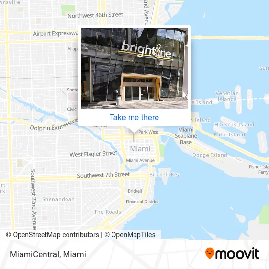
See MiamiCentral on the map
Public Transportation to MiamiCentral
Wondering how to get to MiamiCentral? Moovit helps you find the best way to get to MiamiCentral with step-by-step directions from the nearest public transit station.
Moovit provides free maps and live directions to help you navigate through your city. View schedules, routes, timetables, and find out how long does it take to get to MiamiCentral in real time.
Looking for the nearest stop or station to MiamiCentral? Check out this list of stops closest to your destination: Nw 6 St & 2 Av; NW 2 Av & NW 5 St; College North.
Bus: 100, 101, 2, 21, 211, 3, 7, 109, 110, 401.Train: GREEN, ORANGE.
Want to see if there’s another route that gets you there at an earlier time? Moovit helps you find alternative routes or times. Get directions from and directions to MiamiCentral easily from the Moovit App or Website.
We make riding to MiamiCentral easy, which is why over 1.5 million users, including users in Miami, trust Moovit as the best app for public transit. You don’t need to download an individual bus app or train app, Moovit is your all-in-one transit app that helps you find the best bus time or train time available.
For information on prices of bus and train, costs and ride fares to MiamiCentral, please check the Moovit app.
Use the app to navigate to popular places including to the airport, hospital, stadium, grocery store, mall, coffee shop, school, college, and university.
Location: Miami

- METRORail-Historic Overtown & Lyric Theatre,
- Parkline Miami,
- Khelo & Company in,
- Patagonia Flavors - by Delicatessen Patagonia,
- Citizens Go,
- Miami-Dade County Clerk of Courts,
- Chick-fil-A,
- Cicci di Carne,
- Florida Department of Revenue Child Support Program,
- Historic Overtown Lyric Theatre Station,
- OverTown Transit Center : Child Support Enforcement,
- Miami-Dade County Industrial Facilities Permit IW5 Section,
- Arena-State Plaza Metromover Station,
- Regions Bank,
- Metromover-Wilkie D Ferguson Jr,
- MDT Metrorail - Historic Overtown / Lyric Theatre Station,
- MDC PTRD,
- Miami-Dade County of,
- Powerhouse Gym Miami,
- Overtown Transit Village North
Places Near MiamiCentral
- Aventura Mall, Miami,
- Sawgrass mall ( FL ), Miami Beach,
- Miami Freedom Park, Miami,
- Richard E. Gerstein Justice Building, Miami,
- 1351 NW 12th St, Miami,
- Brickell City Centre, Miami,
- Little Havana, Miami,
- Zoo Miami, Miami,
- Bayside Marketplace, Miami,
- Miami-Dade County Courthouse, Miami,
- Aventura Mall, Miami Beach,
- Marlins Park, Miami,
- Port of Miami Cruise Terminal, Miami,
- Dolphin Mall Bus, Miami,
- Hard Rock Stadium, Miami Gardens,
- Keiser University Flagship Campus, West Palm Beach,
- Wynwood, Miami,
- Sawgrass Mall, Miami,
- Miami Design District, Miami,
- Dolphin Mall, Miami
How to get to popular places in Miami with public transit
Get around Miami by public transit!
Traveling around Miami has never been so easy. See step by step directions as you travel to any attraction, street or major public transit station. View bus and train schedules, arrival times, service alerts and detailed routes on a map, so you know exactly how to get to anywhere in Miami.
When traveling to any destination around Miami use Moovit's Live Directions with Get Off Notifications to know exactly where and how far to walk, how long to wait for your line, and how many stops are left. Moovit will alert you when it's time to get off — no need to constantly re-check whether yours is the next stop.
Wondering how to use public transit in Miami or how to pay for public transit in Miami? Moovit public transit app can help you navigate your way with public transit easily, and at minimum cost. It includes public transit fees, ticket prices, and costs. Looking for a map of Miami public transit lines? Moovit public transit app shows all public transit maps in Miami with all Bus, Train, Light Rail and Ferry routes and stops on an interactive map.
Miami has 4 transit type(s), including: Bus, Train, Light Rail and Ferry, operated by several transit agencies, including Broward County Transit, Miami-Dade Transit, Metrorail, Palm Tran, Tri-Rail, Brightline, MARTY, City of Homestead Trolley, Key West Transit, Treasure Coast Connector, GoLine IRT, Amtrak, Greyhound-us, FlixBus-us and Aventura Express Shuttle Bus