How to get to Miami-Dade Ruby Locksmith Dade Ruby Locksmith by bus?
Click on the bus route to see step by step directions with maps, line arrival times and updated time schedules.
From Hard Rock Stadium
55 minFrom North Miami Senior Highschool
64 minFrom Us07
58 minFrom Bal Harbour
55 minFrom Seminole Hard Rock Hotel & Casino
51 minFrom Opa-Locka, FL
91 minFrom Seminole Hard Rock Hotel & Casino Hollywood (Seminole Hard Rock Hollywood Casino)
61 minFrom Amazon Fulfillment Center - MIA1
87 minFrom Dania Pointe
100 minFrom Hollywood, Florida
78 min
Bus stops near Miami-Dade Ruby Locksmith Dade Ruby Locksmith
Train station near Miami-Dade Ruby Locksmith Dade Ruby Locksmith
- Aventura, 61 min walk,VIEW
Bus lines to Miami-Dade Ruby Locksmith Dade Ruby Locksmith
What are the closest stations to Miami-Dade Ruby Locksmith Dade Ruby Locksmith?
The closest stations to Miami-Dade Ruby Locksmith Dade Ruby Locksmith are:
- Ne 10 Av Rd @ Ne 205 Te is 308 yards away, 5 min walk.
- County Line Road/Southwest 40th Avenue is 1959 yards away, 24 min walk.
- Aventura is 5147 yards away, 61 min walk.
Which bus line stops near Miami-Dade Ruby Locksmith Dade Ruby Locksmith?
199 (199 - Aventura Mall Terminal)
What’s the nearest bus station to Miami-Dade Ruby Locksmith Dade Ruby Locksmith?
The nearest bus station to Miami-Dade Ruby Locksmith Dade Ruby Locksmith is Ne 10 Av Rd @ Ne 205 Te. It’s a 5 min walk away.
What time is the first train to Miami-Dade Ruby Locksmith Dade Ruby Locksmith?
The BLFM is the first train that goes to Miami-Dade Ruby Locksmith Dade Ruby Locksmith. It stops nearby at 6:09 AM.
What time is the last train to Miami-Dade Ruby Locksmith Dade Ruby Locksmith?
The BLFM is the last train that goes to Miami-Dade Ruby Locksmith Dade Ruby Locksmith. It stops nearby at 12:07 AM.
What time is the first bus to Miami-Dade Ruby Locksmith Dade Ruby Locksmith?
The 199 is the first bus that goes to Miami-Dade Ruby Locksmith Dade Ruby Locksmith. It stops nearby at 5:10 AM.
What time is the last bus to Miami-Dade Ruby Locksmith Dade Ruby Locksmith?
The 199 is the last bus that goes to Miami-Dade Ruby Locksmith Dade Ruby Locksmith. It stops nearby at 11:12 PM.
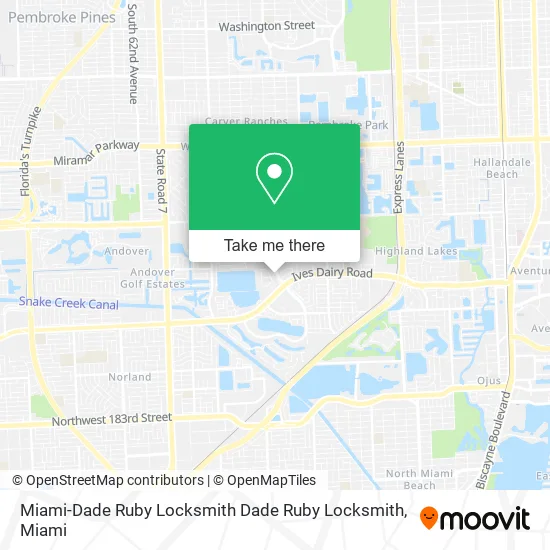
See Miami-Dade Ruby Locksmith Dade Ruby Locksmith on the map
Public Transportation to Miami-Dade Ruby Locksmith Dade Ruby Locksmith
Wondering how to get to Miami-Dade Ruby Locksmith Dade Ruby Locksmith? Moovit helps you find the best way to get to Miami-Dade Ruby Locksmith Dade Ruby Locksmith with step-by-step directions from the nearest public transit station.
Moovit provides free maps and live directions to help you navigate through your city. View schedules, routes, timetables, and find out how long does it take to get to Miami-Dade Ruby Locksmith Dade Ruby Locksmith in real time.
Looking for the nearest stop or station to Miami-Dade Ruby Locksmith Dade Ruby Locksmith? Check out this list of stops closest to your destination: Ne 10 Av Rd @ Ne 205 Te; County Line Road/Southwest 40th Avenue; Aventura.
Bus: 199, 15.Train: BLFM.
Want to see if there’s another route that gets you there at an earlier time? Moovit helps you find alternative routes or times. Get directions from and directions to Miami-Dade Ruby Locksmith Dade Ruby Locksmith easily from the Moovit App or Website.
We make riding to Miami-Dade Ruby Locksmith Dade Ruby Locksmith easy, which is why over 1.5 million users, including users in Miami, trust Moovit as the best app for public transit. You don’t need to download an individual bus app or train app, Moovit is your all-in-one transit app that helps you find the best bus time or train time available.
For information on prices of bus, costs and ride fares to Miami-Dade Ruby Locksmith Dade Ruby Locksmith, please check the Moovit app.
Use the app to navigate to popular places including to the airport, hospital, stadium, grocery store, mall, coffee shop, school, college, and university.
Miami-Dade Ruby Locksmith Dade Ruby Locksmith Address: 795 NE 206th St Miami, FL 33179 street in Miami
- Chabad Calif Club,
- Lex Promotions and Marketing Group,
- Ives Estates,
- All Air Solutions,
- Winn-Dixie,
- Amazon Locker-Gregoire,
- Hilinesport,
- Coinstar,
- Coinstar - Bitcoin ATM,
- Vehicle Locksmith Miami,
- Little Caesars,
- Dollar Tree,
- Mila Apartments,
- Dollar Store Plus,
- Planet Fitness,
- Dependable Produce,
- J&B Home & Business Improvement Service,
- Ron the Recruiter,
- FedEx,
- New Oriental Spa & Massage
Places Near Miami-Dade Ruby Locksmith Dade Ruby Locksmith
- Dolphin Mall, Miami,
- Keiser University Flagship Campus, West Palm Beach,
- Miami VA Hospital, Miami,
- Sawgrass mall ( FL ), Miami Beach,
- Dolphin Mall Bus, Miami,
- Aventura Mall, Miami Beach,
- Miami Design District, Miami,
- Wynwood, Miami,
- Marlins Park, Miami,
- Richard E. Gerstein Justice Building, Miami,
- Bayside Marketplace, Miami,
- Aventura Mall, Miami,
- Sawgrass Mall, Miami,
- Miami-Dade County Courthouse, Miami,
- Little Havana, Miami,
- Port of Miami Cruise Terminal, Miami,
- Hard Rock Stadium, Miami Gardens,
- Brickell City Centre, Miami,
- Miami Freedom Park, Miami,
- Zoo Miami, Miami
How to get to popular places in Miami with public transit
Get around Miami by public transit!
Traveling around Miami has never been so easy. See step by step directions as you travel to any attraction, street or major public transit station. View bus and train schedules, arrival times, service alerts and detailed routes on a map, so you know exactly how to get to anywhere in Miami.
When traveling to any destination around Miami use Moovit's Live Directions with Get Off Notifications to know exactly where and how far to walk, how long to wait for your line, and how many stops are left. Moovit will alert you when it's time to get off — no need to constantly re-check whether yours is the next stop.
Wondering how to use public transit in Miami or how to pay for public transit in Miami? Moovit public transit app can help you navigate your way with public transit easily, and at minimum cost. It includes public transit fees, ticket prices, and costs. Looking for a map of Miami public transit lines? Moovit public transit app shows all public transit maps in Miami with all Bus, Train, Light Rail and Ferry routes and stops on an interactive map.
Miami has 4 transit type(s), including: Bus, Train, Light Rail and Ferry, operated by several transit agencies, including Broward County Transit, Miami-Dade Transit, Metrorail, Palm Tran, Tri-Rail, Brightline, MARTY, City of Homestead Trolley, Key West Transit, Treasure Coast Connector, GoLine IRT, Amtrak, Greyhound-us, FlixBus-us and Aventura Express Shuttle Bus