How to get to Michele Belas Unhas by bus?
Click on the bus route to see step by step directions with maps, line arrival times and updated time schedules.
From Guaratiba, Guaratiba
53 minFrom Pedra De Guaratiba, Pedra De Guaratiba
54 minFrom Ct Ninho das Garças - Guaratiba, Guaratiba
37 minFrom Avenida das Américas / BRT Transoeste, Guaratiba
32 minFrom Sepetiba, Sepetiba
50 minFrom Monte Das Oliveiras, Campo Grande
61 minFrom Itaguaí, Itaguaí
51 minFrom Jardim da Saudade Paciencia, Santa Cruz
57 minFrom Estrada do Tingui, Campo Grande
67 minFrom Estrada do Campinho, Campo Grande
52 min
How to get to Michele Belas Unhas by train?
Click on the train route to see step by step directions with maps, line arrival times and updated time schedules.
Bus stops near Michele Belas Unhas in Santa Cruz
Train station near Michele Belas Unhas in Santa Cruz
- Santa Cruz, 44 min walk,VIEW
Bus lines to Michele Belas Unhas in Santa Cruz
- 849, Base Aérea De Santa Cruz ✈,VIEW
- 2383, Sepetiba,VIEW
- 757, Sepetiba,VIEW
- 898, Campo Grande,VIEW
- SN 898, Sepetiba,VIEW
- 388, Cesarão - Candelária (Brs 5 - Via Santa Cruz - Parador),VIEW
- SN 388, Cesarão - Candelária (BRS 5 - via Terminal Deodoro / Lapa),VIEW
- SR 388, Cesarão - Candelária (Brs 5 - Via Santa Cruz - Expresso),VIEW
- 426P, Itaguaí - Cesarão / 7 de Abril,VIEW
- 460S (EXECUTIVO), Itaguaí - Barra da Tijuca,VIEW
- 570P, Itaguaí - Marechal Hermes (Via Santa Cruz),VIEW
- 753, Santa Cruz - Coelho Neto (Via Urucânia / Estr. do Tinguí),VIEW
- 759, Cesarão - Coelho Neto,VIEW
- SP 759, Cesarão - Terminal Deodoro (via Santa Cruz),VIEW
- 807, Jesuítas - Terminal Curral Falso (Via Santa Cruz),VIEW
- 2303, Cesarão - Carioca (Brs 5 - Via Santa Cruz - Expresso),VIEW
- 2802, São Fernando - Jardim Oceânico (Via Santa Cruz / Av. das Américas),VIEW
- 121T, Caxias - Itaguaí (Via Estrada do Campinho / Santa Cruz),VIEW
- 430P, Chaperó - Santa Cruz (Via Itaguaí),VIEW
- 733P, Santa Sofia - Santa Cruz (via UFRRJ / Piranema),VIEW
What are the closest stations to Michele Belas Unhas?
The closest stations to Michele Belas Unhas are:
- Rua Do Império, 732 is 142 meters away, 2 min walk.
- Rua Ferreira Nobre is 613 meters away, 8 min walk.
- Rua Do Prado / Feirinha is 726 meters away, 10 min walk.
- Rua Do Prado / Hospital Pedro II is 731 meters away, 10 min walk.
- Estação De Santa Cruz is 779 meters away, 11 min walk.
- Rua Do Matadouro, 43 is 1141 meters away, 15 min walk.
- Santa Cruz is 3395 meters away, 44 min walk.
Which bus lines stop near Michele Belas Unhas?
These bus lines stop near Michele Belas Unhas: 17, 20, 430P, 753, 849, 898.
Which train line stops near Michele Belas Unhas?
RAMAL SANTA CRUZ (Santa Cruz (Parador))
What’s the nearest bus station to Michele Belas Unhas in Santa Cruz?
The nearest bus station to Michele Belas Unhas in Santa Cruz is Rua Do Império, 732. It’s a 2 min walk away.
What time is the first train to Michele Belas Unhas in Santa Cruz?
The RAMAL SANTA CRUZ is the first train that goes to Michele Belas Unhas in Santa Cruz. It stops nearby at 3:52 AM.
What time is the last train to Michele Belas Unhas in Santa Cruz?
The RAMAL SANTA CRUZ is the last train that goes to Michele Belas Unhas in Santa Cruz. It stops nearby at 12:02 AM.
What time is the first bus to Michele Belas Unhas in Santa Cruz?
The 388 is the first bus that goes to Michele Belas Unhas in Santa Cruz. It stops nearby at 3:01 AM.
What time is the last bus to Michele Belas Unhas in Santa Cruz?
The SN 388 is the last bus that goes to Michele Belas Unhas in Santa Cruz. It stops nearby at 3:49 AM.
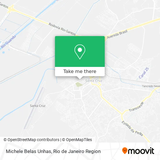
See Michele Belas Unhas, Santa Cruz, on the map
Public Transit to Michele Belas Unhas in Santa Cruz
Wondering how to get to Michele Belas Unhas in Santa Cruz? Moovit helps you find the best way to get to Michele Belas Unhas with step-by-step directions from the nearest public transit station.
Moovit provides free maps and live directions to help you navigate through your city. View schedules, routes, timetables, and find out how long does it take to get to Michele Belas Unhas in real time.
Looking for the nearest stop or station to Michele Belas Unhas? Check out this list of stops closest to your destination: Rua Do Império; Rua Ferreira Nobre; Rua Do Prado / Feirinha; Rua Do Prado / Hospital Pedro II; Estação De Santa Cruz; Rua Do Matadouro; Santa Cruz.
Bus: 17, 20, 430P, 753, 849, 898, 2383, 757, SN 898, 388, SN 388, SR 388, 426P, 460S (EXECUTIVO), 121T, 733P, 804, 809, 904T.Train: RAMAL SANTA CRUZ.
Want to see if there’s another route that gets you there at an earlier time? Moovit helps you find alternative routes or times. Get directions from and directions to Michele Belas Unhas easily from the Moovit App or Website.
We make riding to Michele Belas Unhas easy, which is why over 1.5 million users, including users in Santa Cruz, trust Moovit as the best app for public transit. You don’t need to download an individual bus app or train app, Moovit is your all-in-one transit app that helps you find the best bus time or train time available.
For information on prices of bus and train, costs and ride fares to Michele Belas Unhas, please check the Moovit app.
Use the app to navigate to popular places including to the airport, hospital, stadium, grocery store, mall, coffee shop, school, college, and university.
Michele Belas Unhas Address: Rua do Império, 664 Santa Cruz Rio de Janeiro-RJ 23555-024 street in Santa Cruz
- Imperio dos Parafusos,
- Consultorio Base do Sorriso,
- Deposito de Bebidas Marcio & Maria,
- Moleka Santa Cruz - Império dos Sorvetes,
- Ct Toca do Rato,
- Aupepet,
- Liandra Cristine Calmon Barbosa,
- Evelynesantos,
- Sabor do Mar,
- AC Informatica,
- À Carioca,
- Rua do Império 573,
- Império Santa Cruz Comércio de Telhas-Grupo Tmc,
- G.R.E.S. Acadêmicos de Santa Cruz,
- Xrmerceariae,
- Jardim dos Ipes I,
- Luciana Camargo Harmonizacao Facial,
- Denise Herbalife,
- Rua do Império,
- Rota Material de Construcao
Places Near Michele Belas Unhas (Santa Cruz)
- Hospital Federal Cardoso Fontes, Jacarepaguá,
- Avenida Rio Branco, Centro,
- Rua Licínio Cardoso, São Francisco Xavier,
- Rodoviária Novo Rio (Rodoviária do Rio de Janeiro), Santo Cristo,
- Feirão De Malhas, Duque De Caxias,
- Hospital Pedro Ernesto, Vila Isabel,
- Feira Livre da Gloria, Glória,
- Niterói, Niterói,
- Hospital Federal Do Andaraí, Andaraí,
- Rio De Janeiro,
- Museu Do Amanhã, Centro,
- Rua Ulysses Guimarães 16, Cidade Nova,
- Norte Shopping, Cachambi,
- Shopping RioSul, Botafogo,
- Shopping Nova América, Del Castilho,
- Avenida Venezuela 134, Saúde,
- Hospital Municipal Ronaldo Gazolla, Acari,
- Shopping Rio Sul, Botafogo,
- Praia do Arpoador, Ipanema,
- Shopping Downtown, Barra Da Tijuca
How to get to popular places in Rio de Janeiro Region with public transit
Get around Santa Cruz by public transit!
Traveling around Santa Cruz has never been so easy. See step by step directions as you travel to any attraction, street or major public transit station. View bus and train schedules, arrival times, service alerts and detailed routes on a map, so you know exactly how to get to anywhere in Santa Cruz.
When traveling to any destination around Santa Cruz use Moovit's Live Directions with Get Off Notifications to know exactly where and how far to walk, how long to wait for your line, and how many stops are left. Moovit will alert you when it's time to get off — no need to constantly re-check whether yours is the next stop.
Wondering how to use public transit in Santa Cruz or how to pay for public transit in Santa Cruz? Moovit public transit app can help you navigate your way with public transit easily, and at minimum cost. It includes public transit fees, ticket prices, and costs. Looking for a map of Santa Cruz public transit lines? Moovit public transit app shows all public transit maps in Santa Cruz with all Bus, Train, Metro, Light Rail, Ferry, Cable Car, Gondola and Funicular routes and stops on an interactive map.
Rio de Janeiro Region has 8 transit type(s), including: Bus, Train, Metro, Light Rail, Ferry, Cable Car, Gondola and Funicular, operated by several transit agencies, including TrensRJ, Metrô Rio, VLT Carioca, Barcas Rio, BRT MOBI-Rio, Auto Viação Alpha, Auto Viação Tijuca, Gire Transportes, Transurb, Viação Nossa Senhora das Graças, Consórcio INTERSUL, Braso Lisboa (Municipal), Caprichosa Auto Ônibus, Auto Viação Três Amigos and Rodoviária Âncora Matias