How to get to Micro Tech by bus?
Click on the bus route to see step by step directions with maps, line arrival times and updated time schedules.
From The Studio Theatre, Washington
61 minFrom Cleveland Park, Washington
63 minFrom Kalorama, Washington
77 minFrom Cathedral Heights, Washington
72 minFrom Washington Hebrew Congregation, Washington
72 minFrom The Home Depot, Washington
64 minFrom Fairfield Inn & Suites Washington, DC/New York Avenue, Washington
52 minFrom St. Albans School, Washington
70 minFrom Mva - Beltsville, Prince George's County
72 minFrom 1st St NE & M, Washington
72 min
How to get to Micro Tech by metro?
Click on the metro route to see step by step directions with maps, line arrival times and updated time schedules.
Bus stops near Micro Tech in Montgomery County
Metro station near Micro Tech in Montgomery County
- Silver Spring, 44 min walk,VIEW
Train station near Micro Tech in Montgomery County
- Silver Spring Marc Wb, 46 min walk,VIEW
Bus lines to Micro Tech in Montgomery County
What are the closest stations to Micro Tech?
The closest stations to Micro Tech are:
- E University Bv & Navahoe Dr is 202 yards away, 3 min walk.
- Merrimac Dr And University Blvd is 344 yards away, 5 min walk.
- 11th Ave & Carroll Ave is 432 yards away, 6 min walk.
- Silver Spring is 3682 yards away, 44 min walk.
- Silver Spring Marc Wb is 3874 yards away, 46 min walk.
Which bus lines stop near Micro Tech?
These bus lines stop near Micro Tech: 15, 18, M12, M6X, P43.
Which metro line stops near Micro Tech?
RED (Glenmont)
What’s the nearest bus station to Micro Tech in Montgomery County?
The nearest bus station to Micro Tech in Montgomery County is E University Bv & Navahoe Dr. It’s a 3 min walk away.
What time is the first metro to Micro Tech in Montgomery County?
The RED is the first metro that goes to Micro Tech in Montgomery County. It stops nearby at 5:10 AM.
What time is the last metro to Micro Tech in Montgomery County?
The RED is the last metro that goes to Micro Tech in Montgomery County. It stops nearby at 12:28 AM.
What time is the first train to Micro Tech in Montgomery County?
The MARC is the first train that goes to Micro Tech in Montgomery County. It stops nearby at 5:51 AM.
What time is the last train to Micro Tech in Montgomery County?
The MARC is the last train that goes to Micro Tech in Montgomery County. It stops nearby at 7:37 PM.
What time is the first bus to Micro Tech in Montgomery County?
The 15 is the first bus that goes to Micro Tech in Montgomery County. It stops nearby at 4:22 AM.
What time is the last bus to Micro Tech in Montgomery County?
The M12 is the last bus that goes to Micro Tech in Montgomery County. It stops nearby at 2:35 AM.
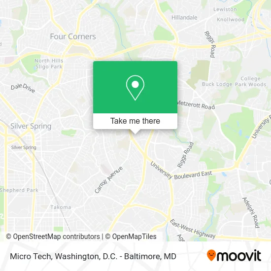
See Micro Tech, Montgomery County, on the map
Public Transit to Micro Tech in Montgomery County
Wondering how to get to Micro Tech in Montgomery County? Moovit helps you find the best way to get to Micro Tech with step-by-step directions from the nearest public transit station.
Moovit provides free maps and live directions to help you navigate through your city. View schedules, routes, timetables, and find out how long does it take to get to Micro Tech in real time.
Looking for the nearest stop or station to Micro Tech? Check out this list of stops closest to your destination: E University Bv & Navahoe Dr; Merrimac Dr And University Blvd; 11th Ave & Carroll Ave; Silver Spring; Silver Spring Marc Wb.
Bus: 15, 18, M12, M6X, P43, 17, 25, 16.Train: MARC.Metro: RED.
Want to see if there’s another route that gets you there at an earlier time? Moovit helps you find alternative routes or times. Get directions from and directions to Micro Tech easily from the Moovit App or Website.
We make riding to Micro Tech easy, which is why over 1.5 million users, including users in Montgomery County, trust Moovit as the best app for public transit. You don’t need to download an individual bus app or train app, Moovit is your all-in-one transit app that helps you find the best bus time or train time available.
For information on prices of bus and metro, costs and ride fares to Micro Tech, please check the Moovit app.
Use the app to navigate to popular places including to the airport, hospital, stadium, grocery store, mall, coffee shop, school, college, and university.
Micro Tech Address: 8413 10th Ave Silver Spring, MD 20903 street in Montgomery County
- University Blvd E (carroll ave university),
- Iglesia Adventista Del Séptimo Día Takoma Park,
- Marquez Jaime MD,
- Takoma Academy Preparatory School,
- Takoma Academy,
- University Blvd Anne St,
- CASA De Maryland,
- Casa Blanca Bakery (Casa Blanca Bakeries),
- Intermex Wire Transfer,
- 4 Corners W & S,
- Silver Spring Jewelry - Takoma Park / Langley Park,
- Mega Mart International Supermarkets,
- Chuck E. Cheese's,
- Iglesia Jesus Restaurando Vidas,
- Megamart,
- MoneyGram,
- Ups,
- Reyes General Mechanic,
- Langley Park Plaza,
- University Blvd E (university blvd and Piney Branch Rd)
Places Near Micro Tech (Montgomery County)
- Museum Of The Bible, Washington,
- Sibley Memorial Hospital, Washington,
- Georgetown, Washington,
- M&T Bank Stadium, Baltimore,
- Washington National Cathedral, Washington,
- National Theatre, Washington,
- Capital One Arena, Washington,
- The Anthem, Washington,
- Westfield Montgomery Mall, Montgomery County,
- National Zoo, Washington,
- National Museum of African American History and Culture, Washington,
- Amazon Hq2, Arlington County,
- Warner Theatre, Washington,
- Basilica of the National Shrine, Washington,
- Camden Yards, Baltimore,
- Washington DC VA Medical Center, Washington,
- Marriott Marquis Washington, DC, Washington,
- Rock Creek Tennis Center, Washington,
- PG Mall, Prince George's County,
- Pennsylvania Ave NW (3rd st and pennsylvania), Washington
How to get to popular places in Washington, D.C. - Baltimore, MD with public transit
Get around Montgomery County by public transit!
Traveling around Montgomery County has never been so easy. See step by step directions as you travel to any attraction, street or major public transit station. View bus and train schedules, arrival times, service alerts and detailed routes on a map, so you know exactly how to get to anywhere in Montgomery County.
When traveling to any destination around Montgomery County use Moovit's Live Directions with Get Off Notifications to know exactly where and how far to walk, how long to wait for your line, and how many stops are left. Moovit will alert you when it's time to get off — no need to constantly re-check whether yours is the next stop.
Wondering how to use public transit in Montgomery County or how to pay for public transit in Montgomery County? Moovit public transit app can help you navigate your way with public transit easily, and at minimum cost. It includes public transit fees, ticket prices, and costs. Looking for a map of Montgomery County public transit lines? Moovit public transit app shows all public transit maps in Montgomery County with all Bus, Train, Metro, Light Rail and Ferry routes and stops on an interactive map.
Washington, D.C. - Baltimore, MD has 5 transit type(s), including: Bus, Train, Metro, Light Rail and Ferry, operated by several transit agencies, including WMATA, Montgomery County Ride On, Fairfax Connector, TheBus, PRTC, DASH - Alexandria, Arlington Transit (ART), RTA of Central Maryland, MDOT MTA, MDOT MTA Light RailLink, MDOT MTA Commuter Bus, MDOT MTA Local Bus, FXBGO!, Virginia Railway Express (VRE) and MARC