How to get to Microsoft Windows Icon by bus?
Click on the bus route to see step by step directions with maps, line arrival times and updated time schedules.
From Bethesda Hospital East-ER, Boynton Beach-Delray Beach
41 minFrom Funky Buddha Brewery And Lounge, Boca Raton
41 minFrom DXN Florida, Boynton Beach-Delray Beach
111 minFrom Florida Atlantic University, Boca Raton
68 minFrom W Woolbright Rd / Jog Rd, Boynton Beach-Delray Beach
119 minFrom Lynn University, Boca Raton
73 minFrom Military Trail & Yamato Rd., Boca Raton
70 minFrom Boca Raton, FL, Boca Raton
46 minFrom Boca Regional Hospital, Boca Raton
80 minFrom Palm Beach State College, Boca Raton
66 min
Bus stops near Microsoft Windows Icon in Boca Raton
Bus lines to Microsoft Windows Icon in Boca Raton
What are the closest stations to Microsoft Windows Icon?
The closest stations to Microsoft Windows Icon are:
- SE 10TH ST at SE 5TH AVE/FEDERAL HW is 715 yards away, 9 min walk.
- SE 5TH AVE at SE 10TH ST is 751 yards away, 10 min walk.
- FEDERAL HWY/NE 6TH AVE at SE 1ST ST is 1765 yards away, 21 min walk.
Which bus lines stop near Microsoft Windows Icon?
These bus lines stop near Microsoft Windows Icon: 1, 70, 81.
What’s the nearest bus station to Microsoft Windows Icon in Boca Raton?
The nearest bus station to Microsoft Windows Icon in Boca Raton is SE 10TH ST at SE 5TH AVE/FEDERAL HW. It’s a 9 min walk away.
What time is the first bus to Microsoft Windows Icon in Boca Raton?
The 1 is the first bus that goes to Microsoft Windows Icon in Boca Raton. It stops nearby at 5:18 AM.
What time is the last bus to Microsoft Windows Icon in Boca Raton?
The 1 is the last bus that goes to Microsoft Windows Icon in Boca Raton. It stops nearby at 10:08 PM.
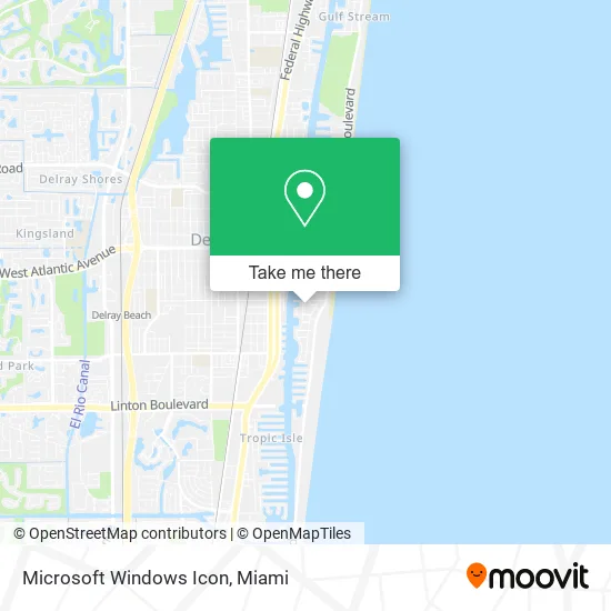
See Microsoft Windows Icon, Boca Raton, on the map
Public Transit to Microsoft Windows Icon in Boca Raton
Wondering how to get to Microsoft Windows Icon in Boca Raton? Moovit helps you find the best way to get to Microsoft Windows Icon with step-by-step directions from the nearest public transit station.
Moovit provides free maps and live directions to help you navigate through your city. View schedules, routes, timetables, and find out how long does it take to get to Microsoft Windows Icon in real time.
Looking for the nearest stop or station to Microsoft Windows Icon? Check out this list of stops closest to your destination: SE 10TH ST at SE 5TH AVE/FEDERAL HW; SE 5TH AVE at SE 10TH ST; FEDERAL HWY/NE 6TH AVE at SE 1ST ST.
Bus: 1, 70, 81, 80, 88.
Want to see if there’s another route that gets you there at an earlier time? Moovit helps you find alternative routes or times. Get directions from and directions to Microsoft Windows Icon easily from the Moovit App or Website.
We make riding to Microsoft Windows Icon easy, which is why over 1.5 million users, including users in Boca Raton, trust Moovit as the best app for public transit. You don’t need to download an individual bus app or train app, Moovit is your all-in-one transit app that helps you find the best bus time or train time available.
For information on prices of bus and train, costs and ride fares to Microsoft Windows Icon, please check the Moovit app.
Use the app to navigate to popular places including to the airport, hospital, stadium, grocery store, mall, coffee shop, school, college, and university.
Microsoft Windows Icon Address: 1011 Bucida Rd street in Boca Raton
- Delray Beach Fl,
- Delray Public Beach,
- United States Life,
- Delray Beach Water Sports - Shed,
- View West Palm Beach Homes,
- Volleyball Courts @ Delray Beach,
- Glimpse,
- Lift Lounge,
- Dean R. Halper,
- Deerfield Beach City Parks & Recreation,
- Green Heart Myofascial Release,
- Candy and Co,
- Lynawaxbar,
- Skin Secrets Delray Beach,
- 3grams Wellness,
- Friedman Family TX LLC,
- Acg Plastic Surgery- Dr. Alexandra Conde Green,
- Calm Waters Counseling Services LLC,
- Loves Hidden Policy,
- Cure Vibe IV
Places Near Microsoft Windows Icon (Boca Raton)
- Miami-Dade County Courthouse, Miami,
- Dolphin Mall, Miami,
- Miami Design District, Miami,
- Sawgrass mall ( FL ), Miami Beach,
- Miami VA Hospital, Miami,
- Richard E. Gerstein Justice Building, Miami,
- Bayside Marketplace, Miami,
- Marlins Park, Miami,
- Little Havana, Miami,
- Aventura Mall, Miami Beach,
- Brickell City Centre, Miami,
- Aventura Mall, Miami,
- Keiser University Flagship Campus, West Palm Beach,
- Zoo Miami, Miami,
- Wynwood, Miami,
- Dolphin Mall Bus, Miami,
- Miami Freedom Park, Miami,
- Port of Miami Cruise Terminal, Miami,
- Sawgrass Mall, Miami,
- Hard Rock Stadium, Miami Gardens
How to get to popular places in Miami with public transit
Get around Boca Raton by public transit!
Traveling around Boca Raton has never been so easy. See step by step directions as you travel to any attraction, street or major public transit station. View bus and train schedules, arrival times, service alerts and detailed routes on a map, so you know exactly how to get to anywhere in Boca Raton.
When traveling to any destination around Boca Raton use Moovit's Live Directions with Get Off Notifications to know exactly where and how far to walk, how long to wait for your line, and how many stops are left. Moovit will alert you when it's time to get off — no need to constantly re-check whether yours is the next stop.
Wondering how to use public transit in Boca Raton or how to pay for public transit in Boca Raton? Moovit public transit app can help you navigate your way with public transit easily, and at minimum cost. It includes public transit fees, ticket prices, and costs. Looking for a map of Boca Raton public transit lines? Moovit public transit app shows all public transit maps in Boca Raton with all Bus, Train, Light Rail and Ferry routes and stops on an interactive map.
Miami has 4 transit type(s), including: Bus, Train, Light Rail and Ferry, operated by several transit agencies, including Broward County Transit, Miami-Dade Transit, Metrorail, Palm Tran, Tri-Rail, Brightline, MARTY, City of Homestead Trolley, Key West Transit, Treasure Coast Connector, GoLine IRT, Amtrak, Greyhound-us, FlixBus-us and Aventura Express Shuttle Bus