Midland Ave @ Smart Ave stop - Tuesday schedule
| Line | Direction | Time |
|---|---|---|
| 25 | Nereid Ave @ White Plains Rd | 6:11 AM |
| 25 | Nereid Ave @ White Plains Rd | 6:31 AM |
| 25 | Nereid Ave @ White Plains Rd | 6:43 AM |
| 25 | Nereid Ave @ White Plains Rd | 6:55 AM |
| 25 | Nereid Ave @ White Plains Rd | 7:07 AM |
| 25 | Nereid Ave @ White Plains Rd | 7:13 AM |
| 25 | Nereid Ave @ White Plains Rd | 7:29 AM |
| 25 | Nereid Ave @ White Plains Rd | 7:47 AM |
| 25 | Nereid Ave @ White Plains Rd | 7:59 AM |
| 25 | Nereid Ave @ White Plains Rd | 8:19 AM |
| 25 | Nereid Ave @ White Plains Rd | 8:39 AM |
| 25 | Nereid Ave @ White Plains Rd | 8:59 AM |
| 25 | Nereid Ave @ White Plains Rd | 9:19 AM |
| 25 | Nereid Ave @ White Plains Rd | 9:50 AM |
| 25 | Nereid Ave @ White Plains Rd | 10:19 AM |
| 25 | Nereid Ave @ White Plains Rd | 10:50 AM |
| 25 | Nereid Ave @ White Plains Rd | 11:25 AM |
| 25 | Nereid Ave @ White Plains Rd | 11:49 AM |
| 25 | Nereid Ave @ White Plains Rd | 12:19 PM |
| 25 | Nereid Ave @ White Plains Rd | 12:49 PM |
| 25 | Nereid Ave @ White Plains Rd | 1:19 PM |
| 25 | Nereid Ave @ White Plains Rd | 1:46 PM |
| 25 | Nereid Ave @ White Plains Rd | 2:11 PM |
| 25 | Nereid Ave @ White Plains Rd | 2:35 PM |
| 25 | Nereid Ave @ White Plains Rd | 2:58 PM |
Directions to Midland Ave @ Smart Ave stop (Yonkers) with public transit
The following transit lines have routes that pass near Midland Ave @ Smart Ave
 Bus: 20, 25, 21, 28.
- Train: 2.
How to get to Midland Ave @ Smart Ave stop by bus?
Click on the bus route to see step by step directions with maps, line arrival times and updated time schedules.
How to get to Midland Ave @ Smart Ave stop by train?
Click on the train route to see step by step directions with maps, line arrival times and updated time schedules.
Bus stops near Midland Ave @ Smart Ave stop in Yonkers
- Midland Ave @ Smart Ave, 1 min walk,
- Central Park Ave @ Midland Ave, 8 min walk,
Train stations near Midland Ave @ Smart Ave station in Yonkers
- Fleetwood, 34 min walk,
Bus lines to Midland Ave @ Smart Ave stop in Yonkers
- 25, Yonkers,
- 20, X - Bedford Park,
- 21, Limited Stops - Bedford Park,
- 28, 23rd St @ 5th Ave,
What are the closest stations to Midland Ave @ Smart Ave?
The closest stations to Midland Ave @ Smart Ave are:
- Midland Ave @ Smart Ave stop is 32 yards away, 1 min walk.
- Central Park Ave @ Midland Ave stop is 611 yards away, 8 min walk.
- Fleetwood station is 2934 yards away, 34 min walk.
Which bus lines stop near Midland Ave @ Smart Ave?
These bus lines stop near Midland Ave @ Smart Ave: 20, 25.
Which train line stops near Midland Ave @ Smart Ave?
2 (To Wassaic)
What’s the nearest bus station to Midland Ave @ Smart Ave in Yonkers?
The nearest bus station to Midland Ave @ Smart Ave in Yonkers is Midland Ave @ Smart Ave. It’s a 1 min walk away.
What time is the first train to Midland Ave @ Smart Ave in Yonkers?
The 2 is the first train that goes to Midland Ave @ Smart Ave in Yonkers. It stops nearby at 4:59 AM.
What time is the last train to Midland Ave @ Smart Ave in Yonkers?
The 2 is the last train that goes to Midland Ave @ Smart Ave in Yonkers. It stops nearby at 2:33 AM.
What time is the first bus to Midland Ave @ Smart Ave in Yonkers?
The 20 is the first bus that goes to Midland Ave @ Smart Ave in Yonkers. It stops nearby at 5:05 AM.
What time is the last bus to Midland Ave @ Smart Ave in Yonkers?
The 20 is the last bus that goes to Midland Ave @ Smart Ave in Yonkers. It stops nearby at 1:43 AM.
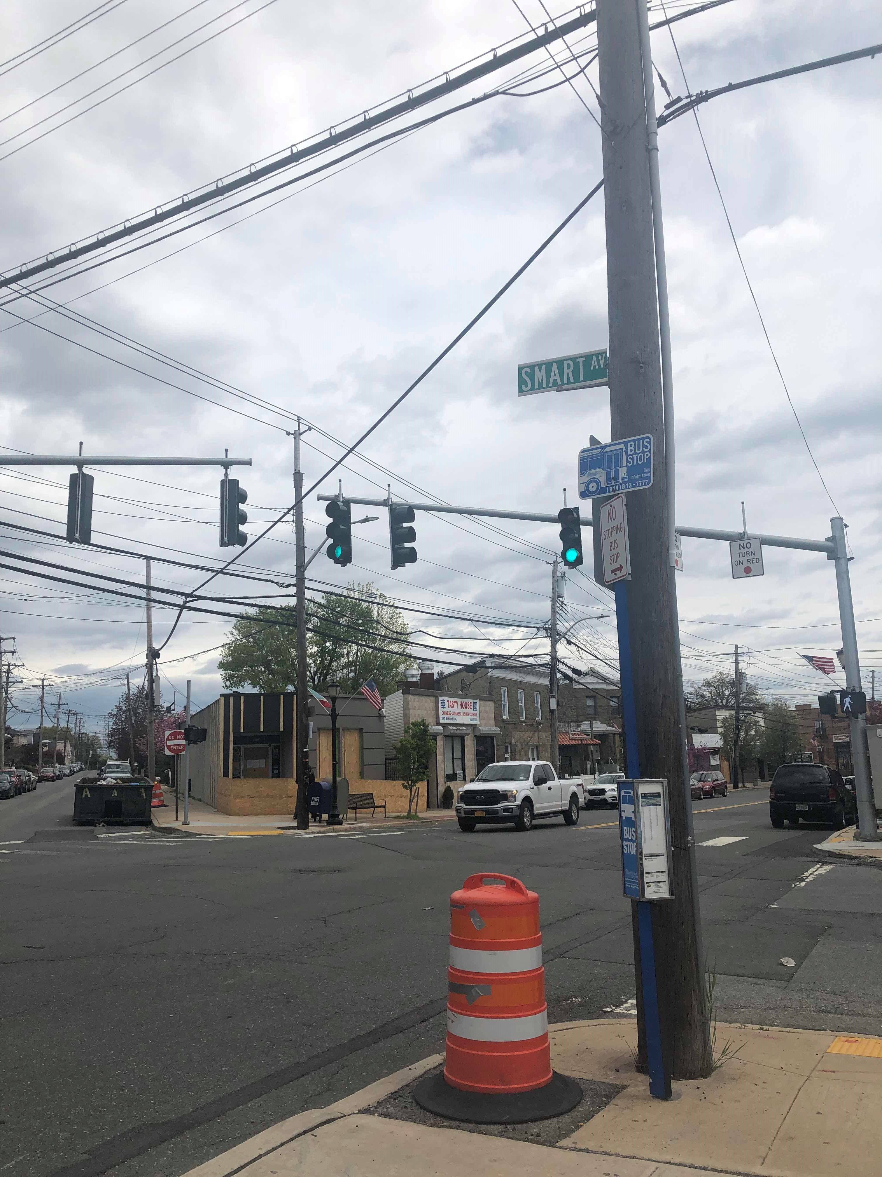
Midland Ave @ Smart Ave station
 Taken by Anonymous
See Midland Ave @ Smart Ave stop, Yonkers, on the map
Public transit to Midland Ave @ Smart Ave stop (ID: 1189) in Yonkers
Looking for directions to Midland Ave @ Smart Ave in Yonkers, United States?
Download the Moovit App to find the current schedule and step-by-step directions for Bus, Train or Subway routes that pass through Midland Ave @ Smart Ave.
Looking for the nearest stops closest to Midland Ave @ Smart Ave ? Check out this list of closest stops to your destination: Midland Ave @ Smart Ave; Central Park Ave @ Midland Ave; Fleetwood.
Bus: 20, 25, 21, 28.Train: 2.
We make riding on public transit to Midland Ave @ Smart Ave easy, which is why over 1.7 billion users, including users in Yonkers trust Moovit as the best app for public transit.
Use the app to navigate to popular places including to the airport, hospital, stadium, grocery store, mall, coffee shop, school, college, and university.
Midland Ave @ Smart Ave stop’s code is 1189
The first line to this stop is 25, at 6:11 AM, and the last line is 25 at 11:36 PM.
846 Midland Ave, Yonkers, NY, USA
This stop serves Bee-Line Bus’s lines
- Midland Ave @ Smart Ave,
- Central Park Ave @ Midland Ave
Bus stops near Midland Ave @ Smart Ave stop
- Fleetwood
Train station near Midland Ave @ Smart Ave station
- Mattituck,
- Poughkeepsie,
- E 180 St,
- Oradell,
- Garden City,
- Union St,
- Halsey St,
- Kings Hwy,
- East New York,
- Red Hook,
- Merrick Blvd / Springfield Blvd,
- Denville,
- W 181 St/Amsterdam Av,
- Court St/President St,
- Fordham,
- Medford,
- Harrison St/West St,
- New Providence,
- White Plains Rd @ E 241st St,
- Rt 9 N & Mulberry St (Dutchess County Fairgrounds)
Popular public transit stations in Yonkers
Get around Yonkers by public transit!
Traveling around Yonkers has never been so easy. See step by step directions as you travel to any attraction, street or major public transit station. View bus and train schedules, arrival times, service alerts and detailed routes on a map, so you know exactly how to get to anywhere in Yonkers.
When traveling to any destination around Yonkers use Moovit's Live Directions with Get Off Notifications to know exactly where and how far to walk, how long to wait for your line, and how many stops are left. Moovit will alert you when it's time to get off — no need to constantly re-check whether yours is the next stop.
Wondering how to use public transit in Yonkers or how to pay for public transit in Yonkers? Moovit public transit app can help you navigate your way with public transit easily, and at minimum cost. It includes public transit fees, ticket prices, and costs. Looking for a map of Yonkers public transit lines? Moovit public transit app shows all public transit maps in Yonkers with all Bus, Train, Subway, Light Rail, Ferry and Cable Car routes and stops on an interactive map.
New York - New Jersey has 6 transit type(s), including: Bus, Train, Subway, Light Rail, Ferry and Cable Car, operated by several transit agencies, including MTA Subway, Metro-North Railroad, LIRR, PATH, MTA New York City Transit - Express routes, MTA Bus, NJ Transit, NYC Ferry, NICE bus, Bee-Line Bus, NJ Transit Rail, Norwalk Transit District, CTTransit - Waterbury-Meriden, Hartford Line and River Valley Transit