How to get to Midorie by bus?
Click on the bus route to see step by step directions with maps, line arrival times and updated time schedules.
From Miami Escorts, Miami Beach
90 minFrom Palmetto High School, Kendall-Palmetto Bay
97 minFrom Skyviews Miami Observation Wheel, Miami
66 minFrom Midtown Miami, Miami
75 minFrom NW 20th St, Miami
51 minFrom San Marco Island, Miami
85 minFrom Century Medical Center, Miami
49 minFrom Bayside Marketplace, Miami
65 minFrom The Shops At Midtown Miami, Miami
75 min
How to get to Midorie by train?
Click on the train route to see step by step directions with maps, line arrival times and updated time schedules.
Bus stop near Midorie in Miami
- Grand Av@matilda St, 3 min walk,VIEW
Train station near Midorie in Miami
- Douglas Road, 27 min walk,VIEW
Bus lines to Midorie in Miami
- MIACOCO, City Of Miami - Coconut Grove Route,VIEW
What are the closest stations to Midorie?
The closest stations to Midorie are:
- Grand Av@matilda St is 159 yards away, 3 min walk.
- Douglas Road is 2235 yards away, 27 min walk.
Which bus lines stop near Midorie?
These bus lines stop near Midorie: 22, 37, MIABRK, MIACOCO.
Which train lines stop near Midorie?
These train lines stop near Midorie: GREEN, ORANGE.
What’s the nearest train station to Midorie in Miami?
The nearest train station to Midorie in Miami is Douglas Road. It’s a 27 min walk away.
What’s the nearest bus station to Midorie in Miami?
The nearest bus station to Midorie in Miami is Grand Av@matilda St. It’s a 3 min walk away.
What time is the first train to Midorie in Miami?
The GREEN is the first train that goes to Midorie in Miami. It stops nearby at 5:06 AM.
What time is the last train to Midorie in Miami?
The GREEN is the last train that goes to Midorie in Miami. It stops nearby at 12:58 AM.
What time is the first bus to Midorie in Miami?
The MIACOCO is the first bus that goes to Midorie in Miami. It stops nearby at 6:38 AM.
What time is the last bus to Midorie in Miami?
The MIACOCO is the last bus that goes to Midorie in Miami. It stops nearby at 11:40 PM.
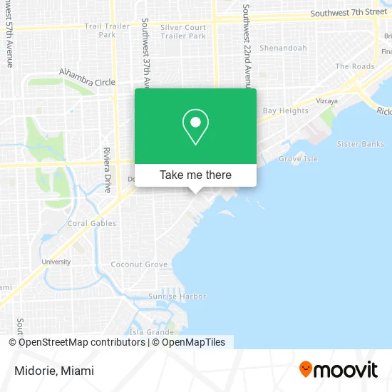
See Midorie, Miami, on the map
Public Transit to Midorie in Miami
Wondering how to get to Midorie in Miami? Moovit helps you find the best way to get to Midorie with step-by-step directions from the nearest public transit station.
Moovit provides free maps and live directions to help you navigate through your city. View schedules, routes, timetables, and find out how long does it take to get to Midorie in real time.
Looking for the nearest stop or station to Midorie? Check out this list of stops closest to your destination: Grand Av@matilda St; Douglas Road.
Bus: 22, 37, MIABRK, MIACOCO.Train: GREEN, ORANGE.
Want to see if there’s another route that gets you there at an earlier time? Moovit helps you find alternative routes or times. Get directions from and directions to Midorie easily from the Moovit App or Website.
We make riding to Midorie easy, which is why over 1.5 million users, including users in Miami, trust Moovit as the best app for public transit. You don’t need to download an individual bus app or train app, Moovit is your all-in-one transit app that helps you find the best bus time or train time available.
For information on prices of bus and train, costs and ride fares to Midorie, please check the Moovit app.
Use the app to navigate to popular places including to the airport, hospital, stadium, grocery store, mall, coffee shop, school, college, and university.
Midorie Address: 3444 Main Hwy Miami, FL 33133 street in Miami
- Danielle Gelato,
- Dombe Cycling Culture,
- Pastelito Papi,
- Brenda's Boutique,
- Therapia by Aroma,
- Fuzzbee's,
- Flips & Friends,
- O'Sole*,
- Ochie,
- Eva USA,
- Agua Bendita,
- Bekanze,
- The Wardrobe & More,
- Terry Jacobs Make Up Studio,
- Moorish Ambiance,
- ATM,
- Pineda Covalin US,
- Meraki Greek Bistro,
- Sushi by Scratch Restaurants: Miami,
- Avance International Salon
Places Near Midorie (Miami)
- Aventura Mall, Miami,
- Miami VA Hospital, Miami,
- Sawgrass Mall, Miami,
- Port of Miami Cruise Terminal, Miami,
- Hard Rock Stadium, Miami Gardens,
- Miami Freedom Park, Miami,
- Brickell City Centre, Miami,
- Miami Design District, Miami,
- Dolphin Mall Bus, Miami,
- Keiser University Flagship Campus, West Palm Beach,
- Richard E. Gerstein Justice Building, Miami,
- Miami-Dade County Courthouse, Miami,
- Little Havana, Miami,
- Zoo Miami, Miami,
- Bayside Marketplace, Miami,
- Marlins Park, Miami,
- Sawgrass mall ( FL ), Miami Beach,
- Dolphin Mall, Miami,
- Aventura Mall, Miami Beach,
- Wynwood, Miami
How to get to popular places in Miami with public transit
Get around Miami by public transit!
Traveling around Miami has never been so easy. See step by step directions as you travel to any attraction, street or major public transit station. View bus and train schedules, arrival times, service alerts and detailed routes on a map, so you know exactly how to get to anywhere in Miami.
When traveling to any destination around Miami use Moovit's Live Directions with Get Off Notifications to know exactly where and how far to walk, how long to wait for your line, and how many stops are left. Moovit will alert you when it's time to get off — no need to constantly re-check whether yours is the next stop.
Wondering how to use public transit in Miami or how to pay for public transit in Miami? Moovit public transit app can help you navigate your way with public transit easily, and at minimum cost. It includes public transit fees, ticket prices, and costs. Looking for a map of Miami public transit lines? Moovit public transit app shows all public transit maps in Miami with all Bus, Train, Light Rail and Ferry routes and stops on an interactive map.
Miami has 4 transit type(s), including: Bus, Train, Light Rail and Ferry, operated by several transit agencies, including Broward County Transit, Miami-Dade Transit, Metrorail, Palm Tran, Tri-Rail, Brightline, MARTY, City of Homestead Trolley, Key West Transit, Treasure Coast Connector, GoLine IRT, Amtrak, Greyhound-us, FlixBus-us and Aventura Express Shuttle Bus