How to get to Mifarma by bus?
Click on the bus route to see step by step directions with maps, line arrival times and updated time schedules.
From Óvalo Gutierrez, Miraflores
42 minFrom Estación Canaval y Moreyra - Metropolitano, San Isidro
37 minFrom Universidad Peruana Cayetano Heredia - UPCH, La Molina
39 minFrom AV ANGAMOS ESTE CUADRA 15, Surquillo
30 minFrom Av. Javier Prado, San Borja
41 minFrom Clinica Ricardo Palma, San Isidro
46 minFrom av. la molina, La Molina
68 minFrom Videna, San Luis
43 minFrom Chorrillos, Chorrillos
33 minFrom Colegio de Abogados de Lima, Miraflores
43 min
How to get to Mifarma by metro?
Click on the metro route to see step by step directions with maps, line arrival times and updated time schedules.
Bus stops near Mifarma in Lima
Metro station near Mifarma in Lima
- Atocongo, 52 min walk,VIEW
Bus lines to Mifarma in Lima
- 1056, Villa El Salvador - San Juan de Lurigancho,VIEW
- 1060, Campoy (San Juan De Lurigancho) - Nueva Esperanza (Villa María Del Triunfo),VIEW
- 1093, S.J.M. - Surquillo - S.J.M.,VIEW
- 1097, Av. Santa Rosa (San Juan De Lurigancho) - Las Palmas (Pachacamac) ,VIEW
- 1099, 28 De Julio (Lima) - San Gabriel (Villa María Del Triunfo),VIEW
- 1108, Montevideo (Lima) - Cementerio (Villa El Salvador),VIEW
- 1109, San Gabriel (Villa María Del Triunfo) - Espinar (Miraflores),VIEW
- 1110, Miraflores - VMT,VIEW
- 1123, José Gálvez (Villa María Del Triunfo) - Parque Kennedy (Miraflores),VIEW
- 1124, V.M.T. - Surquillo,VIEW
- 1125, Surquillo - V.M.T.,VIEW
- 1127, Surquillo - Lurin,VIEW
- 1128, Angamos (Surco) - Las Palmas (Pachacamac),VIEW
- 1185, Ensenada (Puente Piedra) - Av. Lima (Villa El Salvador),VIEW
- 1200, 28 De Julio (Lima) - San Gabriel (Villa María Del Triunfo),VIEW
- 1247, Jose Galvez (Pachacamac) - Chuquitanta (San Martin De Porres),VIEW
- 1252, V.M.T. - San Miguel,VIEW
- 1262, Pachacútec (Ventanilla) - Pastor Sevilla (Villa El Salvador),VIEW
- 1280, Tablada (Villa María Del Triunfo) - Profam (Santa Rosa),VIEW
- 1284, Mariategui (Villa El Salvador),VIEW
What are the closest stations to Mifarma?
The closest stations to Mifarma are:
- Hospital María Auxiliadora is 102 meters away, 2 min walk.
- Maria Auxiliadora is 124 meters away, 2 min walk.
- Avenida Salvador Allende, 602 is 315 meters away, 5 min walk.
- Atocongo is 4053 meters away, 52 min walk.
Which bus lines stop near Mifarma?
These bus lines stop near Mifarma: 1108, 1111, 1125, 1200, 1237, 1284, 1471, 8614, 8711.
Which metro line stops near Mifarma?
LINEA 1 (Bayóvar (San Juan De Lurigancho) - Separadora Industrial (Villa El Salvador))
What’s the nearest bus station to Mifarma in Lima?
The nearest bus stations to Mifarma in Lima are Hospital María Auxiliadora and Maria Auxiliadora. The closest one is a 2 min walk away.
What time is the first metro to Mifarma in Lima?
The LINEA 1 is the first metro that goes to Mifarma in Lima. It stops nearby at 5:04 AM.
What time is the last metro to Mifarma in Lima?
The LINEA 1 is the last metro that goes to Mifarma in Lima. It stops nearby at 10:42 PM.
What time is the first bus to Mifarma in Lima?
The 1237 is the first bus that goes to Mifarma in Lima. It stops nearby at 4:08 AM.
What time is the last bus to Mifarma in Lima?
The 1280 is the last bus that goes to Mifarma in Lima. It stops nearby at 1:34 AM.
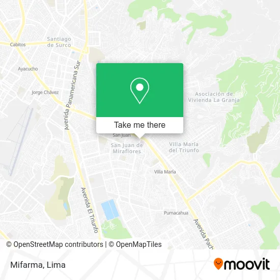
See Mifarma, Lima, on the map
Public Transit to Mifarma in Lima
Wondering how to get to Mifarma in Lima? Moovit helps you find the best way to get to Mifarma with step-by-step directions from the nearest public transit station.
Moovit provides free maps and live directions to help you navigate through your city. View schedules, routes, timetables, and find out how long does it take to get to Mifarma in real time.
Looking for the nearest stop or station to Mifarma? Check out this list of stops closest to your destination: Hospital María Auxiliadora; Maria Auxiliadora; Avenida Salvador Allende; Atocongo.
Bus: 1108, 1111, 1125, 1200, 1237, 1284, 1471, 8614, 8711, 1056, 1060, 1093, 1097, 1099, 1100, 1059, 1062, 1096, 1113, 1118.Metro: LINEA 1.
Want to see if there’s another route that gets you there at an earlier time? Moovit helps you find alternative routes or times. Get directions from and directions to Mifarma easily from the Moovit App or Website.
We make riding to Mifarma easy, which is why over 1.5 million users, including users in Lima, trust Moovit as the best app for public transit. You don’t need to download an individual bus app or train app, Moovit is your all-in-one transit app that helps you find the best bus time or train time available.
For information on prices of bus and metro, costs and ride fares to Mifarma, please check the Moovit app.
Use the app to navigate to popular places including to the airport, hospital, stadium, grocery store, mall, coffee shop, school, college, and university.
Mifarma Address: Avenida Miguel Iglesias 971 San Juan de Miraflores Parcela D, 15801 San Juan de Miraflores street in Lima
- Boticas Perú,
- Botica Internacional,
- Boticas Bio Farma,
- Clínica del Hosp María Auxiliadora,
- BANCO DE LA NACION,
- Diagnostic Salud,
- Hostal Geminis,
- Hospital De La Humanidad Sur,
- Cabinas de Internet El Sótano,
- Inkafarma,
- Villa El Salvador,
- Boticas Jhodaal,
- Pollos a la Brasa,
- Grafica Gutiérrez Srltda,
- Instituto Superior Sergio Bernales,
- Botica Villa El Salvador,
- Banco,
- Boticas Villa El Salvador San Juan de Miraflores,
- San Juan de Miraflores jiron Juan castilla 1156,
- San Juan Zona D Cerca del hospital María Auxiliadora
Places Near Mifarma (Lima)
- Hospital Edgardo Rebagliati Martins, Jesus Mari,
- Larcomar, Miraflores,
- Av. La Marina, San Miguel,
- Av. Abancay, Lima,
- Jockey Plaza, Santiago D,
- Mall Del Sur,
- Circuito Mágico Del Agua, Lima,
- Gamarra,
- Parque de las Leyendas, San Miguel,
- Centro Comercial Plaza Norte, Independen,
- Aeropuerto Internacional Jorge Chávez, Ventanilla,
- av arequipa, Lima,
- Parque Kennedy, Miraflores,
- Pontificia Universidad Católica del Perú - PUCP, San Miguel,
- Plaza San Miguel, San Miguel,
- Paradero Av.Brasil,
- Real Plaza Puruchuco, Ate,
- Miraflores, Miraflores,
- Av. Salaverry, Jesus Mari,
- Barranco, Barranco
How to get to popular places in Lima with public transit
Get around Lima by public transit!
Traveling around Lima has never been so easy. See step by step directions as you travel to any attraction, street or major public transit station. View bus and train schedules, arrival times, service alerts and detailed routes on a map, so you know exactly how to get to anywhere in Lima.
When traveling to any destination around Lima use Moovit's Live Directions with Get Off Notifications to know exactly where and how far to walk, how long to wait for your line, and how many stops are left. Moovit will alert you when it's time to get off — no need to constantly re-check whether yours is the next stop.
Wondering how to use public transit in Lima or how to pay for public transit in Lima? Moovit public transit app can help you navigate your way with public transit easily, and at minimum cost. It includes public transit fees, ticket prices, and costs. Looking for a map of Lima public transit lines? Moovit public transit app shows all public transit maps in Lima with all Bus, Metro and Ferry routes and stops on an interactive map.
Lima has 3 transit type(s), including: Bus, Metro and Ferry, operated by several transit agencies, including Metro de Lima Línea 2 , Metro de Lima, Corredor Rojo, Metropolitano, Metropolitano - Alimentadores, Corredor Morado, Corredor Azul, Rutas Tradicionales, Transportes y Servicios La Esperanza S.A., Las Flores S.A., Virgen de la Asunción S.A., Consorcio HAM, Transportes y Service Canadá S.A., ETUL4SA and ETUCHISA