How to get to Mini Mall Outlet by bus?
Click on the bus route to see step by step directions with maps, line arrival times and updated time schedules.
From Clinton Middle School, Tulsa
101 minFrom The Greenwood Farmers and Artisans Market, Tulsa
48 minFrom Andy's Painting, Tulsa
100 minFrom Oyo Townhouse Tulsa Woodland Hills, Tulsa
37 minFrom Green Light Driving School, Tulsa
125 minFrom Quick Stop (Quick Food Mart), Tulsa
99 minFrom Spray-It Foam Insulation, Tulsa
70 minFrom Express Oil Change & Tire Engineers, Tulsa
37 min
Bus stops near Mini Mall Outlet in Tulsa
What are the closest stations to Mini Mall Outlet?
The closest stations to Mini Mall Outlet are:
- (7807) 31st St & Lakewood Ave Eb is 483 yards away, 6 min walk.
- (7682) Sheridan Rd & 28th St Sb is 650 yards away, 8 min walk.
Which bus lines stop near Mini Mall Outlet?
These bus lines stop near Mini Mall Outlet: 300, 320.
What’s the nearest bus station to Mini Mall Outlet in Tulsa?
The nearest bus station to Mini Mall Outlet in Tulsa is (7807) 31st St & Lakewood Ave Eb. It’s a 6 min walk away.
What time is the first bus to Mini Mall Outlet in Tulsa?
The 320 is the first bus that goes to Mini Mall Outlet in Tulsa. It stops nearby at 6:09 AM.
What time is the last bus to Mini Mall Outlet in Tulsa?
The 320 is the last bus that goes to Mini Mall Outlet in Tulsa. It stops nearby at 6:50 PM.
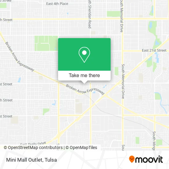
See Mini Mall Outlet, Tulsa, on the map
Public Transit to Mini Mall Outlet in Tulsa
Wondering how to get to Mini Mall Outlet in Tulsa? Moovit helps you find the best way to get to Mini Mall Outlet with step-by-step directions from the nearest public transit station.
Moovit provides free maps and live directions to help you navigate through your city. View schedules, routes, timetables, and find out how long does it take to get to Mini Mall Outlet in real time.
Looking for the nearest stop or station to Mini Mall Outlet? Check out this list of stops closest to your destination: (7807) 31st St & Lakewood Ave Eb; (7682) Sheridan Rd & 28th St Sb.
Bus: 300, 320.
Want to see if there’s another route that gets you there at an earlier time? Moovit helps you find alternative routes or times. Get directions from and directions to Mini Mall Outlet easily from the Moovit App or Website.
We make riding to Mini Mall Outlet easy, which is why over 1.5 million users, including users in Tulsa, trust Moovit as the best app for public transit. You don’t need to download an individual bus app or train app, Moovit is your all-in-one transit app that helps you find the best bus time or train time available.
For information on prices of bus, costs and ride fares to Mini Mall Outlet, please check the Moovit app.
Use the app to navigate to popular places including to the airport, hospital, stadium, grocery store, mall, coffee shop, school, college, and university.
Mini Mall Outlet Address: 5970 E 31st St Tulsa, OK 74135 street in Tulsa
- Well Crafted Massage,
- Pisoneros',
- Phil Styles,
- Feel The Beat Dance Studio,
- Middle Earth Treas,
- Marvs Wine & Liquor,
- Act Language Services,
- Happy Hair Salon,
- David K Hays Certified Public Accountant,
- Daniel Skerbitz CPA,
- Fidolo Tattoo Company,
- City Wide Appliances,
- Michael Shepherd, DDS,
- Greenhouse Clothing,
- Dupree Sports Tulsa,
- Greenhouse Outfitters,
- Torchy's Side Pocket,
- Braiders Lounge,
- Here for You Counseling,
- American Indian Heritage Center
Places Near Mini Mall Outlet (Tulsa)
- St Francis South Cardinal Building, Tulsa,
- Tulsa Ok, Tulsa,
- St. Francis Hospital Outpatient Infusion, Tulsa,
- Bixby, OK, Bixby,
- Fallout Shelter, Tulsa,
- Plaza Santa Cecilia, Tulsa,
- Alagon Spa (Olympus Spa), Tulsa,
- Osage Casino, Tulsa,
- S Garnett Rd / E 21st St, Tulsa,
- Hard Rock Casino, Tulsa,
- Woodland Hills Mall, Tulsa,
- Amazon Fulfillment Center-TUL2, Tulsa,
- River Spirit Casino, Tulsa,
- Zavala Plus, Tulsa,
- Tulsa Zoo, Tulsa,
- Broken Arrow, OK, Broken Arrow,
- Walmart, Tulsa,
- Saint Francis Hospital, Tulsa,
- 71st & Memorial, Tulsa,
- Tulsa State Fair, Tulsa
How to get to popular places in Tulsa with public transit
Get around Tulsa by public transit!
Traveling around Tulsa has never been so easy. See step by step directions as you travel to any attraction, street or major public transit station. View bus and train schedules, arrival times, service alerts and detailed routes on a map, so you know exactly how to get to anywhere in Tulsa.
When traveling to any destination around Tulsa use Moovit's Live Directions with Get Off Notifications to know exactly where and how far to walk, how long to wait for your line, and how many stops are left. Moovit will alert you when it's time to get off — no need to constantly re-check whether yours is the next stop.
Wondering how to use public transit in Tulsa or how to pay for public transit in Tulsa? Moovit public transit app can help you navigate your way with public transit easily, and at minimum cost. It includes public transit fees, ticket prices, and costs. Looking for a map of Tulsa public transit lines? Moovit public transit app shows all public transit maps in Tulsa with all bus routes and stops on an interactive map.
Tulsa has 1 transit type(s), including: bus, operated by several transit agencies, including MetroLink Tulsa and Greyhound-us