Directions to Mini Mercadinho (Duque De Caxias) with public transportation
The following transit lines have routes that pass near Mini Mercadinho
 Bus: 026, 411, 466C, 571C, 765I.
- Train: EXTENSÃO VILA INHOMIRIM, EXTENSÃO GUAPIMIRIM.
How to get to Mini Mercadinho by bus?
Click on the bus route to see step by step directions with maps, line arrival times and updated time schedules.
From Bairro Amapá, Duque de Caxias, Duque De Caxias
97 minFrom Morro do Garibaldi, Duque De Caxias
78 minFrom Campos Elíseos, Duque De Caxias
61 minFrom Sítio H20, Duque De Caxias
92 minFrom Outlet Premium Rio de Janeiro, Duque De Caxias
48 minFrom Caxias x Magé, Duque De Caxias
55 minFrom Xerém, Duque De Caxias
69 minFrom Outlet Premium Caxias, Duque De Caxias
55 minFrom Hospital Estadual Adão Pereira Nunes, Duque De Caxias
41 minFrom Praia de Mauá, Magé
76 min
How to get to Mini Mercadinho by train?
Click on the train route to see step by step directions with maps, line arrival times and updated time schedules.
Bus stops near Mini Mercadinho in Duque De Caxias
Train stations near Mini Mercadinho in Duque De Caxias
Bus lines to Mini Mercadinho in Duque De Caxias
What are the closest stations to Mini Mercadinho?
The closest stations to Mini Mercadinho are:
- Avenida Pedro Álvares Cabral, 1 is 361 meters away, 5 min walk.
- Rua Uu, 2 is 680 meters away, 9 min walk.
- Rua 1, 1680-1880 is 684 meters away, 9 min walk.
- Rua Narcisa Amalia, 429-437 is 725 meters away, 10 min walk.
- Avenida Pedro Álvares Cabral, 223 is 744 meters away, 10 min walk.
- Morabi is 2574 meters away, 33 min walk.
- Parque Estrela is 4504 meters away, 58 min walk.
Which bus lines stop near Mini Mercadinho?
These bus lines stop near Mini Mercadinho: 026, 411, 466C, 571C, 765I.
Which train line stops near Mini Mercadinho?
EXTENSÃO VILA INHOMIRIM (Vila Inhomirim)
What’s the nearest bus station to Mini Mercadinho in Duque De Caxias?
The nearest bus station to Mini Mercadinho in Duque De Caxias is Avenida Pedro Álvares Cabral, 1. It’s a 5 min walk away.
What time is the first train to Mini Mercadinho in Duque De Caxias?
The EXTENSÃO VILA INHOMIRIM is the first train that goes to Mini Mercadinho in Duque De Caxias. It stops nearby at 5:11 AM.
What time is the last train to Mini Mercadinho in Duque De Caxias?
The EXTENSÃO VILA INHOMIRIM is the last train that goes to Mini Mercadinho in Duque De Caxias. It stops nearby at 10:22 PM.
What time is the first bus to Mini Mercadinho in Duque De Caxias?
The 571C is the first bus that goes to Mini Mercadinho in Duque De Caxias. It stops nearby at 4:01 AM.
What time is the last bus to Mini Mercadinho in Duque De Caxias?
The 018 is the last bus that goes to Mini Mercadinho in Duque De Caxias. It stops nearby at 12:54 AM.
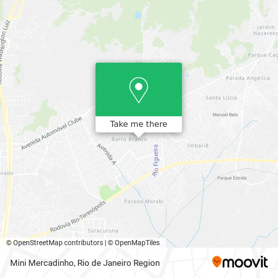
See Mini Mercadinho, Duque De Caxias, on the map
Public Transit to Mini Mercadinho in Duque De Caxias
Wondering how to get to Mini Mercadinho in Duque De Caxias? Moovit helps you find the best way to get to Mini Mercadinho with step-by-step directions from the nearest public transit station.
Moovit provides free maps and live directions to help you navigate through your city. View schedules, routes, timetables, and find out how long does it take to get to Mini Mercadinho in real time.
Looking for the nearest stop or station to Mini Mercadinho? Check out this list of stops closest to your destination: Avenida Pedro Álvares Cabral; Rua Uu; Rua 1; Rua Narcisa Amalia; Avenida Pedro Álvares Cabral; Morabi; Parque Estrela.
Bus: 026, 411, 466C, 571C, 765I, 023, 513, 018, 413, 2470C (EXECUTIVO).Train: EXTENSÃO VILA INHOMIRIM, EXTENSÃO GUAPIMIRIM.
Want to see if there’s another route that gets you there at an earlier time? Moovit helps you find alternative routes or times. Get directions from and directions to Mini Mercadinho easily from the Moovit App or Website.
We make riding to Mini Mercadinho easy, which is why over 1.5 million users, including users in Duque De Caxias, trust Moovit as the best app for public transit. You don’t need to download an individual bus app or train app, Moovit is your all-in-one transit app that helps you find the best bus time or train time available.
For information on prices of bus and train, costs and ride fares to Mini Mercadinho, please check the Moovit app.
Use the app to navigate to popular places including to the airport, hospital, stadium, grocery store, mall, coffee shop, school, college, and university.
Mini Mercadinho Address: Rua Algusto Sergio Botelho, 25 Barro Branco Duque de Caxias-RJ 25267-124 street in Duque De Caxias
- Império Serralheria e Vidraçaria,
- Restaurante Panela De Barro,
- Rua Felipe Camarão, 79,
- Padaria dos Coqueiros,
- Eudora,
- Rua José de Alencar, 3,
- Jardim Barro Branco,
- Lembranças Personalizadas Tudo Para Festa,
- Barro Branco,
- Jardim Anhangá,
- Estrella Marine Ship Supply Eireli,
- Cmf Cargas,
- Igreja Renovação Cristã,
- Marciacristina,
- Igreja Batista Três de Outubro,
- Lorena Salao de Beleza,
- Academia Mix Fitness,
- Vila Ema,
- Unidade de Saúde da Família Nova Campina,
- Centro Educacional Prontidão
Places Near Mini Mercadinho (Duque De Caxias)
- Museu Do Amanhã, Centro,
- Feirão De Malhas, Duque De Caxias,
- Rua Licínio Cardoso, São Francisco Xavier,
- Norte Shopping, Cachambi,
- Rodoviária Novo Rio (Rodoviária do Rio de Janeiro), Santo Cristo,
- Feira Livre da Gloria, Glória,
- Avenida Rio Branco, Centro,
- Avenida Venezuela 134, Saúde,
- Rio De Janeiro,
- Shopping Rio Sul, Botafogo,
- Praia do Arpoador, Ipanema,
- Hospital Municipal Ronaldo Gazolla, Acari,
- Hospital Pedro Ernesto, Vila Isabel,
- Shopping RioSul, Botafogo,
- Shopping Downtown, Barra Da Tijuca,
- Niterói, Niterói,
- Hospital Federal Do Andaraí, Andaraí,
- Hospital Federal Cardoso Fontes, Jacarepaguá,
- Rua Ulysses Guimarães 16, Cidade Nova,
- Shopping Nova América, Del Castilho
How to get to popular places in Rio de Janeiro Region with public transit
Get around Duque De Caxias by public transit!
Traveling around Duque De Caxias has never been so easy. See step by step directions as you travel to any attraction, street or major public transit station. View bus and train schedules, arrival times, service alerts and detailed routes on a map, so you know exactly how to get to anywhere in Duque De Caxias.
When traveling to any destination around Duque De Caxias use Moovit's Live Directions with Get Off Notifications to know exactly where and how far to walk, how long to wait for your line, and how many stops are left. Moovit will alert you when it's time to get off — no need to constantly re-check whether yours is the next stop.
Wondering how to use public transit in Duque De Caxias or how to pay for public transit in Duque De Caxias? Moovit public transit app can help you navigate your way with public transit easily, and at minimum cost. It includes public transit fees, ticket prices, and costs. Looking for a map of Duque De Caxias public transit lines? Moovit public transit app shows all public transit maps in Duque De Caxias with all Bus, Train, Metro, Light Rail, Ferry, Cable Car, Gondola and Funicular routes and stops on an interactive map.
Rio de Janeiro Region has 8 transit type(s), including: Bus, Train, Metro, Light Rail, Ferry, Cable Car, Gondola and Funicular, operated by several transit agencies, including TrensRJ, Metrô Rio, VLT Carioca, Barcas Rio, BRT MOBI-Rio, Auto Viação Alpha, Auto Viação Tijuca, Gire Transportes, Transurb, Viação Nossa Senhora das Graças, Consórcio INTERSUL, Braso Lisboa (Municipal), Caprichosa Auto Ônibus, Auto Viação Três Amigos and Rodoviária Âncora Matias