How to get to Minimundo by bus?
Click on the bus route to see step by step directions with maps, line arrival times and updated time schedules.
From Surquillo, Surquillo
47 minFrom Parque Universitario, Lima
34 minFrom Playa los Yuyos, Barranco
43 minFrom Minedu, San Borja
33 minFrom Avenida Antunez de Mayolo, Los Olivos
49 minFrom AV ANTUNEZ DE MAYOLO CON UNIVERSITARIA, San Martin
45 minFrom #Zzz, Santiago D
51 minFrom Escuela Militar De Chorrillos, Chorrillos
53 minFrom Puente Primavera, Santiago D
47 minFrom Estadio Miguel Grau, Ventanilla
31 min
Bus stops near Minimundo in Lima
Bus lines to Minimundo in Lima
- 1010, Pte. Piedra - Magdalena - Pte. Piedra,VIEW
- 1012, Comas - Magdalena,VIEW
- 1024, Los Sauces - Cerro Candela,VIEW
- 1111, San Gabriel (Villa María Del Triunfo) - Universitaria (Lima),VIEW
- 1173, La Marina (San Miguel) - Pacasmayo (San Martin de Porres),VIEW
- 1205, El Agustino - San Miguel,VIEW
- 1302, Minka (Callao) - Casablanca (San Juan De Lurigancho),VIEW
- 1475, Campoy (San Juan De Lurigancho) - La Paz (Callao),VIEW
- 1482, Chorrillos - S.M.P.,VIEW
- CR43, Ventanilla - Carabayllo,VIEW
- 201, Ovalo La Perla (Callao) - Ceres (Ate),VIEW
- 204, Manchay (Pachacamac) - Faucett (San Miguel),VIEW
- 206, San Marcos (San Miguel) - Alameda Del Corregidor (La Molina),VIEW
- 209, San Marcos (San Miguel) - Tagore (Ate),VIEW
- 1163, Santa Margarita (Ventanilla) - Jockey Plaza (Surco),VIEW
- 1291, Ventanilla - Chorrillos,VIEW
- 1315, Jose Galvez (Pachacamac) - Óvalo Centenario (Callao),VIEW
- IM47, Km. 22 - Faucett - La Marina - Brasil - Caquetá - Km. 22,VIEW
- OM19, Chepen (Villa El Salvador),VIEW
- 1272, Minka (Callao) - Santa Marta (Santa Anita),VIEW
What are the closest stations to Minimundo?
The closest stations to Minimundo are:
- La Marina is 286 meters away, 4 min walk.
- Sucre is 307 meters away, 5 min walk.
- Amazonas is 308 meters away, 5 min walk.
- Jirón Libertad, 1080 is 641 meters away, 9 min walk.
- Junín is 740 meters away, 10 min walk.
Which bus lines stop near Minimundo?
These bus lines stop near Minimundo: 1024, 1111, 1482, 209, OM19.
What’s the nearest bus station to Minimundo in Lima?
The nearest bus station to Minimundo in Lima is La Marina. It’s a 4 min walk away.
What time is the first bus to Minimundo in Lima?
The 1315 is the first bus that goes to Minimundo in Lima. It stops nearby at 4:22 AM.
What time is the last bus to Minimundo in Lima?
The 1315 is the last bus that goes to Minimundo in Lima. It stops nearby at 1:03 AM.
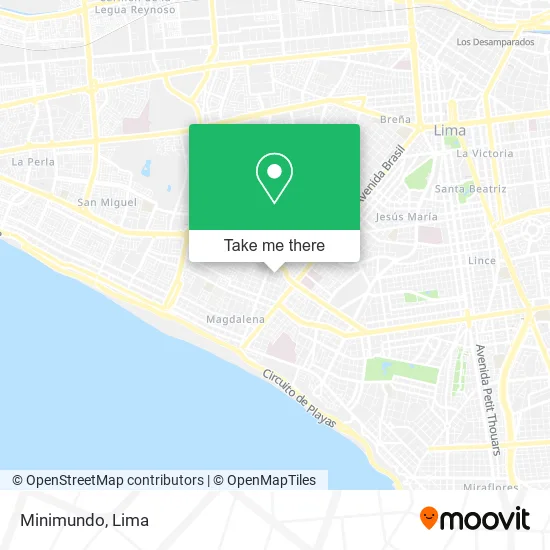
See Minimundo, Lima, on the map
Public Transit to Minimundo in Lima
Wondering how to get to Minimundo in Lima? Moovit helps you find the best way to get to Minimundo with step-by-step directions from the nearest public transit station.
Moovit provides free maps and live directions to help you navigate through your city. View schedules, routes, timetables, and find out how long does it take to get to Minimundo in real time.
Looking for the nearest stop or station to Minimundo? Check out this list of stops closest to your destination: La Marina; Sucre; Amazonas; Jirón Libertad; Junín.
Bus: 1024, 1111, 1482, 209, OM19, 1010, 1012, 1173, 201, 204, 206, 1163, 1291, 1315, IM47, 1272, 1182.
Want to see if there’s another route that gets you there at an earlier time? Moovit helps you find alternative routes or times. Get directions from and directions to Minimundo easily from the Moovit App or Website.
We make riding to Minimundo easy, which is why over 1.5 million users, including users in Lima, trust Moovit as the best app for public transit. You don’t need to download an individual bus app or train app, Moovit is your all-in-one transit app that helps you find the best bus time or train time available.
For information on prices of bus, costs and ride fares to Minimundo, please check the Moovit app.
Use the app to navigate to popular places including to the airport, hospital, stadium, grocery store, mall, coffee shop, school, college, and university.
Minimundo Address: Calle Carlos Bondy Cercado, 15086 Pueblo Libre street in Lima
- Fabibeauty,
- Pezone,
- El kUbil,
- Mercado pueblo libre,
- JR LIBERTAD 1529 PUEBLO LIBRE,
- Lavandería Exclusiva,
- Im Soluciones Digitales SAC,
- El Buen Horno,
- Praga Café,
- JR CARLOS BONDY 457 INTERIOR 8 SEGUNDO PISO,
- Seven Spa,
- Maeida,
- J&V Collection,
- Magdalena del Mar Movimiento Misionero Mundial,
- Espinozavalverde Nidia Emilia,
- Amhole,
- Garage Custom,
- Jr 8 de Octubre 486 Ex Amazonas,
- CALLE LIBERTAD 1515 PUEBLO LIBRE,
- Sucre / Amazonas
Places Near Minimundo (Lima)
- Pontificia Universidad Católica del Perú - PUCP, San Miguel,
- Aeropuerto Internacional Jorge Chávez, Ventanilla,
- Mall Del Sur,
- Parque de las Leyendas, San Miguel,
- Gamarra,
- Parque Kennedy, Miraflores,
- Jockey Plaza, Santiago D,
- Larcomar, Miraflores,
- Real Plaza Puruchuco, Ate,
- Circuito Mágico Del Agua, Lima,
- Av. Abancay, Lima,
- Miraflores, Miraflores,
- Av. Salaverry, Jesus Mari,
- av arequipa, Lima,
- Paradero Av.Brasil,
- Centro Comercial Plaza Norte, Independen,
- Hospital Edgardo Rebagliati Martins, Jesus Mari,
- Barranco, Barranco,
- Av. La Marina, San Miguel,
- Plaza San Miguel, San Miguel
How to get to popular places in Lima with public transit
Get around Lima by public transit!
Traveling around Lima has never been so easy. See step by step directions as you travel to any attraction, street or major public transit station. View bus and train schedules, arrival times, service alerts and detailed routes on a map, so you know exactly how to get to anywhere in Lima.
When traveling to any destination around Lima use Moovit's Live Directions with Get Off Notifications to know exactly where and how far to walk, how long to wait for your line, and how many stops are left. Moovit will alert you when it's time to get off — no need to constantly re-check whether yours is the next stop.
Wondering how to use public transit in Lima or how to pay for public transit in Lima? Moovit public transit app can help you navigate your way with public transit easily, and at minimum cost. It includes public transit fees, ticket prices, and costs. Looking for a map of Lima public transit lines? Moovit public transit app shows all public transit maps in Lima with all Bus, Metro and Ferry routes and stops on an interactive map.
Lima has 3 transit type(s), including: Bus, Metro and Ferry, operated by several transit agencies, including Metro de Lima Línea 2 , Metro de Lima, Corredor Rojo, Metropolitano, Metropolitano - Alimentadores, Corredor Morado, Corredor Azul, Rutas Tradicionales, Transportes y Servicios La Esperanza S.A., Las Flores S.A., Virgen de la Asunción S.A., Consorcio HAM, Transportes y Service Canadá S.A., ETUL4SA and ETUCHISA