Directions to Minute Key (Hialeah) with public transportation
The following transit lines have routes that pass near Minute Key
 Bus: HIAMAR.
How to get to Minute Key by bus?
Click on the bus route to see step by step directions with maps, line arrival times and updated time schedules.
From Trump National Doral Miami, North Westside
44 minFrom Doral Voice, North Westside
79 minFrom Imater Academy Charter Middle/High School, Hialeah
80 minFrom W 49th St / NW 103rd St, Hialeah
86 minFrom Miami Dade College West Campus, North Westside
60 minFrom HIALEAH FLAMINGO NORTH ROUTE, North Westside
91 minFrom Amelia Earhart Park, Miami
132 minFrom Amelia Earhart Park, Miami
136 minFrom Westland Mall, Hialeah
56 minFrom Spin Group, North Westside
77 min
Bus stop near Minute Key in Hialeah
- Nw 138 St@#10990, 3 min walk,VIEW
Bus lines to Minute Key in Hialeah
- HIAMAR, City Of Hialeah Transit (Marlin),VIEW
What are the closest stations to Minute Key?
The closest stations to Minute Key are:
- Nw 138 St@#10990 is 208 yards away, 3 min walk.
Which bus line stops near Minute Key?
HIAMAR (City Of Hialeah Transit (Marlin))
What’s the nearest bus station to Minute Key in Hialeah?
The nearest bus station to Minute Key in Hialeah is Nw 138 St@#10990. It’s a 3 min walk away.
What time is the first bus to Minute Key in Hialeah?
The HIAMAR is the first bus that goes to Minute Key in Hialeah. It stops nearby at 6:10 AM.
What time is the last bus to Minute Key in Hialeah?
The HIAMAR is the last bus that goes to Minute Key in Hialeah. It stops nearby at 9:00 PM.
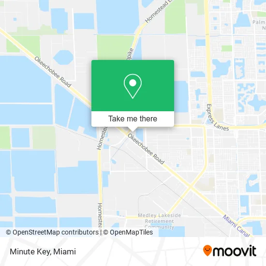
See Minute Key, Hialeah, on the map
Public Transit to Minute Key in Hialeah
Wondering how to get to Minute Key in Hialeah? Moovit helps you find the best way to get to Minute Key with step-by-step directions from the nearest public transit station.
Moovit provides free maps and live directions to help you navigate through your city. View schedules, routes, timetables, and find out how long does it take to get to Minute Key in real time.
Looking for the nearest stop or station to Minute Key? Check out this list of stops closest to your destination: Nw 138 St@#10990.
Bus: HIAMAR.
Want to see if there’s another route that gets you there at an earlier time? Moovit helps you find alternative routes or times. Get directions from and directions to Minute Key easily from the Moovit App or Website.
We make riding to Minute Key easy, which is why over 1.5 million users, including users in Hialeah, trust Moovit as the best app for public transit. You don’t need to download an individual bus app or train app, Moovit is your all-in-one transit app that helps you find the best bus time or train time available.
For information on prices of bus, costs and ride fares to Minute Key, please check the Moovit app.
Use the app to navigate to popular places including to the airport, hospital, stadium, grocery store, mall, coffee shop, school, college, and university.
Minute Key Address: 13895 W Okeechobee Rd Hialeah, FL 33018 street in Hialeah
- Depot,
- 13895 W Okeechobee Rd Parking,
- Masia Rentals,
- Fissol - Branded Restaurant Supplies,
- Cargo Handling Logistics,
- Yade Enterprises Truck & Trailers Parts,
- Cga Builders,
- Cold Parts Supply,
- Adrian Fish Restaurant and Fish Market,
- Krispy Krunchy Chicken,
- Leidy's Lunch,
- Noel Truck Wash,
- Wawa,
- Total Pest Control Hialeah Gardens,
- Extra Space Storage,
- W Okeechobee Rd / NW 138th St,
- CMV Transport,
- Y Z Enterprises,
- Revolt Cyclery,
- Villa Parrilla Restaurant
Places Near Minute Key (Hialeah)
- Miami-Dade County Courthouse, Miami,
- Wynwood, Miami,
- Miami Design District, Miami,
- Port of Miami Cruise Terminal, Miami,
- Aventura Mall, Miami Beach,
- Zoo Miami, Miami,
- Sawgrass mall ( FL ), Miami Beach,
- Keiser University Flagship Campus, West Palm Beach,
- Hard Rock Stadium, Miami Gardens,
- Miami Freedom Park, Miami,
- Dolphin Mall Bus, Miami,
- Brickell City Centre, Miami,
- Sawgrass Mall, Miami,
- Dolphin Mall, Miami,
- Aventura Mall, Miami,
- Miami VA Hospital, Miami,
- Bayside Marketplace, Miami,
- Marlins Park, Miami,
- Little Havana, Miami,
- Richard E. Gerstein Justice Building, Miami
How to get to popular places in Miami with public transit
Get around Hialeah by public transit!
Traveling around Hialeah has never been so easy. See step by step directions as you travel to any attraction, street or major public transit station. View bus and train schedules, arrival times, service alerts and detailed routes on a map, so you know exactly how to get to anywhere in Hialeah.
When traveling to any destination around Hialeah use Moovit's Live Directions with Get Off Notifications to know exactly where and how far to walk, how long to wait for your line, and how many stops are left. Moovit will alert you when it's time to get off — no need to constantly re-check whether yours is the next stop.
Wondering how to use public transit in Hialeah or how to pay for public transit in Hialeah? Moovit public transit app can help you navigate your way with public transit easily, and at minimum cost. It includes public transit fees, ticket prices, and costs. Looking for a map of Hialeah public transit lines? Moovit public transit app shows all public transit maps in Hialeah with all Bus, Train, Light Rail and Ferry routes and stops on an interactive map.
Miami has 4 transit type(s), including: Bus, Train, Light Rail and Ferry, operated by several transit agencies, including Broward County Transit, Miami-Dade Transit, Metrorail, Palm Tran, Tri-Rail, Brightline, MARTY, City of Homestead Trolley, Key West Transit, Treasure Coast Connector, GoLine IRT, Amtrak, Greyhound-us, FlixBus-us and Aventura Express Shuttle Bus