How to get to Miracle-Ear by bus?
Click on the bus route to see step by step directions with maps, line arrival times and updated time schedules.
From Eaux Claires Transit Centre, Edmonton
55 minFrom Comfort Inn Suites Downtown Edmonton, Edmonton
64 minFrom Hardstyle Strength Academy, Edmonton
76 minFrom Canada College, Edmonton
62 minFrom Orthopedic Surgery Centre - Royal Alexandra Hospital, Edmonton
54 minFrom Kensington Bingo, Edmonton
53 minFrom Disbrand Marketing, Edmonton
62 minFrom Service Canada - Canada Place, Edmonton
65 minFrom Dynalife Diagnostics Base Laboratory, Edmonton
63 min
Bus stops near Miracle-Ear in Edmonton
Light Rail stations near Miracle-Ear in Edmonton
- Clareview Station, 28 min walk,VIEW
Bus lines to Miracle-Ear in Edmonton
What are the closest stations to Miracle-Ear?
The closest stations to Miracle-Ear are:
- Clareview Road & 135 Avenue is 582 meters away, 8 min walk.
- Victoria Trail & 139 Avenue is 624 meters away, 9 min walk.
- Clareview Station is 2162 meters away, 28 min walk.
Which bus line stops near Miracle-Ear?
108 (East Clareview Transit Centre→Belvedere Transit Centre)
What’s the nearest light rail station to Miracle-Ear in Edmonton?
The nearest light rail station to Miracle-Ear in Edmonton is Clareview Station. It’s a 28 min walk away.
What’s the nearest bus station to Miracle-Ear in Edmonton?
The nearest bus station to Miracle-Ear in Edmonton is Clareview Road & 135 Avenue. It’s a 8 min walk away.
What time is the first bus to Miracle-Ear in Edmonton?
The 108 is the first bus that goes to Miracle-Ear in Edmonton. It stops nearby at 5:54 AM.
What time is the last bus to Miracle-Ear in Edmonton?
The 108 is the last bus that goes to Miracle-Ear in Edmonton. It stops nearby at 12:11 AM.
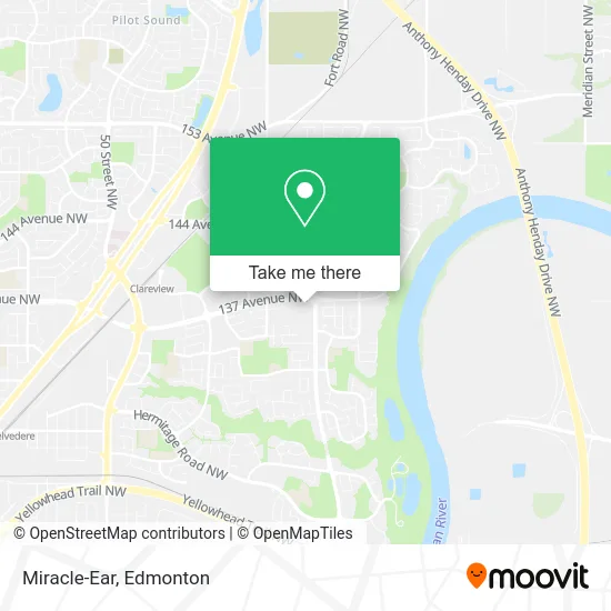
See Miracle-Ear, Edmonton, on the map
Public Transit to Miracle-Ear in Edmonton
Wondering how to get to Miracle-Ear in Edmonton? Moovit helps you find the best way to get to Miracle-Ear with step-by-step directions from the nearest public transit station.
Moovit provides free maps and live directions to help you navigate through your city. View schedules, routes, timetables, and find out how long does it take to get to Miracle-Ear in real time.
Looking for the nearest stop or station to Miracle-Ear? Check out this list of stops closest to your destination: Clareview Road & 135 Avenue; Victoria Trail & 139 Avenue; Clareview Station.
Bus: 108, 627.
Want to see if there’s another route that gets you there at an earlier time? Moovit helps you find alternative routes or times. Get directions from and directions to Miracle-Ear easily from the Moovit App or Website.
We make riding to Miracle-Ear easy, which is why over 1.5 million users, including users in Edmonton, trust Moovit as the best app for public transit. You don’t need to download an individual bus app or train app, Moovit is your all-in-one transit app that helps you find the best bus time or train time available.
For information on prices of bus, costs and ride fares to Miracle-Ear, please check the Moovit app.
Use the app to navigate to popular places including to the airport, hospital, stadium, grocery store, mall, coffee shop, school, college, and university.
Miracle-Ear Address: 2927 137 Ave NW Edmonton, AB T5A 5G8 street in Edmonton
- Amplifon - North East,
- Divine Spine,
- Victoria Barbershop,
- 4Chan,
- WESTERN UNION,
- Ginos Pizza,
- Victoria Trail & 137 Avenue,
- Easyfinancial Svc,
- Pet Valu Canada,
- Barber Shop Boyz,
- Get It Done Moving & Home Services,
- Mixr,
- LKC Construction,
- Andys Lawn Maintnence,
- G & G Electric,
- Costcutter Cleaning Ladies,
- 14023 Victoria Trail Northwest,
- Ajs Slashing,
- Royal Highness Bong & Vape,
- Grayson Mobile Mechanic
Places Near Miracle-Ear (Edmonton)
- Royal Alexandra Hospital, Edmonton,
- Fort Edmonton Park, Edmonton,
- Northgate Centre, Edmonton,
- Edmonton VIA Rail Station, Edmonton,
- Cross Cancer Institute, Edmonton,
- Whyte Avenue, Edmonton,
- Kaye Edmonton Clinic, Edmonton,
- Edmonton EXPO Centre, Edmonton,
- Londonderry Mall, Edmonton,
- West Edmonton Mall, Edmonton,
- University of Alberta, Edmonton,
- Grey Nuns Community Hospital, Edmonton,
- Alberta Legislature Building, Edmonton,
- Rogers Place, Edmonton,
- Edmonton Valley Zoo, Edmonton,
- MacEwan University, Edmonton,
- Edmonton Commonwealth Stadium, Edmonton,
- Borden Park, Edmonton,
- Canada Place Service Canada Centre, Edmonton,
- Kingsway Mall, Edmonton
How to get to popular places in Edmonton with public transit
Get around Edmonton by public transit!
Traveling around Edmonton has never been so easy. See step by step directions as you travel to any attraction, street or major public transit station. View bus and train schedules, arrival times, service alerts and detailed routes on a map, so you know exactly how to get to anywhere in Edmonton.
When traveling to any destination around Edmonton use Moovit's Live Directions with Get Off Notifications to know exactly where and how far to walk, how long to wait for your line, and how many stops are left. Moovit will alert you when it's time to get off — no need to constantly re-check whether yours is the next stop.
Wondering how to use public transit in Edmonton or how to pay for public transit in Edmonton? Moovit public transit app can help you navigate your way with public transit easily, and at minimum cost. It includes public transit fees, ticket prices, and costs. Looking for a map of Edmonton public transit lines? Moovit public transit app shows all public transit maps in Edmonton with all Bus and Light Rail routes and stops on an interactive map.
Edmonton has 2 transit type(s), including: Bus and Light Rail, operated by several transit agencies, including ETS LRT, ETS, Strathcona County Transit, St. Albert Transit, Spruce Grove Transit, Fort Saskatchewan Transit, Beaumont Transit and Leduc Transit