Directions to Mix Food (Cachambi) with public transportation
The following transit lines have routes that pass near Mix Food
 Bus: 2345, 275, 476, 621, 623.
- Metro: L2.
- Train: RAMAL DEODORO, RAMAL SANTA CRUZ, RAMAL JAPERI, RAMAL BELFORD ROXO.
How to get to Mix Food by bus?
Click on the bus route to see step by step directions with maps, line arrival times and updated time schedules.
From Theatro Municipal, Centro
42 minFrom Av. Mem de Sá, Centro
35 minFrom Avenida Treze de Maio, Centro
43 minFrom Jockey Club Brasileiro, Lagoa
57 minFrom Praça Santos Dumont, Gávea
55 minFrom Cemitério São Francisco Xavier, Caju
38 minFrom Avenida Paulo de Frontin, Rio Comprido
38 minFrom Hospital Universitário Gafrée E Guinle, Tijuca
28 minFrom Aquario, Gamboa
47 minFrom Teatro Riachuelo, Centro
46 min
How to get to Mix Food by train?
Click on the train route to see step by step directions with maps, line arrival times and updated time schedules.
How to get to Mix Food by metro?
Click on the metro route to see step by step directions with maps, line arrival times and updated time schedules.
From Theatro Municipal, Centro
62 minFrom Av. Mem de Sá, Centro
66 minFrom Avenida Treze de Maio, Centro
61 minFrom Jockey Club Brasileiro, Lagoa
105 minFrom Praça Santos Dumont, Gávea
104 minFrom Avenida Paulo de Frontin, Rio Comprido
77 minFrom Hospital Universitário Gafrée E Guinle, Tijuca
58 minFrom Aquario, Gamboa
78 minFrom Teatro Riachuelo, Centro
62 min
Bus stops near Mix Food in Cachambi
Bus lines to Mix Food in Cachambi
- 275, Candelária (Circular),VIEW
- SN 474, Meier (Via Lapa),VIEW
- 679, Méier,VIEW
- 625, Saens Peña,VIEW
- 254, Madureira,VIEW
- 277, Rocha Miranda,VIEW
- 476, Méier ↔ Leblon,VIEW
- 623, Saens Peña (Circular),VIEW
- 663, Méier ↔ Fundão,VIEW
- 696, Méier,VIEW
- SN 696, Meier,VIEW
- 457, Copacabana,VIEW
- SN 457, Abolição,VIEW
- 533D, Méier (via São Cristóvão),VIEW
- 621, Penha (Via Grajaú / Itararé),VIEW
- 650, Marechal Hermes,VIEW
- 678, Valqueire,VIEW
- 2345, Valqueire,VIEW
- 2533D (EXECUTIVO), Alcântara,VIEW
- 692, Freguesia,VIEW
What are the closest stations to Mix Food?
The closest stations to Mix Food are:
- Rua Álvares Cabral, 499 is 215 meters away, 3 min walk.
- Rua Ferreira De Andrade, 251-313 is 248 meters away, 4 min walk.
- Rua Aristides Caire, 227-237 is 267 meters away, 4 min walk.
- Rua Capitão Rezende, 620 is 332 meters away, 5 min walk.
- Rua Torres Sobrinho, 46-96 is 365 meters away, 5 min walk.
- Rua Coração De Maria, 401 is 464 meters away, 7 min walk.
- Méier is 1193 meters away, 16 min walk.
- Del Castilho is 1268 meters away, 17 min walk.
Which bus lines stop near Mix Food?
These bus lines stop near Mix Food: 2345, 275, 476, 621, 623, 650.
Which metro line stops near Mix Food?
L2 (Pavuna)
Which train lines stop near Mix Food?
These train lines stop near Mix Food: RAMAL DEODORO, RAMAL SANTA CRUZ.
What’s the nearest train station to Mix Food in Cachambi?
The nearest train station to Mix Food in Cachambi is Méier. It’s a 16 min walk away.
What’s the nearest bus station to Mix Food in Cachambi?
The nearest bus station to Mix Food in Cachambi is Rua Álvares Cabral, 499. It’s a 3 min walk away.
What time is the first train to Mix Food in Cachambi?
The RAMAL DEODORO is the first train that goes to Mix Food in Cachambi. It stops nearby at 4:19 AM.
What time is the last train to Mix Food in Cachambi?
The RAMAL SANTA CRUZ is the last train that goes to Mix Food in Cachambi. It stops nearby at 11:47 PM.
What time is the first bus to Mix Food in Cachambi?
The 457 is the first bus that goes to Mix Food in Cachambi. It stops nearby at 3:08 AM.
What time is the last bus to Mix Food in Cachambi?
The SN 457 is the last bus that goes to Mix Food in Cachambi. It stops nearby at 5:46 AM.
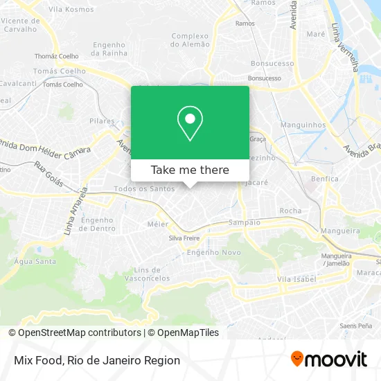
See Mix Food, Cachambi, on the map
Public Transit to Mix Food in Cachambi
Wondering how to get to Mix Food in Cachambi? Moovit helps you find the best way to get to Mix Food with step-by-step directions from the nearest public transit station.
Moovit provides free maps and live directions to help you navigate through your city. View schedules, routes, timetables, and find out how long does it take to get to Mix Food in real time.
Looking for the nearest stop or station to Mix Food? Check out this list of stops closest to your destination: Rua Álvares Cabral; Rua Ferreira De Andrade; Rua Aristides Caire; Rua Capitão Rezende; Rua Torres Sobrinho; Rua Coração De Maria; Méier; Del Castilho.
Bus: 2345, 275, 476, 621, 623, 650, SN 474, 679, 625, 254, 277, 663, 457, SN 457, 533D.Metro: L2.Train: RAMAL DEODORO, RAMAL SANTA CRUZ, RAMAL JAPERI, RAMAL BELFORD ROXO.
Want to see if there’s another route that gets you there at an earlier time? Moovit helps you find alternative routes or times. Get directions from and directions to Mix Food easily from the Moovit App or Website.
We make riding to Mix Food easy, which is why over 1.5 million users, including users in Cachambi, trust Moovit as the best app for public transit. You don’t need to download an individual bus app or train app, Moovit is your all-in-one transit app that helps you find the best bus time or train time available.
For information on prices of bus, metro and train, costs and ride fares to Mix Food, please check the Moovit app.
Use the app to navigate to popular places including to the airport, hospital, stadium, grocery store, mall, coffee shop, school, college, and university.
Mix Food Address: Rua Aristides Caire, 329 Cachambi Rio de Janeiro-RJ 20775-090 street in Cachambi
- Van Linha 679 - Méier x Pilares,
- 314 central das baterias,
- Centro Comunitário Ns. Aparecida-Creche,
- Clube dos Subtenentes e Sargentos da Marinha,
- Rua Aristides Caire 314,
- Lan House,
- Rua Capitão Rezende / Rua Aristides Caire,
- AutoStar Rio Ar Condicionado Automotivo,
- Igreja Evangélica Um Novo Viver,
- Lava Jato e Estacionamento 357 do Meier,
- Centro Espírita ogum beira-mar,
- Comunidade Alianca De Misericordia Do Rj,
- Matriz Nossa Senhora da Conceição Aparecida - Cachambi,
- Rua Capitão Rezende,
- Paróquia Nossa Senhora Aparecida,
- Rua Cachambi Próximo ao 158,
- Rua Cachambi / Rua Capitão Rezende,
- Mercearia Evm Do Meier,
- Creche Escola Be Happy,
- Rua Ferreira de Andrade 154
Places Near Mix Food (Cachambi)
- Praia do Arpoador, Ipanema,
- Shopping Rio Sul, Botafogo,
- Avenida Venezuela 134, Saúde,
- Feira Livre da Gloria, Glória,
- Shopping Downtown, Barra Da Tijuca,
- Hospital Pedro Ernesto, Vila Isabel,
- Norte Shopping, Cachambi,
- Rua Licínio Cardoso, São Francisco Xavier,
- Museu Do Amanhã, Centro,
- Shopping Nova América, Del Castilho,
- Hospital Federal Do Andaraí, Andaraí,
- Rodoviária Novo Rio (Rodoviária do Rio de Janeiro), Santo Cristo,
- Feirão De Malhas, Duque De Caxias,
- Niterói, Niterói,
- Rio De Janeiro,
- Hospital Federal Cardoso Fontes, Jacarepaguá,
- Hospital Municipal Ronaldo Gazolla, Acari,
- Rua Ulysses Guimarães 16, Cidade Nova,
- Shopping RioSul, Botafogo,
- Avenida Rio Branco, Centro
How to get to popular places in Rio de Janeiro Region with public transit
Get around Cachambi by public transit!
Traveling around Cachambi has never been so easy. See step by step directions as you travel to any attraction, street or major public transit station. View bus and train schedules, arrival times, service alerts and detailed routes on a map, so you know exactly how to get to anywhere in Cachambi.
When traveling to any destination around Cachambi use Moovit's Live Directions with Get Off Notifications to know exactly where and how far to walk, how long to wait for your line, and how many stops are left. Moovit will alert you when it's time to get off — no need to constantly re-check whether yours is the next stop.
Wondering how to use public transit in Cachambi or how to pay for public transit in Cachambi? Moovit public transit app can help you navigate your way with public transit easily, and at minimum cost. It includes public transit fees, ticket prices, and costs. Looking for a map of Cachambi public transit lines? Moovit public transit app shows all public transit maps in Cachambi with all Bus, Train, Metro, Light Rail, Ferry, Cable Car, Gondola and Funicular routes and stops on an interactive map.
Rio de Janeiro Region has 8 transit type(s), including: Bus, Train, Metro, Light Rail, Ferry, Cable Car, Gondola and Funicular, operated by several transit agencies, including TrensRJ, Metrô Rio, VLT Carioca, Barcas Rio, BRT MOBI-Rio, Auto Viação Alpha, Auto Viação Tijuca, Gire Transportes, Transurb, Viação Nossa Senhora das Graças, Consórcio INTERSUL, Braso Lisboa (Municipal), Caprichosa Auto Ônibus, Auto Viação Três Amigos and Rodoviária Âncora Matias