How to get to Mm2b by bus?
Click on the bus route to see step by step directions with maps, line arrival times and updated time schedules.
From B Ocean Resort, Fort Lauderdale, Fort Lauderdale
66 minFrom Joe Dimaggio Children's Hospital at Memorial, Hollywood
50 minFrom Galleria Mall, Fort Lauderdale
62 minFrom Plantation, Florida, Plantation
38 minFrom Water Taxi Stop - 15th Street Fisheries, Fort Lauderdale
77 minFrom Walmart Supercenter, Hollywood
39 minFrom Trapeze Swing Club, Fort Lauderdale
40 minFrom A To Z Marble Restoration, Hollywood
56 minFrom Walmart (Walmart Supercenter Hollywood - State Rd 7), Hollywood
38 minFrom Fort Lauderdale-Hollywood International Airport (FLL) (Fort Lauderdale-Hollywood International Airpo, Hollywood
62 min
Bus stops near Mm2b in Plantation
Bus lines to Mm2b in Plantation
What are the closest stations to Mm2b?
The closest stations to Mm2b are:
- US 441/Southwest 18th Street - (Gunther Kia) is 559 yards away, 7 min walk.
- Davie Boulevard/Southwest 42nd Avenue is 883 yards away, 11 min walk.
- Riverland Road/US 441 is 890 yards away, 11 min walk.
Which bus lines stop near Mm2b?
These bus lines stop near Mm2b: 18, 30, 441.
What’s the nearest bus station to Mm2b in Plantation?
The nearest bus station to Mm2b in Plantation is US 441/Southwest 18th Street - (Gunther Kia). It’s a 7 min walk away.
What time is the first bus to Mm2b in Plantation?
The 18 is the first bus that goes to Mm2b in Plantation. It stops nearby at 5:08 AM.
What time is the last bus to Mm2b in Plantation?
The 18 is the last bus that goes to Mm2b in Plantation. It stops nearby at 12:49 AM.
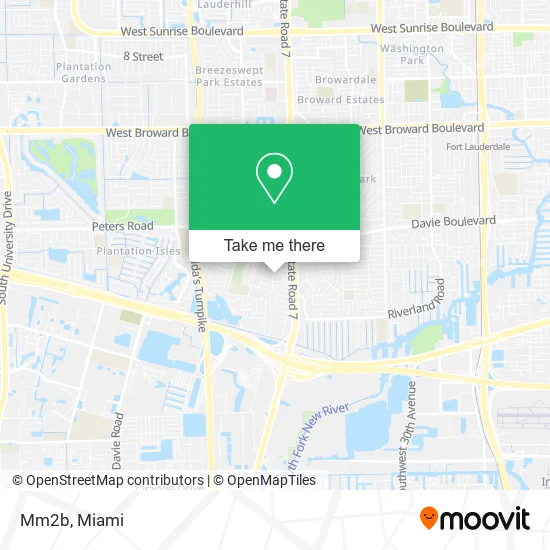
See Mm2b, Plantation, on the map
Public Transit to Mm2b in Plantation
Wondering how to get to Mm2b in Plantation? Moovit helps you find the best way to get to Mm2b with step-by-step directions from the nearest public transit station.
Moovit provides free maps and live directions to help you navigate through your city. View schedules, routes, timetables, and find out how long does it take to get to Mm2b in real time.
Looking for the nearest stop or station to Mm2b? Check out this list of stops closest to your destination: US 441/Southwest 18th Street - (Gunther Kia); Davie Boulevard/Southwest 42nd Avenue; Riverland Road/US 441.
Bus: 18, 30, 441, 09.
Want to see if there’s another route that gets you there at an earlier time? Moovit helps you find alternative routes or times. Get directions from and directions to Mm2b easily from the Moovit App or Website.
We make riding to Mm2b easy, which is why over 1.5 million users, including users in Plantation, trust Moovit as the best app for public transit. You don’t need to download an individual bus app or train app, Moovit is your all-in-one transit app that helps you find the best bus time or train time available.
For information on prices of bus, costs and ride fares to Mm2b, please check the Moovit app.
Use the app to navigate to popular places including to the airport, hospital, stadium, grocery store, mall, coffee shop, school, college, and university.
Mm2b Address: 1850 SW 42nd Ave Fort Lauderdale, FL 33317 street in Plantation
- TT Marine Services,
- La Diferencia Services,
- Maje Motors,
- Plini Pools,
- Synergy,
- La Costa Honduran & Latin Food Restaurant,
- Classy Spa,
- La Hispanlola Unisex Beauty Studio,
- Righteous Ink Tattoo, Body Piercing, & Tattoo Supply,
- Sabor Monti's,
- VMV Med Marketing Services,
- Hello Taco,
- Car Wash 1955 S State Rd 7,
- Broadview Park, Florida,
- Gunther Collision Center,
- Gunther Volkswagen Service,
- Amazon Locker-Mechanics,
- Robert's Lawn Service,
- Regal Cabinets & Quartz,
- Koosh Buyers
Places Near Mm2b (Plantation)
- Wynwood, Miami,
- Richard E. Gerstein Justice Building, Miami,
- Brickell City Centre, Miami,
- Keiser University Flagship Campus, West Palm Beach,
- Bayside Marketplace, Miami,
- Miami VA Hospital, Miami,
- Little Havana, Miami,
- Zoo Miami, Miami,
- Dolphin Mall Bus, Miami,
- Port of Miami Cruise Terminal, Miami,
- Sawgrass Mall, Miami,
- Sawgrass mall ( FL ), Miami Beach,
- Dolphin Mall, Miami,
- Aventura Mall, Miami Beach,
- Hard Rock Stadium, Miami Gardens,
- Miami Design District, Miami,
- Miami Freedom Park, Miami,
- Marlins Park, Miami,
- Aventura Mall, Miami,
- Miami-Dade County Courthouse, Miami
How to get to popular places in Miami with public transit
Get around Plantation by public transit!
Traveling around Plantation has never been so easy. See step by step directions as you travel to any attraction, street or major public transit station. View bus and train schedules, arrival times, service alerts and detailed routes on a map, so you know exactly how to get to anywhere in Plantation.
When traveling to any destination around Plantation use Moovit's Live Directions with Get Off Notifications to know exactly where and how far to walk, how long to wait for your line, and how many stops are left. Moovit will alert you when it's time to get off — no need to constantly re-check whether yours is the next stop.
Wondering how to use public transit in Plantation or how to pay for public transit in Plantation? Moovit public transit app can help you navigate your way with public transit easily, and at minimum cost. It includes public transit fees, ticket prices, and costs. Looking for a map of Plantation public transit lines? Moovit public transit app shows all public transit maps in Plantation with all Bus, Train, Light Rail and Ferry routes and stops on an interactive map.
Miami has 4 transit type(s), including: Bus, Train, Light Rail and Ferry, operated by several transit agencies, including Broward County Transit, Miami-Dade Transit, Metrorail, Palm Tran, Tri-Rail, Brightline, MARTY, City of Homestead Trolley, Key West Transit, Treasure Coast Connector, GoLine IRT, Amtrak, Greyhound-us, FlixBus-us and Aventura Express Shuttle Bus