Directions to Mn Lopes (Santa Cruz) with public transportation
The following transit lines have routes that pass near Mn Lopes
 Bus: 10, 17, 20, 2335, 460S (EXECUTIVO).
- Train: RAMAL SANTA CRUZ.
How to get to Mn Lopes by bus?
Click on the bus route to see step by step directions with maps, line arrival times and updated time schedules.
From BRT - Estação Mato Alto, Guaratiba
33 minFrom Pedra De Guaratiba, Pedra De Guaratiba
42 minFrom Estrada Do Mato Alto, Campo Grande
61 minFrom Guaratiba, Guaratiba
43 minFrom Monte Das Oliveiras, Campo Grande
49 minFrom Ct Ninho das Garças - Guaratiba, Guaratiba
37 minFrom Avenida Cesário de Melo, Campo Grande
52 minFrom Cemitério De Campo Grande, Campo Grande
49 minFrom Estrada do Tingui, Campo Grande
74 minFrom Estrada do Monteiro, Campo Grande
53 min
How to get to Mn Lopes by train?
Click on the train route to see step by step directions with maps, line arrival times and updated time schedules.
Bus stops near Mn Lopes in Santa Cruz
- Cajueiros, 9 min walk,VIEW
- BRT Cajueiros - Crpd Santa Cruz (Sentido Curral Falso), 9 min walk,VIEW
- Avenida Antares, 2598 | R. Cruvelo Cavalcanti, 10 min walk,VIEW
- Continac, 10 min walk,VIEW
- Rua São Benedito, 74-160, 16 min walk,VIEW
- Rua Felipe Cardoso 1439 Santa Cruz Rio De Janeiro - Rio De Janeiro 23520 Brasil, 17 min walk,VIEW
- BRT Gastão Rangel (Sentido Curral Falso), 18 min walk,VIEW
Train station near Mn Lopes in Santa Cruz
- Tancredo Neves, 21 min walk,VIEW
Bus lines to Mn Lopes in Santa Cruz
- 10, Santa Cruz,VIEW
- 11, Santa Cruz (Parador),VIEW
- 17, Campo Grande (Parador),VIEW
- 20, Santa Cruz (Expresso),VIEW
- 388, Cesarão - Candelária (Brs 5 - Via Santa Cruz - Parador),VIEW
- SN 388, Cesarão - Candelária (BRS 5 - via Terminal Deodoro / Lapa),VIEW
- SR 388, Cesarão - Candelária (Brs 5 - Via Santa Cruz - Expresso),VIEW
- 426P, Itaguaí - Cesarão / 7 de Abril,VIEW
- 460S (EXECUTIVO), Itaguaí - Barra da Tijuca,VIEW
- 570P, Itaguaí - Marechal Hermes (Via Santa Cruz),VIEW
- 759, Cesarão - Coelho Neto,VIEW
- SP 759, Cesarão - Terminal Deodoro (via Santa Cruz),VIEW
- 885, Santa Cruz - Terminal Mato Alto (Via Pedra de Guaratiba),VIEW
- 2303, Cesarão - Carioca (Brs 5 - Via Santa Cruz - Expresso),VIEW
- 2335, Santa Cruz - Castelo (Brs 3 - Via Pedra / Barra),VIEW
- 2802, São Fernando - Jardim Oceânico (Via Santa Cruz / Av. das Américas),VIEW
- 754, Terminal Deodoro,VIEW
- SN 897, Pingo D'Água,VIEW
- 756, Coelho Neto,VIEW
- 807, Curral Falso,VIEW
What are the closest stations to Mn Lopes?
The closest stations to Mn Lopes are:
- Cajueiros is 638 meters away, 9 min walk.
- BRT Cajueiros - Crpd Santa Cruz (Sentido Curral Falso) is 652 meters away, 9 min walk.
- Avenida Antares, 2598 | R. Cruvelo Cavalcanti is 707 meters away, 10 min walk.
- Continac is 720 meters away, 10 min walk.
- Rua São Benedito, 74-160 is 1180 meters away, 16 min walk.
- Rua Felipe Cardoso 1439 Santa Cruz Rio De Janeiro - Rio De Janeiro 23520 Brasil is 1320 meters away, 17 min walk.
- BRT Gastão Rangel (Sentido Curral Falso) is 1326 meters away, 18 min walk.
- Tancredo Neves is 1568 meters away, 21 min walk.
Which bus lines stop near Mn Lopes?
These bus lines stop near Mn Lopes: 10, 17, 20, 2335, 460S (EXECUTIVO).
Which train line stops near Mn Lopes?
RAMAL SANTA CRUZ (Santa Cruz (Parador))
What’s the nearest train station to Mn Lopes in Santa Cruz?
The nearest train station to Mn Lopes in Santa Cruz is Tancredo Neves. It’s a 21 min walk away.
What’s the nearest bus station to Mn Lopes in Santa Cruz?
The nearest bus stations to Mn Lopes in Santa Cruz are Cajueiros and BRT Cajueiros - Crpd Santa Cruz (Sentido Curral Falso). The closest one is a 9 min walk away.
What time is the first train to Mn Lopes in Santa Cruz?
The RAMAL SANTA CRUZ is the first train that goes to Mn Lopes in Santa Cruz. It stops nearby at 3:52 AM.
What time is the last train to Mn Lopes in Santa Cruz?
The RAMAL SANTA CRUZ is the last train that goes to Mn Lopes in Santa Cruz. It stops nearby at 12:02 AM.
What time is the first bus to Mn Lopes in Santa Cruz?
The 17 is the first bus that goes to Mn Lopes in Santa Cruz. It stops nearby at 3:01 AM.
What time is the last bus to Mn Lopes in Santa Cruz?
The SN 388 is the last bus that goes to Mn Lopes in Santa Cruz. It stops nearby at 3:54 AM.
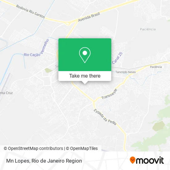
See Mn Lopes, Santa Cruz, on the map
Public Transit to Mn Lopes in Santa Cruz
Wondering how to get to Mn Lopes in Santa Cruz? Moovit helps you find the best way to get to Mn Lopes with step-by-step directions from the nearest public transit station.
Moovit provides free maps and live directions to help you navigate through your city. View schedules, routes, timetables, and find out how long does it take to get to Mn Lopes in real time.
Looking for the nearest stop or station to Mn Lopes? Check out this list of stops closest to your destination: Cajueiros; BRT Cajueiros - Crpd Santa Cruz (Sentido Curral Falso); Avenida Antares; Continac; Rua São Benedito; Rua Felipe Cardoso 1439 Santa Cruz Rio De Janeiro - Rio De Janeiro 23520 Brasil; BRT Gastão Rangel (Sentido Curral Falso); Tancredo Neves.
Bus: 10, 17, 20, 2335, 460S (EXECUTIVO), 11, 388, SN 388, SR 388, 426P, 754, SN 897, 756, 807, 892.Train: RAMAL SANTA CRUZ.
Want to see if there’s another route that gets you there at an earlier time? Moovit helps you find alternative routes or times. Get directions from and directions to Mn Lopes easily from the Moovit App or Website.
We make riding to Mn Lopes easy, which is why over 1.5 million users, including users in Santa Cruz, trust Moovit as the best app for public transit. You don’t need to download an individual bus app or train app, Moovit is your all-in-one transit app that helps you find the best bus time or train time available.
For information on prices of bus and train, costs and ride fares to Mn Lopes, please check the Moovit app.
Use the app to navigate to popular places including to the airport, hospital, stadium, grocery store, mall, coffee shop, school, college, and university.
Mn Lopes Address: Rua Projetada C, 326 Santa Cruz Rio de Janeiro-RJ 21046-405 street in Santa Cruz
- Rua Projetada C / Rua Antônio Pinto Menezes,
- Travessa Coqueiros Lto Bairro Rolas 1,
- Karol Bronze,
- Rio Estrela,
- Casa Seu Mata Virgem,
- Escola Imaginarte,
- Igreja Apostolica Crista de Senador Camara,
- Mada,
- Espaço Florence,
- May Eletrica,
- Moto Pecas Toca da Raposa,
- Adgaleão - Lugar de Ser Feliz,
- Alex F,
- Marias Atelie,
- Mfa Empreendimento Tngp Ltda,
- Lounge Hair,
- Laura Nails,
- Rua Delair de Almeida,
- Esb Instalacoes e Manutencoes,
- Placas Lins
Places Near Mn Lopes (Santa Cruz)
- Hospital Federal Cardoso Fontes, Jacarepaguá,
- Museu Do Amanhã, Centro,
- Shopping RioSul, Botafogo,
- Niterói, Niterói,
- Shopping Downtown, Barra Da Tijuca,
- Rodoviária Novo Rio (Rodoviária do Rio de Janeiro), Santo Cristo,
- Rua Licínio Cardoso, São Francisco Xavier,
- Rua Ulysses Guimarães 16, Cidade Nova,
- Praia do Arpoador, Ipanema,
- Hospital Municipal Ronaldo Gazolla, Acari,
- Avenida Venezuela 134, Saúde,
- Shopping Nova América, Del Castilho,
- Norte Shopping, Cachambi,
- Hospital Pedro Ernesto, Vila Isabel,
- Hospital Federal Do Andaraí, Andaraí,
- Feirão De Malhas, Duque De Caxias,
- Shopping Rio Sul, Botafogo,
- Rio De Janeiro,
- Feira Livre da Gloria, Glória,
- Avenida Rio Branco, Centro
How to get to popular places in Rio de Janeiro Region with public transit
Get around Santa Cruz by public transit!
Traveling around Santa Cruz has never been so easy. See step by step directions as you travel to any attraction, street or major public transit station. View bus and train schedules, arrival times, service alerts and detailed routes on a map, so you know exactly how to get to anywhere in Santa Cruz.
When traveling to any destination around Santa Cruz use Moovit's Live Directions with Get Off Notifications to know exactly where and how far to walk, how long to wait for your line, and how many stops are left. Moovit will alert you when it's time to get off — no need to constantly re-check whether yours is the next stop.
Wondering how to use public transit in Santa Cruz or how to pay for public transit in Santa Cruz? Moovit public transit app can help you navigate your way with public transit easily, and at minimum cost. It includes public transit fees, ticket prices, and costs. Looking for a map of Santa Cruz public transit lines? Moovit public transit app shows all public transit maps in Santa Cruz with all Bus, Train, Metro, Light Rail, Ferry, Cable Car, Gondola and Funicular routes and stops on an interactive map.
Rio de Janeiro Region has 8 transit type(s), including: Bus, Train, Metro, Light Rail, Ferry, Cable Car, Gondola and Funicular, operated by several transit agencies, including TrensRJ, Metrô Rio, VLT Carioca, Barcas Rio, BRT MOBI-Rio, Auto Viação Alpha, Auto Viação Tijuca, Gire Transportes, Transurb, Viação Nossa Senhora das Graças, Consórcio INTERSUL, Braso Lisboa (Municipal), Caprichosa Auto Ônibus, Auto Viação Três Amigos and Rodoviária Âncora Matias