How to get to Mobil by bus?
Click on the bus route to see step by step directions with maps, line arrival times and updated time schedules.
From Embassy Suites-Bethesda Washington DC, Montgomery County
74 minFrom Albert Einstein High School, Montgomery County
45 minFrom The Music Center At Strathmore, Montgomery County
62 minFrom RIO Washingtonian Center, Montgomery County
36 minFrom I-270 Exit 9A/B (I-370 / Sam Eig Hwy. Interchange), Montgomery County
57 minFrom Washington DC Temple, Montgomery County
59 minFrom Adventist HealthCare Shady Grove Medical Center, Montgomery County
59 minFrom Canopy By Hilton Washington DC Bethesda North North Bethesda, Montgomery County
57 minFrom Bethesda North Marriott Hotel & Conference Center, Montgomery County
53 minFrom Park Potomac Place, Montgomery County
63 min
Bus stops near Mobil in Montgomery County
Bus lines to Mobil in Montgomery County
What are the closest stations to Mobil?
The closest stations to Mobil are:
- Georgia Av+Norbeck Rd is 100 yards away, 2 min walk.
- Norbeck Rd & Georgia Ave is 278 yards away, 4 min walk.
- Norbeck Rd & Norbeck Blvd is 892 yards away, 11 min walk.
- Georgia Avenue Park & Ride is 1109 yards away, 14 min walk.
Which bus lines stop near Mobil?
These bus lines stop near Mobil: M20, M22.
What’s the nearest bus station to Mobil in Montgomery County?
The nearest bus station to Mobil in Montgomery County is Georgia Av+Norbeck Rd. It’s a 2 min walk away.
What time is the first bus to Mobil in Montgomery County?
The 201 is the first bus that goes to Mobil in Montgomery County. It stops nearby at 4:21 AM.
What time is the last bus to Mobil in Montgomery County?
The M22 is the last bus that goes to Mobil in Montgomery County. It stops nearby at 2:25 AM.
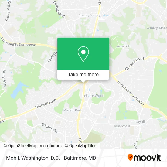
See Mobil, Montgomery County, on the map
Public Transit to Mobil in Montgomery County
Wondering how to get to Mobil in Montgomery County? Moovit helps you find the best way to get to Mobil with step-by-step directions from the nearest public transit station.
Moovit provides free maps and live directions to help you navigate through your city. View schedules, routes, timetables, and find out how long does it take to get to Mobil in real time.
Looking for the nearest stop or station to Mobil? Check out this list of stops closest to your destination: Georgia Av+Norbeck Rd; Norbeck Rd & Georgia Ave; Norbeck Rd & Norbeck Blvd; Georgia Avenue Park & Ride.
Bus: M20, M22, 52, 51, 201, 204.
Want to see if there’s another route that gets you there at an earlier time? Moovit helps you find alternative routes or times. Get directions from and directions to Mobil easily from the Moovit App or Website.
We make riding to Mobil easy, which is why over 1.5 million users, including users in Montgomery County, trust Moovit as the best app for public transit. You don’t need to download an individual bus app or train app, Moovit is your all-in-one transit app that helps you find the best bus time or train time available.
For information on prices of bus and metro, costs and ride fares to Mobil, please check the Moovit app.
Use the app to navigate to popular places including to the airport, hospital, stadium, grocery store, mall, coffee shop, school, college, and university.
Mobil Address: Georgia Ave Access Road street in Montgomery County
- Georgia Avenue & Norbeck Road,
- Norbeck Park & Ride,
- Cars Auto Sales,
- A and C Auto Sales,
- Belles Springs Structures,
- Norbeck-Muncaster Rec Center,
- Intercounty Connector (ICC) / MD 200,
- St Patricks Church,
- Hamere Berhan Kidus Yohannes,
- Vik Uberoi, M.D.,
- National Veterinary Associates,
- Centers for Advanced Orthopaedics,
- Philip Koi, MD,
- Candice Fori, Pa-C,
- Melissa Mendez, M.D.,
- Truist - ATM,
- Johnny Kim - Wilmington Advisors @ M&T,
- David M. Plasse - M&T Bank,
- Cam Physical Therapy and Wellness Services,
- Leandra
Places Near Mobil (Montgomery County)
- Rock Creek Tennis Center, Washington,
- Basilica of the National Shrine, Washington,
- The Anthem, Washington,
- National Zoo, Washington,
- Museum Of The Bible, Washington,
- Washington DC VA Medical Center, Washington,
- Washington National Cathedral, Washington,
- Capital One Arena, Washington,
- M&T Bank Stadium, Baltimore,
- PG Mall, Prince George's County,
- Sibley Memorial Hospital, Washington,
- Marriott Marquis Washington, DC, Washington,
- Georgetown, Washington,
- Westfield Montgomery Mall, Montgomery County,
- Camden Yards, Baltimore,
- National Museum of African American History and Culture, Washington,
- Pennsylvania Ave NW (3rd st and pennsylvania), Washington,
- National Mall, Washington,
- Amazon Hq2, Arlington County,
- Warner Theatre, Washington
How to get to popular places in Washington, D.C. - Baltimore, MD with public transit
Get around Montgomery County by public transit!
Traveling around Montgomery County has never been so easy. See step by step directions as you travel to any attraction, street or major public transit station. View bus and train schedules, arrival times, service alerts and detailed routes on a map, so you know exactly how to get to anywhere in Montgomery County.
When traveling to any destination around Montgomery County use Moovit's Live Directions with Get Off Notifications to know exactly where and how far to walk, how long to wait for your line, and how many stops are left. Moovit will alert you when it's time to get off — no need to constantly re-check whether yours is the next stop.
Wondering how to use public transit in Montgomery County or how to pay for public transit in Montgomery County? Moovit public transit app can help you navigate your way with public transit easily, and at minimum cost. It includes public transit fees, ticket prices, and costs. Looking for a map of Montgomery County public transit lines? Moovit public transit app shows all public transit maps in Montgomery County with all Bus, Train, Metro, Light Rail and Ferry routes and stops on an interactive map.
Washington, D.C. - Baltimore, MD has 5 transit type(s), including: Bus, Train, Metro, Light Rail and Ferry, operated by several transit agencies, including WMATA, Montgomery County Ride On, Fairfax Connector, TheBus, PRTC, DASH - Alexandria, Arlington Transit (ART), RTA of Central Maryland, MDOT MTA, MDOT MTA Light RailLink, MDOT MTA Commuter Bus, MDOT MTA Local Bus, FXBGO!, Virginia Railway Express (VRE) and MARC