Directions to Mobilpro Store (Jersey City) with public transportation
The following transit lines have routes that pass near Mobilpro Store
 Bus: 1, 16.
- Train: YEL.
- Ferry: LIBERTY HARBOR - PIER 11 / WALL ST.
How to get to Mobilpro Store by bus?
Click on the bus route to see step by step directions with maps, line arrival times and updated time schedules.
From Bloomingdale's NY 59th St, Manhattan
97 minFrom The Westin New York Grand Central, Manhattan
91 minFrom IKEA, Manhattan
98 minFrom Bushwick, Manhattan
97 minFrom Walmart, Kearny
72 minFrom Hell's Kitchen, Manhattan
72 minFrom Roosevelt Island Tramway, Manhattan
97 minFrom Fifth Avenue, Manhattan
88 minFrom Gramercy Park, Manhattan
95 minFrom 2nd Ave (59th st and 2nd ave), Manhattan
98 min
How to get to Mobilpro Store by train?
Click on the train route to see step by step directions with maps, line arrival times and updated time schedules.
From Bushwick, Manhattan
115 minFrom IKEA, Manhattan
119 minFrom Fifth Avenue, Manhattan
80 minFrom 2nd Ave (59th st and 2nd ave), Manhattan
115 minFrom Gramercy Park, Manhattan
61 minFrom Hell's Kitchen, Manhattan
79 minFrom Bloomingdale's NY 59th St, Manhattan
119 minFrom The Westin New York Grand Central, Manhattan
76 minFrom Roosevelt Island Tramway, Manhattan
116 min
Bus stops near Mobilpro Store in Jersey City
Light Rail stations near Mobilpro Store in Jersey City
- Marin Boulevard Light Rail Station, 9 min walk,VIEW
Ferry station near Mobilpro Store in Jersey City
- Liberty Harbor, 28 min walk,VIEW
Bus lines to Mobilpro Store in Jersey City
What are the closest stations to Mobilpro Store?
The closest stations to Mobilpro Store are:
- Communipaw Ave at Whiton St is 137 yards away, 2 min walk.
- Pacific Ave at Communipaw Ave is 202 yards away, 3 min walk.
- Marin Boulevard Light Rail Station is 685 yards away, 9 min walk.
- Liberty Harbor is 2328 yards away, 28 min walk.
Which bus lines stop near Mobilpro Store?
These bus lines stop near Mobilpro Store: 1, 16.
Which train line stops near Mobilpro Store?
YEL (Journal Square - 33rd Street)
What’s the nearest light rail station to Mobilpro Store in Jersey City?
The nearest light rail station to Mobilpro Store in Jersey City is Marin Boulevard Light Rail Station. It’s a 9 min walk away.
What’s the nearest bus station to Mobilpro Store in Jersey City?
The nearest bus station to Mobilpro Store in Jersey City is Communipaw Ave at Whiton St. It’s a 2 min walk away.
What’s the nearest ferry station to Mobilpro Store in Jersey City?
The nearest ferry station to Mobilpro Store in Jersey City is Liberty Harbor. It’s a 28 min walk away.
What time is the first light rail to Mobilpro Store in Jersey City?
The HBLR is the first light rail that goes to Mobilpro Store in Jersey City. It stops nearby at 4:37 AM.
What time is the last light rail to Mobilpro Store in Jersey City?
The HBLR is the last light rail that goes to Mobilpro Store in Jersey City. It stops nearby at 2:25 AM.
What time is the first bus to Mobilpro Store in Jersey City?
The 1 is the first bus that goes to Mobilpro Store in Jersey City. It stops nearby at 4:54 AM.
What time is the last bus to Mobilpro Store in Jersey City?
The 1 is the last bus that goes to Mobilpro Store in Jersey City. It stops nearby at 11:15 PM.
What time is the first ferry to Mobilpro Store in Jersey City?
The LIBERTY HARBOR - PIER 11 / WALL ST is the first ferry that goes to Mobilpro Store in Jersey City. It stops nearby at 6:00 AM.
What time is the last ferry to Mobilpro Store in Jersey City?
The LIBERTY HARBOR - PIER 11 / WALL ST is the last ferry that goes to Mobilpro Store in Jersey City. It stops nearby at 7:12 PM.
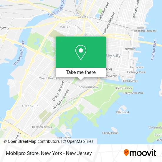
See Mobilpro Store, Jersey City, on the map
Public Transit to Mobilpro Store in Jersey City
Wondering how to get to Mobilpro Store in Jersey City? Moovit helps you find the best way to get to Mobilpro Store with step-by-step directions from the nearest public transit station.
Moovit provides free maps and live directions to help you navigate through your city. View schedules, routes, timetables, and find out how long does it take to get to Mobilpro Store in real time.
Looking for the nearest stop or station to Mobilpro Store? Check out this list of stops closest to your destination: Communipaw Ave at Whiton St; Pacific Ave at Communipaw Ave; Marin Boulevard Light Rail Station; Liberty Harbor.
Bus: 1, 16.Train: YEL.Ferry: LIBERTY HARBOR - PIER 11 / WALL ST.
Want to see if there’s another route that gets you there at an earlier time? Moovit helps you find alternative routes or times. Get directions from and directions to Mobilpro Store easily from the Moovit App or Website.
We make riding to Mobilpro Store easy, which is why over 1.5 million users, including users in Jersey City, trust Moovit as the best app for public transit. You don’t need to download an individual bus app or train app, Moovit is your all-in-one transit app that helps you find the best bus time or train time available.
For information on prices of bus, train and subway, costs and ride fares to Mobilpro Store, please check the Moovit app.
Use the app to navigate to popular places including to the airport, hospital, stadium, grocery store, mall, coffee shop, school, college, and university.
Mobilpro Store Address: Secaucus, Nueva Jersey 07094, EE. UU. street in Jersey City
- Arlington Arrivals,
- Smartprep Usa,
- Maestro Del Amor,
- Moving Services,
- Penélope Santana Photography,
- Terror Prints,
- Apple Blossoms,
- Rsc Handyman Works,
- Primelife-3,
- William Burke Garrett,
- Tapville Social - Jersey City,
- Leal & Asociados Abogados,
- David Pallet Liquidation,
- Global Nation Open University,
- Yohan’S Photo,
- Jc, NJ,
- Academy I Middle School,
- Jersey City Nueva Jersey,
- Dr. Jean Manzzini,
- Admiral Plumbing Company
Places Near Mobilpro Store (Jersey City)
- Bellevue Hospital, Manhattan,
- qqqq, Manhattan,
- 111 Centre New York City Supreme Court, Manhattan,
- 66 John Street, Manhattan,
- SoHo, Manhattan,
- 376 Hudson Street, Manhattan,
- Times Square, Manhattan,
- Rockefeller Center, Manhattan,
- San Gennaro Feast, Manhattan,
- 1 Police Plaza, Manhattan,
- Hudson Yards, Manhattan,
- Wall Street, Manhattan,
- 26 Federal Plaza, Manhattan,
- Chinatown, Manhattan,
- Queens Center Mall, Queens,
- 3 Stone St, Manhattan,
- Mountainside Hospital, Glen Ridge,
- Pier 83, Manhattan,
- 911 Memorial, Manhattan,
- Katz's Deli, Manhattan
How to get to popular places in New York - New Jersey with public transit
Get around Jersey City by public transit!
Traveling around Jersey City has never been so easy. See step by step directions as you travel to any attraction, street or major public transit station. View bus and train schedules, arrival times, service alerts and detailed routes on a map, so you know exactly how to get to anywhere in Jersey City.
When traveling to any destination around Jersey City use Moovit's Live Directions with Get Off Notifications to know exactly where and how far to walk, how long to wait for your line, and how many stops are left. Moovit will alert you when it's time to get off — no need to constantly re-check whether yours is the next stop.
Wondering how to use public transit in Jersey City or how to pay for public transit in Jersey City? Moovit public transit app can help you navigate your way with public transit easily, and at minimum cost. It includes public transit fees, ticket prices, and costs. Looking for a map of Jersey City public transit lines? Moovit public transit app shows all public transit maps in Jersey City with all Bus, Train, Subway, Light Rail, Ferry and Cable Car routes and stops on an interactive map.
New York - New Jersey has 6 transit type(s), including: Bus, Train, Subway, Light Rail, Ferry and Cable Car, operated by several transit agencies, including MTA Subway, Metro-North Railroad, LIRR, PATH, MTA New York City Transit - Express routes, MTA Bus, NJ Transit, NYC Ferry, NICE bus, Bee-Line Bus, NJ Transit Rail, Norwalk Transit District, Hartford Line, River Valley Transit and HART