Directions to Mod Fountain (Huntington) with public transportation
The following transit lines have routes that pass near Mod Fountain
 Bus: 7, H10, H30.
- Train: PORT JEFFERSON BRANCH.
How to get to Mod Fountain by bus?
Click on the bus route to see step by step directions with maps, line arrival times and updated time schedules.
From Crest Hollow Country Club, Woodbury
81 minFrom Hauppauge ny, Hauppauge
94 minFrom Woodbury Long Island, Woodbury
85 minFrom Good Samaritan Hospital Medical Center, West Islip
130 minFrom Baxter Pavillion @ Good Sam, West Islip
147 minFrom Plainview, NY, Plainview
97 minFrom Tanger Outlets, Deer Park
108 minFrom Tanger Outlets, Deer Park, Deer Park
110 minFrom Jake's 58 Casino, Islandia
123 minFrom Brentwood, NY, Brentwood
105 min
How to get to Mod Fountain by train?
Click on the train route to see step by step directions with maps, line arrival times and updated time schedules.
Bus stop near Mod Fountain in Huntington
- Park Circle, 7 min walk,VIEW
Train station near Mod Fountain in Huntington
- Northport, 29 min walk,VIEW
Bus lines to Mod Fountain in Huntington
- H30, Walt Whitman Shops To Halesite,VIEW
What are the closest stations to Mod Fountain?
The closest stations to Mod Fountain are:
- Park Circle is 537 yards away, 7 min walk.
- Northport is 2435 yards away, 29 min walk.
Which bus lines stop near Mod Fountain?
These bus lines stop near Mod Fountain: 7, H10, H30.
Which train line stops near Mod Fountain?
PORT JEFFERSON BRANCH (New York)
What’s the nearest train station to Mod Fountain in Huntington?
The nearest train station to Mod Fountain in Huntington is Northport. It’s a 29 min walk away.
What’s the nearest bus station to Mod Fountain in Huntington?
The nearest bus station to Mod Fountain in Huntington is Park Circle. It’s a 7 min walk away.
What time is the first train to Mod Fountain in Huntington?
The PORT JEFFERSON BRANCH is the first train that goes to Mod Fountain in Huntington. It stops nearby at 4:56 AM.
What time is the last train to Mod Fountain in Huntington?
The PORT JEFFERSON BRANCH is the last train that goes to Mod Fountain in Huntington. It stops nearby at 1:59 AM.
What time is the first bus to Mod Fountain in Huntington?
The H30 is the first bus that goes to Mod Fountain in Huntington. It stops nearby at 8:00 AM.
What time is the last bus to Mod Fountain in Huntington?
The H30 is the last bus that goes to Mod Fountain in Huntington. It stops nearby at 6:40 PM.
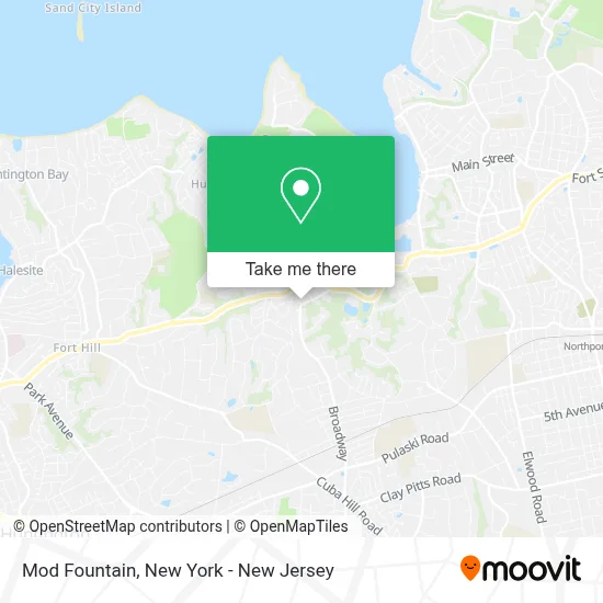
See Mod Fountain, Huntington, on the map
Public Transit to Mod Fountain in Huntington
Wondering how to get to Mod Fountain in Huntington? Moovit helps you find the best way to get to Mod Fountain with step-by-step directions from the nearest public transit station.
Moovit provides free maps and live directions to help you navigate through your city. View schedules, routes, timetables, and find out how long does it take to get to Mod Fountain in real time.
Looking for the nearest stop or station to Mod Fountain? Check out this list of stops closest to your destination: Park Circle; Northport.
Bus: 7, H10, H30.Train: PORT JEFFERSON BRANCH.
Want to see if there’s another route that gets you there at an earlier time? Moovit helps you find alternative routes or times. Get directions from and directions to Mod Fountain easily from the Moovit App or Website.
We make riding to Mod Fountain easy, which is why over 1.5 million users, including users in Huntington, trust Moovit as the best app for public transit. You don’t need to download an individual bus app or train app, Moovit is your all-in-one transit app that helps you find the best bus time or train time available.
For information on prices of bus and train, costs and ride fares to Mod Fountain, please check the Moovit app.
Use the app to navigate to popular places including to the airport, hospital, stadium, grocery store, mall, coffee shop, school, college, and university.
Mod Fountain Address: 27 Blenheim Ln street in Huntington
- United States Postal Service,
- Us Post Office,
- Centerport, New York,
- Mill Pond Steak & Seafood,
- Lynch Development Associates,
- St Patrick's Church (St Patrick's R C Church of Huntington All Depts),
- St Patrick's Church,
- Water's Edge,
- Suydam Homestead,
- Suydam Homestead,
- Dove Arthur Torr Helen Cottage,
- Forum Worldwide,
- Russia Vip Travel,
- Forum Business Advisors,
- Wholesale Merchandise,
- Union Installers,
- Centerport Behavioral Health Llc,
- Tlc Computer Services Inc.,
- Brookside Multicare Nursing Center,
- Mike's Gym Equipment
Places Near Mod Fountain (Huntington)
- Chinatown, Manhattan,
- 66 John Street, Manhattan,
- 911 Memorial, Manhattan,
- Rockefeller Center, Manhattan,
- 26 Federal Plaza, Manhattan,
- 3 Stone St, Manhattan,
- Hudson Yards, Manhattan,
- Wall Street, Manhattan,
- San Gennaro Feast, Manhattan,
- Katz's Deli, Manhattan,
- Bellevue Hospital, Manhattan,
- 376 Hudson Street, Manhattan,
- 111 Centre New York City Supreme Court, Manhattan,
- qqqq, Manhattan,
- Queens Center Mall, Queens,
- Pier 83, Manhattan,
- Times Square, Manhattan,
- Mountainside Hospital, Glen Ridge,
- 1 Police Plaza, Manhattan,
- SoHo, Manhattan
How to get to popular places in New York - New Jersey with public transit
Get around Huntington by public transit!
Traveling around Huntington has never been so easy. See step by step directions as you travel to any attraction, street or major public transit station. View bus and train schedules, arrival times, service alerts and detailed routes on a map, so you know exactly how to get to anywhere in Huntington.
When traveling to any destination around Huntington use Moovit's Live Directions with Get Off Notifications to know exactly where and how far to walk, how long to wait for your line, and how many stops are left. Moovit will alert you when it's time to get off — no need to constantly re-check whether yours is the next stop.
Wondering how to use public transit in Huntington or how to pay for public transit in Huntington? Moovit public transit app can help you navigate your way with public transit easily, and at minimum cost. It includes public transit fees, ticket prices, and costs. Looking for a map of Huntington public transit lines? Moovit public transit app shows all public transit maps in Huntington with all Bus, Train, Subway, Light Rail, Ferry and Cable Car routes and stops on an interactive map.
New York - New Jersey has 6 transit type(s), including: Bus, Train, Subway, Light Rail, Ferry and Cable Car, operated by several transit agencies, including MTA Subway, Metro-North Railroad, LIRR, PATH, MTA New York City Transit - Express routes, MTA Bus, NJ Transit, NYC Ferry, NICE bus, Bee-Line Bus, NJ Transit Rail, Norwalk Transit District, Hartford Line, River Valley Transit and HART