How to get to Mod Media Group by bus?
Click on the bus route to see step by step directions with maps, line arrival times and updated time schedules.
From Xtreme Action Park, Fort Lauderdale
53 minFrom Cam Transfer, Coral Springs-Margate
48 minFrom Northeast High School, Fort Lauderdale
52 minFrom Wilton Manors, Fort Lauderdale
69 minFrom E Oakland Park Blvd / US-1, Fort Lauderdale
24 minFrom Galleria Mall, Fort Lauderdale
49 minFrom Banco Davivienda sa Miami Internatl Branch, Fort Lauderdale
75 minFrom Margate, FL, Coral Springs-Margate
55 minFrom Galleria at Fort Lauderdale (Galleria Mall At Fort Lauderdale), Fort Lauderdale
43 min
Bus stops near Mod Media Group in Pompano Beach
Bus lines to Mod Media Group in Pompano Beach
What are the closest stations to Mod Media Group?
The closest stations to Mod Media Group are:
- Atlantic Boulevard/Southeast 20th Avenue is 136 yards away, 2 min walk.
- US 1/Atlantic Boulevard is 235 yards away, 4 min walk.
Which bus lines stop near Mod Media Group?
These bus lines stop near Mod Media Group: 10, 42.
What’s the nearest bus station to Mod Media Group in Pompano Beach?
The nearest bus station to Mod Media Group in Pompano Beach is Atlantic Boulevard/Southeast 20th Avenue. It’s a 2 min walk away.
What time is the first bus to Mod Media Group in Pompano Beach?
The 10 is the first bus that goes to Mod Media Group in Pompano Beach. It stops nearby at 5:14 AM.
What time is the last bus to Mod Media Group in Pompano Beach?
The 10 is the last bus that goes to Mod Media Group in Pompano Beach. It stops nearby at 11:49 PM.
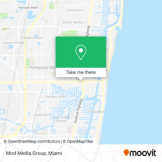
See Mod Media Group, Pompano Beach, on the map
Public Transit to Mod Media Group in Pompano Beach
Wondering how to get to Mod Media Group in Pompano Beach? Moovit helps you find the best way to get to Mod Media Group with step-by-step directions from the nearest public transit station.
Moovit provides free maps and live directions to help you navigate through your city. View schedules, routes, timetables, and find out how long does it take to get to Mod Media Group in real time.
Looking for the nearest stop or station to Mod Media Group? Check out this list of stops closest to your destination: Atlantic Boulevard/Southeast 20th Avenue; US 1/Atlantic Boulevard.
Bus: 10, 42.
Want to see if there’s another route that gets you there at an earlier time? Moovit helps you find alternative routes or times. Get directions from and directions to Mod Media Group easily from the Moovit App or Website.
We make riding to Mod Media Group easy, which is why over 1.5 million users, including users in Pompano Beach, trust Moovit as the best app for public transit. You don’t need to download an individual bus app or train app, Moovit is your all-in-one transit app that helps you find the best bus time or train time available.
For information on prices of bus, costs and ride fares to Mod Media Group, please check the Moovit app.
Use the app to navigate to popular places including to the airport, hospital, stadium, grocery store, mall, coffee shop, school, college, and university.
Mod Media Group Address: 1937 E Atlantic Blvd Pompano Beach, FL 33060 street in Pompano Beach
- Springer & Harris Real Estate,
- Brydger & Porras,
- Kay Henriques,
- LJW Legal,
- Four Seasons Spa Asian Massage,
- Fortress Moving,
- The Grill Show,
- Difarina,
- Suzy Salon,
- Di Farina Meat Shop,
- Rednodo Digital Agency,
- Florida Draw Bridges,
- Shingle & Roofing Systems,
- CIRCLE K,
- Single Breath,
- Shred Nations,
- Acs Consulting Group,
- Auto Locksmith Near Me,
- Posh Wine Bar,
- Libertyx Bitcoin ATM
Places Near Mod Media Group (Pompano Beach)
- Dolphin Mall Bus, Miami,
- Little Havana, Miami,
- Miami Design District, Miami,
- Aventura Mall, Miami Beach,
- Zoo Miami, Miami,
- Hard Rock Stadium, Miami Gardens,
- Port of Miami Cruise Terminal, Miami,
- Brickell City Centre, Miami,
- Wynwood, Miami,
- Miami VA Hospital, Miami,
- Sawgrass mall ( FL ), Miami Beach,
- Richard E. Gerstein Justice Building, Miami,
- Keiser University Flagship Campus, West Palm Beach,
- Marlins Park, Miami,
- Dolphin Mall, Miami,
- Miami-Dade County Courthouse, Miami,
- Aventura Mall, Miami,
- Miami Freedom Park, Miami,
- Sawgrass Mall, Miami,
- Bayside Marketplace, Miami
How to get to popular places in Miami with public transit
Get around Pompano Beach by public transit!
Traveling around Pompano Beach has never been so easy. See step by step directions as you travel to any attraction, street or major public transit station. View bus and train schedules, arrival times, service alerts and detailed routes on a map, so you know exactly how to get to anywhere in Pompano Beach.
When traveling to any destination around Pompano Beach use Moovit's Live Directions with Get Off Notifications to know exactly where and how far to walk, how long to wait for your line, and how many stops are left. Moovit will alert you when it's time to get off — no need to constantly re-check whether yours is the next stop.
Wondering how to use public transit in Pompano Beach or how to pay for public transit in Pompano Beach? Moovit public transit app can help you navigate your way with public transit easily, and at minimum cost. It includes public transit fees, ticket prices, and costs. Looking for a map of Pompano Beach public transit lines? Moovit public transit app shows all public transit maps in Pompano Beach with all Bus, Train, Light Rail and Ferry routes and stops on an interactive map.
Miami has 4 transit type(s), including: Bus, Train, Light Rail and Ferry, operated by several transit agencies, including Broward County Transit, Miami-Dade Transit, Metrorail, Palm Tran, Tri-Rail, Brightline, MARTY, City of Homestead Trolley, Key West Transit, Treasure Coast Connector, GoLine IRT, Amtrak, Greyhound-us, FlixBus-us and Aventura Express Shuttle Bus