How to get to Moda Miha by bus?
Click on the bus route to see step by step directions with maps, line arrival times and updated time schedules.
From Dirección General de Tráfico (DGT), Alcalá De Henares
53 minFrom C.C. Cuadernillos, Alcalá De Henares
28 minFrom Hospital Universitario De Guadalajara, Guadalajara
53 minFrom Centro Comercial Alcalá Magna, Área Metropolitana De Madrid Y Corredor Del Henares
63 minFrom Cementerio Jardín, Área Metropolitana De Madrid Y Corredor Del Henares
59 minFrom Autobús 227 EXPRESS, Alcalá De Henares
62 minFrom Centro Penitenciario Alcalá Meco - Madrid II, Alcalá De Henares
80 minFrom Centro Comercial Ferial Plaza, Guadalajara
87 minFrom Hospital Príncipe De Asturias, Alcalá De Henares
63 minFrom Centro Francisco Díaz, Alcalá De Henares
40 min
How to get to Moda Miha by train?
Click on the train route to see step by step directions with maps, line arrival times and updated time schedules.
From Hospital Príncipe De Asturias, Alcalá De Henares
42 minFrom Dirección General de Tráfico (DGT), Alcalá De Henares
40 minFrom C.C. Cuadernillos, Alcalá De Henares
25 minFrom Centro Comercial Alcalá Magna, Área Metropolitana De Madrid Y Corredor Del Henares
40 minFrom Centro Francisco Díaz, Alcalá De Henares
46 minFrom Autobús 227 EXPRESS, Alcalá De Henares
38 min
Bus stops near Moda Miha in Azuqueca De Henares
Train station near Moda Miha in Azuqueca De Henares
- Azuqueca, 9 min walk,VIEW
Bus lines to Moda Miha in Azuqueca De Henares
What are the closest stations to Moda Miha?
The closest stations to Moda Miha are:
- Azuqueca - Av. Torrelaguna is 363 meters away, 5 min walk.
- Avda. Ferrocarril, Esq. Segovia (El Foro) is 394 meters away, 6 min walk.
- Azuqueca - Guardia Civil is 447 meters away, 6 min walk.
- Avda. Constitución (Centro Médico Y Especialidades) is 549 meters away, 8 min walk.
- Azuqueca is 679 meters away, 9 min walk.
Which bus lines stop near Moda Miha?
These bus lines stop near Moda Miha: VAC243, VCM-048.
Which train line stops near Moda Miha?
C2 (Guadalajara)
What’s the nearest train station to Moda Miha in Azuqueca De Henares?
The nearest train station to Moda Miha in Azuqueca De Henares is Azuqueca. It’s a 9 min walk away.
What’s the nearest bus station to Moda Miha in Azuqueca De Henares?
The nearest bus station to Moda Miha in Azuqueca De Henares is Azuqueca - Av. Torrelaguna. It’s a 5 min walk away.
What time is the first train to Moda Miha in Azuqueca De Henares?
The C2 is the first train that goes to Moda Miha in Azuqueca De Henares. It stops nearby at 5:38 AM.
What time is the last train to Moda Miha in Azuqueca De Henares?
The C2 is the last train that goes to Moda Miha in Azuqueca De Henares. It stops nearby at 12:42 AM.
What time is the first bus to Moda Miha in Azuqueca De Henares?
The VCM-048 is the first bus that goes to Moda Miha in Azuqueca De Henares. It stops nearby at 6:35 AM.
What time is the last bus to Moda Miha in Azuqueca De Henares?
The VCM-048 is the last bus that goes to Moda Miha in Azuqueca De Henares. It stops nearby at 11:33 PM.
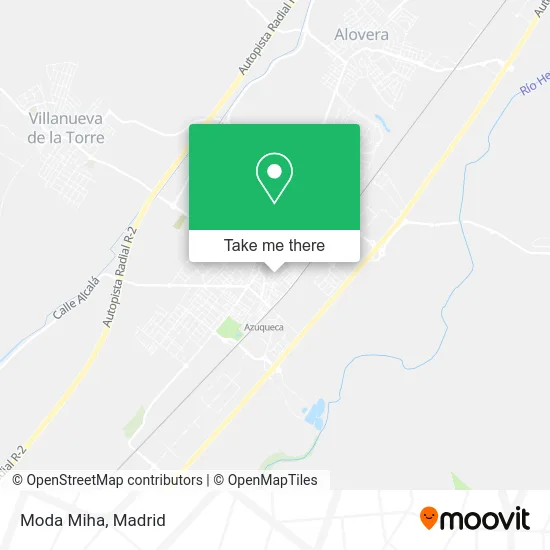
See Moda Miha, Azuqueca De Henares, on the map
Public Transit to Moda Miha in Azuqueca De Henares
Wondering how to get to Moda Miha in Azuqueca De Henares? Moovit helps you find the best way to get to Moda Miha with step-by-step directions from the nearest public transit station.
Moovit provides free maps and live directions to help you navigate through your city. View schedules, routes, timetables, and find out how long does it take to get to Moda Miha in real time.
Looking for the nearest stop or station to Moda Miha? Check out this list of stops closest to your destination: Azuqueca - Av. Torrelaguna; Avda. Ferrocarril; Azuqueca - Guardia Civil; Avda. Constitución (Centro Médico Y Especialidades); Azuqueca.
Bus: VAC243, VCM-048, L1, L2.Train: C2, C7.
Want to see if there’s another route that gets you there at an earlier time? Moovit helps you find alternative routes or times. Get directions from and directions to Moda Miha easily from the Moovit App or Website.
We make riding to Moda Miha easy, which is why over 1.5 million users, including users in Azuqueca De Henares, trust Moovit as the best app for public transit. You don’t need to download an individual bus app or train app, Moovit is your all-in-one transit app that helps you find the best bus time or train time available.
For information on prices of bus and train, costs and ride fares to Moda Miha, please check the Moovit app.
Use the app to navigate to popular places including to the airport, hospital, stadium, grocery store, mall, coffee shop, school, college, and university.
Moda Miha Address: Avenida Guadalajara, 5 19200 Azuqueca de Henares street in Azuqueca De Henares
- Pedretel,
- Bodega Extremeña,
- Bar Trigueros,
- Bazar Alimentación,
- Expendeduría Nc,
- Moda Nina,
- Amazon Counter-Estanco Nãšmero 3,
- Antares de Seguridad,
- Nacex,
- Pablo Blanco Jimeno,
- Lacon Carrillo Maria Ángeles,
- Mi Mini Shop,
- La Imperial,
- Chiquibay Azuqueca Moda Infantil y Juvenil,
- Rabanal Rodriguez Alfredo Julio,
- Dominguez Castro J,
- María Teresa Iglesias Peinado,
- White House Real State,
- Persa Casilda Lia,
- Hernando Diez I
Places Near Moda Miha (Azuqueca De Henares)
- Hospital Clínico Universitario San Carlos, Madrid,
- Centro Comercial Islazul, Área Metropolitana De Madrid Y Corredor Del Henares,
- Centro Comercial La Gavia, Área Metropolitana De Madrid Y Corredor Del Henares,
- Rastro De Madrid, Área Metropolitana De Madrid Y Corredor Del Henares,
- Hospital Universitario Ramón y Cajal, Madrid,
- Sala La Riviera, Madrid,
- Estacion de Chamartin, Madrid,
- Palacio De Vistalegre, Área Metropolitana De Madrid Y Corredor Del Henares,
- Mercadillo de Majadahonda, Majadahonda,
- Mendez Alvaro, Madrid,
- Plenilunio, Área Metropolitana De Madrid Y Corredor Del Henares,
- Hospital Universitario La Paz, Madrid,
- Centro Comercial Oasiz Madrid, Área Metropolitana De Madrid Y Corredor Del Henares,
- Wizink Center, Madrid,
- Tres Aguas, Alcorcón,
- Plaza Mayor, Madrid,
- Estadio Wanda Metropolitano, Área Metropolitana De Madrid Y Corredor Del Henares,
- Centro Comercial La Vaguada, Área Metropolitana De Madrid Y Corredor Del Henares,
- Calle de López de Hoyos 169, Madrid,
- Nassica, Área Metropolitana De Madrid Y Corredor Del Henares
How to get to popular places in Madrid with public transit
Get around Azuqueca De Henares by public transit!
Traveling around Azuqueca De Henares has never been so easy. See step by step directions as you travel to any attraction, street or major public transit station. View bus and train schedules, arrival times, service alerts and detailed routes on a map, so you know exactly how to get to anywhere in Azuqueca De Henares.
When traveling to any destination around Azuqueca De Henares use Moovit's Live Directions with Get Off Notifications to know exactly where and how far to walk, how long to wait for your line, and how many stops are left. Moovit will alert you when it's time to get off — no need to constantly re-check whether yours is the next stop.
Wondering how to use public transit in Azuqueca De Henares or how to pay for public transit in Azuqueca De Henares? Moovit public transit app can help you navigate your way with public transit easily, and at minimum cost. It includes public transit fees, ticket prices, and costs. Looking for a map of Azuqueca De Henares public transit lines? Moovit public transit app shows all public transit maps in Azuqueca De Henares with all Bus, Train, Metro and Light Rail routes and stops on an interactive map.
Madrid has 4 transit type(s), including: Bus, Train, Metro and Light Rail, operated by several transit agencies, including Metro de Madrid, Metro Ligero, Tranvía de Parla, Renfe Cercanías - Servicios de Autobús especiales, Renfe Cercanias, Renfe Cercanías, EMT, Interurbanos, Urbanos de Alcalá de Henares, Urbanos de Alcobendas, Urbanos de Alcorcón, Urbanos de Algete, Urbanos de Aranjuez, Urbanos de Arganda del Rey and Urbanos de Arroyomolinos