How to get to Moda Talia by bus?
Click on the bus route to see step by step directions with maps, line arrival times and updated time schedules.
From Batman Çayı, Merkez
42 minFrom Malabadi Mesleki ve Teknik Anadolu Lisesi, Merkez
30 minFrom Batman Çayı, Merkez
27 minFrom Şeyh Muhammed Zilani Türbesi, Beşiri
46 minFrom Emekli Toki, Merkez
29 minFrom Cezeri Anadolu Lisesi, Merkez
38 minFrom Al Alçı Fabrikası, Merkez
40 minFrom Batman Köşk Aquapark, Merkez
38 minFrom Batman Üniversitesi Batı Raman Kampüsü, Bismil
39 minFrom Abdülhamid Han Anadolu Lisesi Yurdu, Merkez
29 min
Bus stops near Moda Talia in Merkez
Bus lines to Moda Talia in Merkez
- 4, Seyitler-Güneykent-Bölge Hast./Ring,VIEW
- 15, Belediye-Sağlık Mh.-Otogar-Bölge/Ring,VIEW
- 14, Belediye-Kültür-Bölge Hastanesi/Ring,VIEW
- 2, Belediye - Bayındırlık - Gültepe,VIEW
- 5, Petrolkent - Bölge Hastanesi - Tilmerç Toki,VIEW
- 8, Belediye-Şafak-Gap Mah.-Bölge,VIEW
- 10, Belediye-Yavuz Selim-Oduncular Sitesi,VIEW
- 11, Belediye - Körük - Afet Konutları,VIEW
- 12, Havalimanı✈︎,VIEW
- 13, Belediye - Organize Sanayi,VIEW
- 17, Belediye-Şafak-Siirt Çevreyolu-Çamlıtepe-Bölge,VIEW
- 18, Belediye - Memursen,VIEW
- 19, Belediye - Binatlı(Bilêyder),VIEW
- 20, Belediye - Bıçakçı,VIEW
- 22, Belediye - Diktepe - Akoba,VIEW
- 27, Belediye - Samanyolu - Üçyol,VIEW
- 28, Belediye - Bayraklı - Yaylıca,VIEW
- 29, Belediye - Çevrimova,VIEW
- 30, Belediye - Danalı - Kösetarla,VIEW
- 31, Belediye - Kocalar,VIEW
What are the closest stations to Moda Talia?
The closest stations to Moda Talia are:
- Edip Solmaz Blv is 143 meters away, 2 min walk.
- Aram Tigran Parkı-Diş Hst is 223 meters away, 3 min walk.
- Sanat Sokağı is 228 meters away, 4 min walk.
- Belediye is 270 meters away, 4 min walk.
- Yunus Emre Cd is 355 meters away, 5 min walk.
Which bus lines stop near Moda Talia?
These bus lines stop near Moda Talia: 13, 19, 20, 9B.
What’s the nearest bus station to Moda Talia in Merkez?
The nearest bus station to Moda Talia in Merkez is Edip Solmaz Blv. It’s a 2 min walk away.
What time is the first bus to Moda Talia in Merkez?
The 14 is the first bus that goes to Moda Talia in Merkez. It stops nearby at 6:01 AM.
What time is the last bus to Moda Talia in Merkez?
The 2 is the last bus that goes to Moda Talia in Merkez. It stops nearby at 12:59 AM.
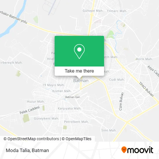
See Moda Talia, Merkez, on the map
Public Transit to Moda Talia in Merkez
Wondering how to get to Moda Talia in Merkez? Moovit helps you find the best way to get to Moda Talia with step-by-step directions from the nearest public transit station.
Moovit provides free maps and live directions to help you navigate through your city. View schedules, routes, timetables, and find out how long does it take to get to Moda Talia in real time.
Looking for the nearest stop or station to Moda Talia? Check out this list of stops closest to your destination: Edip Solmaz Blv; Aram Tigran Parkı-Diş Hst; Sanat Sokağı; Belediye; Yunus Emre Cd.
Bus: 13, 19, 20, 9B, 4, 15, 14, 2, 5, 8, 10, 11, 7, 3.
Want to see if there’s another route that gets you there at an earlier time? Moovit helps you find alternative routes or times. Get directions from and directions to Moda Talia easily from the Moovit App or Website.
We make riding to Moda Talia easy, which is why over 1.5 million users, including users in Merkez, trust Moovit as the best app for public transit. You don’t need to download an individual bus app or train app, Moovit is your all-in-one transit app that helps you find the best bus time or train time available.
For information on prices of bus, costs and ride fares to Moda Talia, please check the Moovit app.
Use the app to navigate to popular places including to the airport, hospital, stadium, grocery store, mall, coffee shop, school, college, and university.
Moda Talia Address: Edip Solmaz Bulvarı, 22 72060 Raman, Batman street in Merkez
- Mitanni Outlet,
- Karmen Cicekcilik Davet &Organizasyon,
- Akser Naklıyat,
- Karmen Çiçekçilik,
- Acelya Cicek Evi,
- Gönülaçar Müzik Evi 2000 Iş Merkezi,
- Hanım Butik,
- Bahoz Giris Cikis,
- Game City Playsation Salonu,
- Tercih Collectinon,
- Barangero Parfüm,
- Batmanda Süpriz Evlilik Teklifi Organizasyonu,
- Xalo Hayran Cigerci,
- Okcu Masaj Salonu,
- Dicle Cafe&Oyun Salonu,
- Serbest Muhasebeci Mehmet Şafi Tilki,
- Akademi Eğitim Danışmanlık,
- Coffe Koçerler,
- Batman İhtiyaç Akademi,
- Kozlu Cafe
Places Near Moda Talia (Merkez)
- Ehmede Xane Taziye Evi, Merkez,
- Fatih Anadolu Lisesi, Merkez,
- Korik Mah., Merkez,
- Şırnak, Merkez,
- Batman Otogarı, Merkez,
- A7, Merkez,
- Muş Alparslan Üniversitesi, Merkez,
- Mardin Sehir Merkezi, Merkez,
- Batman Eğitim Ve Araştırma Hastanesi, Merkez,
- 19 Mayıs Mahallesi, Merkez,
- Alyans Düğün Salonu, Merkez,
- Petrol City Avm, Merkez,
- Slıbini Taziye Evi, Merkez,
- Bayındır Mah., Merkez,
- Batman Nevroz Alanı, Merkez,
- Tilmerc Mah., Merkez,
- Perşembe Pazarı, Merkez,
- Van Erciş, Merkez,
- Batman İlçe Otogarı, Merkez,
- Batman Organize Sanayi Bölgesi, Merkez
How to get to popular places in Batman with public transit
Get around Merkez by public transit!
Traveling around Merkez has never been so easy. See step by step directions as you travel to any attraction, street or major public transit station. View bus and train schedules, arrival times, service alerts and detailed routes on a map, so you know exactly how to get to anywhere in Merkez.
When traveling to any destination around Merkez use Moovit's Live Directions with Get Off Notifications to know exactly where and how far to walk, how long to wait for your line, and how many stops are left. Moovit will alert you when it's time to get off — no need to constantly re-check whether yours is the next stop.
Wondering how to use public transit in Merkez or how to pay for public transit in Merkez? Moovit public transit app can help you navigate your way with public transit easily, and at minimum cost. It includes public transit fees, ticket prices, and costs. Looking for a map of Merkez public transit lines? Moovit public transit app shows all public transit maps in Merkez with all bus routes and stops on an interactive map.
Batman has 1 transit type(s), including: bus, operated by several transit agencies, including Batman Belediyesi