How to get to Modalfa Avintes by bus?
Click on the bus route to see step by step directions with maps, line arrival times and updated time schedules.
From Jardim Botânico do Porto, Lordelo do Ouro e Massarelos
76 minFrom Praia de Miramar, Vila Nova De Gaia
86 minFrom Miramar, Vila Nova De Gaia
87 minFrom 18a Esquadra Da PSP Viso, Ramalde
91 minFrom Bairro das Campinas, Ramalde
85 minFrom Escola Secundária Aurélia de Sousa, Bonfim
88 minFrom Rua Doutor Pedro de Sousa, Ramalde
87 minFrom Campus Asprela, Paranhos
68 minFrom Univ. Católica, Aldoar, Foz do Douro e Nevogilde
91 minFrom Rua Alfredo Keil, Aldoar, Foz do Douro e Nevogilde
81 min
How to get to Modalfa Avintes by metro?
Click on the metro route to see step by step directions with maps, line arrival times and updated time schedules.
Bus stops near Modalfa Avintes in Vila Nova De Gaia
Metro station near Modalfa Avintes in Vila Nova De Gaia
- Hospital Santos Silva, 36 min walk,VIEW
Bus lines to Modalfa Avintes in Vila Nova De Gaia
- 9041, D. João II (Metro),VIEW
- 9026, Crestuma (Igreja) - D. João II (Metro),VIEW
- 9027, Canedo - D. João II (Metro) (via Lever),VIEW
- 9027, Igreja Lever - D. João II (Metro),VIEW
- 9027, Mosteirô A - D. João II (Metro),VIEW
- 9028, Mosteirô A - D. João II (Metro),VIEW
- 9028, Lomba - D. João II (Metro) (via Lever pela N222),VIEW
- 9028, Igreja - LOMBA - D. João II (Metro),VIEW
- 9029, Canedo - D. João II (Metro) (via Crestuma),VIEW
- 9029, Mosteirô A - D. João II (Metro),VIEW
- 9029, Lever (Escola) - D. João II (Metro),VIEW
What are the closest stations to Modalfa Avintes?
The closest stations to Modalfa Avintes are:
- R. Padre António Vieira is 21 meters away, 1 min walk.
- Bairro Sargento - ARCOS is 741 meters away, 10 min walk.
- Hospital Santos Silva is 2802 meters away, 36 min walk.
Which bus lines stop near Modalfa Avintes?
These bus lines stop near Modalfa Avintes: 9025, 9026, 9029, 9083.
Which metro line stops near Modalfa Avintes?
D (Vila d'Este)
What’s the nearest bus station to Modalfa Avintes in Vila Nova De Gaia?
The nearest bus station to Modalfa Avintes in Vila Nova De Gaia is R. Padre António Vieira. It’s a 1 min walk away.
What time is the first metro to Modalfa Avintes in Vila Nova De Gaia?
The D is the first metro that goes to Modalfa Avintes in Vila Nova De Gaia. It stops nearby at 6:00 AM.
What time is the last metro to Modalfa Avintes in Vila Nova De Gaia?
The D is the last metro that goes to Modalfa Avintes in Vila Nova De Gaia. It stops nearby at 1:35 AM.
What time is the first bus to Modalfa Avintes in Vila Nova De Gaia?
The 9029 is the first bus that goes to Modalfa Avintes in Vila Nova De Gaia. It stops nearby at 6:05 AM.
What time is the last bus to Modalfa Avintes in Vila Nova De Gaia?
The 9027 is the last bus that goes to Modalfa Avintes in Vila Nova De Gaia. It stops nearby at 1:17 AM.
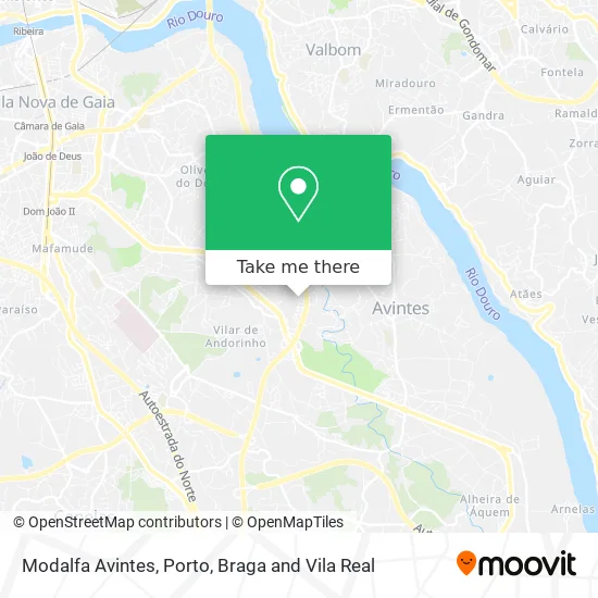
See Modalfa Avintes, Vila Nova De Gaia, on the map
Public Transit to Modalfa Avintes in Vila Nova De Gaia
Wondering how to get to Modalfa Avintes in Vila Nova De Gaia? Moovit helps you find the best way to get to Modalfa Avintes with step-by-step directions from the nearest public transit station.
Moovit provides free maps and live directions to help you navigate through your city. View schedules, routes, timetables, and find out how long does it take to get to Modalfa Avintes in real time.
Looking for the nearest stop or station to Modalfa Avintes? Check out this list of stops closest to your destination: R. Padre António Vieira; Bairro Sargento - ARCOS; Hospital Santos Silva.
Bus: 9025, 9026, 9029, 9083, 9041, 9027, 9027, 9027, 9028.Metro: D.
Want to see if there’s another route that gets you there at an earlier time? Moovit helps you find alternative routes or times. Get directions from and directions to Modalfa Avintes easily from the Moovit App or Website.
We make riding to Modalfa Avintes easy, which is why over 1.5 million users, including users in Vila Nova De Gaia, trust Moovit as the best app for public transit. You don’t need to download an individual bus app or train app, Moovit is your all-in-one transit app that helps you find the best bus time or train time available.
For information on prices of bus, metro and train, costs and ride fares to Modalfa Avintes, please check the Moovit app.
Use the app to navigate to popular places including to the airport, hospital, stadium, grocery store, mall, coffee shop, school, college, and university.
Modalfa Avintes Address: Rua Bento de Espinosa 4430-608 Vila Nova de Gaia street in Vila Nova De Gaia
- Rua Bento Espinosa,
- Praceta Francisco Fernandes de Pinho 211,
- Ieta - Industria de Estofos e Transformação de Automóveis S.a.,
- José Alberto Oliveira Rodrigues,
- Recantto,
- Rua Mariz 1009,
- N222,
- AMF Mobilidade-Vila Nova de Gaia,
- Rua Balsa,
- Isg - Instituto de Saúde de Gaia,
- Rua Padre Maia,
- Rua São João Batista,
- EN 222,
- Espaço Urbano Low Cost,
- Pinto, Lucinda Filomena Ribeiro Rodrigues Figueiredo,
- AMF Mobilidade,
- Associação de Pais e Encarregados de Educação da Escola E.b.1 de Pisão Vila Nova de Gaia,
- Prio,
- Associação Recreativa e Cultural os Modestos de Vilar de Andorinho,
- Mensagem Relâmpago-Planeamento e Instalações Unipessoal Lda
Places Near Modalfa Avintes (Vila Nova De Gaia)
- Valongo, Valongo,
- Hospital de Santo António, Cedofeita, Santo Ildefonso, Sé, Miragaia, São Nicolau e Vitória,
- Avintes, Vila Nova De Gaia,
- Parque Aquatico Amarante - Aqua Aventura, Amarante,
- Leça da Palmeira, Matosinhos e Leça da Palmeira,
- Maia, Maia,
- Hospital Santos Silva, Vila Nova De Gaia,
- Palácio de Cristal, Lordelo do Ouro e Massarelos,
- Rua Calouste Gulbenkian, Lordelo do Ouro e Massarelos,
- Hospital da Prelada, Ramalde,
- VILA do CONDE PORTO FASHION OUTLET, Modivas,
- MAR Shopping, Matosinhos e Leça da Palmeira,
- Zoo Santo Inácio, Vila Nova De Gaia,
- Canidelo, Vila Nova De Gaia,
- Arrábida Shopping, Santa Marinha e São Pedro da Afurada,
- El Corte Inglés de Gaia, Mafamude e Vilar do Paraíso,
- Senhor de Matosinhos, Matosinhos e Leça da Palmeira,
- Exponor, Matosinhos e Leça da Palmeira,
- Espinho, Espinho,
- Acesso ao Shopping Parque Nascente, Campanhã
How to get to popular places in Porto, Braga and Vila Real with public transit
Get around Vila Nova De Gaia by public transit!
Traveling around Vila Nova De Gaia has never been so easy. See step by step directions as you travel to any attraction, street or major public transit station. View bus and train schedules, arrival times, service alerts and detailed routes on a map, so you know exactly how to get to anywhere in Vila Nova De Gaia.
When traveling to any destination around Vila Nova De Gaia use Moovit's Live Directions with Get Off Notifications to know exactly where and how far to walk, how long to wait for your line, and how many stops are left. Moovit will alert you when it's time to get off — no need to constantly re-check whether yours is the next stop.
Wondering how to use public transit in Vila Nova De Gaia or how to pay for public transit in Vila Nova De Gaia? Moovit public transit app can help you navigate your way with public transit easily, and at minimum cost. It includes public transit fees, ticket prices, and costs. Looking for a map of Vila Nova De Gaia public transit lines? Moovit public transit app shows all public transit maps in Vila Nova De Gaia with all Bus, Train, Metro, Ferry, Funicular and Gondola routes and stops on an interactive map.
Porto, Braga and Vila Real has 6 transit type(s), including: Bus, Train, Metro, Ferry, Funicular and Gondola, operated by several transit agencies, including Metro do Porto, Metro do Porto - Metrobus, CP - Comboios de Portugal, STCP, UNIR Mobilidade da Area Metropolitana do Porto, Getbus - Aerobus, Mobiave, Valpibus, TUB - Transportes Urbanos de Braga, TuViana, Guimabus, Ave Mobilidade, Cávado Mobilidade, Transdev and Câmara Municipal de Santo Tirso