How to get to Modas Joaaned by bus?
Click on the bus route to see step by step directions with maps, line arrival times and updated time schedules.
From Planetario de Puebla, Puebla
42 minFrom Templo De Santa María Acueyeca, Santa Isabel Cholula
68 minFrom Parque Industrial 2000, Puebla
69 minFrom Huejotzingo, San Andrés Cholula
32 minFrom Fraccionamiento Barrios de Santa Catarina, Puebla
45 minFrom Museo Infantil La Constancia Mexicana, San Pedro Cholula
47 minFrom Parque Industrial San Jeronimo Caleras, San Pedro Cholula
46 minFrom Oficinas Administrativas Pemex Logistica, Puebla
63 minFrom Calle 11 Oriente, Puebla
32 minFrom Autobuses Puebla - Cholula: Terminal Centro, San Andrés Cholula
27 min
Bus stops near Modas Joaaned in Ocoyucan
Bus lines to Modas Joaaned in Ocoyucan
- RUTA 54A, Ramal 1, La Vista - Centro,VIEW
- RUTA NGA, Ramal 3, Santa Clara - Santa María,VIEW
- RUTA 45, Ramal 1, Bugambilias - Azcárate,VIEW
- RUTA VILLA FRONTERA, Ramal 1, Jorge Murad - San José Xilotzingo (Ida),VIEW
- RUTA 4, Ramal 2, Infonavit Agua Santa - Centro,VIEW
- RUTA 55, Ramal 2, La Margarita - Concepción La Cruz (Regreso),VIEW
- RUTA 8, Ramal 2, San José Chapulco - Barrio De Santiago,VIEW
- RUTA 63, Ramal 1, Inf. Amalucan - Guadalupe Hidalgo (Ida),VIEW
What are the closest stations to Modas Joaaned?
The closest stations to Modas Joaaned are:
- Huele De Noche is 26 meters away, 1 min walk.
- Huele De Noche 48 is 33 meters away, 1 min walk.
- Huele De Noche, 48 is 78 meters away, 2 min walk.
- Avenida 63-A Oriente 203 is 83 meters away, 2 min walk.
- Avenida Bugambilias, 6325 is 103 meters away, 2 min walk.
Which bus lines stop near Modas Joaaned?
These bus lines stop near Modas Joaaned: RUTA 4, RUTA 54A, RUTA 55, RUTA 8, RUTA NGA, RUTA VILLA FRONTERA.
What’s the nearest bus station to Modas Joaaned in Ocoyucan?
The nearest bus stations to Modas Joaaned in Ocoyucan are Huele De Noche and Huele De Noche 48. The closest one is a 1 min walk away.
What time is the first bus to Modas Joaaned in Ocoyucan?
The RUTA 45 is the first bus that goes to Modas Joaaned in Ocoyucan. It stops nearby at 6:00 AM.
What time is the last bus to Modas Joaaned in Ocoyucan?
The RUTA 45 is the last bus that goes to Modas Joaaned in Ocoyucan. It stops nearby at 11:09 PM.
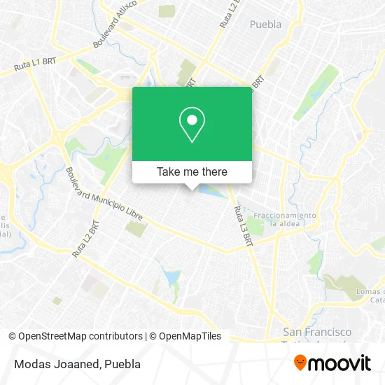
See Modas Joaaned, Ocoyucan, on the map
Public Transit to Modas Joaaned in Ocoyucan
Wondering how to get to Modas Joaaned in Ocoyucan? Moovit helps you find the best way to get to Modas Joaaned with step-by-step directions from the nearest public transit station.
Moovit provides free maps and live directions to help you navigate through your city. View schedules, routes, timetables, and find out how long does it take to get to Modas Joaaned in real time.
Looking for the nearest stop or station to Modas Joaaned? Check out this list of stops closest to your destination: Huele De Noche; Huele De Noche 48; Huele De Noche; Avenida 63-A Oriente 203; Avenida Bugambilias.
Bus: RUTA 4, RUTA 54A, RUTA 55, RUTA 8, RUTA NGA, RUTA VILLA FRONTERA, RUTA 45, RUTA 63.
Want to see if there’s another route that gets you there at an earlier time? Moovit helps you find alternative routes or times. Get directions from and directions to Modas Joaaned easily from the Moovit App or Website.
We make riding to Modas Joaaned easy, which is why over 1.5 million users, including users in Ocoyucan, trust Moovit as the best app for public transit. You don’t need to download an individual bus app or train app, Moovit is your all-in-one transit app that helps you find the best bus time or train time available.
For information on prices of bus, costs and ride fares to Modas Joaaned, please check the Moovit app.
Use the app to navigate to popular places including to the airport, hospital, stadium, grocery store, mall, coffee shop, school, college, and university.
Modas Joaaned Address: Modas Joaaned, Calle Huele de Noche, Conjunto Habitacional Xaxalpa, 72124 Puebla, Puebla street in Ocoyucan
- Dispensario Medico Emiliano Zapata,
- Floreria,
- Papeleria Angytos y Zoe,
- Accesorios para Mascotas,
- Polleria Leo,
- Plantas Medicinales Virgencita de Juquila,
- Accesorios para Celular,
- Polleria Raquelito,
- Dulceria Brenda,
- Barbacoa Lupita,
- Pasteleria,
- Polleria Bugambilias,
- Dulceria Alma,
- Carnicería La Estrella,
- Aurys Nails,
- Boneteria y Merceria,
- Perfumeria 5ta Avenida,
- Cemitas Gloria,
- Zapateria,
- Venta de Ropa y Novedades Ofelia
Places Near Modas Joaaned (Ocoyucan)
- 25 Zona Militar, Puebla,
- Hospital Traumatología y Ortopedia de Puebla, San Pedro Cholula,
- Hospital Imss La Margarita, Puebla,
- Centro de Desarrollo Comunitario Tres Cruces, Puebla,
- Plaza Dorada Centro Comercial, Puebla,
- Estadio Cuauhtémoc, Puebla,
- Parque Puebla, Puebla,
- Secretaria de Finanzas, Puebla,
- Tres Cruces, Puebla,
- Ciudad Judicial del Estado de Puebla, San Andrés Cholula,
- Ciudad Universitaria, Puebla,
- Centro Integral de Servicios CIS, San Andrés Cholula,
- SAT, San Andrés Cholula,
- Zona de los Fuertes, Puebla,
- Plaza Las Animas, Puebla,
- Parque Ecologico, Pue., San Andrés Cholula,
- Centro Comercial Angelópolis, San Andrés Cholula,
- Hospital General Regional 36 IMSS San Alejandro, San Andrés Cholula,
- Complejo Cultural Universitario, Ocoyucan,
- Galerías Serdán, San Pedro Cholula
How to get to popular places in Puebla with public transit
Get around Ocoyucan by public transit!
Traveling around Ocoyucan has never been so easy. See step by step directions as you travel to any attraction, street or major public transit station. View bus and train schedules, arrival times, service alerts and detailed routes on a map, so you know exactly how to get to anywhere in Ocoyucan.
When traveling to any destination around Ocoyucan use Moovit's Live Directions with Get Off Notifications to know exactly where and how far to walk, how long to wait for your line, and how many stops are left. Moovit will alert you when it's time to get off — no need to constantly re-check whether yours is the next stop.
Wondering how to use public transit in Ocoyucan or how to pay for public transit in Ocoyucan? Moovit public transit app can help you navigate your way with public transit easily, and at minimum cost. It includes public transit fees, ticket prices, and costs. Looking for a map of Ocoyucan public transit lines? Moovit public transit app shows all public transit maps in Ocoyucan with all bus routes and stops on an interactive map.
Puebla has 1 transit type(s), including: bus, operated by several transit agencies, including RUTA, RUTA Alimentadoras, Rutas Convencionales and Líneas temporales