How to get to Mont Group by bus?
Click on the bus route to see step by step directions with maps, line arrival times and updated time schedules.
From Parque María Reiche, Miraflores
42 minFrom Villa Maria del Triunfo, Villa Mari
47 minFrom Av Guardia Civil, San Isidro
49 minFrom Tomas Marsano, Surquillo
42 minFrom Polideportivo Limatambo, San Borja
52 minFrom AV AVIACION, San Borja
50 minFrom Velatorio Santísimo Nombre De Jesús, San Borja
44 minFrom Parque María Reiche Miraflores, Miraflores
42 minFrom Puente San Luis Conchan, Villa El S
31 min
Bus stops near Mont Group in Chorrillos
Bus lines to Mont Group in Chorrillos
- 1055, Campoy (San Juan De Lurigancho) - Delicias De Villa (Chorrillos),VIEW
- 1098, Wiesse (San Juan de Lurigancho) - Sumac Paccha (Lurín),VIEW
- 7706, S.J.M. - Chorrillos,VIEW
- AS04, Parque Zonal Huáscar (Villa El Salvador) - Terminal Matellini (Chorrillos),VIEW
- 7701, Explanada - El Triunfo - Explanada,VIEW
- 1054, Wiesse (San Juan De Lurigancho) - Cedros de Villa (Chorrillos),VIEW
- 1090, Los Horizontes (Chorrillos) - Óvalo Gutiérrez (Miraflores) ,VIEW
- 1095, Parque Mora (Miraflores) - Cedros de Villa (Chorrillos) ,VIEW
- 1231, Chorrillos - Carabayllo,VIEW
- 1376, Bolichera (Surco) - Cedros de Villa (Chorillos) ,VIEW
- 7702, Chorrillos - S.J.M.,VIEW
- 7703, S.J.M. - Chorrillos,VIEW
- 7805, V.M.T. - Chorrillos,VIEW
- AS02, Cedros De Villa (Chorrillos) - Terminal Matellini (Chorrillos),VIEW
- 1087, Chorrillos - Jesús María [52T],VIEW
- 1400, Villa María del Triunfo - Chorrillos [La J],VIEW
- 1401, Villa María del Triunfo - Chorrillos [La N],VIEW
- 8706, Villa María del Triunfo - Chorrillos [La J],VIEW
What are the closest stations to Mont Group?
The closest stations to Mont Group are:
- Lavalle is 200 meters away, 3 min walk.
- Confraternidad is 262 meters away, 4 min walk.
- Alameda Sur is 420 meters away, 6 min walk.
- Avenida Santa Anita, 104 is 779 meters away, 11 min walk.
Which bus lines stop near Mont Group?
These bus lines stop near Mont Group: 1054, 1055, 1090, 1095, 1098, 1231, 7703, 7706.
What’s the nearest bus station to Mont Group in Chorrillos?
The nearest bus station to Mont Group in Chorrillos is Lavalle. It’s a 3 min walk away.
What time is the first bus to Mont Group in Chorrillos?
The 1054 is the first bus that goes to Mont Group in Chorrillos. It stops nearby at 3:48 AM.
What time is the last bus to Mont Group in Chorrillos?
The 1400 is the last bus that goes to Mont Group in Chorrillos. It stops nearby at 12:05 AM.
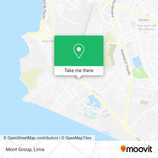
See Mont Group, Chorrillos, on the map
Public Transit to Mont Group in Chorrillos
Wondering how to get to Mont Group in Chorrillos? Moovit helps you find the best way to get to Mont Group with step-by-step directions from the nearest public transit station.
Moovit provides free maps and live directions to help you navigate through your city. View schedules, routes, timetables, and find out how long does it take to get to Mont Group in real time.
Looking for the nearest stop or station to Mont Group? Check out this list of stops closest to your destination: Lavalle; Confraternidad; Alameda Sur; Avenida Santa Anita.
Bus: 1054, 1055, 1090, 1095, 1098, 1231, 7703, 7706, AS04, 7701, 1376, 1087, 1400, 1401, 8706.
Want to see if there’s another route that gets you there at an earlier time? Moovit helps you find alternative routes or times. Get directions from and directions to Mont Group easily from the Moovit App or Website.
We make riding to Mont Group easy, which is why over 1.5 million users, including users in Chorrillos, trust Moovit as the best app for public transit. You don’t need to download an individual bus app or train app, Moovit is your all-in-one transit app that helps you find the best bus time or train time available.
For information on prices of bus, costs and ride fares to Mont Group, please check the Moovit app.
Use the app to navigate to popular places including to the airport, hospital, stadium, grocery store, mall, coffee shop, school, college, and university.
Mont Group Address: Avenida Camino del Inca 264 San Juan Bautista de Villa, 15067 Chorrillos street in Chorrillos
- Carpinteria Metálica Ludena,
- Av Defensores del Morro,
- Frito Pez,
- Ortopedia Grace,
- Ortopedia Del Niño Y El Adulto,
- Avenida Defensores del Morro 264,
- Instituto Nacional De Rehabilitacion "Dra. Adriana Rebaza Flores",
- Instituto Especializado de Rehabilitación "Dra. Adriana Rebaza Flores" Amistad Perú - Japón,
- IE María Auxiliadora - CHORRILLOS,
- Instituto Nacional De Rehabilitación,
- Av Huaylas,
- Agro Veterinaria,
- Pernosur,
- BANCO GNB,
- Avenida Huaylas,
- Calle Inti 147 San Juan Bautista de Villa,
- Academia Deportiva "Cantolao",
- Metropolitano,
- Calle Antaras mz M lote 22 urb san juan bautista chorrillos,
- Calle Inti
Places Near Mont Group (Chorrillos)
- av arequipa, Lima,
- Plaza San Miguel, San Miguel,
- Paradero Av.Brasil,
- Parque Kennedy, Miraflores,
- Jockey Plaza, Santiago D,
- Larcomar, Miraflores,
- Av. Salaverry, Jesus Mari,
- Gamarra,
- Centro Comercial Plaza Norte, Independen,
- Circuito Mágico Del Agua, Lima,
- Barranco, Barranco,
- Aeropuerto Internacional Jorge Chávez, Ventanilla,
- Mall Del Sur,
- Pontificia Universidad Católica del Perú - PUCP, San Miguel,
- Av. La Marina, San Miguel,
- Av. Abancay, Lima,
- Hospital Edgardo Rebagliati Martins, Jesus Mari,
- Real Plaza Puruchuco, Ate,
- Miraflores, Miraflores,
- Parque de las Leyendas, San Miguel
How to get to popular places in Lima with public transit
Get around Chorrillos by public transit!
Traveling around Chorrillos has never been so easy. See step by step directions as you travel to any attraction, street or major public transit station. View bus and train schedules, arrival times, service alerts and detailed routes on a map, so you know exactly how to get to anywhere in Chorrillos.
When traveling to any destination around Chorrillos use Moovit's Live Directions with Get Off Notifications to know exactly where and how far to walk, how long to wait for your line, and how many stops are left. Moovit will alert you when it's time to get off — no need to constantly re-check whether yours is the next stop.
Wondering how to use public transit in Chorrillos or how to pay for public transit in Chorrillos? Moovit public transit app can help you navigate your way with public transit easily, and at minimum cost. It includes public transit fees, ticket prices, and costs. Looking for a map of Chorrillos public transit lines? Moovit public transit app shows all public transit maps in Chorrillos with all Bus, Metro and Ferry routes and stops on an interactive map.
Lima has 3 transit type(s), including: Bus, Metro and Ferry, operated by several transit agencies, including Metro de Lima Línea 2 , Metro de Lima, Corredor Rojo, Metropolitano, Metropolitano - Alimentadores, Corredor Morado, Corredor Azul, Rutas Tradicionales, Transportes y Servicios La Esperanza S.A., Las Flores S.A., Virgen de la Asunción S.A., Consorcio HAM, Transportes y Service Canadá S.A., ETUL4SA and ETUCHISA