How to get to Moonruby by bus?
Click on the bus route to see step by step directions with maps, line arrival times and updated time schedules.
From Las Olas, Fort Lauderdale
44 minFrom Las Olas Beach, Fort Lauderdale
55 minFrom Port Everglades, Fort Lauderdale
68 minFrom Ross, Fort Lauderdale
31 minFrom Fort Lauderdale Beach, Fort Lauderdale
56 minFrom Coral Square Mall Shopping Center, Coral Springs-Margate
64 minFrom Broward County, Fort Lauderdale
45 minFrom Water Taxi Stop - 15th Street Fisheries, Fort Lauderdale
103 minFrom Las Olas Beach, Fort Lauderdale
57 minFrom Coral Ridge Mall, Fort Lauderdale
30 min
Bus stops near Moonruby in Fort Lauderdale
Bus lines to Moonruby in Fort Lauderdale
What are the closest stations to Moonruby?
The closest stations to Moonruby are:
- Oakland Park Boulevard/Northwest 33rd Avenue is 107 yards away, 2 min walk.
- Northwest 31st Avenue/Oakland Park Boulevard (North) is 709 yards away, 9 min walk.
Which bus lines stop near Moonruby?
These bus lines stop near Moonruby: 31, 72.
What’s the nearest bus station to Moonruby in Fort Lauderdale?
The nearest bus station to Moonruby in Fort Lauderdale is Oakland Park Boulevard/Northwest 33rd Avenue. It’s a 2 min walk away.
What time is the first bus to Moonruby in Fort Lauderdale?
The 72 is the first bus that goes to Moonruby in Fort Lauderdale. It stops nearby at 5:02 AM.
What time is the last bus to Moonruby in Fort Lauderdale?
The 72 is the last bus that goes to Moonruby in Fort Lauderdale. It stops nearby at 1:12 AM.
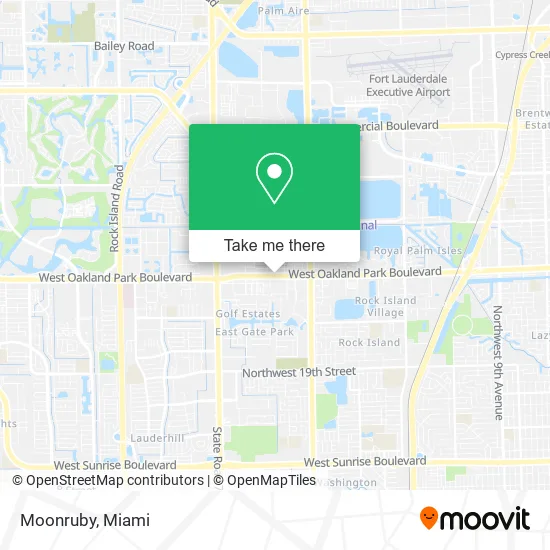
See Moonruby, Fort Lauderdale, on the map
Public Transit to Moonruby in Fort Lauderdale
Wondering how to get to Moonruby in Fort Lauderdale? Moovit helps you find the best way to get to Moonruby with step-by-step directions from the nearest public transit station.
Moovit provides free maps and live directions to help you navigate through your city. View schedules, routes, timetables, and find out how long does it take to get to Moonruby in real time.
Looking for the nearest stop or station to Moonruby? Check out this list of stops closest to your destination: Oakland Park Boulevard/Northwest 33rd Avenue; Northwest 31st Avenue/Oakland Park Boulevard (North).
Bus: 31, 72.
Want to see if there’s another route that gets you there at an earlier time? Moovit helps you find alternative routes or times. Get directions from and directions to Moonruby easily from the Moovit App or Website.
We make riding to Moonruby easy, which is why over 1.5 million users, including users in Fort Lauderdale, trust Moovit as the best app for public transit. You don’t need to download an individual bus app or train app, Moovit is your all-in-one transit app that helps you find the best bus time or train time available.
For information on prices of bus, costs and ride fares to Moonruby, please check the Moovit app.
Use the app to navigate to popular places including to the airport, hospital, stadium, grocery store, mall, coffee shop, school, college, and university.
Moonruby Address: 3419 W Oakland Park Blvd Fort Lauderdale, FL 33309 street in Fort Lauderdale
- Mon Desir Restaurant,
- Trinity 3 Financial,
- Achievers Club,
- Florida Pools Plus,
- Restoration Worship Center,
- Seventh Day Baptist Church,
- FTL Auto Sales,
- Championship Academy HS,
- Jampro Plumbing,
- A Dt - ADT Alarm & Security - Main Number,
- Broward County Library (Broward County Libraries),
- Purely Plumbing,
- S Schwartz Jonathan Pa,
- Clifford Charles - Intuit Turbotax Verified Pro,
- New York Jewelry,
- Oakland Park Fleamarket Jewelry Exchange,
- Jewelry King,
- Infinity Jewelry,
- USA Flea Market,
- Allure Tre Bel Esthetics & Skin Care
Places Near Moonruby (Fort Lauderdale)
- Miami Design District, Miami,
- Zoo Miami, Miami,
- Dolphin Mall, Miami,
- Little Havana, Miami,
- Wynwood, Miami,
- Hard Rock Stadium, Miami Gardens,
- Bayside Marketplace, Miami,
- Port of Miami Cruise Terminal, Miami,
- Sawgrass mall ( FL ), Miami Beach,
- Miami-Dade County Courthouse, Miami,
- Aventura Mall, Miami Beach,
- Miami VA Hospital, Miami,
- Sawgrass Mall, Miami,
- Keiser University Flagship Campus, West Palm Beach,
- Marlins Park, Miami,
- Dolphin Mall Bus, Miami,
- Richard E. Gerstein Justice Building, Miami,
- Brickell City Centre, Miami,
- Miami Freedom Park, Miami,
- Aventura Mall, Miami
How to get to popular places in Miami with public transit
Get around Fort Lauderdale by public transit!
Traveling around Fort Lauderdale has never been so easy. See step by step directions as you travel to any attraction, street or major public transit station. View bus and train schedules, arrival times, service alerts and detailed routes on a map, so you know exactly how to get to anywhere in Fort Lauderdale.
When traveling to any destination around Fort Lauderdale use Moovit's Live Directions with Get Off Notifications to know exactly where and how far to walk, how long to wait for your line, and how many stops are left. Moovit will alert you when it's time to get off — no need to constantly re-check whether yours is the next stop.
Wondering how to use public transit in Fort Lauderdale or how to pay for public transit in Fort Lauderdale? Moovit public transit app can help you navigate your way with public transit easily, and at minimum cost. It includes public transit fees, ticket prices, and costs. Looking for a map of Fort Lauderdale public transit lines? Moovit public transit app shows all public transit maps in Fort Lauderdale with all Bus, Train, Light Rail and Ferry routes and stops on an interactive map.
Miami has 4 transit type(s), including: Bus, Train, Light Rail and Ferry, operated by several transit agencies, including Broward County Transit, Miami-Dade Transit, Metrorail, Palm Tran, Tri-Rail, Brightline, MARTY, City of Homestead Trolley, Key West Transit, Treasure Coast Connector, GoLine IRT, Amtrak, Greyhound-us, FlixBus-us and Aventura Express Shuttle Bus