Directions to Morro Da Água Santa with public transportation
The following transit lines have routes that pass near Morro Da Água Santa
 Bus: 238, 239, 390, 607, 685.
- Train: RAMAL JAPERI, RAMAL SANTA CRUZ, RAMAL DEODORO.
How to get to Morro Da Água Santa by bus?
Click on the bus route to see step by step directions with maps, line arrival times and updated time schedules.
How to get to Morro Da Água Santa by train?
Click on the train route to see step by step directions with maps, line arrival times and updated time schedules.
Train station near Morro Da Água Santa
- Olímpica De Engenho De Dentro, 26 min walk,VIEW
What are the closest stations to Morro Da Água Santa?
The closest stations to Morro Da Água Santa are:
- Olímpica De Engenho De Dentro is 1990 meters away, 26 min walk.
Which bus lines stop near Morro Da Água Santa?
These bus lines stop near Morro Da Água Santa: 238, 239, 390, 607, 685.
Which train lines stop near Morro Da Água Santa?
These train lines stop near Morro Da Água Santa: RAMAL JAPERI, RAMAL SANTA CRUZ.
What’s the nearest train station to Morro Da Água Santa?
The nearest train station to Morro Da Água Santa is Olímpica De Engenho De Dentro. It’s a 26 min walk away.
What time is the first train to Morro Da Água Santa?
The RAMAL DEODORO is the first train that goes to Morro Da Água Santa. It stops nearby at 4:23 AM.
What time is the last train to Morro Da Água Santa?
The RAMAL SANTA CRUZ is the last train that goes to Morro Da Água Santa. It stops nearby at 11:42 PM.
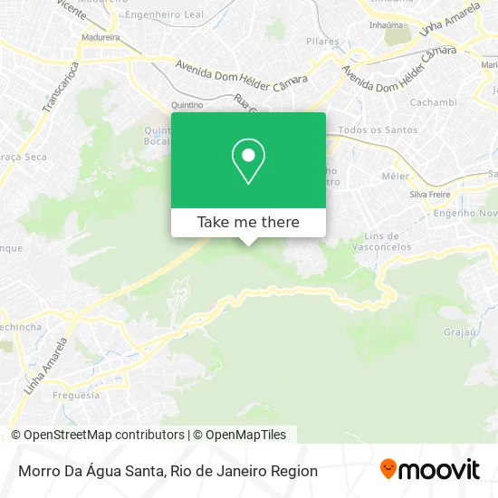
See Morro Da Água Santa on the map
Public Transportation to Morro Da Água Santa
Wondering how to get to Morro Da Água Santa? Moovit helps you find the best way to get to Morro Da Água Santa with step-by-step directions from the nearest public transit station.
Moovit provides free maps and live directions to help you navigate through your city. View schedules, routes, timetables, and find out how long does it take to get to Morro Da Água Santa in real time.
Looking for the nearest stop or station to Morro Da Água Santa? Check out this list of stops closest to your destination: Olímpica De Engenho De Dentro.
Bus: 238, 239, 390, 607, 685.Train: RAMAL JAPERI, RAMAL SANTA CRUZ, RAMAL DEODORO.
Want to see if there’s another route that gets you there at an earlier time? Moovit helps you find alternative routes or times. Get directions from and directions to Morro Da Água Santa easily from the Moovit App or Website.
We make riding to Morro Da Água Santa easy, which is why over 1.5 million users, including users in Água Santa, trust Moovit as the best app for public transit. You don’t need to download an individual bus app or train app, Moovit is your all-in-one transit app that helps you find the best bus time or train time available.
For information on prices of bus and train, costs and ride fares to Morro Da Água Santa, please check the Moovit app.
Use the app to navigate to popular places including to the airport, hospital, stadium, grocery store, mall, coffee shop, school, college, and university.
Location: Água Santa, Rio de Janeiro Region
- Cachoeira de Xerém,
- Rua Anovaldo Rocha,
- Av. Projetada 345,
- Rua da Pátria, 273,
- Rua Anovaldo Rocha, 352,
- Edifício Toronto 3000 (Le Monde Offices),
- Morro Camarista Méier,
- Pedágio Água Santa,
- Rua Antônio de Souza Mendes 425,
- Rua Engenheiro Oscár da Costa 740,
- Estrada Paulo de Medeiros,
- Rua Dois de Fevereiro 1561,
- Teleférico Complexo do Alemão - Estação Palmeiras,
- Rua Lopes da Cruz 176,
- Pedreira,
- LAMSA,
- Rua Monteiro da Luz 917,
- Pedágio LAMSA,
- Serra Do Padilha,
- Presídio Ary Franco
Places Near Morro Da Água Santa
- Rodoviária Novo Rio (Rodoviária do Rio de Janeiro), Santo Cristo,
- Norte Shopping, Cachambi,
- Feira Livre da Gloria, Glória,
- Shopping Nova América, Del Castilho,
- Hospital Pedro Ernesto, Vila Isabel,
- Niterói, Niterói,
- Hospital Federal Do Andaraí, Andaraí,
- Shopping RioSul, Botafogo,
- Praia do Arpoador, Ipanema,
- Rua Licínio Cardoso, São Francisco Xavier,
- Hospital Municipal Ronaldo Gazolla, Acari,
- Avenida Venezuela 134, Saúde,
- Shopping Rio Sul, Botafogo,
- Shopping Downtown, Barra Da Tijuca,
- Rua Ulysses Guimarães 16, Cidade Nova,
- Avenida Rio Branco, Centro,
- Rio De Janeiro,
- Hospital Federal Cardoso Fontes, Jacarepaguá,
- Feirão De Malhas, Duque De Caxias,
- Museu Do Amanhã, Centro
How to get to popular places in Rio de Janeiro Region with public transit
Get around Água Santa by public transit!
Traveling around Água Santa has never been so easy. See step by step directions as you travel to any attraction, street or major public transit station. View bus and train schedules, arrival times, service alerts and detailed routes on a map, so you know exactly how to get to anywhere in Água Santa.
When traveling to any destination around Água Santa use Moovit's Live Directions with Get Off Notifications to know exactly where and how far to walk, how long to wait for your line, and how many stops are left. Moovit will alert you when it's time to get off — no need to constantly re-check whether yours is the next stop.
Wondering how to use public transit in Água Santa or how to pay for public transit in Água Santa? Moovit public transit app can help you navigate your way with public transit easily, and at minimum cost. It includes public transit fees, ticket prices, and costs. Looking for a map of Água Santa public transit lines? Moovit public transit app shows all public transit maps in Água Santa with all Bus, Train, Metro, Light Rail, Ferry, Cable Car, Gondola and Funicular routes and stops on an interactive map.
Rio de Janeiro Region has 8 transit type(s), including: Bus, Train, Metro, Light Rail, Ferry, Cable Car, Gondola and Funicular, operated by several transit agencies, including TrensRJ, Metrô Rio, VLT Carioca, Barcas Rio, BRT MOBI-Rio, Auto Viação Alpha, Auto Viação Tijuca, Gire Transportes, Transurb, Viação Nossa Senhora das Graças, Consórcio INTERSUL, Braso Lisboa (Municipal), Caprichosa Auto Ônibus, Auto Viação Três Amigos and Rodoviária Âncora Matias