Directions to Moveis Lider (Colombo) with public transportation
The following transit lines have routes that pass near Moveis Lider
How to get to Moveis Lider by bus?
Click on the bus route to see step by step directions with maps, line arrival times and updated time schedules.
From Jardim Botânico, Jardim Botânico
41 minFrom Rua Lourenço Pinto 277, Centro
31 minFrom Rua Barão do Rio Branco 122, Centro
34 minFrom Rua Parnaíba, São Francisco
50 minFrom Largo da Ordem, São Francisco
53 minFrom Terminal Colombo, Colombo
49 minFrom Parque São Lourenço, São Lourenço
48 minFrom Rua Marechal Deodoro 51, Centro
34 minFrom Rua Tapajós - Mercês/São Francisco, Mercês
47 minFrom Alameda Dr. Muricy, Centro
33 min
Bus stops near Moveis Lider in Colombo
Bus lines to Moveis Lider in Colombo
- B11 MARACANÃ / SANTA CÂNDIDA, MARACANÃ / SANTA CÂNDIDA,VIEW
- B57 CAMPO ALTO / SANTA CÂNDIDA, CAMPO ALTO / SANTA CÂNDIDA,VIEW
- B58 MARACANÃ / SANTA CÂNDIDA (CIRCULAR), MARACANÃ / SANTA CÂNDIDA (CIRCULAR),VIEW
- B39 CAMPO ALTO / SANTA CÂNDIDA, Terminal Santa Cândida ↺ Campo Alto / Capela do Atuba (Circular),VIEW
- 222 VILA ESPERANÇA, Terminal Boa Vista → Vila Esperança,VIEW
- 229 MAD. PENHA / FERNANDO DE NORONHA, Terminal Boa Vista ↺ Penha (Circular),VIEW
- B69 MAD. CURITIBA / SÃO DIMAS, Terminal Guadalupe → São Dimas,VIEW
- B03 GUARAITUBA / ALTO DA XV (VIA MARACANÃ), Terminal Guaraituba ↺ Jardim Social / Alto da Rua XV (Circular),VIEW
- B06 GUARAITUBA / RUI BARBOSA (VIA MARACANÃ / SEMIDIRETO), Marechal Dedoro → Terminal Guaraituba ,VIEW
- B20 GUARAITUBA / CABRAL (VIA MARACANÃ), Terminal Guaraituba → Terminal Cabral,VIEW
- B29 ROÇA GRANDE / APDEC (VIA MARACANÃ), Terminal Roça Grande → APDEC,VIEW
- B42 MARACANÃ / ESTAÇÃO ATUBA, Terminal Maracanã → Estação Atuba,VIEW
- B89 GUARAITUBA / RUI BARBOSA (VIA MARACANÃ / CABRAL), Terminal Guaraituba → Praça Rui Barbosa,VIEW
- Y99 TUNAS DO PARANÁ / GUADALUPE, Terminal Guadalupe → Tunas do Paraná,VIEW
- 0950-500 CURITIBA / ADRIANÓPOLIS (VIA TUNAS DO PARANÁ), Curitiba → Adrianópolis,VIEW
What are the closest stations to Moveis Lider?
The closest stations to Moveis Lider are:
- Travessa Bolívia, 27 is 242 meters away, 4 min walk.
- Avenida Argentina, 300 is 292 meters away, 4 min walk.
- R. Huxley, 223 is 433 meters away, 6 min walk.
- R. Huxley, 220 is 440 meters away, 6 min walk.
- Estrada Da Ribeira (Soreluz) is 446 meters away, 6 min walk.
- Estrada Da Ribeira (Telhas Camboriú) is 497 meters away, 7 min walk.
Which bus lines stop near Moveis Lider?
These bus lines stop near Moveis Lider: B06 GUARAITUBA / RUI BARBOSA (VIA MARACANÃ / SEMIDIRETO), B11 MARACANÃ / SANTA CÂNDIDA, B20 GUARAITUBA / CABRAL (VIA MARACANÃ).
What’s the nearest bus station to Moveis Lider in Colombo?
The nearest bus stations to Moveis Lider in Colombo are Travessa Bolívia, 27 and Avenida Argentina, 300. The closest one is a 4 min walk away.
What time is the first bus to Moveis Lider in Colombo?
The 229 MAD. PENHA / FERNANDO DE NORONHA is the first bus that goes to Moveis Lider in Colombo. It stops nearby at 3:50 AM.
What time is the last bus to Moveis Lider in Colombo?
The 229 MAD. PENHA / FERNANDO DE NORONHA is the last bus that goes to Moveis Lider in Colombo. It stops nearby at 2:56 AM.
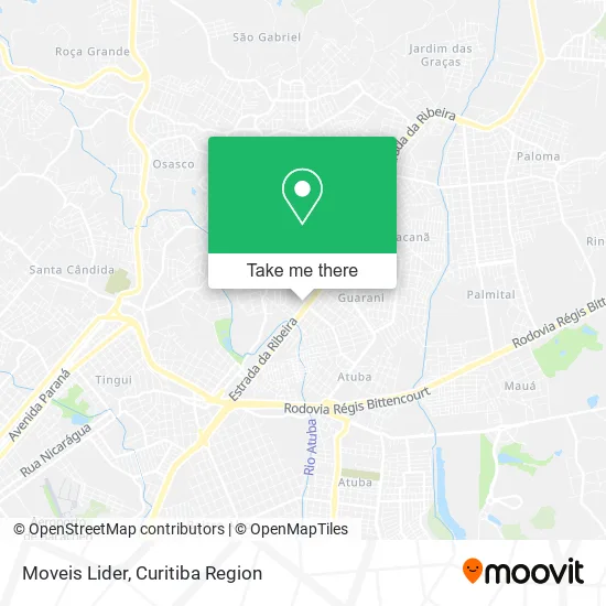
See Moveis Lider, Colombo, on the map
Public Transit to Moveis Lider in Colombo
Wondering how to get to Moveis Lider in Colombo? Moovit helps you find the best way to get to Moveis Lider with step-by-step directions from the nearest public transit station.
Moovit provides free maps and live directions to help you navigate through your city. View schedules, routes, timetables, and find out how long does it take to get to Moveis Lider in real time.
Looking for the nearest stop or station to Moveis Lider? Check out this list of stops closest to your destination: Travessa Bolívia; Avenida Argentina; R. Huxley; R. Huxley; Estrada Da Ribeira (Soreluz); Estrada Da Ribeira (Telhas Camboriú).
Bus: B06 GUARAITUBA / RUI BARBOSA (VIA MARACANÃ / SEMIDIRETO), B11 MARACANÃ / SANTA CÂNDIDA, B20 GUARAITUBA / CABRAL (VIA MARACANÃ), B57 CAMPO ALTO / SANTA CÂNDIDA, B58 MARACANÃ / SANTA CÂNDIDA (CIRCULAR), B39 CAMPO ALTO / SANTA CÂNDIDA, 222 VILA ESPERANÇA, 229 MAD. PENHA / FERNANDO DE NORONHA, B69 MAD. CURITIBA / SÃO DIMAS, B03 GUARAITUBA / ALTO DA XV (VIA MARACANÃ), B29 ROÇA GRANDE / APDEC (VIA MARACANÃ), B42 MARACANÃ / ESTAÇÃO ATUBA, 0950-500 CURITIBA / ADRIANÓPOLIS (VIA TUNAS DO PARANÁ).
Want to see if there’s another route that gets you there at an earlier time? Moovit helps you find alternative routes or times. Get directions from and directions to Moveis Lider easily from the Moovit App or Website.
We make riding to Moveis Lider easy, which is why over 1.5 million users, including users in Colombo, trust Moovit as the best app for public transit. You don’t need to download an individual bus app or train app, Moovit is your all-in-one transit app that helps you find the best bus time or train time available.
For information on prices of bus, costs and ride fares to Moveis Lider, please check the Moovit app.
Use the app to navigate to popular places including to the airport, hospital, stadium, grocery store, mall, coffee shop, school, college, and university.
Moveis Lider Address: Avenida Madrid, Rio Verde Colombo-PR 83405-420 street in Colombo
- Carrocerias Valle,
- Marli Aparecida Collere Walesko,
- Equipe Central de Radiadores,
- BR-476 25,
- A Mattos Grafica,
- Riccaplas,
- Leandro and Vinicius,
- Ki Bife,
- Fermiano,
- S M G P Marmores Granitos e Pedras,
- Farmacias Biomed,
- Paulista Real Car - Lataria e Pintura,
- Dog do Laco,
- Melo Comércio Paraná - Mármores e Granitos,
- Loja Tobelus,
- Loja de Móveis Rio Verde,
- Sicredi - Alto Maracanã,
- Br100,
- Melo,
- Bem Protege Colombo
Places Near Moveis Lider (Colombo)
- Hospital Madalena Sofia, Bairro Alto,
- Hospital Da Cruz Vermelha, Batel,
- Jardim Botânico de Curitiba PR, Centro,
- Hospital Erasto Gaertner, Jardim Das Américas,
- Hospital de Clínicas (HC - UFPR), Centro,
- Shopping Estação, Rebouças,
- Shopping Palladium, Portão,
- Hospital Universitário Evangélico de Curitiba, Bigorrilho,
- Park Shopping Barigüi, Mossunguê,
- Hhhhh, Fazendinha,
- Pontifícia Universidade Católica do Paraná (PUCPR), Prado Velho,
- Hospital Nossa Senhora Das Graças, Mercês,
- Hospital Do Senhor - Madre Virgínia, São José Dos Pinhais,
- Arena Da Baixada - Curitiba,
- Parque Barigui, Mercês,
- Jockey Plaza Shopping Center, Tarumã,
- Rua Martim Afonso 558, Mercês,
- Hospital Angelina Caron, Campina Grande Do Sul,
- Rua General Mário Tourinho, Campina Do Siqueira,
- Hospital do Rocio, Campo
How to get to popular places in Curitiba Region with public transit
Get around Colombo by public transit!
Traveling around Colombo has never been so easy. See step by step directions as you travel to any attraction, street or major public transit station. View bus and train schedules, arrival times, service alerts and detailed routes on a map, so you know exactly how to get to anywhere in Colombo.
When traveling to any destination around Colombo use Moovit's Live Directions with Get Off Notifications to know exactly where and how far to walk, how long to wait for your line, and how many stops are left. Moovit will alert you when it's time to get off — no need to constantly re-check whether yours is the next stop.
Wondering how to use public transit in Colombo or how to pay for public transit in Colombo? Moovit public transit app can help you navigate your way with public transit easily, and at minimum cost. It includes public transit fees, ticket prices, and costs. Looking for a map of Colombo public transit lines? Moovit public transit app shows all public transit maps in Colombo with all Bus and Cable Car routes and stops on an interactive map.
Curitiba Region has 2 transit type(s), including: Bus and Cable Car, operated by several transit agencies, including Sistema Integrado de Mobilidade (URBS), Sistema Integrado de Mobilidade (AMEP), URBS (Cartões bancários e Dinheiro), URBS (Cartões bancários / Cartão URBS), AMEP (Cartões bancários / Cartão MetroCard), AMEP (Cartões bancários / Cartão MetroCard / Dinheiro), Viação Colombo (Dinheiro), TRIAR (Cartão TRIAR / Dinheiro), Empresa Curitiba Cerro Azul (Dinheiro), Expresso Nossa Senhora da Penha (Dinheiro), Empresa Campo Alto Tijucas (Dinheiro), Auto Viação São José (Cartão VEM / Dinheiro), BRT S/A (Cartão VEM / Dinheiro), TransPiedade (Cartão Cidadão / Dinheiro) and Oceânica Sul (Cartão Transporte / Dinheiro)
Public transit lines with stations closest to Moveis Lider in Colombo
Bus lines with stations closest to Moveis Lider in Colombo
Estrada Da Ribeira (Soreluz)
 B03 GUARAITUBA / ALTO DA XV (VIA MARACANÃ)GUARAITUBA / ALTO DA XV (via MARACANÃ)
- B06 GUARAITUBA / RUI BARBOSA (VIA MARACANÃ / SEMIDIRETO)GUARAITUBA / RUI BARBOSA (via MARACANÃ / SEMIDIRETO)
- B20 GUARAITUBA / CABRAL (VIA MARACANÃ)GUARAITUBA / CABRAL (via MARACANÃ)
- B29 ROÇA GRANDE / APDEC (VIA MARACANÃ)ROÇA GRANDE / APDEC (via MARACANÃ)
- B42 MARACANÃ / ESTAÇÃO ATUBAMARACANÃ / ESTAÇÃO ATUBA