How to get to Mr. Can by bus?
Click on the bus route to see step by step directions with maps, line arrival times and updated time schedules.
From Farmacia Homeopática y Naturista La Fuente de las Hadas, Aguascalientes
57 minFrom Imeco, Aguascalientes
60 minFrom Fabrica Valle Redondo, Aguascalientes
31 minFrom Jatco 1 Agu, Aguascalientes
54 minFrom Jardines del Lago, Aguascalientes
50 minFrom Calle Francisco Javier Mina, Aguascalientes
34 minFrom Meridiam Park, Aguascalientes
57 minFrom Zona Centro, Aguascalientes
57 minFrom Jatco, Aguascalientes
55 minFrom Terminal 50, Aguascalientes
50 min
Bus stops near Mr. Can in Aguascalientes
Bus lines to Mr. Can in Aguascalientes
What are the closest stations to Mr. Can?
The closest stations to Mr. Can are:
- Avenida Héroe De Nacozari, 802 is 138 meters away, 2 min walk.
- General Álvaro Obregón, 540 is 399 meters away, 6 min walk.
- Avenida Héroe De Nacozari, 548 is 420 meters away, 6 min walk.
- Nuevo Hospital Hidalgo is 524 meters away, 7 min walk.
- General Miguel Barragán, 704 is 621 meters away, 9 min walk.
Which bus lines stop near Mr. Can?
These bus lines stop near Mr. Can: RUTA 02, RUTA 18, RUTA 28.
What’s the nearest bus station to Mr. Can in Aguascalientes?
The nearest bus station to Mr. Can in Aguascalientes is Avenida Héroe De Nacozari, 802. It’s a 2 min walk away.
What time is the first bus to Mr. Can in Aguascalientes?
The RUTA 37 is the first bus that goes to Mr. Can in Aguascalientes. It stops nearby at 6:15 AM.
What time is the last bus to Mr. Can in Aguascalientes?
The RUTA 02 is the last bus that goes to Mr. Can in Aguascalientes. It stops nearby at 10:30 PM.
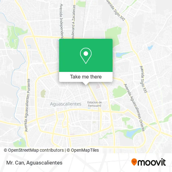
See Mr. Can, Aguascalientes, on the map
Public Transit to Mr. Can in Aguascalientes
Wondering how to get to Mr. Can in Aguascalientes? Moovit helps you find the best way to get to Mr. Can with step-by-step directions from the nearest public transit station.
Moovit provides free maps and live directions to help you navigate through your city. View schedules, routes, timetables, and find out how long does it take to get to Mr. Can in real time.
Looking for the nearest stop or station to Mr. Can? Check out this list of stops closest to your destination: Avenida Héroe De Nacozari; General Álvaro Obregón; Avenida Héroe De Nacozari; Nuevo Hospital Hidalgo; General Miguel Barragán.
Bus: RUTA 02, RUTA 18, RUTA 28, RUTA 27, RUTA 36, RUTA 16, RUTA 51, RUTA 03, RUTA 37.
Want to see if there’s another route that gets you there at an earlier time? Moovit helps you find alternative routes or times. Get directions from and directions to Mr. Can easily from the Moovit App or Website.
We make riding to Mr. Can easy, which is why over 1.5 million users, including users in Aguascalientes, trust Moovit as the best app for public transit. You don’t need to download an individual bus app or train app, Moovit is your all-in-one transit app that helps you find the best bus time or train time available.
For information on prices of bus, costs and ride fares to Mr. Can, please check the Moovit app.
Use the app to navigate to popular places including to the airport, hospital, stadium, grocery store, mall, coffee shop, school, college, and university.
Mr. Can Address: Avenida Héroe de Nacozari Norte 904, Gremial, 20030 Aguascalientes, Aguascalientes street in Aguascalientes
- WESTERN UNION,
- Servicios de Profesores Particulares,
- Sherwin-Williams,
- Taqueria,
- Cai No 1 Jugando Aprendemos,
- Rosales Pedroza Jose de Jesus,
- Canal 26 en Vivo,
- Comercializadora de Cosméticos Osmar,
- Mercibeaucoup,
- Anahata Estudio de Danza y Yoga,
- Centro de Terapias Alternativas,
- Solar City,
- Banamex Modelo 3 Centurias,
- Salon de Eventos Diana,
- Contreras Carreto Asociados,
- Abts Vasco,
- Extrade II,
- Avenida Héroe de Nacozari 1102,
- Tienda Naturista Dana,
- Birria y Menudo Los Romo
Places Near Mr. Can (Aguascalientes)
- Terminal De Combis, Aguascalientes,
- Universidad Autónoma de Aguascalientes, Aguascalientes,
- Isla San Marcos, Aguascalientes,
- Nuevo Hospital Hidalgo, Aguascalientes,
- Aeropuerto de Aguascalientes S.A. de C.V., Aguascalientes,
- Hospital Imss No. 3, Aguascalientes,
- Jesús María, Aguascalientes,
- Parque Las Tres Centurias, Aguascalientes,
- Centro Comercial Altaria, Aguascalientes,
- Agropecuario, Aguascalientes,
- Blvd. Luis Donaldo Colosio, Aguascalientes,
- Central De Autobuses, Aguascalientes,
- Ciudad industrial, Aguascalientes,
- Centro, Aguascalientes,
- La Isla San Marcos, Aguascalientes,
- ESPACIOS, Aguascalientes,
- Villas de Nuestra Señora de la Asunción, Aguascalientes,
- Villasuncion, Aguascalientes,
- Imss Clinica 1, Aguascalientes,
- clinica 3 uaa, Aguascalientes
How to get to popular places in Aguascalientes with public transit
Get around Aguascalientes by public transit!
Traveling around Aguascalientes has never been so easy. See step by step directions as you travel to any attraction, street or major public transit station. View bus and train schedules, arrival times, service alerts and detailed routes on a map, so you know exactly how to get to anywhere in Aguascalientes.
When traveling to any destination around Aguascalientes use Moovit's Live Directions with Get Off Notifications to know exactly where and how far to walk, how long to wait for your line, and how many stops are left. Moovit will alert you when it's time to get off — no need to constantly re-check whether yours is the next stop.
Wondering how to use public transit in Aguascalientes or how to pay for public transit in Aguascalientes? Moovit public transit app can help you navigate your way with public transit easily, and at minimum cost. It includes public transit fees, ticket prices, and costs. Looking for a map of Aguascalientes public transit lines? Moovit public transit app shows all public transit maps in Aguascalientes with all bus routes and stops on an interactive map.
Aguascalientes has 1 transit type(s), including: bus, operated by several transit agencies, including Coordinación General de Movilidad