Directions to Mr. Locksmith (Indianapolis City (Balance)) with public transportation
The following transit lines have routes that pass near Mr. Locksmith
 Bus: 10.
How to get to Mr. Locksmith by bus?
Click on the bus route to see step by step directions with maps, line arrival times and updated time schedules.
From Little People, Indianapolis City (Balance)
20 minFrom Chipotle, Indianapolis City (Balance)
44 minFrom Indiana University-Purdue University Indianapolis (IUPUI), Indianapolis City (Balance)
30 minFrom Indianapolis Urban League, Indianapolis City (Balance)
32 minFrom Elevated Esthetics Relax and Rejuvenate, Indianapolis City (Balance)
57 minFrom Moller Road & 38th Street, Indianapolis
46 minFrom IUPUI: Science Building, Room 131 (LD 131), Indianapolis City (Balance)
28 minFrom Fastenal, Indianapolis City (Balance)
67 minFrom Crispus Attucks High School, Indianapolis City (Balance)
46 minFrom Indiana University Natatorium, Indianapolis City (Balance)
32 min
Bus stop near Mr. Locksmith in Indianapolis City (Balance)
- 10th St & Chapel Hill Rd, 5 min walk,VIEW
Bus lines to Mr. Locksmith in Indianapolis City (Balance)
- 10, Shortridge Rd,VIEW
What are the closest stations to Mr. Locksmith?
The closest stations to Mr. Locksmith are:
- 10th St & Chapel Hill Rd is 351 yards away, 5 min walk.
Which bus line stops near Mr. Locksmith?
10 (Meijer Avon)
What’s the nearest bus station to Mr. Locksmith in Indianapolis City (Balance)?
The nearest bus station to Mr. Locksmith in Indianapolis City (Balance) is 10th St & Chapel Hill Rd. It’s a 5 min walk away.
What time is the first bus to Mr. Locksmith in Indianapolis City (Balance)?
The 10 is the first bus that goes to Mr. Locksmith in Indianapolis City (Balance). It stops nearby at 5:24 AM.
What time is the last bus to Mr. Locksmith in Indianapolis City (Balance)?
The 10 is the last bus that goes to Mr. Locksmith in Indianapolis City (Balance). It stops nearby at 12:15 AM.
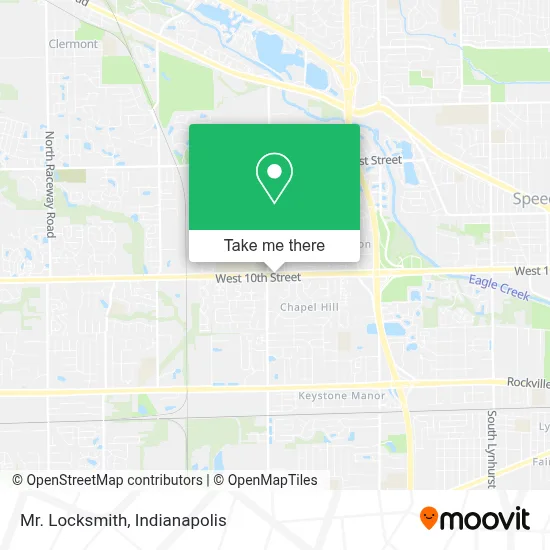
See Mr. Locksmith, Indianapolis City (Balance), on the map
Public Transit to Mr. Locksmith in Indianapolis City (Balance)
Wondering how to get to Mr. Locksmith in Indianapolis City (Balance)? Moovit helps you find the best way to get to Mr. Locksmith with step-by-step directions from the nearest public transit station.
Moovit provides free maps and live directions to help you navigate through your city. View schedules, routes, timetables, and find out how long does it take to get to Mr. Locksmith in real time.
Looking for the nearest stop or station to Mr. Locksmith? Check out this list of stops closest to your destination: 10th St & Chapel Hill Rd.
Bus: 10.
Want to see if there’s another route that gets you there at an earlier time? Moovit helps you find alternative routes or times. Get directions from and directions to Mr. Locksmith easily from the Moovit App or Website.
We make riding to Mr. Locksmith easy, which is why over 1.5 million users, including users in Indianapolis City (Balance), trust Moovit as the best app for public transit. You don’t need to download an individual bus app or train app, Moovit is your all-in-one transit app that helps you find the best bus time or train time available.
For information on prices of bus, costs and ride fares to Mr. Locksmith, please check the Moovit app.
Use the app to navigate to popular places including to the airport, hospital, stadium, grocery store, mall, coffee shop, school, college, and university.
Mr. Locksmith Address: 7235 W 10th St street in Indianapolis City (Balance)
- TACO BELL,
- Indy West Dental,
- Payday Loans Indianapolis in,
- Checkers,
- STARBUCKS,
- Custom Creation Hair Design,
- Rightway Garage Door,
- Dr Tavel,
- WESTERN UNION,
- ATM,
- Snipes,
- Musalla Hill Park,
- Laundry Connection of Indiana,
- Ethiopian Market,
- K&M Vending,
- Metro by T-Mobile Indi,
- ASAP Locksmith In Indianapolis,
- Queen's Beauty Supply,
- Musalla Hill Apartments,
- Dina Braids and Boutique
Places Near Mr. Locksmith (Indianapolis City (Balance))
- THE BALT, Indianapolis City (Balance),
- Lucas Oil Stadium, Indianapolis City (Balance),
- Cotter's Massage Parlor With Happy Endings, Indianapolis City (Balance),
- Castleton Square Mall, Indianapolis,
- 119 W 19th St Parking, Indianapolis City (Balance),
- Indianapolis Airport Zone 2, Indianapolis City (Balance),
- Gainbridge Fieldhouse, Indianapolis City (Balance),
- I U Health Methodist Hospital, Indianapolis City (Balance),
- St. Vincent Hospital - Indianapolis, Indianapolis City (Balance),
- Indiana Convention Center, Indianapolis City (Balance),
- Indiana, Indianapolis City (Balance),
- Methodist Hospital of Indianapolis, Indianapolis City (Balance),
- I-465 / I-65 Interchange, Indianapolis City (Balance),
- Jersey Barn, Indianapolis City (Balance),
- Indianapolis Motor Speedway, Speedway,
- Plainfield, IN, Plainfield,
- Train Ride At Castleton Mall, Indianapolis City (Balance),
- Lilly Corporate Center (Eli Lilly & Co), Indianapolis City (Balance),
- Eskenazi Hospital, Indianapolis City (Balance),
- St. Vincent entrance #1, Indianapolis City (Balance)
How to get to popular places in Indianapolis with public transit
Get around Indianapolis City (Balance) by public transit!
Traveling around Indianapolis City (Balance) has never been so easy. See step by step directions as you travel to any attraction, street or major public transit station. View bus and train schedules, arrival times, service alerts and detailed routes on a map, so you know exactly how to get to anywhere in Indianapolis City (Balance).
When traveling to any destination around Indianapolis City (Balance) use Moovit's Live Directions with Get Off Notifications to know exactly where and how far to walk, how long to wait for your line, and how many stops are left. Moovit will alert you when it's time to get off — no need to constantly re-check whether yours is the next stop.
Wondering how to use public transit in Indianapolis City (Balance) or how to pay for public transit in Indianapolis City (Balance)? Moovit public transit app can help you navigate your way with public transit easily, and at minimum cost. It includes public transit fees, ticket prices, and costs. Looking for a map of Indianapolis City (Balance) public transit lines? Moovit public transit app shows all public transit maps in Indianapolis City (Balance) with all bus routes and stops on an interactive map.
Indianapolis has 1 transit type(s), including: bus, operated by several transit agencies, including IndyGo, FlixBus-us and Greyhound-us