How to get to Mrm Serralheria by bus?
Click on the bus route to see step by step directions with maps, line arrival times and updated time schedules.
From Hospital Federal Cardoso Fontes, Jacarepaguá
66 minFrom Avenida Brasil, Ramos
44 minFrom Quintino, RJ, Quintino Bocaiúva
34 minFrom Vila do João, Maré
42 minFrom Estrada do Campo da Areia 182, Pechincha
54 minFrom Rua Cardoso de Morais 61, Bonsucesso
44 minFrom Estrada do Pau-Ferro, Freguesia (Jacarepaguá)
57 minFrom Jardim 25 De Agosto, Duque De Caxias
43 minFrom Fundação Oswaldo Cruz (Fiocruz), Manguinhos
31 min
How to get to Mrm Serralheria by train?
Click on the train route to see step by step directions with maps, line arrival times and updated time schedules.
Bus stops near Mrm Serralheria in Colégio
Metro station near Mrm Serralheria in Colégio
- Colégio, 11 min walk,VIEW
Bus lines to Mrm Serralheria in Colégio
- 562, Caxias - Pau-Ferro (via Rocha Miranda),VIEW
- 563, Caxias - Rocha Miranda,VIEW
- 569, Caxias - Madureira (via Rocha Miranda),VIEW
- 639, Jardim América - Saens Peña (Brs 6 - Via Rocha Miranda / Madureira / Méier),VIEW
- SN 639, Jardim América - Saens Peña (Brs 6 - Via Rocha Miranda / Madureira / Méier),VIEW
- 685, LECD140 - Terminal Margaridas - Méier (via Rua dos Diamantes),VIEW
- SN 685, Irajá - Méier (Via Rua dos Diamantes),VIEW
- SVB 685, Terminal Margaridas - Méier (via Rua Ururaí / Madureira Shopping),VIEW
- 920, Pavuna - Bonsucesso (Via Fazenda Botafogo),VIEW
- 349, Castelo,VIEW
- 296, Irajá,VIEW
- 350, Castelo,VIEW
- 561, Freguesia,VIEW
- 568L, Caxias,VIEW
- 629, Saens Peña,VIEW
- SN 629, Saens Peña,VIEW
- 712, Cascadura,VIEW
- 774, Jardim América,VIEW
- SV 774, Madureira (via Terminal Margaridas),VIEW
- 905, Bonsucesso,VIEW
What are the closest stations to Mrm Serralheria?
The closest stations to Mrm Serralheria are:
- Estrada Do Colégio, 245 is 47 meters away, 1 min walk.
- Estrada Do Colégio, 167 is 337 meters away, 5 min walk.
- Avenida Monsenhor Félix, 1580 | Mundial Irajá is 450 meters away, 6 min walk.
- Colégio is 776 meters away, 11 min walk.
Which bus lines stop near Mrm Serralheria?
These bus lines stop near Mrm Serralheria: 562, 563, 639, 685, 920.
Which train line stops near Mrm Serralheria?
RAMAL BELFORD ROXO (Belford Roxo)
What’s the nearest metro station to Mrm Serralheria in Colégio?
The nearest metro station to Mrm Serralheria in Colégio is Colégio. It’s a 11 min walk away.
What’s the nearest bus station to Mrm Serralheria in Colégio?
The nearest bus station to Mrm Serralheria in Colégio is Estrada Do Colégio, 245. It’s a 1 min walk away.
What time is the first metro to Mrm Serralheria in Colégio?
The L2 is the first metro that goes to Mrm Serralheria in Colégio. It stops nearby at 5:04 AM.
What time is the last metro to Mrm Serralheria in Colégio?
The L2 is the last metro that goes to Mrm Serralheria in Colégio. It stops nearby at 12:47 AM.
What time is the first bus to Mrm Serralheria in Colégio?
The SN 629 is the first bus that goes to Mrm Serralheria in Colégio. It stops nearby at 3:05 AM.
What time is the last bus to Mrm Serralheria in Colégio?
The SN 639 is the last bus that goes to Mrm Serralheria in Colégio. It stops nearby at 3:32 AM.
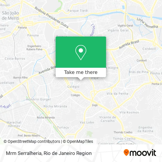
See Mrm Serralheria, Colégio, on the map
Public Transit to Mrm Serralheria in Colégio
Wondering how to get to Mrm Serralheria in Colégio? Moovit helps you find the best way to get to Mrm Serralheria with step-by-step directions from the nearest public transit station.
Moovit provides free maps and live directions to help you navigate through your city. View schedules, routes, timetables, and find out how long does it take to get to Mrm Serralheria in real time.
Looking for the nearest stop or station to Mrm Serralheria? Check out this list of stops closest to your destination: Estrada Do Colégio; Estrada Do Colégio; Avenida Monsenhor Félix; Colégio.
Bus: 562, 563, 639, 685, 920, 569, SN 639, 349, 296, 350, 561, 568L, 629.Metro: L2.Train: RAMAL BELFORD ROXO.
Want to see if there’s another route that gets you there at an earlier time? Moovit helps you find alternative routes or times. Get directions from and directions to Mrm Serralheria easily from the Moovit App or Website.
We make riding to Mrm Serralheria easy, which is why over 1.5 million users, including users in Colégio, trust Moovit as the best app for public transit. You don’t need to download an individual bus app or train app, Moovit is your all-in-one transit app that helps you find the best bus time or train time available.
For information on prices of bus, train and metro, costs and ride fares to Mrm Serralheria, please check the Moovit app.
Use the app to navigate to popular places including to the airport, hospital, stadium, grocery store, mall, coffee shop, school, college, and university.
Mrm Serralheria Address: Estrada do Colégio, 690 Colégio Rio de Janeiro-RJ 21235-280 street in Colégio
- Serede Colegio,
- Juninho Tattoo Artist,
- Um Novo Mundo Para Voce!,
- Eletrimax,
- Estrada do Colégio 860,
- Barbearia 21,
- Rua Vitalino Ribeiro - Colégio,
- Nerds Paradise,
- Estrada do Colégio Próximo ao 361-595,
- Praça De Rocha Miranda,
- Serede - Oi,
- Rua Dúlio Costa,
- Escola Municipal Mendes Viana,
- Raboni - Distribuidora de Produtos Cosmeticos e de Perfum,
- Ciep Dom Oscar Romero,
- Estrada do Colégio / Rua Margarida Max,
- Ric Lanches,
- Farmácia Meira,
- Rua Vitalino Ribeiro,
- Rua Ator Dulio Costa, 500
Places Near Mrm Serralheria (Colégio)
- Shopping Downtown, Barra Da Tijuca,
- Museu Do Amanhã, Centro,
- Shopping Rio Sul, Botafogo,
- Hospital Federal Cardoso Fontes, Jacarepaguá,
- Niterói, Niterói,
- Hospital Federal Do Andaraí, Andaraí,
- Hospital Pedro Ernesto, Vila Isabel,
- Feirão De Malhas, Duque De Caxias,
- Rua Ulysses Guimarães 16, Cidade Nova,
- Praia do Arpoador, Ipanema,
- Rua Licínio Cardoso, São Francisco Xavier,
- Shopping Nova América, Del Castilho,
- Avenida Rio Branco, Centro,
- Hospital Municipal Ronaldo Gazolla, Acari,
- Rio De Janeiro,
- Avenida Venezuela 134, Saúde,
- Rodoviária Novo Rio (Rodoviária do Rio de Janeiro), Santo Cristo,
- Norte Shopping, Cachambi,
- Feira Livre da Gloria, Glória,
- Shopping RioSul, Botafogo
How to get to popular places in Rio de Janeiro Region with public transit
Get around Colégio by public transit!
Traveling around Colégio has never been so easy. See step by step directions as you travel to any attraction, street or major public transit station. View bus and train schedules, arrival times, service alerts and detailed routes on a map, so you know exactly how to get to anywhere in Colégio.
When traveling to any destination around Colégio use Moovit's Live Directions with Get Off Notifications to know exactly where and how far to walk, how long to wait for your line, and how many stops are left. Moovit will alert you when it's time to get off — no need to constantly re-check whether yours is the next stop.
Wondering how to use public transit in Colégio or how to pay for public transit in Colégio? Moovit public transit app can help you navigate your way with public transit easily, and at minimum cost. It includes public transit fees, ticket prices, and costs. Looking for a map of Colégio public transit lines? Moovit public transit app shows all public transit maps in Colégio with all Bus, Train, Metro, Light Rail, Ferry, Cable Car, Gondola and Funicular routes and stops on an interactive map.
Rio de Janeiro Region has 8 transit type(s), including: Bus, Train, Metro, Light Rail, Ferry, Cable Car, Gondola and Funicular, operated by several transit agencies, including TrensRJ, Metrô Rio, VLT Carioca, Barcas Rio, BRT MOBI-Rio, Auto Viação Alpha, Auto Viação Tijuca, Gire Transportes, Transurb, Viação Nossa Senhora das Graças, Consórcio INTERSUL, Braso Lisboa (Municipal), Caprichosa Auto Ônibus, Auto Viação Três Amigos and Rodoviária Âncora Matias