Directions to Mt Mobile (Ramat Gan) with public transportation
The following transit lines have routes that pass near Mt Mobile
 Bus: 1, 238, 240, 50, 66.
- Light Rail: R1, R3.
- Israel Railways: Be'er Sheva Center - Herzliya, Herzliya - Jerusalem/Yitzhak Navon, Carmiel - Beer Sheva Center, Ofakim - Herzliya, Ashdod Ad Halom - Herzliya.
How to get to Mt Mobile by bus?
Click on the bus route to see step by step directions with maps, line arrival times and updated time schedules.
From Holon Cemetery, Bat Yam
78 minFrom Jabotinsky Petah Tikva, Petah Tikva
21 minFrom Regional Labor Court, Bat Yam
47 minFrom Herzliya Medical Center, Herzliya
40 minFrom Kiryat Ono Mall, Kiryat Ono
31 minFrom Sirkin Mall, Petah Tikva
45 minFrom Shared Taxi from Tel Aviv to Netanya, Herzliya
38 minFrom Avshalom Gisin, Petah Tikva
34 minFrom Bat Yam Magistrate Court, Bat Yam
47 minFrom Kiron Gate, Kiryat Ono
37 min
How to get to Mt Mobile by Israel Railways?
Click on the Israel Railways route to see step by step directions with maps, line arrival times and updated time schedules.
Bus stops near Mt Mobile in Ramat Gan
- Jabotinsky Road/HaChashmonaim, 2 min walk,VIEW
- Jabotinsky Road/Gilad, 3 min walk,VIEW
- Aba Hillel Light Rail Station/Jabotinsky Road, 4 min walk,VIEW
- Jabotinsky Road/Bialik, 5 min walk,VIEW
- Elite Junction/Arlozorov, 5 min walk,VIEW
- ביאליק/ויינשל, 7 min walk,VIEW
- Bialik/Mevo HaRimon, 7 min walk,VIEW
- Abba Hillel Road/Jabotinsky Road, 7 min walk,VIEW
- Derech Abba Hillel/HaYetzira, 7 min walk,VIEW
Light Rail stations near Mt Mobile in Ramat Gan
- Bialik Light Rail Station, 8 min walk,VIEW
Israel Railways station near Mt Mobile in Ramat Gan
- Tel Aviv Savidor Central Station, 17 min walk,VIEW
Bus lines to Mt Mobile in Ramat Gan
- Red Savvus, Ramat Gan,VIEW
- 50, Petah Tikva,VIEW
- 69, Ramat Gan,VIEW
- 70, Ramat Gan,VIEW
- 240, Bat Yam,VIEW
- 1, Bat Yam,VIEW
- 28, Kiryat Ono,VIEW
- 51, Tel Aviv-Yafo,VIEW
- 53, Bnei Brak,VIEW
- 67, Ayalon Mall,VIEW
- 82, Tel Aviv-Yafo,VIEW
- 379, Elad,VIEW
- 466, Petah Tikva,VIEW
- 504, Tel Aviv-Yafo,VIEW
- 567, Kfar Saba,VIEW
- 186, Ariel,VIEW
- 250, Rosh HaAyin,VIEW
- 285, Elkana,VIEW
- 285, Etz Efraim,VIEW
- 285, Ariel,VIEW
What are the closest stations to Mt Mobile?
The closest stations to Mt Mobile are:
- Jabotinsky Road/HaChashmonaim is 134 meters away, 2 min walk.
- Jabotinsky Road/Gilad is 182 meters away, 3 min walk.
- Aba Hillel Light Rail Station/Jabotinsky Road is 283 meters away, 4 min walk.
- Jabotinsky Road/Bialik is 336 meters away, 5 min walk.
- Elite Junction/Arlozorov is 345 meters away, 5 min walk.
- ביאליק/ויינשל is 451 meters away, 7 min walk.
- Bialik/Mevo HaRimon is 465 meters away, 7 min walk.
- Abba Hillel Road/Jabotinsky Road is 487 meters away, 7 min walk.
- Derech Abba Hillel/HaYetzira is 520 meters away, 7 min walk.
- Bialik Light Rail Station is 598 meters away, 8 min walk.
- Tel Aviv Savidor Central Station is 1282 meters away, 17 min walk.
Which bus lines stop near Mt Mobile?
These bus lines stop near Mt Mobile: 1, 238, 240, 50, 66, 68.
Which light rail lines stop near Mt Mobile?
These light rail lines stop near Mt Mobile: R1, R3.
Which Israel Railways lines stop near Mt Mobile?
These Israel Railways lines stop near Mt Mobile: Be'er Sheva Center - Herzliya, Herzliya - Jerusalem/Yitzhak Navon, Carmiel - Beer Sheva Center.
What’s the nearest light rail station to Mt Mobile in Ramat Gan?
The nearest light rail station to Mt Mobile in Ramat Gan is Bialik Light Rail Station. It’s a 8 min walk away.
What’s the nearest Israel Railways station to Mt Mobile in Ramat Gan?
The nearest Israel Railways station to Mt Mobile in Ramat Gan is Tel Aviv Savidor Central Station. It’s a 17 min walk away.
What’s the nearest bus station to Mt Mobile in Ramat Gan?
The nearest bus station to Mt Mobile in Ramat Gan is Jabotinsky Road/HaChashmonaim. It’s a 2 min walk away.
What time is the first light rail to Mt Mobile in Ramat Gan?
The R3 is the first light rail that goes to Mt Mobile in Ramat Gan. It stops nearby at 5:38 AM.
What time is the last light rail to Mt Mobile in Ramat Gan?
The R2 is the last light rail that goes to Mt Mobile in Ramat Gan. It stops nearby at 12:59 AM.
What time is the first Israel Railways to Mt Mobile in Ramat Gan?
The Jerusalem/Yitzhak Navon - Herzliya is the first Israel Railways that goes to Mt Mobile in Ramat Gan. It stops nearby at 3:09 AM.
What time is the last Israel Railways to Mt Mobile in Ramat Gan?
The Nahariya - Modi'in Center is the last Israel Railways that goes to Mt Mobile in Ramat Gan. It stops nearby at 4:34 AM.
What time is the first bus to Mt Mobile in Ramat Gan?
The 70 is the first bus that goes to Mt Mobile in Ramat Gan. It stops nearby at 5:02 AM.
What time is the last bus to Mt Mobile in Ramat Gan?
The 61 is the last bus that goes to Mt Mobile in Ramat Gan. It stops nearby at 2:21 AM.
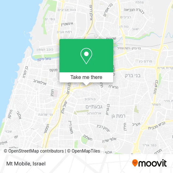
See Mt Mobile, Ramat Gan, on the map
Public Transit to Mt Mobile in Ramat Gan
Wondering how to get to Mt Mobile in Ramat Gan? Moovit helps you find the best way to get to Mt Mobile with step-by-step directions from the nearest public transit station.
Moovit provides free maps and live directions to help you navigate through your city. View schedules, routes, timetables, and find out how long does it take to get to Mt Mobile in real time.
Looking for the nearest stop or station to Mt Mobile? Check out this list of stops closest to your destination: Jabotinsky Road/HaChashmonaim; Jabotinsky Road/Gilad; Aba Hillel Light Rail Station/Jabotinsky Road; Jabotinsky Road/Bialik; Elite Junction/Arlozorov; ביאליק/ויינשל; Bialik/Mevo HaRimon; Abba Hillel Road/Jabotinsky Road; Derech Abba Hillel/HaYetzira; Bialik Light Rail Station; Tel Aviv Savidor Central Station.
Bus: 1, 238, 240, 50, 66, 68, Red Savvus, 69, 70, 28, 51, 53, 67, 186, 250, 285, 285, 285, Blue Savbus, 188.Light Rail: R1, R3.Israel Railways: Be'er Sheva Center - Herzliya, Herzliya - Jerusalem/Yitzhak Navon, Carmiel - Beer Sheva Center, Ofakim - Herzliya, Ashdod Ad Halom - Herzliya, Ashkelon - Binyamina, Ashkelon - Herzliya, Ashkelon - Tel Aviv Center.
Want to see if there’s another route that gets you there at an earlier time? Moovit helps you find alternative routes or times. Get directions from and directions to Mt Mobile easily from the Moovit App or Website.
We make riding to Mt Mobile easy, which is why over 1.5 million users, including users in Ramat Gan, trust Moovit as the best app for public transit. You don’t need to download an individual bus app or train app, Moovit is your all-in-one transit app that helps you find the best bus time or train time available.
For information on prices of bus, light rail and Israel Railways, costs and ride fares to Mt Mobile, please check the Moovit app.
Use the app to navigate to popular places including to the airport, hospital, stadium, grocery store, mall, coffee shop, school, college, and university.
Mt Mobile Address: Zeev Jabotinsky street in Ramat Gan
- Twin Towers 2,
- Beemp,
- Ze'ev Jabotinsky Street,
- Hagefen Sports Hall,
- Menachem Begin Road 7,
- Abba Hillel Street 12,
- Zeev Jabotinsky Street 33,
- 1 Twin Towers,
- Jabotinsky 33,
- Shelter - Ramat Gan, Benjamin,
- Anar - Persian Restaurant,
- HaMitmid Tower,
- Benjamin 28,
- Polling Station 58 Matya Center Ramat Gan,
- Shelter - Ramat Gan, Lan,
- Menora Mivtachim House,
- National Insurance Ramat Gan,
- Olivia Snack Shop,
- Shelter - Ramat Gan, Arlozorov,
- Macro Cleaning Supplies
Places Near Mt Mobile (Ramat Gan)
- Assuta Hospital - Ramat HaHayal, Tel Aviv-Yafo,
- Bislach 17, Ramat Negev Regional Council,
- HaKotel, Jerusalem,
- Dizengoff Center, Tel Aviv-Yafo,
- Expo Tel Aviv, Tel Aviv-Yafo,
- Southern Medical Center, Ramat Negev Regional Council,
- Glilot Complex, Hof HaSharon Regional Council,
- Ramat Gan Stadium, Ramat Gan,
- Beilinson Hospital, Petah Tikva,
- Yarkon Park, Tel Aviv-Yafo,
- Azrieli, Tel Aviv-Yafo,
- Tel HaShomer North Gate, Ramat Gan,
- Bloomfield Stadium, Tel Aviv-Yafo,
- Moovit Office, Nes Ziona,
- Tel Hashomer Base, Ramat Gan,
- Kashcafe, Kiryat Ata,
- Menora Mivtachim Arena, Tel Aviv-Yafo,
- Gideon Camp - Military Base 7, Emek Lod Regional Council,
- Ichilov Hospital, Tel Aviv-Yafo,
- Carmel Market, Tel Aviv-Yafo
How to get to popular places in Israel with public transit
Get around Ramat Gan by public transit!
Traveling around Ramat Gan has never been so easy. See step by step directions as you travel to any attraction, street or major public transit station. View bus and train schedules, arrival times, service alerts and detailed routes on a map, so you know exactly how to get to anywhere in Ramat Gan.
When traveling to any destination around Ramat Gan use Moovit's Live Directions with Get Off Notifications to know exactly where and how far to walk, how long to wait for your line, and how many stops are left. Moovit will alert you when it's time to get off — no need to constantly re-check whether yours is the next stop.
Wondering how to use public transit in Ramat Gan or how to pay for public transit in Ramat Gan? Moovit public transit app can help you navigate your way with public transit easily, and at minimum cost. It includes public transit fees, ticket prices, and costs. Looking for a map of Ramat Gan public transit lines? Moovit public transit app shows all public transit maps in Ramat Gan with all Bus, Israel Railways, Light Rail, Carmelit / Rachbalit and Shuttle routes and stops on an interactive map.
Israel has 5 transit type(s), including: Bus, Israel Railways, Light Rail, Carmelit / Rachbalit and Shuttle, operated by several transit agencies, including Dan, Tel Aviv Light Rail - Tevel - Red Line, Israel Railways, Egged, Metropoline, Kavim, Electra Afikim, Nateev Express, Extra, Extra Jerusalem, Jerusalem Light Rail - Kfir, Egged Jerusalem Envelope Route, Dan Badarom, Dan Beer-Sheva and Electra Afikim Transport
