How to get to Muero by bus?
Click on the bus route to see step by step directions with maps, line arrival times and updated time schedules.
From Hospital Edgardo Rebagliati Martins, Jesus Mari
29 minFrom Av Salaverry, Miraflores
28 minFrom Avenida Nicolás Ayllón, Lima
41 minFrom Larcomar, Miraflores
48 minFrom Chongo de Huayta, Los Olivos
43 minFrom Av. Universitaria y Av. Naranjal, Los Olivos
46 minFrom Av. 28 de Julio, Miraflores
47 minFrom Mercado Covida, Los Olivos
34 minFrom ovalo huandoy, Los Olivos
46 minFrom Av. La mar, Miraflores
36 min
Bus stops near Muero in San Miguel
Bus lines to Muero in San Miguel
- 1163, Santa Margarita (Ventanilla) - Jockey Plaza (Surco),VIEW
- 1173, La Marina (San Miguel) - Pacasmayo (San Martin de Porres),VIEW
- 1203, Portón (San Juan De Lurigancho) - Plaza Norte (San Martin De Porres) - Portón (San Juan De Lurigancho),VIEW
- 1275, Upc (Santiago De Surco) - Oquendo (San Martín De Porres),VIEW
- 1276, Puente Benavides (Surco),VIEW
- 1286, San Diego (S.M. Porres) - Mariategui (S.J. Lurigancho),VIEW
- 1291, Ventanilla - Chorrillos,VIEW
- 1293, José Gálvez (Pachacamac) - Mi Perú (Ventanilla),VIEW
- 1300, San Juan De Lurigancho - Ventanilla,VIEW
- 1316, Pachacútec/Mi Perú (Ventanilla) - Mariátegui (San Juan de Lurigancho),VIEW
- 1435, Minka (Callao) - Torre Blanca (Carabayllo),VIEW
- 1442, Pachacútec (Ventanilla) - La Marina (San Miguel),VIEW
- 1482, Chorrillos - S.M.P.,VIEW
- 1491, Puente Benavides (Surco) - Pacasmayo (Callao),VIEW
- CR16, San Miguel - Ventanilla,VIEW
- CR34, San Miguel - Comas,VIEW
- CR35, Ventanilla - San Miguel,VIEW
- CR43, Ventanilla - Carabayllo,VIEW
- CR51, Comas - San Miguel,VIEW
- CR62, Carabayllo - Lima - Carabayllo,VIEW
What are the closest stations to Muero?
The closest stations to Muero are:
- Los Andes is 270 meters away, 4 min walk.
- Huancauri is 282 meters away, 4 min walk.
- Añaquito is 365 meters away, 5 min walk.
- Jose Marti is 473 meters away, 7 min walk.
- Faucett is 520 meters away, 7 min walk.
- Bellavista - Chosicanos is 823 meters away, 11 min walk.
Which bus lines stop near Muero?
These bus lines stop near Muero: 1173, 1203, 1275, 1286, 1291, 1480, 1482, CR62.
What’s the nearest bus station to Muero in San Miguel?
The nearest bus stations to Muero in San Miguel are Los Andes and Huancauri. The closest one is a 4 min walk away.
What time is the first bus to Muero in San Miguel?
The 1228 is the first bus that goes to Muero in San Miguel. It stops nearby at 4:05 AM.
What time is the last bus to Muero in San Miguel?
The IM47 is the last bus that goes to Muero in San Miguel. It stops nearby at 12:35 AM.
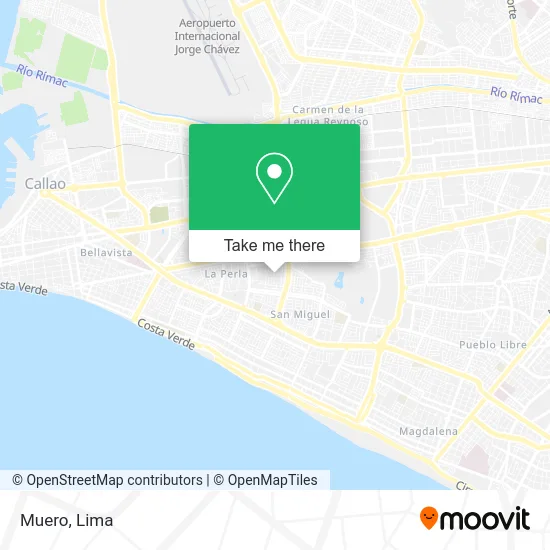
See Muero, San Miguel, on the map
Public Transit to Muero in San Miguel
Wondering how to get to Muero in San Miguel? Moovit helps you find the best way to get to Muero with step-by-step directions from the nearest public transit station.
Moovit provides free maps and live directions to help you navigate through your city. View schedules, routes, timetables, and find out how long does it take to get to Muero in real time.
Looking for the nearest stop or station to Muero? Check out this list of stops closest to your destination: Los Andes; Huancauri; Añaquito; Jose Marti; Faucett; Bellavista - Chosicanos.
Bus: 1173, 1203, 1275, 1286, 1291, 1480, 1482, CR62, 1163, 1276, 1138, 1258, 1228, 1254, 1317, 1007, 1030, 1223, 1234, 1448.
Want to see if there’s another route that gets you there at an earlier time? Moovit helps you find alternative routes or times. Get directions from and directions to Muero easily from the Moovit App or Website.
We make riding to Muero easy, which is why over 1.5 million users, including users in San Miguel, trust Moovit as the best app for public transit. You don’t need to download an individual bus app or train app, Moovit is your all-in-one transit app that helps you find the best bus time or train time available.
For information on prices of bus, costs and ride fares to Muero, please check the Moovit app.
Use the app to navigate to popular places including to the airport, hospital, stadium, grocery store, mall, coffee shop, school, college, and university.
Muero Address: Calle Paso de los Andes Maranga 6ta Etapa, 15088 San Miguel street in San Miguel
- Calle Taquitahuana 162 Maranga San Miguel,
- CALLE TAQUITAHUANA SAN MIGUEL,
- Parque Las tradiciones de Ricardo Palma,
- Calle Quiquijana,
- Paso de los Andes 165,
- AV AÑAQUITO 230 MARANGA,
- CALLE AÑAQUITO,
- Bonilla Foinquinos Olga Rosario,
- parque santiago acuña,
- Colegio santa lucia,
- Maranga Jirón Paso de los Andes Nº 239,
- Automatización Cuenca,
- Artesanias-Artesanias,
- El Refugio,
- jr quiquijana cdra 1,
- Curotto Osorio José Carlos,
- CERCA A AV PIO XII Y FAUCETT,
- CALLE LAUTARO 141 SAN MIGUEL,
- Izaguirre Carranza Isolina Maria,
- Mi Banco
Places Near Muero (San Miguel)
- Hospital Edgardo Rebagliati Martins, Jesus Mari,
- Plaza San Miguel, San Miguel,
- Av. Abancay, Lima,
- Aeropuerto Internacional Jorge Chávez, Ventanilla,
- Parque de las Leyendas, San Miguel,
- Parque Kennedy, Miraflores,
- Av. Salaverry, Jesus Mari,
- Gamarra,
- Jockey Plaza, Santiago D,
- Barranco, Barranco,
- Paradero Av.Brasil,
- Av. La Marina, San Miguel,
- Circuito Mágico Del Agua, Lima,
- Centro Comercial Plaza Norte, Independen,
- Larcomar, Miraflores,
- Mall Del Sur,
- Real Plaza Puruchuco, Ate,
- Pontificia Universidad Católica del Perú - PUCP, San Miguel,
- av arequipa, Lima,
- Miraflores, Miraflores
How to get to popular places in Lima with public transit
Get around San Miguel by public transit!
Traveling around San Miguel has never been so easy. See step by step directions as you travel to any attraction, street or major public transit station. View bus and train schedules, arrival times, service alerts and detailed routes on a map, so you know exactly how to get to anywhere in San Miguel.
When traveling to any destination around San Miguel use Moovit's Live Directions with Get Off Notifications to know exactly where and how far to walk, how long to wait for your line, and how many stops are left. Moovit will alert you when it's time to get off — no need to constantly re-check whether yours is the next stop.
Wondering how to use public transit in San Miguel or how to pay for public transit in San Miguel? Moovit public transit app can help you navigate your way with public transit easily, and at minimum cost. It includes public transit fees, ticket prices, and costs. Looking for a map of San Miguel public transit lines? Moovit public transit app shows all public transit maps in San Miguel with all Bus, Metro and Ferry routes and stops on an interactive map.
Lima has 3 transit type(s), including: Bus, Metro and Ferry, operated by several transit agencies, including Metro de Lima Línea 2 , Metro de Lima, Corredor Rojo, Metropolitano, Metropolitano - Alimentadores, Corredor Morado, Corredor Azul, Rutas Tradicionales, Transportes y Servicios La Esperanza S.A., Las Flores S.A., Virgen de la Asunción S.A., Consorcio HAM, Transportes y Service Canadá S.A., ETUL4SA and ETUCHISA