Directions to Multiply (Indianapolis City (Balance)) with public transportation
The following transit lines have routes that pass near Multiply
 Bus: 16, 3, 92, 31, GREYHOUND US0100.
How to get to Multiply by bus?
Click on the bus route to see step by step directions with maps, line arrival times and updated time schedules.
From Enterprise Rent-A-Car, Indianapolis City (Balance)
51 minFrom Lynhurst And Rockville Road, Indianapolis City (Balance)
51 minFrom Pennington Hob, Indianapolis City (Balance)
40 minFrom Heartland Outdoors, Indianapolis City (Balance)
50 minFrom Wethington Law Office, Beech Grove
50 minFrom Marion County Assessor's Office (South), Beech Grove
59 minFrom Exit 107/Keystone Ave/S, Indianapolis City (Balance)
35 minFrom 38th North Dr / N Hawthorne Ln, Indianapolis City (Balance)
57 minFrom Credit Union 1, Indianapolis City (Balance)
51 min
Bus stops near Multiply in Indianapolis City (Balance)
Bus lines to Multiply in Indianapolis City (Balance)
- 16, Emerson,VIEW
- 31, U S 31,VIEW
- GREYHOUND US0100, Atlanta - Chicago,VIEW
- GREYHOUND US0112, Montgomery - Nashville - Detroit,VIEW
- GREYHOUND US0120S, Chicago - Indianapolis,VIEW
- GREYHOUND US0157S, Indianapolis - Des Moines,VIEW
- GREYHOUND US0421, New York - Pittsburgh - St. Louis,VIEW
- 13, Keystone & National,VIEW
- 26, Keystone Crossing,VIEW
- 56, Emerson/Thompson,VIEW
- 90, 66th,VIEW
- 24, Transit Center,VIEW
What are the closest stations to Multiply?
The closest stations to Multiply are:
- Meridian St & Mccarty St is 244 yards away, 4 min walk.
- Indianapolis Bus Station is 731 yards away, 9 min walk.
- East St & Warsaw St is 1097 yards away, 14 min walk.
- Virginia Ave & New Jersey St (New Jersey Station Nb) is 1119 yards away, 14 min walk.
- Missouri St & South St is 1179 yards away, 15 min walk.
Which bus lines stop near Multiply?
These bus lines stop near Multiply: 16, 3, 92.
What’s the nearest bus station to Multiply in Indianapolis City (Balance)?
The nearest bus station to Multiply in Indianapolis City (Balance) is Meridian St & Mccarty St. It’s a 4 min walk away.
What time is the first bus to Multiply in Indianapolis City (Balance)?
The GREYHOUND US0100 is the first bus that goes to Multiply in Indianapolis City (Balance). It stops nearby at 4:40 AM.
What time is the last bus to Multiply in Indianapolis City (Balance)?
The GREYHOUND US0421 is the last bus that goes to Multiply in Indianapolis City (Balance). It stops nearby at 7:35 PM.
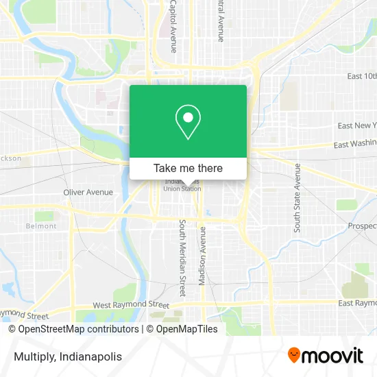
See Multiply, Indianapolis City (Balance), on the map
Public Transit to Multiply in Indianapolis City (Balance)
Wondering how to get to Multiply in Indianapolis City (Balance)? Moovit helps you find the best way to get to Multiply with step-by-step directions from the nearest public transit station.
Moovit provides free maps and live directions to help you navigate through your city. View schedules, routes, timetables, and find out how long does it take to get to Multiply in real time.
Looking for the nearest stop or station to Multiply? Check out this list of stops closest to your destination: Meridian St & Mccarty St; Indianapolis Bus Station; East St & Warsaw St; Virginia Ave & New Jersey St (New Jersey Station Nb); Missouri St & South St.
Bus: 16, 3, 92, 31, GREYHOUND US0100, GREYHOUND US0112, GREYHOUND US0120S, GREYHOUND US0157S, GREYHOUND US0421, 13, 26, 56, 90, 24.
Want to see if there’s another route that gets you there at an earlier time? Moovit helps you find alternative routes or times. Get directions from and directions to Multiply easily from the Moovit App or Website.
We make riding to Multiply easy, which is why over 1.5 million users, including users in Indianapolis City (Balance), trust Moovit as the best app for public transit. You don’t need to download an individual bus app or train app, Moovit is your all-in-one transit app that helps you find the best bus time or train time available.
For information on prices of bus, costs and ride fares to Multiply, please check the Moovit app.
Use the app to navigate to popular places including to the airport, hospital, stadium, grocery store, mall, coffee shop, school, college, and university.
Multiply Address: 525 S Meridian St Indianapolis, IN 46225 street in Indianapolis City (Balance)
- Marketing Informatics,
- Costello,
- Lightbound Studios,
- Indianapolis Ward Locksmiths,
- Lido Video,
- Spur Interactiv,
- Scale Computing,
- Springbuk,
- Union Campus,
- Remodel Health,
- Cogent Scientific,
- Essig Research, Inc.,
- Hangar - Experience Indy,
- Cinderwood,
- Hemlock Counseling Services,
- Wells Strategy + Solutions,
- Ellison Brewing Company,
- HP Enterprise Services,
- Rolls Royce Heritage Trust Allison,
- Meridian Center
Places Near Multiply (Indianapolis City (Balance))
- 119 W 19th St Parking, Indianapolis City (Balance),
- Indiana, Indianapolis City (Balance),
- St. Vincent Hospital - Indianapolis, Indianapolis City (Balance),
- Train Ride At Castleton Mall, Indianapolis City (Balance),
- I-465 / I-65 Interchange, Indianapolis City (Balance),
- Jersey Barn, Indianapolis City (Balance),
- Plainfield, IN, Plainfield,
- Castleton Square Mall, Indianapolis,
- Lilly Corporate Center (Eli Lilly & Co), Indianapolis City (Balance),
- Methodist Hospital of Indianapolis, Indianapolis City (Balance),
- Indiana Convention Center, Indianapolis City (Balance),
- Lucas Oil Stadium, Indianapolis City (Balance),
- St. Vincent entrance #1, Indianapolis City (Balance),
- I U Health Methodist Hospital, Indianapolis City (Balance),
- Eskenazi Hospital, Indianapolis City (Balance),
- Cotter's Massage Parlor With Happy Endings, Indianapolis City (Balance),
- THE BALT, Indianapolis City (Balance),
- Indianapolis Airport Zone 2, Indianapolis City (Balance),
- Indianapolis Motor Speedway, Speedway,
- Gainbridge Fieldhouse, Indianapolis City (Balance)
How to get to popular places in Indianapolis with public transit
Get around Indianapolis City (Balance) by public transit!
Traveling around Indianapolis City (Balance) has never been so easy. See step by step directions as you travel to any attraction, street or major public transit station. View bus and train schedules, arrival times, service alerts and detailed routes on a map, so you know exactly how to get to anywhere in Indianapolis City (Balance).
When traveling to any destination around Indianapolis City (Balance) use Moovit's Live Directions with Get Off Notifications to know exactly where and how far to walk, how long to wait for your line, and how many stops are left. Moovit will alert you when it's time to get off — no need to constantly re-check whether yours is the next stop.
Wondering how to use public transit in Indianapolis City (Balance) or how to pay for public transit in Indianapolis City (Balance)? Moovit public transit app can help you navigate your way with public transit easily, and at minimum cost. It includes public transit fees, ticket prices, and costs. Looking for a map of Indianapolis City (Balance) public transit lines? Moovit public transit app shows all public transit maps in Indianapolis City (Balance) with all bus routes and stops on an interactive map.
Indianapolis has 1 transit type(s), including: bus, operated by several transit agencies, including IndyGo, FlixBus-us and Greyhound-us