Directions to Mundo Cão (Praia Da Bandeira) with public transportation
The following transit lines have routes that pass near Mundo Cão
 Bus: 323, 327, 328, 634, 910.
- Ferry: COCOTÁ - PRAÇA XV, ILHA DO GOVERNADOR - PRAÇA XV.
How to get to Mundo Cão by bus?
Click on the bus route to see step by step directions with maps, line arrival times and updated time schedules.
From Rodovia Governador Mário Covas, Km 321 e Km 322 s/n, Niterói
81 minFrom Vila do João, Maré
54 minFrom Largo Do Boi Tolo, Centro
58 minFrom Avenida Presidente Vargas 435, Centro
55 minFrom clinica nova guanabara, Olaria
52 minFrom Passarela 9, Bonsucesso
41 minFrom Linha 545 Alcântara X Candelária, Centro
56 minFrom Rua Sá Freire, Imperial De São Cristóvão
56 minFrom Hospital Servidores Do Estado/Rj, Gamboa
61 minFrom Praça Das Nações, Bonsucesso
53 min
How to get to Mundo Cão by ferry?
Click on the ferry route to see step by step directions with maps, line arrival times and updated time schedules.
Bus stops near Mundo Cão in Praia Da Bandeira
Ferry stations near Mundo Cão in Praia Da Bandeira
Bus lines to Mundo Cão in Praia Da Bandeira
- 327, Castelo,VIEW
- 901, Bananal,VIEW
- 323, Bananal - Castelo (Brs 4 - via Linha Vermelha),VIEW
- 328, Bananal - Candelária (Brs 4 - via Av. Brasil),VIEW
- SN 328, Bananal - Candelária (Brs 4 - via Aeroporto / Av. Brasil),VIEW
- SP 328, Bananal - BRT Fundão (via Cocotá / Cacuia),VIEW
- SR 328, Bananal - Candelária (Brs 4 - Expresso),VIEW
- 634, Bananal - Saens Peña (Brs 6 - via Bonsucesso),VIEW
- 635, Bananal - Saens Peña (Brs 6 - via Linha Vermelha / São Cristóvão),VIEW
- 696, Praia do Dendê - Méier (Via Av. Brasil),VIEW
- SN 696, Praia do Dendê - Meier (Via Praia do Rosa / Bancários),VIEW
- 739L, Vilar dos Teles - Cocotá (Via 25 de Agosto),VIEW
- SVB 901, Bananal - Bonsucesso (via Praia do Barão / Estrada do Galeão - Direto),VIEW
- 910, Bananal - Irajá (via Olaria / Penha / Largo do Bicão),VIEW
- SE 913, Bananal - Del Castilho (Integração Com Metrô),VIEW
- 921, Ribeira - Bancários (via Cocotá),VIEW
- SV 921, Ribeira - Bancários (via Barcas),VIEW
- 925, Bancários - Aeroporto ✈ (Via Área de Apoio - Circular),VIEW
- 2342, Bananal - Castelo (Brs 4),VIEW
- 913, Del Castilho (Saídas do Bananal),VIEW
What are the closest stations to Mundo Cão?
The closest stations to Mundo Cão are:
- Praia Da Bandeira, 211 is 92 meters away, 2 min walk.
- Estrada Da Cacuia, 1352 is 804 meters away, 11 min walk.
- Rua Tenente Cleto Campêlo, 582 is 891 meters away, 12 min walk.
- Terminal De Barcas - Cocotá ⛴ is 2507 meters away, 32 min walk.
- Praia Da Bica - Ilha Do Governador is 3217 meters away, 41 min walk.
Which bus lines stop near Mundo Cão?
These bus lines stop near Mundo Cão: 323, 327, 328, 634, 910.
Which ferry line stops near Mundo Cão?
COCOTÁ - PRAÇA XV (Cocotá)
What’s the nearest bus station to Mundo Cão in Praia Da Bandeira?
The nearest bus station to Mundo Cão in Praia Da Bandeira is Praia Da Bandeira, 211. It’s a 2 min walk away.
What time is the first bus to Mundo Cão in Praia Da Bandeira?
The SN 328 is the first bus that goes to Mundo Cão in Praia Da Bandeira. It stops nearby at 3:00 AM.
What time is the last bus to Mundo Cão in Praia Da Bandeira?
The SN 634 is the last bus that goes to Mundo Cão in Praia Da Bandeira. It stops nearby at 3:44 AM.
What time is the first ferry to Mundo Cão in Praia Da Bandeira?
The COCOTÁ - PRAÇA XV is the first ferry that goes to Mundo Cão in Praia Da Bandeira. It stops nearby at 7:00 AM.
What time is the last ferry to Mundo Cão in Praia Da Bandeira?
The COCOTÁ - PRAÇA XV is the last ferry that goes to Mundo Cão in Praia Da Bandeira. It stops nearby at 8:45 PM.
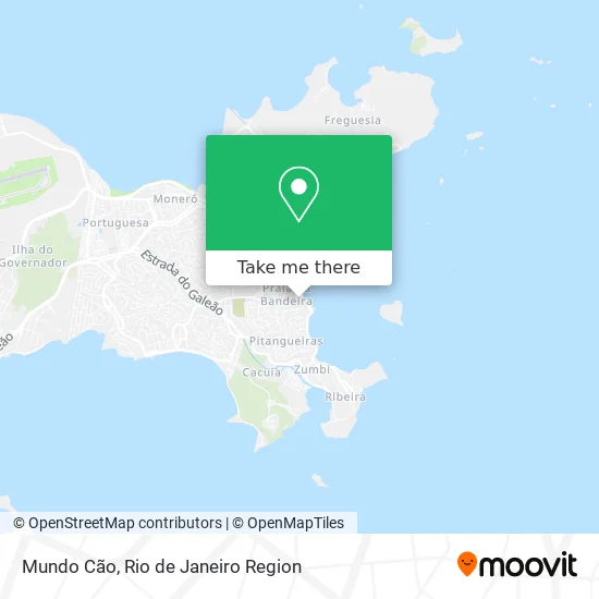
See Mundo Cão, Praia Da Bandeira, on the map
Public Transit to Mundo Cão in Praia Da Bandeira
Wondering how to get to Mundo Cão in Praia Da Bandeira? Moovit helps you find the best way to get to Mundo Cão with step-by-step directions from the nearest public transit station.
Moovit provides free maps and live directions to help you navigate through your city. View schedules, routes, timetables, and find out how long does it take to get to Mundo Cão in real time.
Looking for the nearest stop or station to Mundo Cão? Check out this list of stops closest to your destination: Praia Da Bandeira, 211; Estrada Da Cacuia; Rua Tenente Cleto Campêlo; Terminal De Barcas - Cocotá ⛴; Praia Da Bica - Ilha Do Governador.
Bus: 323, 327, 328, 634, 910, 901, SN 328, SP 328, SR 328, 913.Ferry: COCOTÁ - PRAÇA XV, ILHA DO GOVERNADOR - PRAÇA XV.
Want to see if there’s another route that gets you there at an earlier time? Moovit helps you find alternative routes or times. Get directions from and directions to Mundo Cão easily from the Moovit App or Website.
We make riding to Mundo Cão easy, which is why over 1.5 million users, including users in Praia Da Bandeira, trust Moovit as the best app for public transit. You don’t need to download an individual bus app or train app, Moovit is your all-in-one transit app that helps you find the best bus time or train time available.
For information on prices of bus and ferry, costs and ride fares to Mundo Cão, please check the Moovit app.
Use the app to navigate to popular places including to the airport, hospital, stadium, grocery store, mall, coffee shop, school, college, and university.
Mundo Cão Address: Rua Altinópolis, 61 Praia da Bandeira Rio de Janeiro-RJ 21921-540 street in Praia Da Bandeira
- Rua Capitão Barbosa 6,
- Praia da Bandeira,
- Rua Maciel Monteiro / Praia da Bandeira,
- Praça Comandante Nelson Mege,
- Altinópolis,
- Rua Altinópolis,
- Rua Ambaitinga, 3,
- Centro Educacional e Cultural Henriques Fernandes,
- Cantina Chf,
- Rua Ambaitinga / Praia da Bandeira,
- Rua Ambaitinga 165,
- Praia Da Bandeira,
- Condomínio Vista del Mar 1,
- Edu Portoes Servicos e Equipamentos Eletricos,
- República Estudantil - Ufrj,
- Campo Tijolinho,
- Globo Novelas,
- Rua Frei Inocêncio S/Nº,
- Rua Frei Inocêncio,
- Rua Afonso Henrique Martins Saldanha
Places Near Mundo Cão (Praia Da Bandeira)
- Museu Do Amanhã, Centro,
- Feira Livre da Gloria, Glória,
- Avenida Venezuela 134, Saúde,
- Shopping Nova América, Del Castilho,
- Norte Shopping, Cachambi,
- Hospital Municipal Ronaldo Gazolla, Acari,
- Rua Ulysses Guimarães 16, Cidade Nova,
- Shopping Downtown, Barra Da Tijuca,
- Niterói, Niterói,
- Shopping RioSul, Botafogo,
- Hospital Federal Cardoso Fontes, Jacarepaguá,
- Rua Licínio Cardoso, São Francisco Xavier,
- Shopping Rio Sul, Botafogo,
- Avenida Rio Branco, Centro,
- Rio De Janeiro,
- Rodoviária Novo Rio (Rodoviária do Rio de Janeiro), Santo Cristo,
- Hospital Pedro Ernesto, Vila Isabel,
- Hospital Federal Do Andaraí, Andaraí,
- Feirão De Malhas, Duque De Caxias,
- Praia do Arpoador, Ipanema
How to get to popular places in Rio de Janeiro Region with public transit
Get around Praia Da Bandeira by public transit!
Traveling around Praia Da Bandeira has never been so easy. See step by step directions as you travel to any attraction, street or major public transit station. View bus and train schedules, arrival times, service alerts and detailed routes on a map, so you know exactly how to get to anywhere in Praia Da Bandeira.
When traveling to any destination around Praia Da Bandeira use Moovit's Live Directions with Get Off Notifications to know exactly where and how far to walk, how long to wait for your line, and how many stops are left. Moovit will alert you when it's time to get off — no need to constantly re-check whether yours is the next stop.
Wondering how to use public transit in Praia Da Bandeira or how to pay for public transit in Praia Da Bandeira? Moovit public transit app can help you navigate your way with public transit easily, and at minimum cost. It includes public transit fees, ticket prices, and costs. Looking for a map of Praia Da Bandeira public transit lines? Moovit public transit app shows all public transit maps in Praia Da Bandeira with all Bus, Train, Metro, Light Rail, Ferry, Cable Car, Gondola and Funicular routes and stops on an interactive map.
Rio de Janeiro Region has 8 transit type(s), including: Bus, Train, Metro, Light Rail, Ferry, Cable Car, Gondola and Funicular, operated by several transit agencies, including TrensRJ, Metrô Rio, VLT Carioca, Barcas Rio, BRT MOBI-Rio, Auto Viação Alpha, Auto Viação Tijuca, Gire Transportes, Transurb, Viação Nossa Senhora das Graças, Consórcio INTERSUL, Braso Lisboa (Municipal), Caprichosa Auto Ônibus, Auto Viação Três Amigos and Rodoviária Âncora Matias