Directions to Mundo Cien (Marchamalo) with public transportation
The following transit lines have routes that pass near Mundo Cien
 Bus: VCM-010/L1, VCM-010/L2.
- Train: C2, C7.
How to get to Mundo Cien by bus?
Click on the bus route to see step by step directions with maps, line arrival times and updated time schedules.
From Hospital Príncipe De Asturias, Alcalá De Henares
67 minFrom Dirección General de Tráfico (DGT), Alcalá De Henares
81 minFrom C.C. Cuadernillos, Alcalá De Henares
48 minFrom Autobús 227 EXPRESS, Alcalá De Henares
67 minFrom Centro Comercial Alcalá Magna, Área Metropolitana De Madrid Y Corredor Del Henares
82 minFrom Azuqueca de Henares, Azuqueca De Henares
70 minFrom Centro Penitenciario Alcalá Meco - Madrid II, Alcalá De Henares
118 minFrom Centro Francisco Díaz, Alcalá De Henares
78 minFrom Hospital Universitario De Guadalajara, Guadalajara
31 minFrom Centro Comercial Ferial Plaza, Guadalajara
20 min
How to get to Mundo Cien by train?
Click on the train route to see step by step directions with maps, line arrival times and updated time schedules.
Bus stops near Mundo Cien in Marchamalo
Train station near Mundo Cien in Marchamalo
- Guadalajara, 45 min walk,VIEW
What are the closest stations to Mundo Cien?
The closest stations to Mundo Cien are:
- Marchamalo - Plaza Mayor is 89 meters away, 2 min walk.
- Marchamalo - Plaza Alameda is 277 meters away, 4 min walk.
- Guadalajara is 3433 meters away, 45 min walk.
Which bus line stops near Mundo Cien?
VCM-010/L1 (Marchamalo - Guadalajara - Marchamalo)
Which train line stops near Mundo Cien?
C2 (Guadalajara)
What’s the nearest bus station to Mundo Cien in Marchamalo?
The nearest bus station to Mundo Cien in Marchamalo is Marchamalo - Plaza Mayor. It’s a 2 min walk away.
What time is the first train to Mundo Cien in Marchamalo?
The C2 is the first train that goes to Mundo Cien in Marchamalo. It stops nearby at 5:30 AM.
What time is the last train to Mundo Cien in Marchamalo?
The C2 is the last train that goes to Mundo Cien in Marchamalo. It stops nearby at 12:53 AM.
What time is the first bus to Mundo Cien in Marchamalo?
The VCM-010/L2 is the first bus that goes to Mundo Cien in Marchamalo. It stops nearby at 5:30 AM.
What time is the last bus to Mundo Cien in Marchamalo?
The VCM-010/L1 is the last bus that goes to Mundo Cien in Marchamalo. It stops nearby at 12:25 AM.
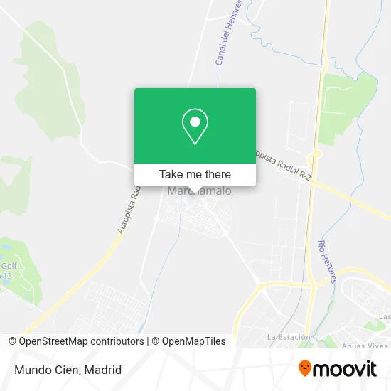
See Mundo Cien, Marchamalo, on the map
Public Transit to Mundo Cien in Marchamalo
Wondering how to get to Mundo Cien in Marchamalo? Moovit helps you find the best way to get to Mundo Cien with step-by-step directions from the nearest public transit station.
Moovit provides free maps and live directions to help you navigate through your city. View schedules, routes, timetables, and find out how long does it take to get to Mundo Cien in real time.
Looking for the nearest stop or station to Mundo Cien? Check out this list of stops closest to your destination: Marchamalo - Plaza Mayor; Marchamalo - Plaza Alameda; Guadalajara.
Bus: VCM-010/L1, VCM-010/L2.Train: C2, C7.
Want to see if there’s another route that gets you there at an earlier time? Moovit helps you find alternative routes or times. Get directions from and directions to Mundo Cien easily from the Moovit App or Website.
We make riding to Mundo Cien easy, which is why over 1.5 million users, including users in Marchamalo, trust Moovit as the best app for public transit. You don’t need to download an individual bus app or train app, Moovit is your all-in-one transit app that helps you find the best bus time or train time available.
For information on prices of bus and train, costs and ride fares to Mundo Cien, please check the Moovit app.
Use the app to navigate to popular places including to the airport, hospital, stadium, grocery store, mall, coffee shop, school, college, and university.
Mundo Cien Address: Travesía Berninches, 2 19180 Marchamalo street in Marchamalo
- Bar El Puente De Triana,
- Recinto Ferial de Marchamalo,
- Lactalis Nestle Productos Lacteos Refrigerados Iberia,
- Centro de Terapias Naturales Parasanitario,
- Avenida de Roanne 66,
- Fonseca Santiago, j,
- Lamchachti,
- Granja Cantos Blancos,
- Calle San Pedro 13,
- Cubiertas Jesús Roberto,
- Centro de Estética Elena Polanco,
- Fuentes Bellot Jesus,
- Trofeo Formación,
- Fundacion Internacional O'Belén,
- Calle Musicos,
- Gerencia De Atencion Primaria De Guadalajara-sescam,
- Cementerio de Marchamalo,
- Lara Retuerta,
- Calle Lope de Vega, 33,
- Tejados El Tajo
Places Near Mundo Cien (Marchamalo)
- Rastro De Madrid, Área Metropolitana De Madrid Y Corredor Del Henares,
- Hospital Universitario La Paz, Madrid,
- Mercadillo de Majadahonda, Majadahonda,
- Mendez Alvaro, Madrid,
- Hospital Clínico Universitario San Carlos, Madrid,
- Calle de López de Hoyos 169, Madrid,
- Estadio Wanda Metropolitano, Área Metropolitana De Madrid Y Corredor Del Henares,
- Wizink Center, Madrid,
- Palacio De Vistalegre, Área Metropolitana De Madrid Y Corredor Del Henares,
- Tres Aguas, Alcorcón,
- Centro Comercial Islazul, Área Metropolitana De Madrid Y Corredor Del Henares,
- Centro Comercial La Gavia, Área Metropolitana De Madrid Y Corredor Del Henares,
- Hospital Universitario Ramón y Cajal, Madrid,
- Plenilunio, Área Metropolitana De Madrid Y Corredor Del Henares,
- Sala La Riviera, Madrid,
- Plaza Mayor, Madrid,
- Centro Comercial La Vaguada, Área Metropolitana De Madrid Y Corredor Del Henares,
- Centro Comercial Oasiz Madrid, Área Metropolitana De Madrid Y Corredor Del Henares,
- Estacion de Chamartin, Madrid,
- Nassica, Área Metropolitana De Madrid Y Corredor Del Henares
How to get to popular places in Madrid with public transit
Get around Marchamalo by public transit!
Traveling around Marchamalo has never been so easy. See step by step directions as you travel to any attraction, street or major public transit station. View bus and train schedules, arrival times, service alerts and detailed routes on a map, so you know exactly how to get to anywhere in Marchamalo.
When traveling to any destination around Marchamalo use Moovit's Live Directions with Get Off Notifications to know exactly where and how far to walk, how long to wait for your line, and how many stops are left. Moovit will alert you when it's time to get off — no need to constantly re-check whether yours is the next stop.
Wondering how to use public transit in Marchamalo or how to pay for public transit in Marchamalo? Moovit public transit app can help you navigate your way with public transit easily, and at minimum cost. It includes public transit fees, ticket prices, and costs. Looking for a map of Marchamalo public transit lines? Moovit public transit app shows all public transit maps in Marchamalo with all Bus, Train, Metro and Light Rail routes and stops on an interactive map.
Madrid has 4 transit type(s), including: Bus, Train, Metro and Light Rail, operated by several transit agencies, including Metro de Madrid, Metro Ligero, Tranvía de Parla, Renfe Cercanías - Servicios de Autobús especiales, Renfe Cercanias, Renfe Cercanías, EMT, Interurbanos, Urbanos de Alcalá de Henares, Urbanos de Alcobendas, Urbanos de Alcorcón, Urbanos de Algete, Urbanos de Aranjuez, Urbanos de Arganda del Rey and Urbanos de Arroyomolinos