How to get to Mundo Electrogas by bus?
Click on the bus route to see step by step directions with maps, line arrival times and updated time schedules.
From Parque Coimbra, Área Metropolitana De Madrid Y Corredor Del Henares
78 minFrom Islazul (Centro Comercial Islazul), Madrid
77 minFrom Decathlon (DECATHLON Usera), Madrid
78 minFrom Metro Oporto, Madrid
74 minFrom Coliseum Alfonso Pérez, Getafe
76 minFrom DECATHLON Usera, Madrid
78 minFrom Tanatorio de Leganés, Leganés
42 minFrom CIUDAD DEL AUTOMOVIL, Leganés
47 minFrom Orcasitas, Madrid
76 minFrom Centro Comercial Xanadú, Arroyomolinos
56 min
How to get to Mundo Electrogas by train?
Click on the train route to see step by step directions with maps, line arrival times and updated time schedules.
How to get to Mundo Electrogas by metro?
Click on the metro route to see step by step directions with maps, line arrival times and updated time schedules.
From Islazul (Centro Comercial Islazul), Madrid
86 minFrom Decathlon (DECATHLON Usera), Madrid
76 minFrom Metro Oporto, Madrid
55 minFrom Coliseum Alfonso Pérez, Getafe
36 minFrom DECATHLON Usera, Madrid
76 minFrom Tanatorio de Leganés, Leganés
41 minFrom CIUDAD DEL AUTOMOVIL, Leganés
38 minFrom Orcasitas, Madrid
76 min
Bus stops near Mundo Electrogas in Alcorcón
Metro stations near Mundo Electrogas in Alcorcón
Train station near Mundo Electrogas in Alcorcón
- Las Retamas, 49 min walk,VIEW
Bus lines to Mundo Electrogas in Alcorcón
- 450, Olímpico Fco. Fdez. Ochoa - Av. Oeste,VIEW
- 510, Guadiana - Colegio,VIEW
- 513, Polvoranca - Servicios Municipales,VIEW
- 520, P.º Arroyomolinos - E Polígono Industrial 1,VIEW
- 1, Fuente Cisneros,VIEW
- 512, Polvoranca - Olímpico Fco. Fdez. Ochoa,VIEW
- N501, Av. Portugal - Rio Duero,VIEW
- VAC063, 701: Madrid (Estación Sur),VIEW
- VAC082, Alcorcón,VIEW
- VAC087, 903: Madrid (Estación Sur),VIEW
- VAC226, Madrid (Estación Sur),VIEW
What are the closest stations to Mundo Electrogas?
The closest stations to Mundo Electrogas are:
- Polvoranca - Jabonería is 239 meters away, 4 min walk.
- Cáceres - Iglesia is 316 meters away, 5 min walk.
- Av. Móstoles - Est. Alcorcón Central is 538 meters away, 8 min walk.
- Parque Lisboa is 709 meters away, 10 min walk.
- Puerta Del Sur is 725 meters away, 10 min walk.
- Las Retamas is 3728 meters away, 49 min walk.
Which bus lines stop near Mundo Electrogas?
These bus lines stop near Mundo Electrogas: 450, 512, 513.
Which train line stops near Mundo Electrogas?
C5 (Humanes)
Which metro lines stop near Mundo Electrogas?
These metro lines stop near Mundo Electrogas: M-10, M-12.
What’s the nearest metro station to Mundo Electrogas in Alcorcón?
The nearest metro stations to Mundo Electrogas in Alcorcón are Parque Lisboa and Puerta Del Sur. The closest one is a 10 min walk away.
What’s the nearest bus station to Mundo Electrogas in Alcorcón?
The nearest bus station to Mundo Electrogas in Alcorcón is Polvoranca - Jabonería. It’s a 4 min walk away.
What time is the first metro to Mundo Electrogas in Alcorcón?
The M-12 is the first metro that goes to Mundo Electrogas in Alcorcón. It stops nearby at 6:05 AM.
What time is the last metro to Mundo Electrogas in Alcorcón?
The M-12 is the last metro that goes to Mundo Electrogas in Alcorcón. It stops nearby at 2:17 AM.
What time is the first train to Mundo Electrogas in Alcorcón?
The C5 is the first train that goes to Mundo Electrogas in Alcorcón. It stops nearby at 5:21 AM.
What time is the last train to Mundo Electrogas in Alcorcón?
The C5 is the last train that goes to Mundo Electrogas in Alcorcón. It stops nearby at 12:33 AM.
What time is the first bus to Mundo Electrogas in Alcorcón?
The N501 is the first bus that goes to Mundo Electrogas in Alcorcón. It stops nearby at 3:07 AM.
What time is the last bus to Mundo Electrogas in Alcorcón?
The N501 is the last bus that goes to Mundo Electrogas in Alcorcón. It stops nearby at 2:51 AM.
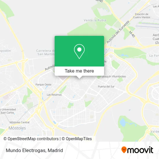
See Mundo Electrogas, Alcorcón, on the map
Public Transit to Mundo Electrogas in Alcorcón
Wondering how to get to Mundo Electrogas in Alcorcón? Moovit helps you find the best way to get to Mundo Electrogas with step-by-step directions from the nearest public transit station.
Moovit provides free maps and live directions to help you navigate through your city. View schedules, routes, timetables, and find out how long does it take to get to Mundo Electrogas in real time.
Looking for the nearest stop or station to Mundo Electrogas? Check out this list of stops closest to your destination: Polvoranca - Jabonería; Cáceres - Iglesia; Av. Móstoles - Est. Alcorcón Central; Parque Lisboa; Puerta Del Sur; Las Retamas.
Bus: 450, 512, 513, 510, 520, 1, N501, VAC063, VAC082, VAC087, VAC226.Train: C5.Metro: M-10, M-12.
Want to see if there’s another route that gets you there at an earlier time? Moovit helps you find alternative routes or times. Get directions from and directions to Mundo Electrogas easily from the Moovit App or Website.
We make riding to Mundo Electrogas easy, which is why over 1.5 million users, including users in Alcorcón, trust Moovit as the best app for public transit. You don’t need to download an individual bus app or train app, Moovit is your all-in-one transit app that helps you find the best bus time or train time available.
For information on prices of bus, metro and train, costs and ride fares to Mundo Electrogas, please check the Moovit app.
Use the app to navigate to popular places including to the airport, hospital, stadium, grocery store, mall, coffee shop, school, college, and university.
Mundo Electrogas Address: Calle Mayor, 28921 Alcorcón street in Alcorcón
- S2 Quality Kroma,
- Feng,
- Pizzería Dolce Vita Alcorcón,
- Salud y Cuerpo,
- Bar,
- Aurum,
- Frutería Calle Mayor 3,
- Proselco,
- Decathlon,
- Calle Porto Cristo 5,
- Cr Studio Nails,
- Palmero Flores a,
- Servigabriel,
- Muñoz Nuñez, c,
- Peluquería Soria,
- Calle Mayor / Calle Soria,
- Jian Yang,
- The Beauty Corner,
- Expendeduría de Tabaco,
- Jamononline.Es
Places Near Mundo Electrogas (Alcorcón)
- Plenilunio, Área Metropolitana De Madrid Y Corredor Del Henares,
- Centro Comercial La Gavia, Área Metropolitana De Madrid Y Corredor Del Henares,
- Centro Comercial La Vaguada, Área Metropolitana De Madrid Y Corredor Del Henares,
- Mendez Alvaro, Madrid,
- Centro Comercial Oasiz Madrid, Área Metropolitana De Madrid Y Corredor Del Henares,
- Hospital Universitario La Paz, Madrid,
- Wizink Center, Madrid,
- Plaza Mayor, Madrid,
- Calle de López de Hoyos 169, Madrid,
- Mercadillo de Majadahonda, Majadahonda,
- Nassica, Área Metropolitana De Madrid Y Corredor Del Henares,
- Hospital Clínico Universitario San Carlos, Madrid,
- Tres Aguas, Alcorcón,
- Hospital Universitario Ramón y Cajal, Madrid,
- Sala La Riviera, Madrid,
- Estacion de Chamartin, Madrid,
- Rastro De Madrid, Área Metropolitana De Madrid Y Corredor Del Henares,
- Centro Comercial Islazul, Área Metropolitana De Madrid Y Corredor Del Henares,
- Estadio Wanda Metropolitano, Área Metropolitana De Madrid Y Corredor Del Henares,
- Palacio De Vistalegre, Área Metropolitana De Madrid Y Corredor Del Henares
How to get to popular places in Madrid with public transit
Get around Alcorcón by public transit!
Traveling around Alcorcón has never been so easy. See step by step directions as you travel to any attraction, street or major public transit station. View bus and train schedules, arrival times, service alerts and detailed routes on a map, so you know exactly how to get to anywhere in Alcorcón.
When traveling to any destination around Alcorcón use Moovit's Live Directions with Get Off Notifications to know exactly where and how far to walk, how long to wait for your line, and how many stops are left. Moovit will alert you when it's time to get off — no need to constantly re-check whether yours is the next stop.
Wondering how to use public transit in Alcorcón or how to pay for public transit in Alcorcón? Moovit public transit app can help you navigate your way with public transit easily, and at minimum cost. It includes public transit fees, ticket prices, and costs. Looking for a map of Alcorcón public transit lines? Moovit public transit app shows all public transit maps in Alcorcón with all Bus, Train, Metro and Light Rail routes and stops on an interactive map.
Madrid has 4 transit type(s), including: Bus, Train, Metro and Light Rail, operated by several transit agencies, including Metro de Madrid, Metro Ligero, Tranvía de Parla, Renfe Cercanías - Servicios de Autobús especiales, Renfe Cercanias, Renfe Cercanías, EMT, Interurbanos, Urbanos de Alcalá de Henares, Urbanos de Alcobendas, Urbanos de Alcorcón, Urbanos de Algete, Urbanos de Aranjuez, Urbanos de Arganda del Rey and Urbanos de Arroyomolinos