Directions to Mustafa N Muhammad MD (Baltimore County) with public transportation
The following transit lines have routes that pass near Mustafa N Muhammad MD
 Bus: 51, TOWSON PURPLE, 53.
How to get to Mustafa N Muhammad MD by bus?
Click on the bus route to see step by step directions with maps, line arrival times and updated time schedules.
From Walmart, Baltimore
58 minFrom The Johns Hopkins Hospital, Baltimore
55 minFrom Enoch Pratt Free Library - Central Library, Baltimore
36 minFrom Druid Hill Park, Baltimore
63 minFrom Western High School, Baltimore
38 minFrom Mondawmin Mall, Baltimore
57 minFrom Lyric Theater, Baltimore
33 minFrom Medstar Union Memorial Hospital, Baltimore
25 minFrom Johns Hopkins Mountcastle Auditorium, Baltimore
47 minFrom Social Security Administration, Baltimore
58 min
Bus stops near Mustafa N Muhammad MD in Baltimore County
Light Rail stations near Mustafa N Muhammad MD in Baltimore County
- Falls Road, 61 min walk,VIEW
Bus lines to Mustafa N Muhammad MD in Baltimore County
What are the closest stations to Mustafa N Muhammad MD?
The closest stations to Mustafa N Muhammad MD are:
- Gbmc Hospital & La Petite Child Care Center Eb is 19 yards away, 1 min walk.
- Gbmc Internal Rd @ Lapetite Child Care Sb 0024 (South) is 307 yards away, 4 min walk.
- Sheppard Pratt Hospital Eb is 922 yards away, 12 min walk.
- Falls Road is 5221 yards away, 61 min walk.
Which bus line stops near Mustafa N Muhammad MD?
51 (Towson Town Center)
What’s the nearest bus station to Mustafa N Muhammad MD in Baltimore County?
The nearest bus station to Mustafa N Muhammad MD in Baltimore County is Gbmc Hospital & La Petite Child Care Center Eb. It’s a 1 min walk away.
What time is the first light rail to Mustafa N Muhammad MD in Baltimore County?
The LIGHT RAILLINK is the first light rail that goes to Mustafa N Muhammad MD in Baltimore County. It stops nearby at 4:33 AM.
What time is the last light rail to Mustafa N Muhammad MD in Baltimore County?
The LIGHT RAILLINK is the last light rail that goes to Mustafa N Muhammad MD in Baltimore County. It stops nearby at 1:09 AM.
What time is the first bus to Mustafa N Muhammad MD in Baltimore County?
The 53 is the first bus that goes to Mustafa N Muhammad MD in Baltimore County. It stops nearby at 3:43 AM.
What time is the last bus to Mustafa N Muhammad MD in Baltimore County?
The 53 is the last bus that goes to Mustafa N Muhammad MD in Baltimore County. It stops nearby at 1:37 AM.
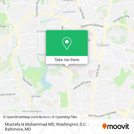
See Mustafa N Muhammad MD, Baltimore County, on the map
Public Transit to Mustafa N Muhammad MD in Baltimore County
Wondering how to get to Mustafa N Muhammad MD in Baltimore County? Moovit helps you find the best way to get to Mustafa N Muhammad MD with step-by-step directions from the nearest public transit station.
Moovit provides free maps and live directions to help you navigate through your city. View schedules, routes, timetables, and find out how long does it take to get to Mustafa N Muhammad MD in real time.
Looking for the nearest stop or station to Mustafa N Muhammad MD? Check out this list of stops closest to your destination: Gbmc Hospital & La Petite Child Care Center Eb; Gbmc Internal Rd @ Lapetite Child Care Sb 0024 (South); Sheppard Pratt Hospital Eb; Falls Road.
Bus: 51, TOWSON PURPLE, 53.
Want to see if there’s another route that gets you there at an earlier time? Moovit helps you find alternative routes or times. Get directions from and directions to Mustafa N Muhammad MD easily from the Moovit App or Website.
We make riding to Mustafa N Muhammad MD easy, which is why over 1.5 million users, including users in Baltimore County, trust Moovit as the best app for public transit. You don’t need to download an individual bus app or train app, Moovit is your all-in-one transit app that helps you find the best bus time or train time available.
For information on prices of bus and metro, costs and ride fares to Mustafa N Muhammad MD, please check the Moovit app.
Use the app to navigate to popular places including to the airport, hospital, stadium, grocery store, mall, coffee shop, school, college, and university.
Mustafa N Muhammad MD Address: 6701 N Charles St Towson, MD 21204 street in Baltimore County
- Orthopaedic Assoc of CNTRL MD, Pa,
- Radiation Oncology Health Care Pa,
- Jarrettsville Family Care,
- GBMC Healthcare,
- Berman Garage,
- Institutional Review Board,
- Express Oasis GBMC,
- Lyle T Saylor MD,
- Ronald L Silverman Dr,
- Towson Maryland MD,
- Johns Hopkins Pediatric Endocrinology and Diabetes,
- Richard N Carey M.D.,
- Physicians Anesthesia Associate - Mark D Dwyer MD,
- The Corner Shop at GBM,
- Rehan Khan MD,
- Janet Crane, MD,
- Scott Maizel MD,
- Johns Hopkins Pediatric Gastroenterology,
- Eric Jelin, MD,
- GMBC Physicians Pavillion West
Places Near Mustafa N Muhammad MD (Baltimore County)
- Washington National Cathedral, Washington,
- Basilica of the National Shrine, Washington,
- Amazon Hq2, Arlington County,
- Museum Of The Bible, Washington,
- Westfield Montgomery Mall, Montgomery County,
- The Anthem, Washington,
- National Museum of African American History and Culture, Washington,
- National Mall, Washington,
- M&T Bank Stadium, Baltimore,
- Washington DC VA Medical Center, Washington,
- Rock Creek Tennis Center, Washington,
- Capital One Arena, Washington,
- Warner Theatre, Washington,
- Marriott Marquis Washington, DC, Washington,
- Sibley Memorial Hospital, Washington,
- Georgetown, Washington,
- Pennsylvania Ave NW (3rd st and pennsylvania), Washington,
- Camden Yards, Baltimore,
- National Zoo, Washington,
- PG Mall, Prince George's County
How to get to popular places in Washington, D.C. - Baltimore, MD with public transit
Get around Baltimore County by public transit!
Traveling around Baltimore County has never been so easy. See step by step directions as you travel to any attraction, street or major public transit station. View bus and train schedules, arrival times, service alerts and detailed routes on a map, so you know exactly how to get to anywhere in Baltimore County.
When traveling to any destination around Baltimore County use Moovit's Live Directions with Get Off Notifications to know exactly where and how far to walk, how long to wait for your line, and how many stops are left. Moovit will alert you when it's time to get off — no need to constantly re-check whether yours is the next stop.
Wondering how to use public transit in Baltimore County or how to pay for public transit in Baltimore County? Moovit public transit app can help you navigate your way with public transit easily, and at minimum cost. It includes public transit fees, ticket prices, and costs. Looking for a map of Baltimore County public transit lines? Moovit public transit app shows all public transit maps in Baltimore County with all Bus, Train, Metro, Light Rail and Ferry routes and stops on an interactive map.
Washington, D.C. - Baltimore, MD has 5 transit type(s), including: Bus, Train, Metro, Light Rail and Ferry, operated by several transit agencies, including WMATA, Montgomery County Ride On, Fairfax Connector, TheBus, PRTC, DASH - Alexandria, Arlington Transit (ART), RTA of Central Maryland, MDOT MTA, MDOT MTA Light RailLink, MDOT MTA Commuter Bus, MDOT MTA Local Bus, FXBGO!, Virginia Railway Express (VRE) and MARC