Directions to My Computer Tech (Arlington County) with public transportation
The following transit lines have routes that pass near My Computer Tech
 Bus: 43, A40, 282, 482, 682.
- Train: FREDERICKSBURG LINE, MANASSAS LINE.
- Metro: BLUE, YELLOW, METRO STATION CLOSURE SHUTTLE.
How to get to My Computer Tech by bus?
Click on the bus route to see step by step directions with maps, line arrival times and updated time schedules.
From Providence Hospital, Washington
106 minFrom MedStar Georgetown University Hospital, Washington
53 minFrom Rock Creek Park, Washington
83 minFrom Comet Ping Pong, Washington
86 minFrom Punch Bowl Social, Arlington County
48 minFrom Rock Creek Park, Washington
103 minFrom Politics and Prose, Washington
88 minFrom Islamic Center of Washington, Washington
68 minFrom St Elizabeths Hospital, Washington
109 minFrom Saint Sophia Greek Orthodox Cathedral, Washington
54 min
How to get to My Computer Tech by metro?
Click on the metro route to see step by step directions with maps, line arrival times and updated time schedules.
From Providence Hospital, Washington
58 minFrom Comet Ping Pong, Washington
64 minFrom Punch Bowl Social, Arlington County
43 minFrom Politics and Prose, Washington
64 minFrom Islamic Center of Washington, Washington
58 minFrom St Elizabeths Hospital, Washington
51 minFrom Saint Sophia Greek Orthodox Cathedral, Washington
61 min
Bus stops near My Computer Tech in Arlington County
- Eads St & 12th St, 10 min walk,VIEW
- S Eads St & 13th St, 10 min walk,VIEW
- Army-Navy Dr & S Eads St, 11 min walk,VIEW
- Metro Pentagon Bay L6, 19 min walk,VIEW
- Pentagon+Bay L3, 20 min walk,VIEW
- Pentagon Transit Center Bay U3, 20 min walk,VIEW
- Pentagon Bus Bay L6, 20 min walk,VIEW
- Pentagon Metro @ Bay U3, 20 min walk,VIEW
- Pentagon Transit Ctr + Bus Bay U7, 21 min walk,VIEW
- Pentagon+Bay U6, 21 min walk,VIEW
- Pentagon Metro, 21 min walk,VIEW
Metro station near My Computer Tech in Arlington County
- Pentagon City, 38 min walk,VIEW
Train station near My Computer Tech in Arlington County
- Crystal City, 42 min walk,VIEW
Bus lines to My Computer Tech in Arlington County
- 282, Crystal City Via Rosslyn & Pentagon,VIEW
- 482, Crystal City Via Rosslyn And Pentagon,VIEW
- 682, East Gate Via Stone Ridge II,VIEW
- 882, Loudoun Gateway,VIEW
- 972-C, Pentagon / Dale City,VIEW
- A27, North To Pentagon,VIEW
- A66, East To Pentagon,VIEW
- 598, 598 Pentagon - Crystal City,VIEW
- 698, 698 Pentagon,VIEW
- F81, West To Rolling Valley P+R,VIEW
- F83, East To Pentagon,VIEW
- 42, Ballston,VIEW
- 87, Pentagon,VIEW
- 284, Pentagon,VIEW
- A11, South To Huntington,VIEW
- 35, Pentagon Transit Center,VIEW
- A90, North To Pentagon,VIEW
- SLC, Route 17 & Spotsy Lots,VIEW
- 563, Woodbridge - Neabsco Garage,VIEW
- 612, Gainesville - Xfer at Pentagon To Woodbridge/Spotsy,VIEW
What are the closest stations to My Computer Tech?
The closest stations to My Computer Tech are:
- Eads St & 12th St is 771 yards away, 10 min walk.
- S Eads St & 13th St is 782 yards away, 10 min walk.
- Army-Navy Dr & S Eads St is 914 yards away, 11 min walk.
- Metro Pentagon Bay L6 is 1587 yards away, 19 min walk.
- Pentagon+Bay L3 is 1632 yards away, 20 min walk.
- Pentagon Transit Center Bay U3 is 1644 yards away, 20 min walk.
- Pentagon Bus Bay L6 is 1657 yards away, 20 min walk.
- Pentagon Metro @ Bay U3 is 1674 yards away, 20 min walk.
- Pentagon Transit Ctr + Bus Bay U7 is 1722 yards away, 21 min walk.
- Pentagon+Bay U6 is 1726 yards away, 21 min walk.
- Pentagon Metro is 1750 yards away, 21 min walk.
- Pentagon City is 3153 yards away, 38 min walk.
- Crystal City is 3243 yards away, 42 min walk.
Which bus lines stop near My Computer Tech?
These bus lines stop near My Computer Tech: 43, A40.
Which metro lines stop near My Computer Tech?
These metro lines stop near My Computer Tech: BLUE, YELLOW.
What’s the nearest bus station to My Computer Tech in Arlington County?
The nearest bus stations to My Computer Tech in Arlington County are Eads St & 12th St and S Eads St & 13th St. The closest one is a 10 min walk away.
What time is the first metro to My Computer Tech in Arlington County?
The YELLOW is the first metro that goes to My Computer Tech in Arlington County. It stops nearby at 5:11 AM.
What time is the last metro to My Computer Tech in Arlington County?
The BLUE is the last metro that goes to My Computer Tech in Arlington County. It stops nearby at 12:26 AM.
What time is the first train to My Computer Tech in Arlington County?
The MANASSAS LINE is the first train that goes to My Computer Tech in Arlington County. It stops nearby at 6:04 AM.
What time is the last train to My Computer Tech in Arlington County?
The MANASSAS LINE is the last train that goes to My Computer Tech in Arlington County. It stops nearby at 7:15 PM.
What time is the first bus to My Computer Tech in Arlington County?
The 35 is the first bus that goes to My Computer Tech in Arlington County. It stops nearby at 4:49 AM.
What time is the last bus to My Computer Tech in Arlington County?
The 35 is the last bus that goes to My Computer Tech in Arlington County. It stops nearby at 2:16 AM.
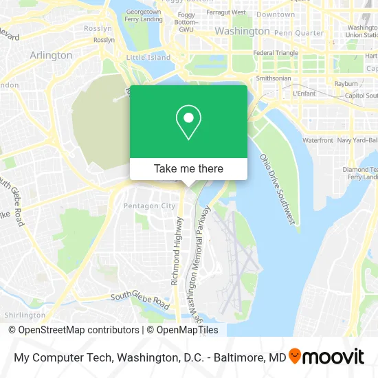
See My Computer Tech, Arlington County, on the map
Public Transit to My Computer Tech in Arlington County
Wondering how to get to My Computer Tech in Arlington County? Moovit helps you find the best way to get to My Computer Tech with step-by-step directions from the nearest public transit station.
Moovit provides free maps and live directions to help you navigate through your city. View schedules, routes, timetables, and find out how long does it take to get to My Computer Tech in real time.
Looking for the nearest stop or station to My Computer Tech? Check out this list of stops closest to your destination: Eads St & 12th St; S Eads St & 13th St; Army-Navy Dr & S Eads St; Metro Pentagon Bay L6; Pentagon+Bay L3; Pentagon Transit Center Bay U3; Pentagon Bus Bay L6; Pentagon Metro @ Bay U3; Pentagon Transit Ctr + Bus Bay U7; Pentagon+Bay U6; Pentagon Metro; Pentagon City; Crystal City.
Bus: 43, A40, 282, 482, 682, 882, 972-C, A27, A66, 598, 698.Train: FREDERICKSBURG LINE, MANASSAS LINE.Metro: BLUE, YELLOW, METRO STATION CLOSURE SHUTTLE.
Want to see if there’s another route that gets you there at an earlier time? Moovit helps you find alternative routes or times. Get directions from and directions to My Computer Tech easily from the Moovit App or Website.
We make riding to My Computer Tech easy, which is why over 1.7 million users, including users in Arlington County, trust Moovit as the best app for public transit. You don’t need to download an individual bus app or train app, Moovit is your all-in-one transit app that helps you find the best bus time or train time available.
For information on prices of bus and metro, costs and ride fares to My Computer Tech, please check the Moovit app.
Use the app to navigate to popular places including to the airport, hospital, stadium, grocery store, mall, coffee shop, school, college, and university.
My Computer Tech Address: 2221 S Clark St street in Arlington County
- Becu Atm (Boeing Employees Only),
- Festival Peruano De Arlington Virginia,
- Long Bridge Park,
- C2c Events, Inc.,
- Gtp Media,
- Defense Security Cooperation,
- Noel - Hr Armor,
- Mine Safety And Health Administration,
- Doubletree Restaurant,
- Pentagon Pass Office,
- Skydome Restaurant,
- Doubletree by Hilton,
- Holiday Inn,
- Washington Reagan Airport,
- DoubleTree by Hilton Hotel Washington DC-Crystal City,
- Doubletree Crystal City Va,
- Tetra Tech,
- Marine Corps Marathon,
- Amazon Locker - Lido,
- Anthony's Pizza
Places Near My Computer Tech (Arlington County)
- Marriott Marquis Washington, DC, Washington,
- M&T Bank Stadium, Baltimore,
- Westfield Montgomery Mall, Montgomery County,
- Museum Of The Bible, Washington,
- Capital One Arena, Washington,
- Pennsylvania Ave NW (3rd st and pennsylvania), Washington,
- Washington DC VA Medical Center, Washington,
- PG Mall, Prince George's County,
- National Zoo, Washington,
- Sibley Memorial Hospital, Washington,
- Amazon Hq2, Arlington County,
- Warner Theatre, Washington,
- Rock Creek Tennis Center, Washington,
- Basilica of the National Shrine, Washington,
- Washington National Cathedral, Washington,
- The Anthem, Washington,
- Camden Yards, Baltimore,
- National Theatre, Washington,
- National Museum of African American History and Culture, Washington,
- Georgetown, Washington
How to get to popular places in Washington, D.C. - Baltimore, MD with public transit
Get around Arlington County by public transit!
Traveling around Arlington County has never been so easy. See step by step directions as you travel to any attraction, street or major public transit station. View bus and train schedules, arrival times, service alerts and detailed routes on a map, so you know exactly how to get to anywhere in Arlington County.
When traveling to any destination around Arlington County use Moovit's Live Directions with Get Off Notifications to know exactly where and how far to walk, how long to wait for your line, and how many stops are left. Moovit will alert you when it's time to get off — no need to constantly re-check whether yours is the next stop.
Wondering how to use public transit in Arlington County or how to pay for public transit in Arlington County? Moovit public transit app can help you navigate your way with public transit easily, and at minimum cost. It includes public transit fees, ticket prices, and costs. Looking for a map of Arlington County public transit lines? Moovit public transit app shows all public transit maps in Arlington County with all Bus, Train, Metro, Light Rail and Ferry routes and stops on an interactive map.
Washington, D.C. - Baltimore, MD has 5 transit type(s), including: Bus, Train, Metro, Light Rail and Ferry, operated by several transit agencies, including WMATA, Montgomery County Ride On, Fairfax Connector, TheBus, PRTC, DASH - Alexandria, Arlington Transit (ART), RTA of Central Maryland, MDOT MTA, MDOT MTA Light RailLink, MDOT MTA Commuter Bus, MDOT MTA Local Bus, FXBGO!, Virginia Railway Express (VRE) and MARC