Directions to My Covenant Place (Baltimore) with public transportation
The following transit lines have routes that pass near My Covenant Place
 Bus: 21, 54, CITYLINK GOLD, CITYLINK LIME.
- Train: ACELA, CARDINAL, CAROLINIAN, CRESCENT, NORTHEAST REGIONAL.
- Metro: METRO.
How to get to My Covenant Place by bus?
Click on the bus route to see step by step directions with maps, line arrival times and updated time schedules.
From Baltimore City Community College (BCCC) - Liberty Campus, Baltimore
38 minFrom Walmart, Baltimore County
48 minFrom Western High School, Baltimore
40 minFrom Towson, MD, Baltimore County
46 minFrom Mva, Baltimore
57 minFrom Medstar Franklin Square Medical Center, Baltimore County
51 minFrom I-70 at Security Blvd Baltimore City Lot Park & Ride, Baltimore
60 minFrom Reisterstown Road Plaza, Baltimore
66 minFrom Towson Town Center, Baltimore County
48 minFrom I-695 Exit 29 (Loch Raven Blvd (MD 542)/Cromwell Bridge Rd), Baltimore County
52 min
How to get to My Covenant Place by metro?
Click on the metro route to see step by step directions with maps, line arrival times and updated time schedules.
Bus stops near My Covenant Place in Baltimore
Metro station near My Covenant Place in Baltimore
- Johns Hopkins Metro, 28 min walk,VIEW
Train stations near My Covenant Place in Baltimore
Light Rail stations near My Covenant Place in Baltimore
- Penn Station, 55 min walk,VIEW
Bus lines to My Covenant Place in Baltimore
What are the closest stations to My Covenant Place?
The closest stations to My Covenant Place are:
- Preston St & Caroline St Wb FS is 183 yards away, 3 min walk.
- Harford Ave & Federal St FS Nb is 241 yards away, 4 min walk.
- North Ave & Harford Rd FS Eb is 470 yards away, 6 min walk.
- Johns Hopkins Metro is 2334 yards away, 28 min walk.
- Baltimore Penn Station is 4640 yards away, 55 min walk.
- Penn Station is 4640 yards away, 55 min walk.
- Penn Station Marc Sb is 4716 yards away, 56 min walk.
Which bus lines stop near My Covenant Place?
These bus lines stop near My Covenant Place: 21, 54, CITYLINK GOLD.
Which metro line stops near My Covenant Place?
METRO (Towards John Hopkins)
What’s the nearest metro station to My Covenant Place in Baltimore?
The nearest metro station to My Covenant Place in Baltimore is Johns Hopkins Metro. It’s a 28 min walk away.
What’s the nearest bus station to My Covenant Place in Baltimore?
The nearest bus station to My Covenant Place in Baltimore is Preston St & Caroline St Wb FS. It’s a 3 min walk away.
What time is the first light rail to My Covenant Place in Baltimore?
The LIGHT RAILLINK is the first light rail that goes to My Covenant Place in Baltimore. It stops nearby at 3:56 AM.
What time is the last light rail to My Covenant Place in Baltimore?
The LIGHT RAILLINK is the last light rail that goes to My Covenant Place in Baltimore. It stops nearby at 11:44 PM.
What time is the first metro to My Covenant Place in Baltimore?
The METRO is the first metro that goes to My Covenant Place in Baltimore. It stops nearby at 4:21 AM.
What time is the last metro to My Covenant Place in Baltimore?
The METRO is the last metro that goes to My Covenant Place in Baltimore. It stops nearby at 12:29 AM.
What time is the first train to My Covenant Place in Baltimore?
The MARC is the first train that goes to My Covenant Place in Baltimore. It stops nearby at 4:30 AM.
What time is the last train to My Covenant Place in Baltimore?
The SILVER METEOR is the last train that goes to My Covenant Place in Baltimore. It stops nearby at 7:57 AM.
What time is the first bus to My Covenant Place in Baltimore?
The 54 is the first bus that goes to My Covenant Place in Baltimore. It stops nearby at 3:04 AM.
What time is the last bus to My Covenant Place in Baltimore?
The 54 is the last bus that goes to My Covenant Place in Baltimore. It stops nearby at 3:07 AM.
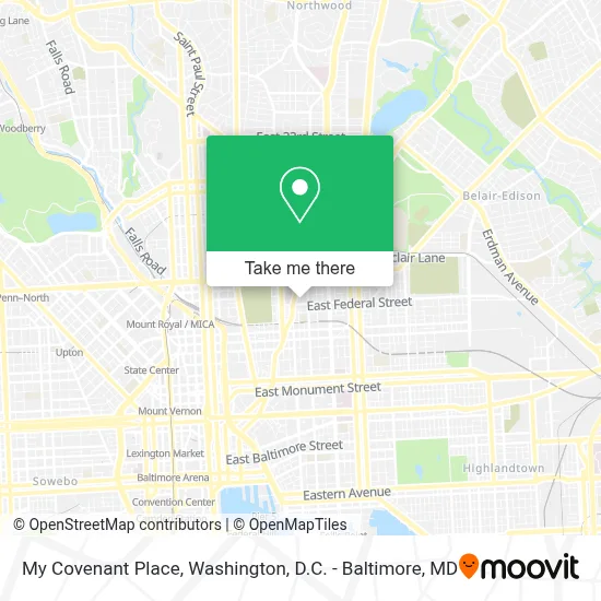
See My Covenant Place, Baltimore, on the map
Public Transit to My Covenant Place in Baltimore
Wondering how to get to My Covenant Place in Baltimore? Moovit helps you find the best way to get to My Covenant Place with step-by-step directions from the nearest public transit station.
Moovit provides free maps and live directions to help you navigate through your city. View schedules, routes, timetables, and find out how long does it take to get to My Covenant Place in real time.
Looking for the nearest stop or station to My Covenant Place? Check out this list of stops closest to your destination: Preston St & Caroline St Wb FS; Harford Ave & Federal St FS Nb; North Ave & Harford Rd FS Eb; Johns Hopkins Metro; Baltimore Penn Station; Penn Station; Penn Station Marc Sb.
Bus: 21, 54, CITYLINK GOLD, CITYLINK LIME.Train: ACELA, CARDINAL, CAROLINIAN, CRESCENT, NORTHEAST REGIONAL, MARC.Metro: METRO.
Want to see if there’s another route that gets you there at an earlier time? Moovit helps you find alternative routes or times. Get directions from and directions to My Covenant Place easily from the Moovit App or Website.
We make riding to My Covenant Place easy, which is why over 1.7 million users, including users in Baltimore, trust Moovit as the best app for public transit. You don’t need to download an individual bus app or train app, Moovit is your all-in-one transit app that helps you find the best bus time or train time available.
For information on prices of bus and metro, costs and ride fares to My Covenant Place, please check the Moovit app.
Use the app to navigate to popular places including to the airport, hospital, stadium, grocery store, mall, coffee shop, school, college, and university.
My Covenant Place Address: 1400 E Federal St street in Baltimore
- Harford Rd (harford road and E North Ave),
- MTA Bus Stop - North Ave & Harford Rd,
- Calvin B Scruggs Funeral Home,
- Preston and Eden St,
- Great Blacks In Wax Museum,
- Baltimore City District Court (Eastside District Court),
- N Eden St Building 1226,
- Down Da Hill,
- Aisquith St Building 1228,
- Baltimore Social Service Dept,
- Baltimore City Schools Transportation,
- Dee's Place NA Meetings,
- Green Mount Cemetery (Greenmount Cemetery),
- Johns Hopkins East Baltimore Medical Center,
- Greenmount Ave (north ave & greenmount),
- E North Ave and Greenmount,
- MTA Kirk Bus Division,
- Wonderground,
- E Chase St (greenmount chase),
- Eternal Sacred Order of Cherubim and Seraphim Church, Mount of Grace.
Places Near My Covenant Place (Baltimore)
- Museum Of The Bible, Washington,
- Basilica of the National Shrine, Washington,
- Rock Creek Tennis Center, Washington,
- Camden Yards, Baltimore,
- PG Mall, Prince George's County,
- Capital One Arena, Washington,
- Sibley Memorial Hospital, Washington,
- National Theatre, Washington,
- Washington DC VA Medical Center, Washington,
- Warner Theatre, Washington,
- Pennsylvania Ave NW (3rd st and pennsylvania), Washington,
- Marriott Marquis Washington, DC, Washington,
- Georgetown, Washington,
- National Museum of African American History and Culture, Washington,
- National Zoo, Washington,
- The Anthem, Washington,
- Washington National Cathedral, Washington,
- Amazon Hq2, Arlington County,
- Westfield Montgomery Mall, Montgomery County,
- M&T Bank Stadium, Baltimore
How to get to popular places in Washington, D.C. - Baltimore, MD with public transit
Get around Baltimore by public transit!
Traveling around Baltimore has never been so easy. See step by step directions as you travel to any attraction, street or major public transit station. View bus and train schedules, arrival times, service alerts and detailed routes on a map, so you know exactly how to get to anywhere in Baltimore.
When traveling to any destination around Baltimore use Moovit's Live Directions with Get Off Notifications to know exactly where and how far to walk, how long to wait for your line, and how many stops are left. Moovit will alert you when it's time to get off — no need to constantly re-check whether yours is the next stop.
Wondering how to use public transit in Baltimore or how to pay for public transit in Baltimore? Moovit public transit app can help you navigate your way with public transit easily, and at minimum cost. It includes public transit fees, ticket prices, and costs. Looking for a map of Baltimore public transit lines? Moovit public transit app shows all public transit maps in Baltimore with all Bus, Train, Metro, Light Rail and Ferry routes and stops on an interactive map.
Washington, D.C. - Baltimore, MD has 5 transit type(s), including: Bus, Train, Metro, Light Rail and Ferry, operated by several transit agencies, including WMATA, Montgomery County Ride On, Fairfax Connector, TheBus, PRTC, DASH - Alexandria, Arlington Transit (ART), RTA of Central Maryland, MDOT MTA, MDOT MTA Light RailLink, MDOT MTA Commuter Bus, MDOT MTA Local Bus, FXBGO!, Virginia Railway Express (VRE) and MARC